
| 
| |
|
|
This page contains present day photos (Year 2000 to date) of Ontario's King's Highway 17, arranged by location from Renfrew
westerly to Deep River. All photographs displayed on this page were taken by the Webmaster (Cameron Bevers), unless specifically noted otherwise. Click on any
thumbnail to see a larger image!
Please note that all photographs displayed on this
website are protected by copyright. These photographs must not be reproduced, published,
electronically stored or copied, distributed, or posted onto other websites without
my written permission. If you want to use photos from this website, please
email me first for permission. Thank-you!
|
|---|
|
Page 12: Present Day King's Highway 17 Photographs (Renfrew to Deep River)
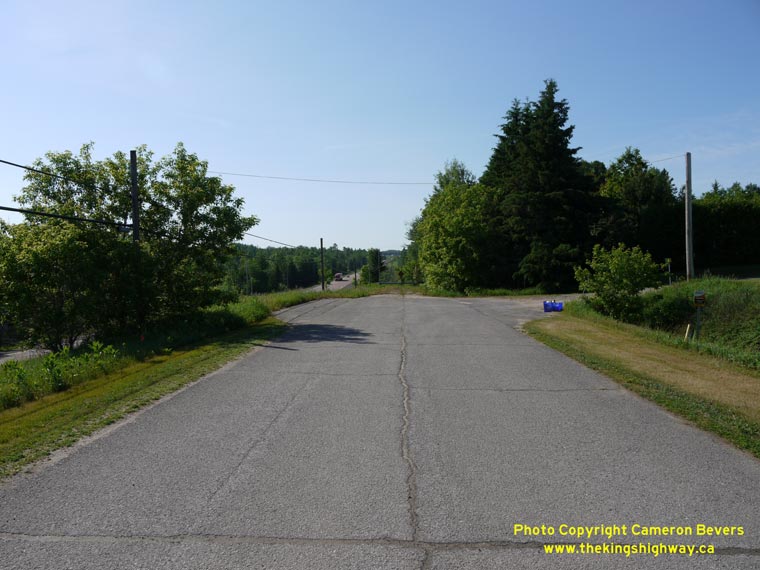

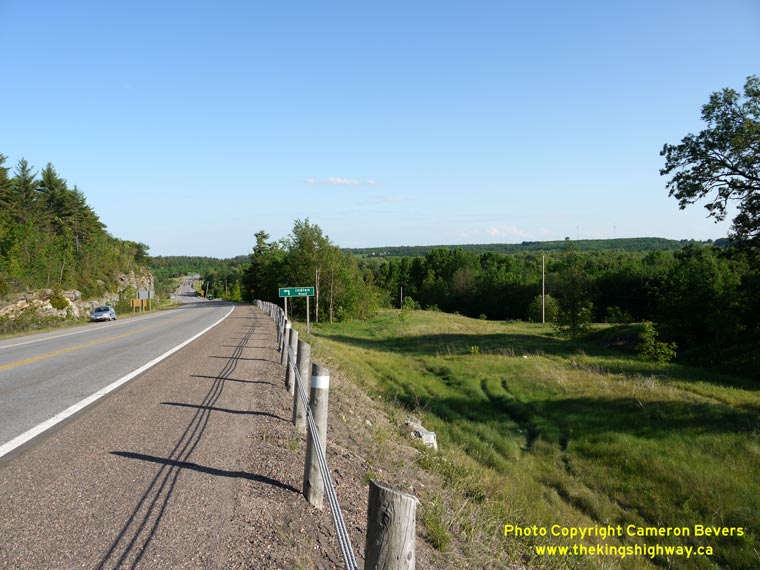
Left - Bypassed Hwy 17 alignment south of Cobden. Note the new highway alignment at left. (Photograph taken on June 4, 2010 - © Cameron Bevers) Right - Former Hwy 17 alignment (Union Cemetery Road) south of Cobden. When the grade of Hwy 17 was revised in this area during the 1960s, the highway was relocated onto an entirely new alignment to the east in order to avoid disturbing the adjacent cemetery. Highways that are seemingly built out-of-alignment in rural areas are often the result of a cemetery beside the highway. (Photograph taken on June 4, 2010 - © Cameron Bevers) 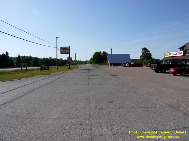
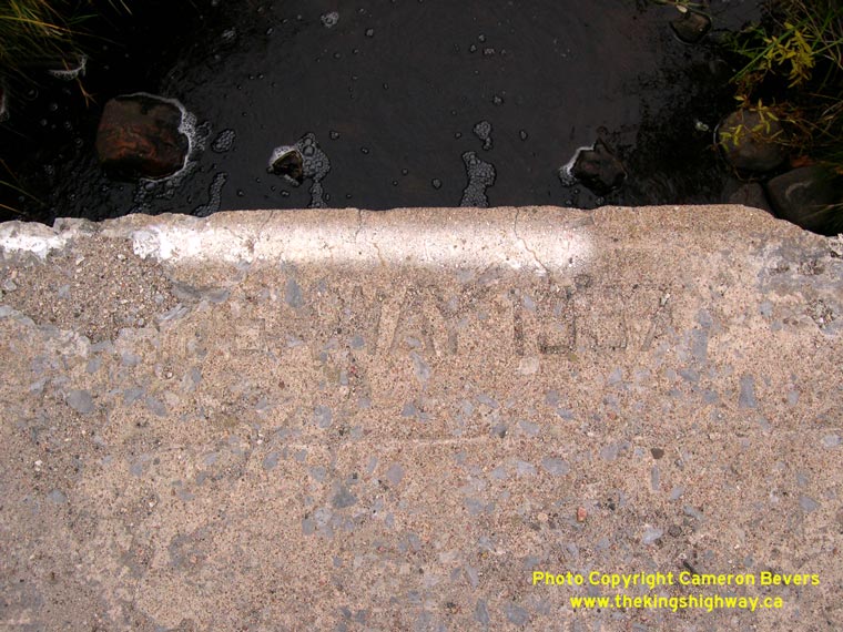
Left - The original twin-slab concrete pavement on this former Hwy 17 alignment south of Cobden is still evident below the asphalt top course. (Photograph taken on June 4, 2010 - © Cameron Bevers) Right - Facing west along Hwy 17 towards Cobden from Forresters Falls Road. See an Enlarged Photo Here. (Photograph taken on June 4, 2010 - © Cameron Bevers) 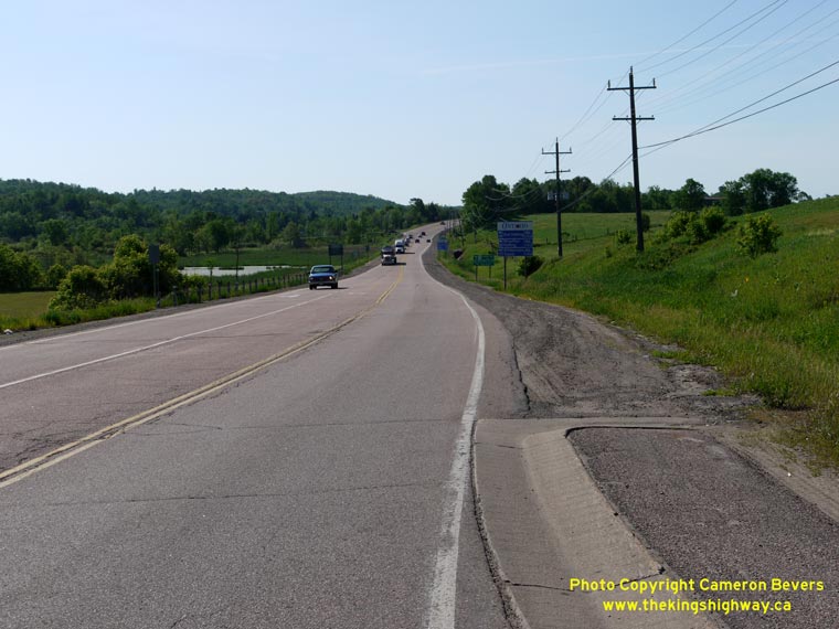

Left - Facing east along Hwy 17 towards Renfrew from the eastern limits of Cobden. (Photograph taken on June 4, 2010 - © Cameron Bevers) Right - Facing west along Hwy 17 from the eastern limits of Cobden. (Photograph taken on June 4, 2010 - © Cameron Bevers) 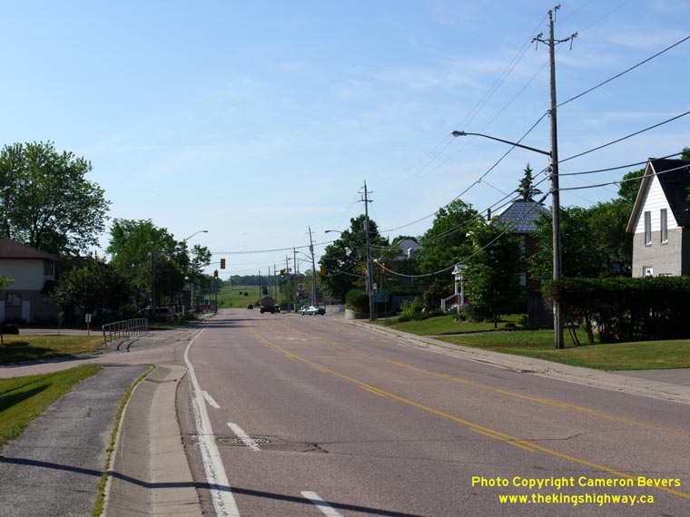
Left - Facing east along Hwy 17 in Cobden. It is the only sizeable town situated directly on Hwy 17 between Ottawa and Chalk River. Every other town
in the Ottawa Valley has been bypassed during various highway improvement projects that have taken place over the past few decades. (Photograph taken on June 4, 2010 - © Cameron Bevers) Right - Facing west along Hwy 17 in Cobden. See an Enlarged Photo Here. (Photograph taken on June 4, 2010 - © Cameron Bevers) 
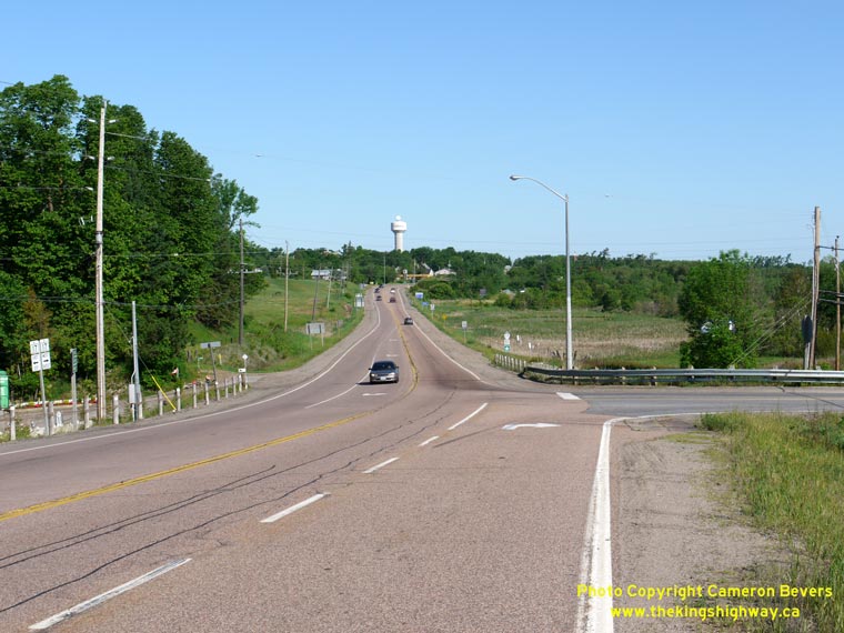
Left - Facing east along Hwy 17 at the western limits of Cobden. Note the oversized 50 km/h speed limit sign beside the highway heading into Cobden.
The speed limit on the approaches to Cobden is posted at 90 km/h, so the 50 km/h speed limit through town would not be expected by most motorists. This
problem is compounded by the tangential alignment of Hwy 17 approaching the western side of Cobden and the setback of the buildings from the edge of the
highway. Although the oversized signs do provide greater emphasis on the reduced speed limit through town, they are not likely very effective in slowing
down traffic in this area. Most drivers would still interpret the driving environment here as a rural highway and would probably drive at a speed that they
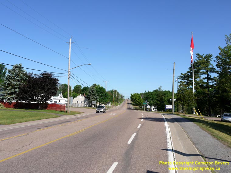
perceive would be reasonable for a rural driving environment. (Photograph taken on June 4, 2010 - © Cameron Bevers) Right - Facing west along Hwy 17 towards Pembroke from the western limits of Cobden. (Photograph taken on June 4, 2010 - © Cameron Bevers) 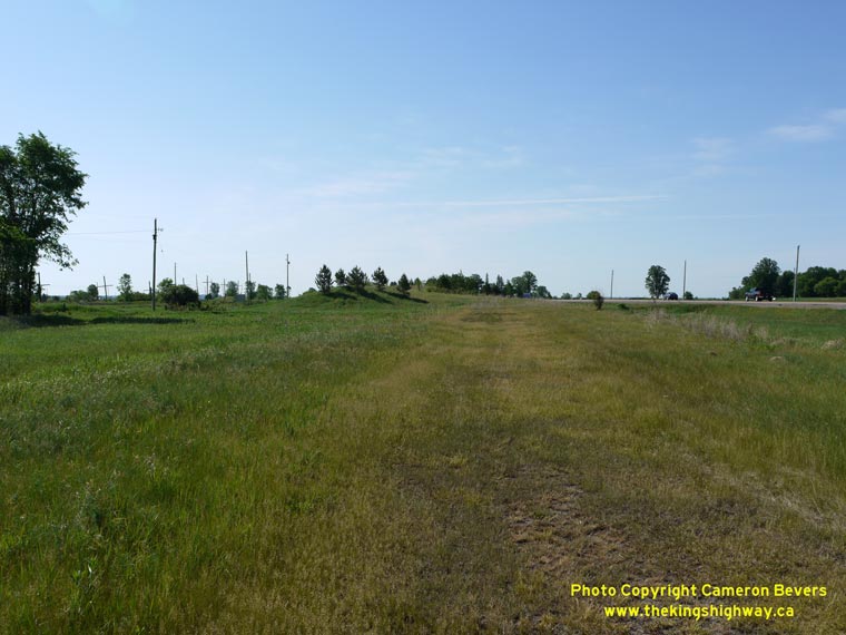
Left - Facing east along Hwy 17 towards the site of the former Cobden Railway Overhead at Shields Crossing. Until it was demolished in the mid-1990s,
this massive 35-span structure carried Hwy 17 across the Ottawa Valley Railway (formerly Canadian Pacific Railway) which intersected the highway at a
severe skew. Compare this present-day photo of the former bridge site with this
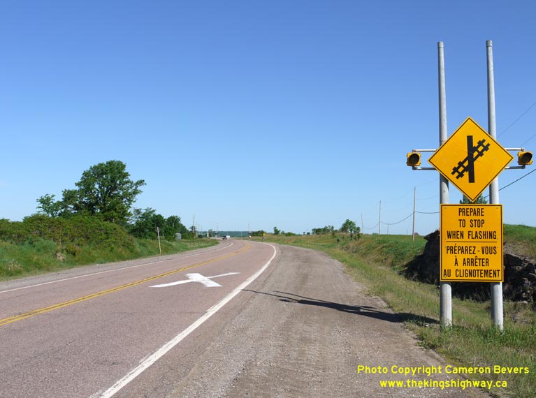
1961 Photo of the Cobden Overhead, taken shortly after it was completed. (Photograph taken on June 4, 2010 - © Cameron Bevers) Right - Approaching Shields Crossing on Hwy 17 in Westmeath Township, just west of Cobden. As with most at-grade railway crossings on Hwy 17, advance warning signs with dual flashing amber beacons have been installed. The flashing amber beacons are actuated whenever a train approaches the railway crossing. See an Enlarged Photo Here. (Photograph taken on June 4, 2010 - © Cameron Bevers) 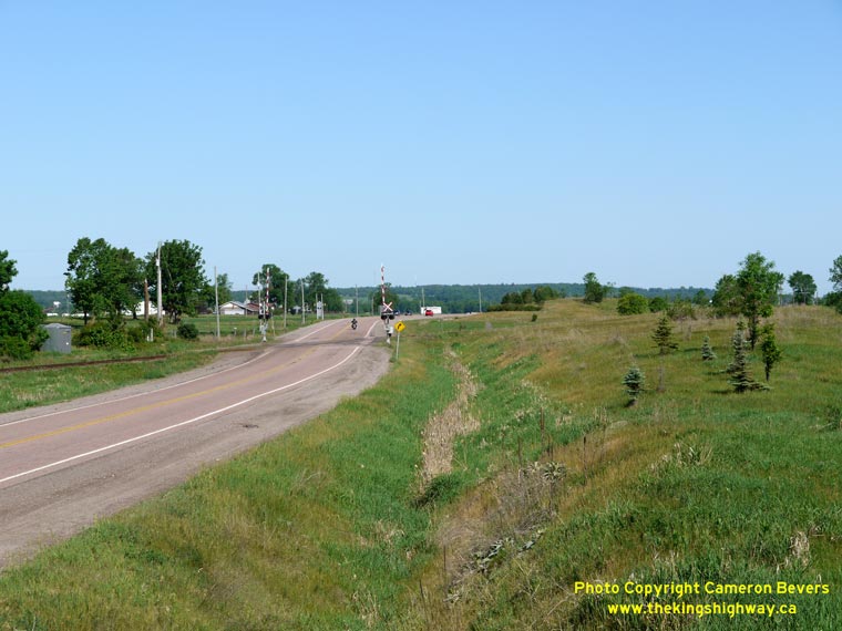
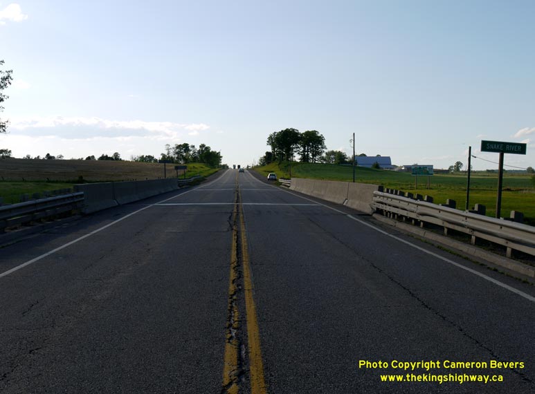
Left - Facing west along Hwy 17 towards Pembroke at the Ottawa Valley Railway at Shields Crossing, just west of Cobden. (Photograph taken on June 4, 2010 - © Cameron Bevers) Right - Snake River Bridge on Hwy 17 between Cobden and Pembroke. Structure completed in 1961. (Photograph taken on June 1, 2010 - © Cameron Bevers) 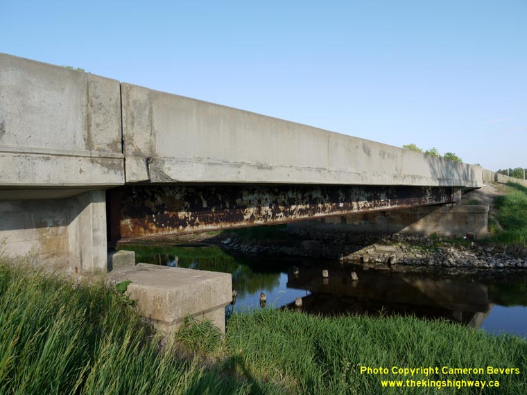
Left - Southern side of the Snake River Bridge on Hwy 17 near Cobden. Note the timber bents in the river, which are the remnants of an earlier
timber bridge that was removed from this location in the 1920s. A new steel truss bridge was constructed at this location in 1927, shortly after the
Department of Highways took over the Cobden-Pembroke Road. While this new truss bridge was capable of carrying heavy traffic, it was built with lane
widths that did not meet Trans-Canada Highway standards. Accordingly, the steel truss bridge was replaced with a wider steel beam structure in 1961. (Photograph taken on June 1, 2010 - © Cameron Bevers) Right - Facing west along Hwy 17 at the Snake River Bridge between Cobden and Pembroke. (Photograph taken on June 1, 2010 - © Cameron Bevers) 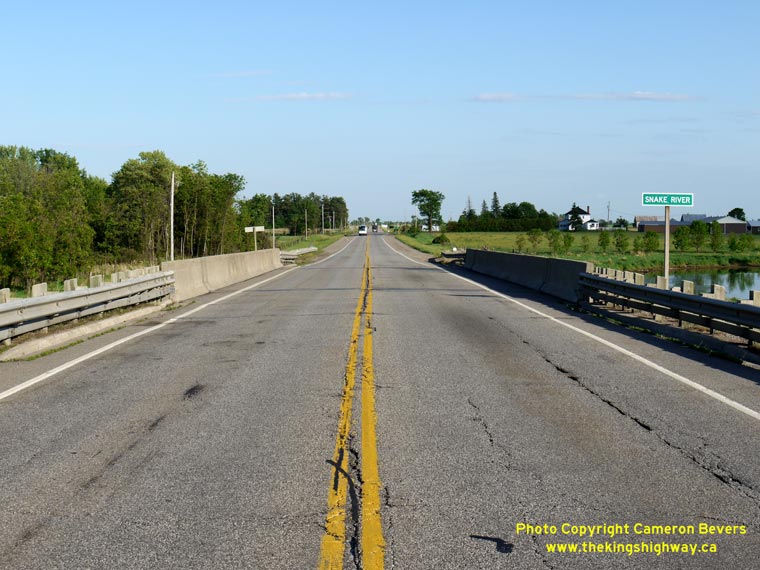
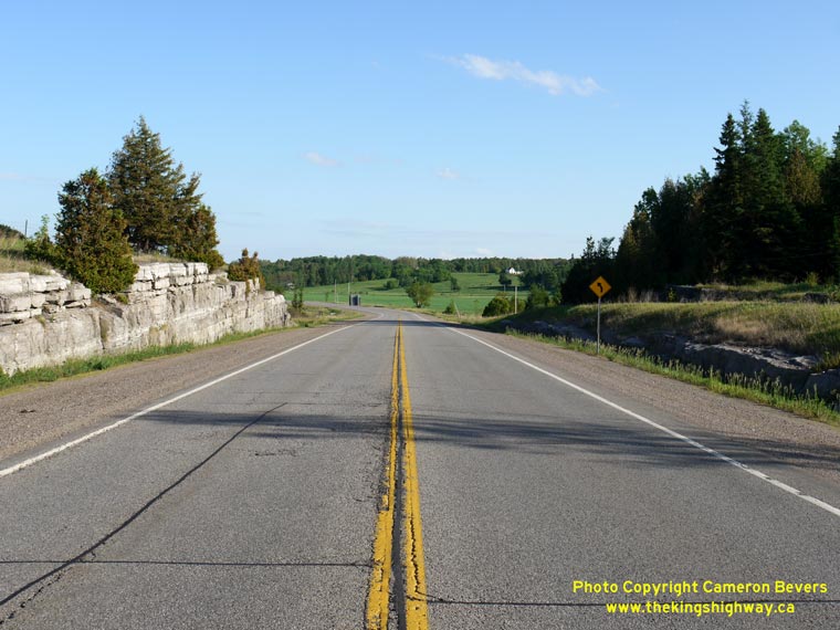
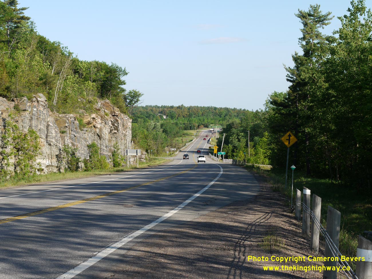
Left - Facing east along Hwy 17 at the Snake River Bridge between Cobden and Pembroke. (Photograph taken on June 1, 2010 - © Cameron Bevers) Right - Rock cut on Hwy 17 south of Meath Hill. Geologically, the Ottawa Valley is very diverse. Between Ottawa and Pembroke, the bedrock is a contrasting blend of dolomite and granite. In most other areas of the province, there is a clearly-defined line between the dolomite that is normally found in Southern and Eastern Ontario and the granite that is typical for Northern Ontario. (Photograph taken on June 1, 2010 - © Cameron Bevers) 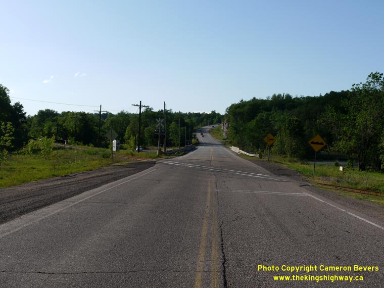
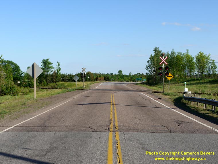
Left - Facing west along Hwy 17 at the Ottawa Valley Railway Crossing at Meath Hill. (Photograph taken on June 1, 2010 - © Cameron Bevers) Right - Facing east along Hwy 17 towards the Ottawa Valley Railway Crossing at Meath Hill, south of Pembroke. (Photograph taken on June 1, 2010 - © Cameron Bevers) 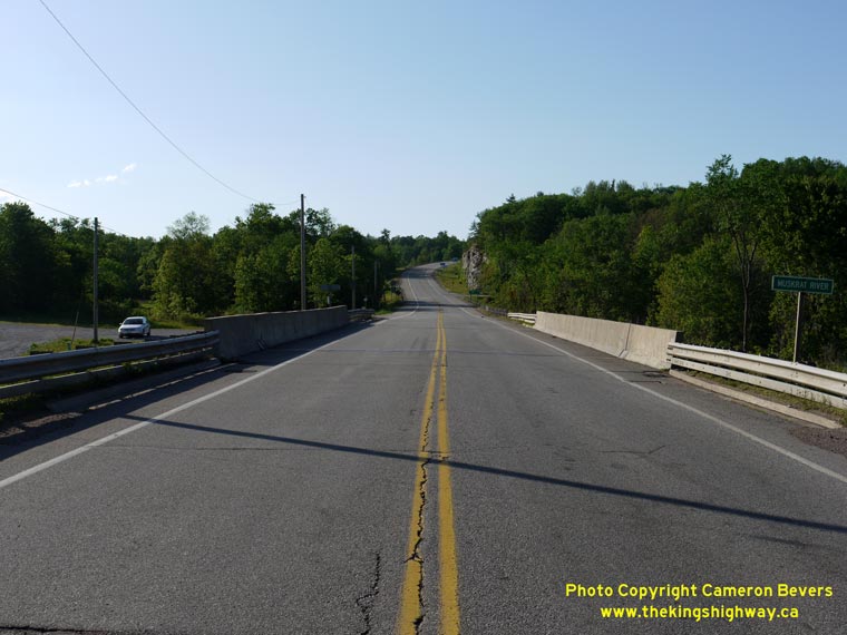
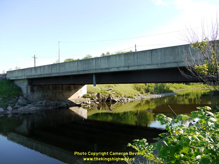
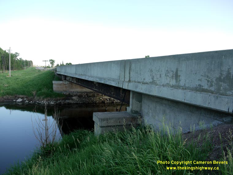
Left - Facing west along Hwy 17 at the Muskrat River Bridge at Meath Hill, south of Pembroke. (Photograph taken on June 1, 2010 - © Cameron Bevers) Right - Northern side of the Muskrat River Bridge on Hwy 17 at Meath Hill. Structure completed in 1970. (Photograph taken on June 1, 2010 - © Cameron Bevers) 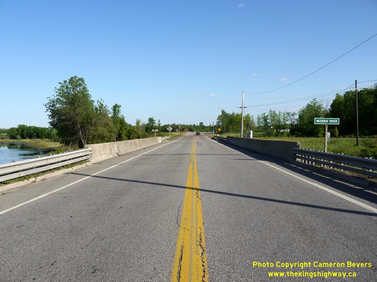
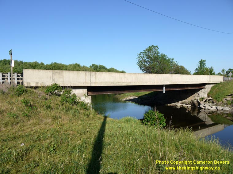
Left - Facing east along Hwy 17 at the Muskrat River Bridge at Meath Hill, south of Pembroke. (Photograph taken on June 1, 2010 - © Cameron Bevers) Right - Southern side of the Muskrat River Bridge on Hwy 17 at Meath Hill. This simple steel beam structure replaced a narrow steel truss bridge that was built at this location by the Department of Highways in 1928. (Photograph taken on June 1, 2010 - © Cameron Bevers) 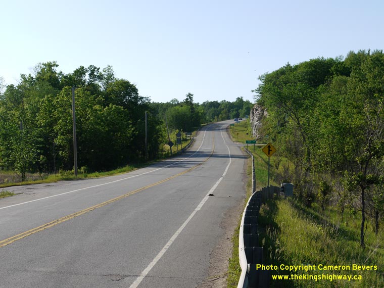

Left - Facing west along Hwy 17 from the Muskrat River Bridge towards Meath Hill near Pembroke. (Photograph taken on June 1, 2010 - © Cameron Bevers) Right - Granite outcrop at Meath Hill, which was cut back in an effort to straighten the alignment of Hwy 17 approaching the Muskrat River Bridge and the adjacent at-grade railway crossing. See an Enlarged Photo Here. (Photograph taken on June 1, 2010 - © Cameron Bevers) 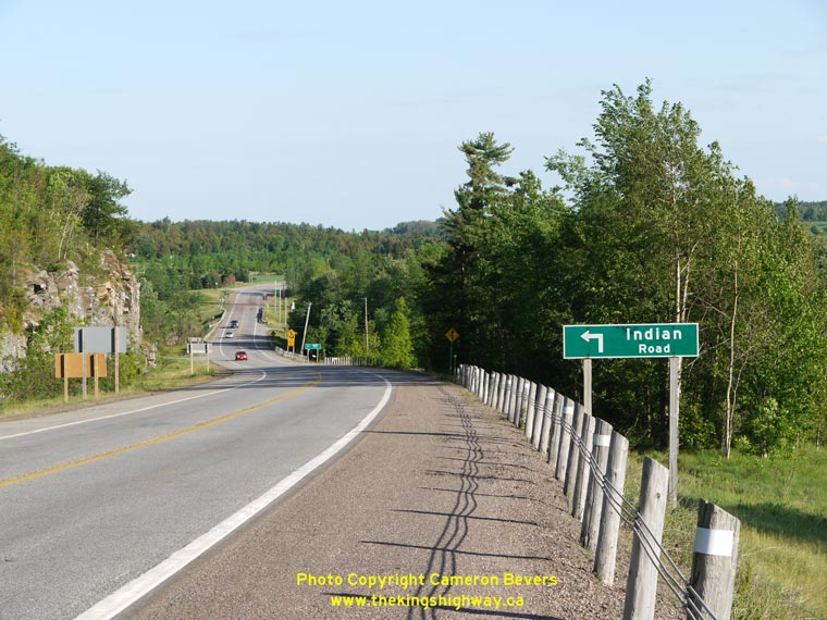
Left - Facing east down Meath Hill towards the Muskrat River Bridge on Hwy 17. (Photograph taken on June 1, 2010 - © Cameron Bevers) Right - Meath Hill on Hwy 17, facing east towards the Muskrat River Bridge. Note the abandoned Hwy 17 alignment at right, where a sharp curve on the original highway alignment was removed during a reconstruction project several decades ago. The graded right-of-way of the old highway is still visible today. (Photograph taken on June 1, 2010 - © Cameron Bevers) 

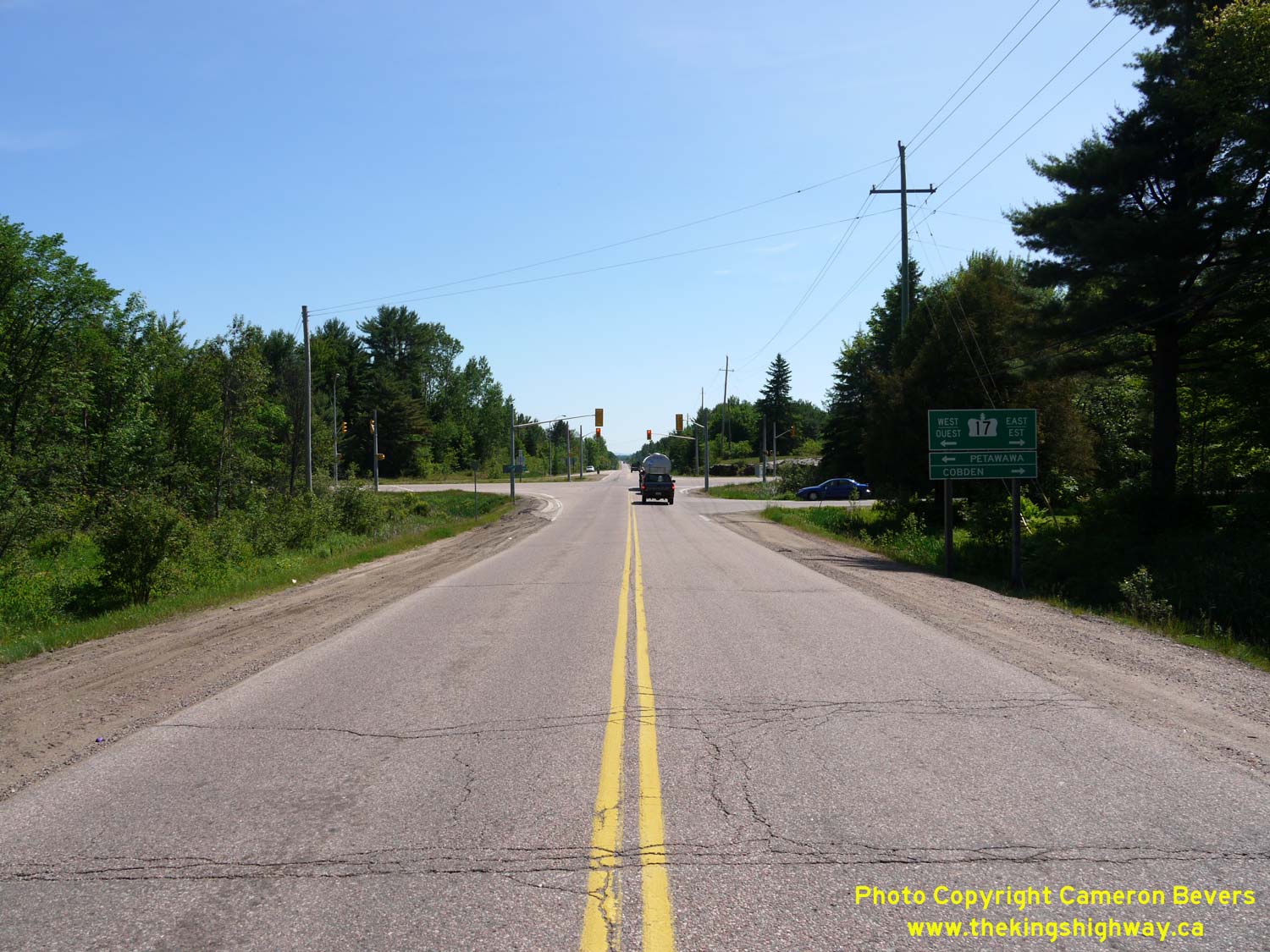
Left - Approaching the Hwy 17 Junction on Hwy 41, facing north towards Pembroke. (Photograph taken on June 1, 2010 - © Cameron Bevers) Right - Facing north along Hwy 41 towards the Hwy 17 Junction in Pembroke. There are no right-turn channelizations on the south side of the intersection. (Photograph taken on June 1, 2010 - © Cameron Bevers) 

Left - Facing south along Hwy 41 towards Eganville from the Hwy 17 Junction in Pembroke. (Photograph taken on June 1, 2010 - © Cameron Bevers) Right - Distance sign on Southbound Hwy 41 leaving Pembroke. Eganville and Napanee are the only towns with a population over 500 along the entire highway. (Photograph taken on June 1, 2010 - © Cameron Bevers) 

Left - Facing north along Hwy 41 at the Hwy 17 Junction in Pembroke. Although Hwy 41 continues as a signed route for an additional 4 km into
Downtown Pembroke, the assumed portion of Hwy 41 owned by the Province ends just beyond the Hwy 17 Junction. (Photograph taken on June 1, 2010 - © Cameron Bevers) Right - Guide signs on Northbound Hwy 41 at the Hwy 17 Junction in Pembroke. (Photograph taken on June 1, 2010 - © Cameron Bevers) 

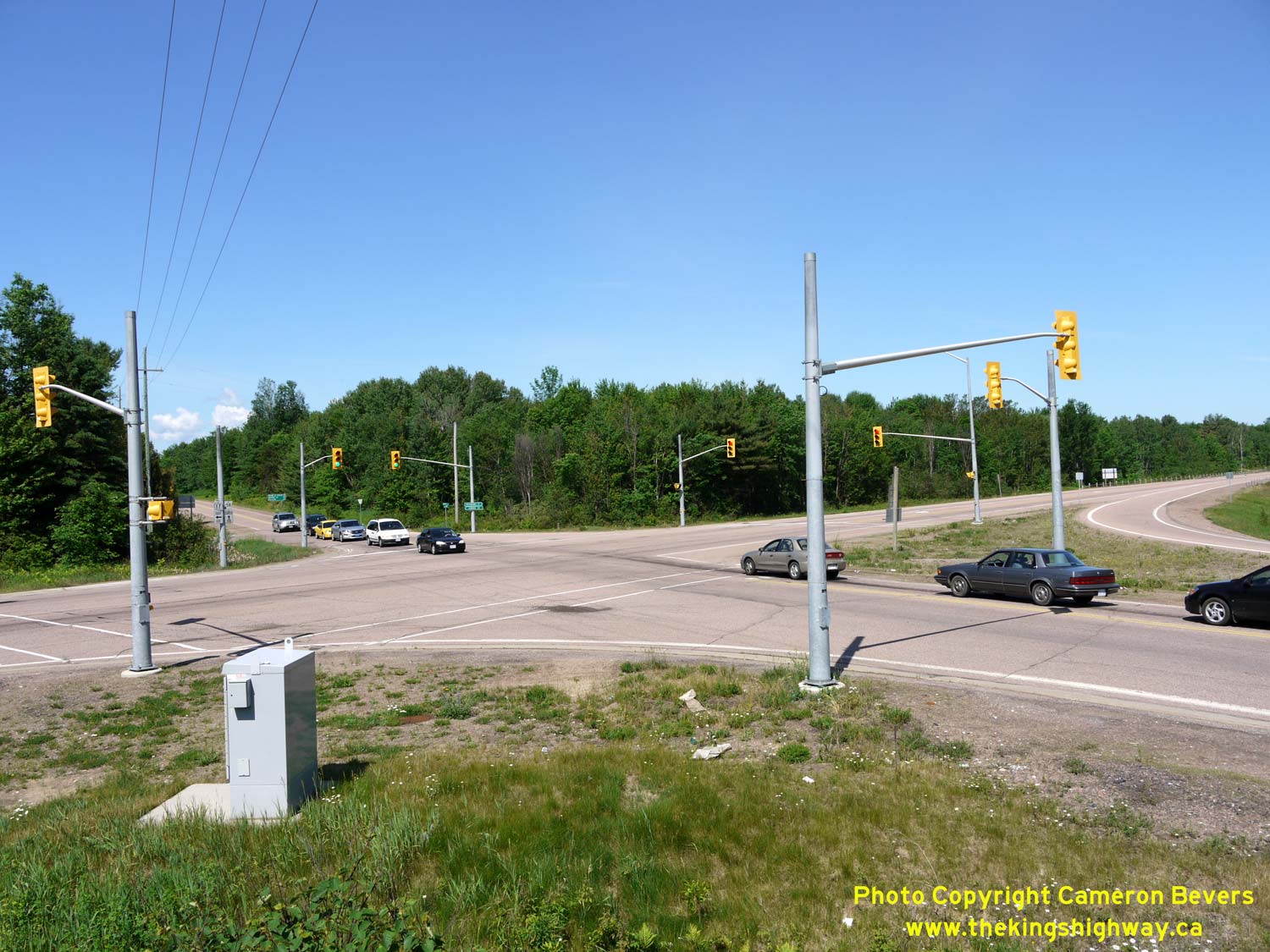
Left - Approaching the Hwy 41 Junction on Hwy 17 in Pembroke, facing west. (Photograph taken on June 1, 2010 - © Cameron Bevers) Right - Advance guide signs for the Hwy 41 Junction on Hwy 17 in Pembroke. The right turn onto Northbound Hwy 41 from Westbound Hwy 17 is channelized, which is why the advance arrows are angled upwards and to the right. The turn onto Southbound Hwy 41 from Westbound Hwy 17 is accomplished via a conventional left-turn lane. (Photograph taken on June 1, 2010 - © Cameron Bevers) 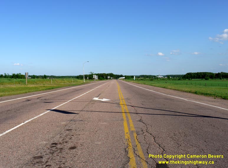

Left - Facing east along Hwy 17 towards Cobden from the Hwy 41 Junction in Pembroke. (Photograph taken on June 1, 2010 - © Cameron Bevers) Right - Turn-off guide signs for the Hwy 41 Junction on Hwy 17 in Pembroke. With 7 separate signboards and tabs, this is arguably one of the most complicated sign assemblies seen anywhere on the provincial highway network. (Photograph taken on June 1, 2010 - © Cameron Bevers) 

Left - Facing south along Hwy 41 towards the Hwy 17 Junction in Pembroke. Note the right-turn channelizations on the north side of the intersection. (Photograph taken on June 1, 2010 - © Cameron Bevers) Right - Unlike many channelized right-turn lanes built in Ontario, there was no curb and gutter constructed at the Hwy 17 & Hwy 41 Junction. Storm water drainage is accommodated through normal pavement crossfall and drainage swales. (Photograph taken on June 1, 2010 - © Cameron Bevers) 

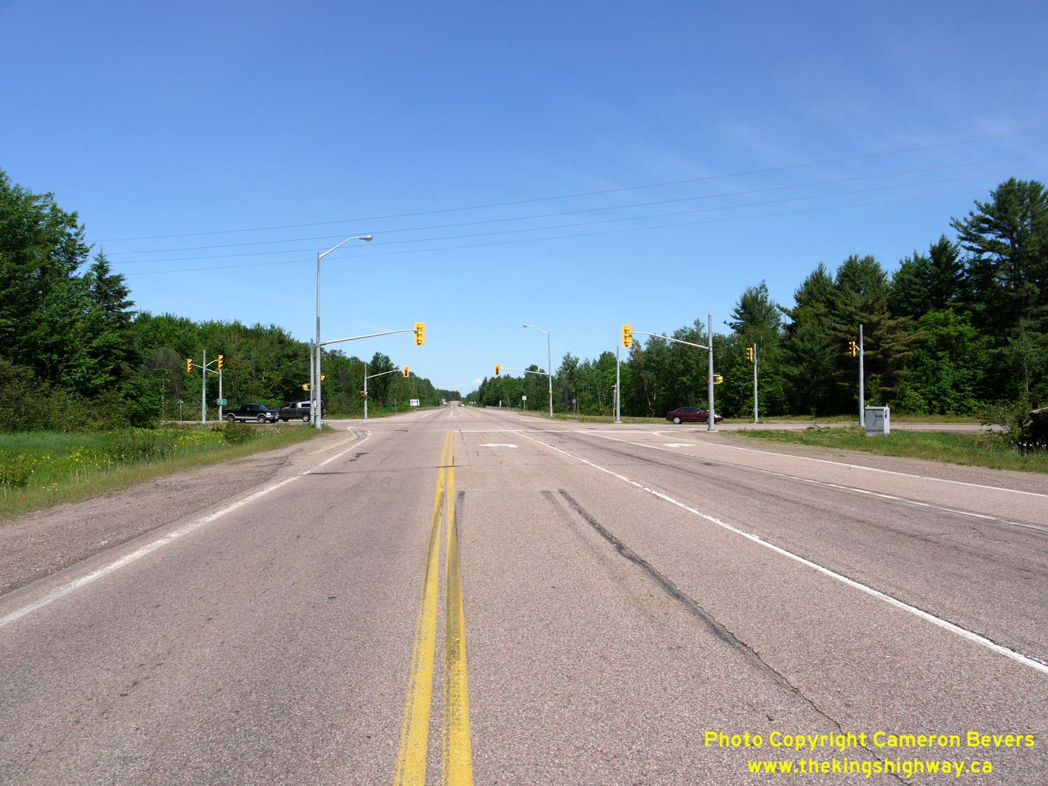
Left - Facing south along Hwy 41 at the Hwy 17 Junction. The traffic signals at this intersection operate on a simple two-phase timing plan, with no
advance protected left-turn arrows. (Photograph taken on June 1, 2010 - © Cameron Bevers) Right - Facing east along Hwy 17 towards the Hwy 41 Junction in Pembroke. Note the amber warning beacons at right, which begin to flash when the traffic signal ahead is red. See an Enlarged Photo Here. (Photograph taken on June 1, 2010 - © Cameron Bevers) 

Left - Facing east along Hwy 17 at the Hwy 41 Junction in Pembroke. The channelized right-turn lane on the left side of the photo carries traffic
from Southbound Hwy 41 to Westbound Hwy 17. (Photograph taken on June 1, 2010 - © Cameron Bevers) Right - Overview of the Hwy 17 & Hwy 41 Junction in Pembroke. Ever since the downloading of Hwy 62 & Hwy 148 west of Pembroke, the Hwy 41 Junction is the first King's Highway encountered along Hwy 17 east of the North Bay area, located 200 km to the west. (Photograph taken on June 1, 2010 - © Cameron Bevers) 

Left - Facing west along Hwy 17 towards Petawawa from the Hwy 41 Junction in Pembroke. (Photograph taken on June 1, 2010 - © Cameron Bevers) Right - Approaching the Hwy 41 Junction on Eastbound Hwy 17 in Pembroke. (Photograph taken on June 1, 2010 - © Cameron Bevers) 

Left - Guide signs on Southbound Hwy 41 at the Hwy 17 Junction in Pembroke. (Photograph taken on June 1, 2010 - © Cameron Bevers) Right - Facing north along Hwy 41 towards Pembroke from the Hwy 17 Junction. Note the large Irving Gas Station on the right-hand side of the highway. The Irving brand is somewhat of an anomaly in Ontario, where there are only a handful of gas stations operated by Irving Oil. However, these Irving Gas Stations are ubiquitous in Eastern Canada and New England, where the company operates hundreds of locations. See an Enlarged Photo Here. (Photograph taken on June 1, 2010 - © Cameron Bevers) 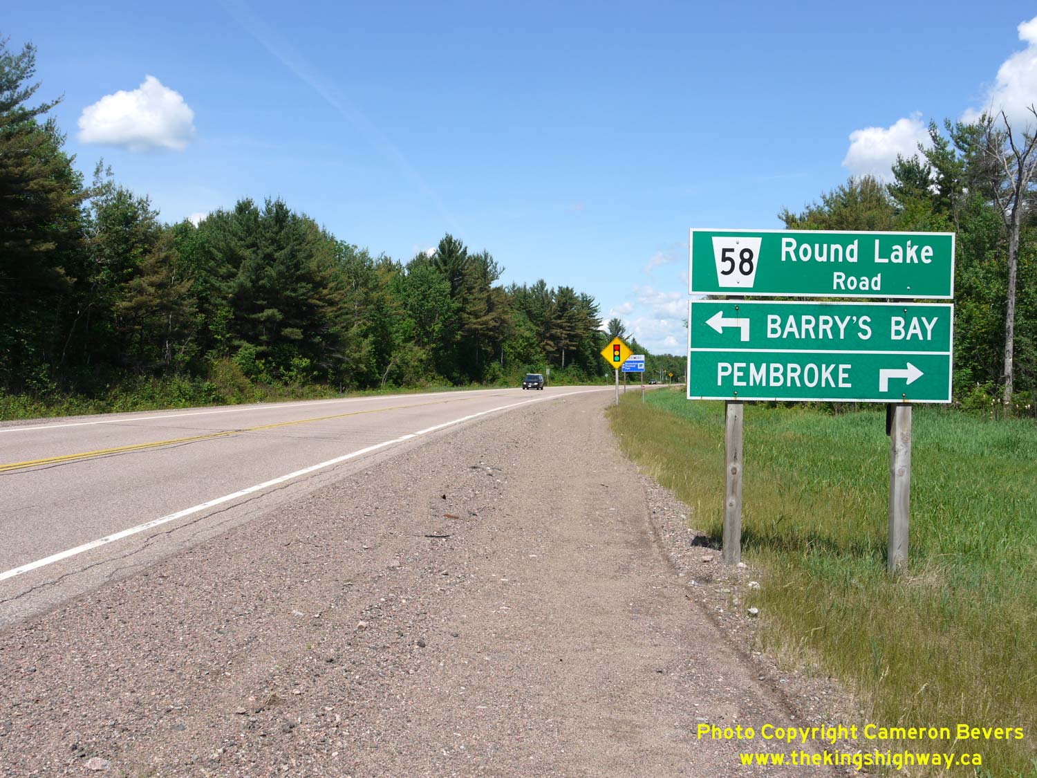
Left - Facing west along Hwy 17 towards Petawawa approaching Round Lake Road (Hwy 62 & Hwy 148) near Pembroke. Up until 1997, Round Lake Road south of the
Hwy 17 Junction was part of King's Highway 62, while north of the Hwy 17 Junction, Round Lake Road was known as King's Highway 148. Both of these provincial highways
were transferred to the County of Renfrew in 1997. Renfrew County renamed the two former highways collectively as Renfrew County Road 58. See an
Enlarged Photo Here. (Photograph taken on June 4, 2010 - © Cameron Bevers) Right - Facing north along Round Lake Road (Hwy 62) towards the Hwy 17 Junction near Pembroke. Prior to 1997, Hwy 62 reached its northern terminus at the Hwy 17 Junction. As a result of highway transfers and government service realignment in the 1990s, provincial ownership of Hwy 62 now ends in Maynooth, located about 130 km to the south. See an Enlarged Photo Here. (Photograph taken on June 4, 2010 - © Cameron Bevers) 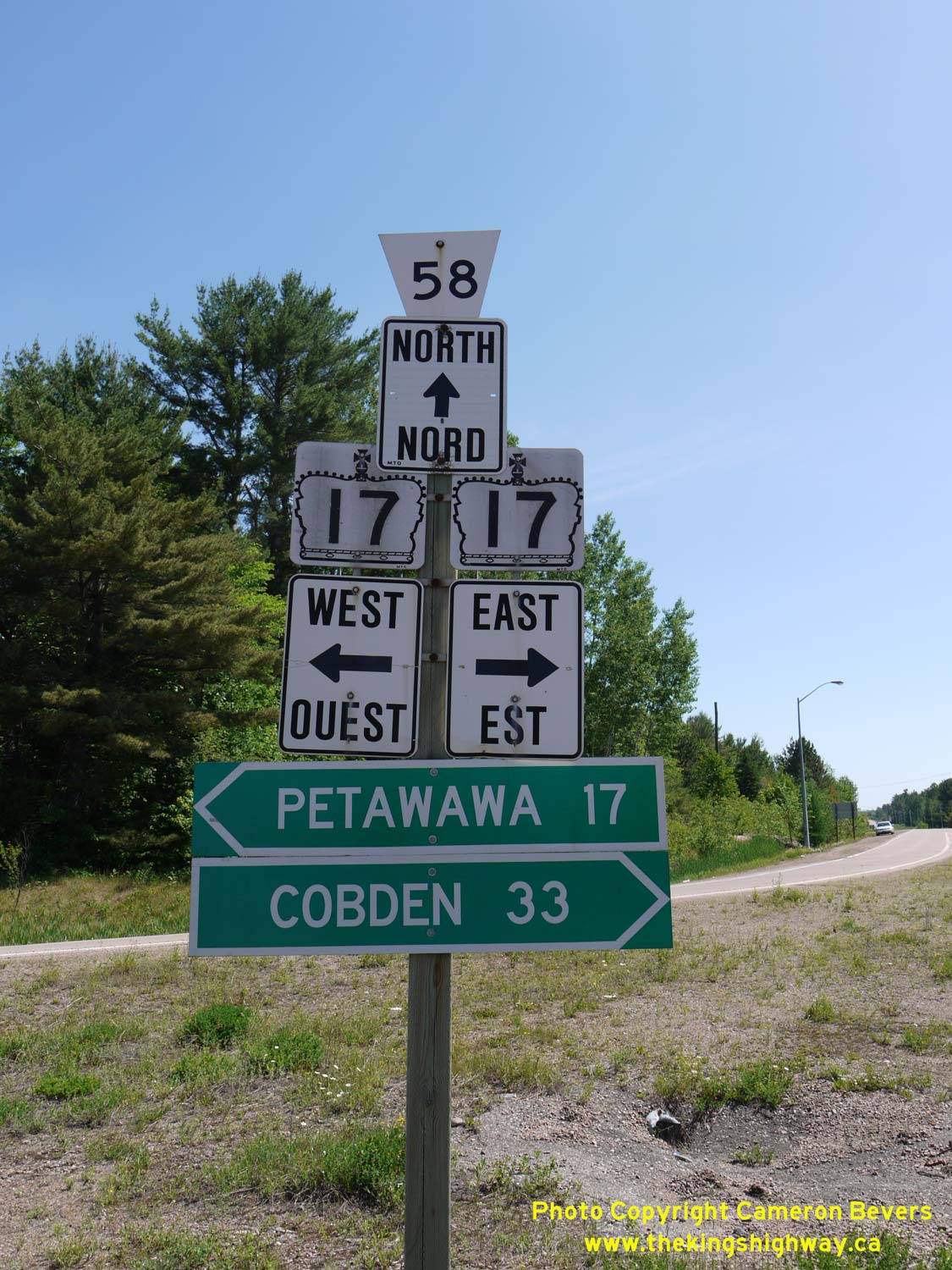
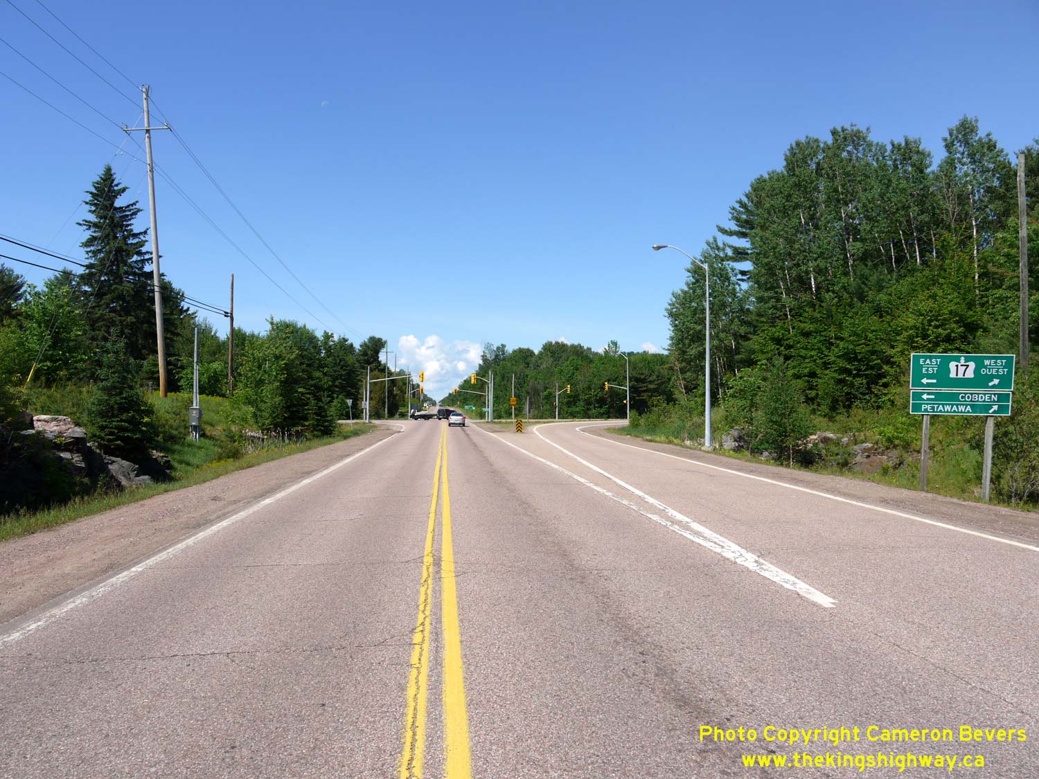
Above - Junction sign assembly at the Hwy 17 and Former Hwy 62 & Hwy 148 Junction near Pembroke. Prior to 1997, the County Road 58 flowerpot route marker
would have been a Hwy 148 provincial crown sign. Jurisdiction over both Hwy 62 & Hwy 148 in this area was transferred from the province to the County of Renfrew,
effective March 31, 1997. See an Enlarged Photo Here. (Photograph taken on June 4, 2010 - © Cameron Bevers) 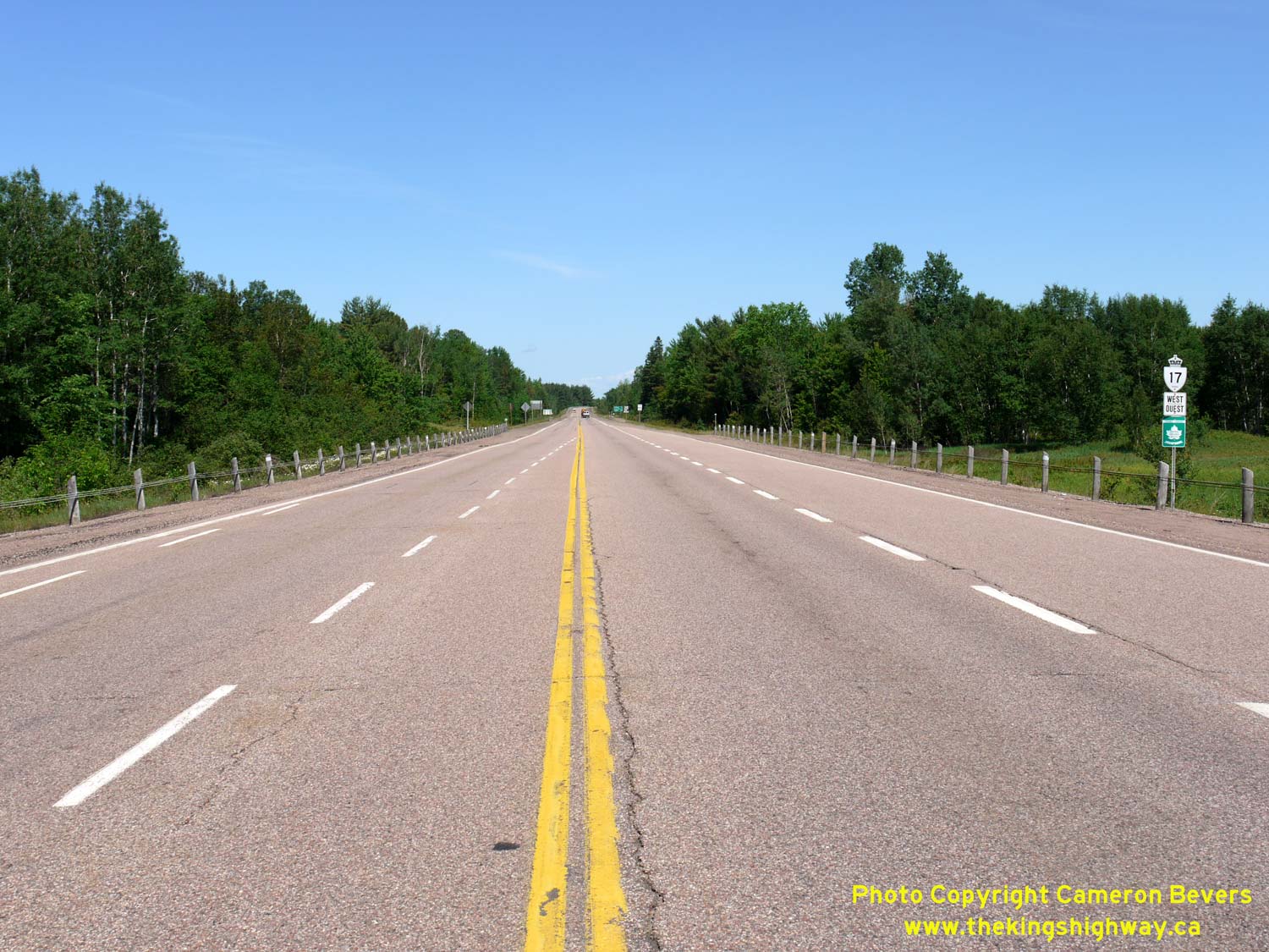
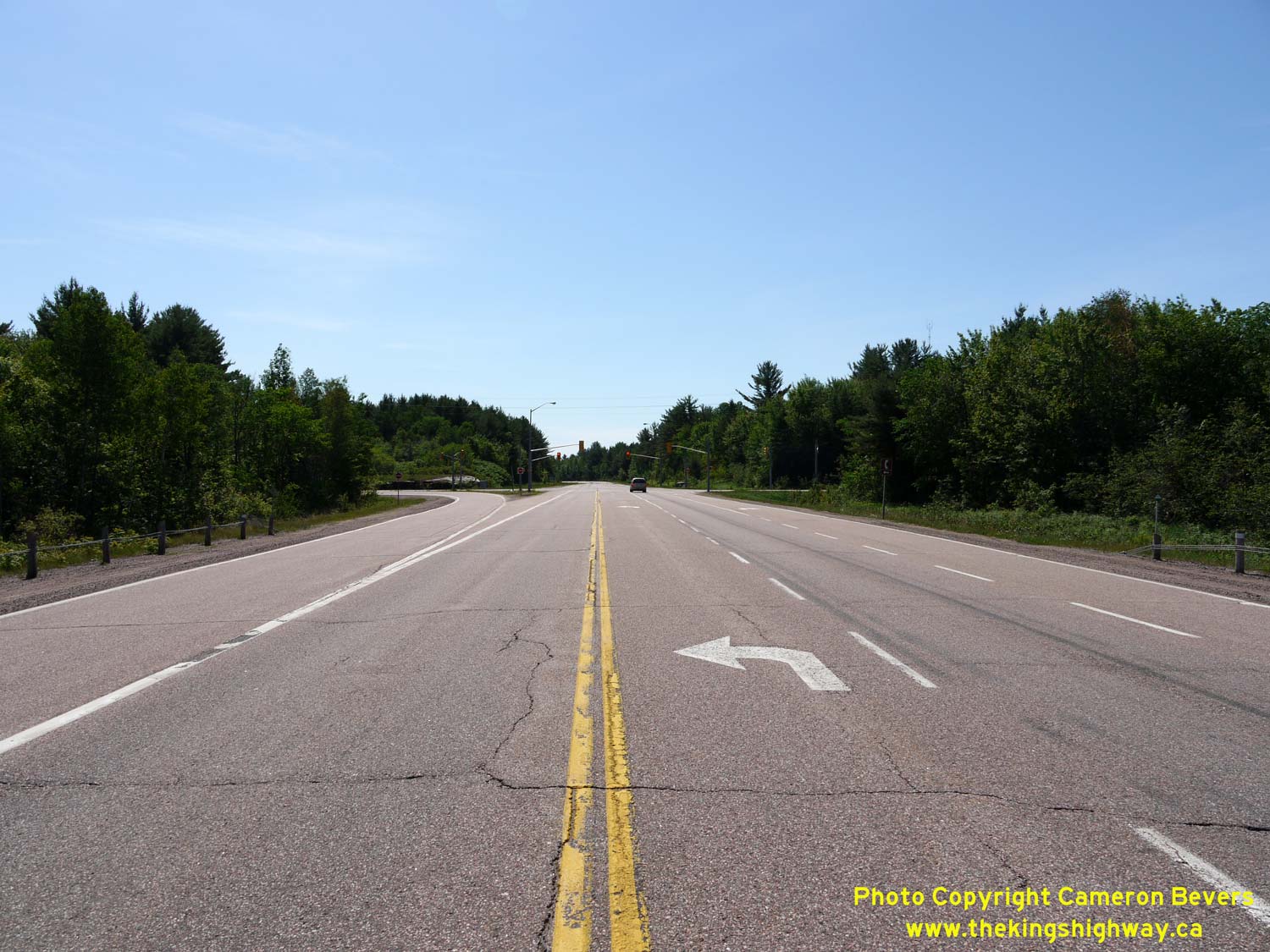
Left - Facing west along Hwy 17 towards Petawawa from the Round Lake Road (Hwy 62 & Hwy 148) Junction. See an
Enlarged Photo Here. (Photograph taken on June 4, 2010 - © Cameron Bevers) Right - Approaching the Round Lake Road (Hwy 62 & Hwy 148) Junction on Hwy 17, facing east towards Renfrew. See an Enlarged Photo Here. (Photograph taken on June 4, 2010 - © Cameron Bevers) 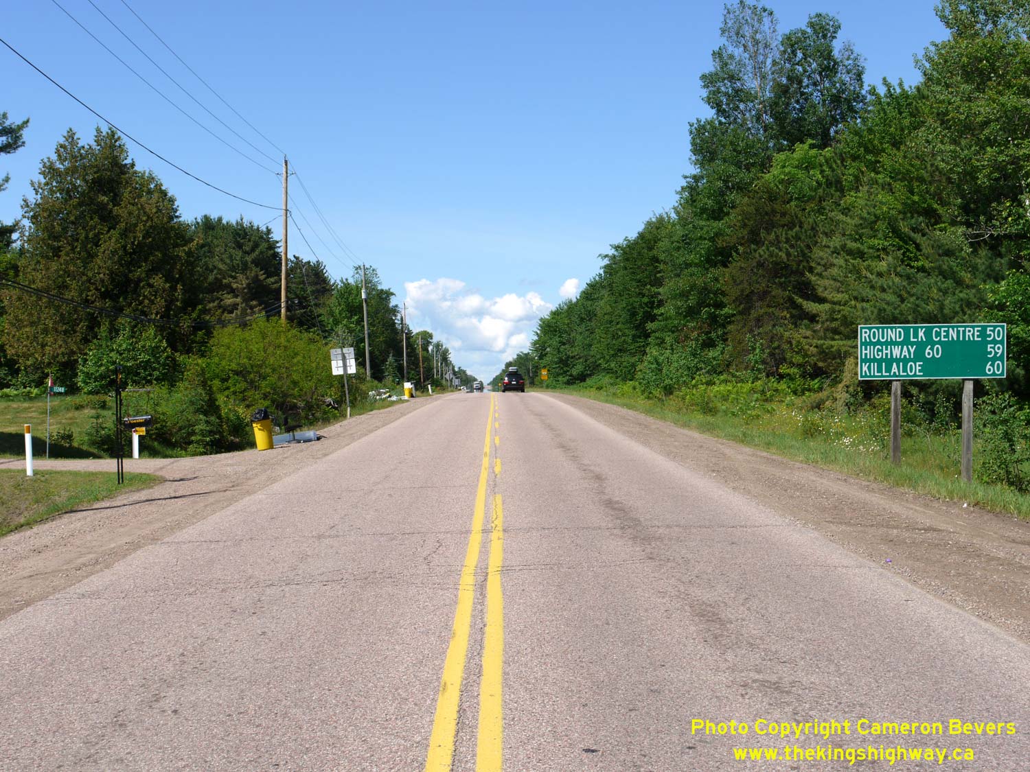
Left - Facing south along Round Lake Road (Hwy 62) from the Hwy 17 Junction. It is interesting to note that the distance guide sign at right lists Hwy 60 as a
destination. This is actually the next highway junction beyond Hwy 17, when heading south out of Pembroke. See an
Enlarged Photo Here. (Photograph taken on June 4, 2010 - © Cameron Bevers) Right - Facing west along Hwy 17 at the Round Lake Road (Hwy 62 & Hwy 148) Junction. See an Enlarged Photo Here. (Photograph taken on June 4, 2010 - © Cameron Bevers) 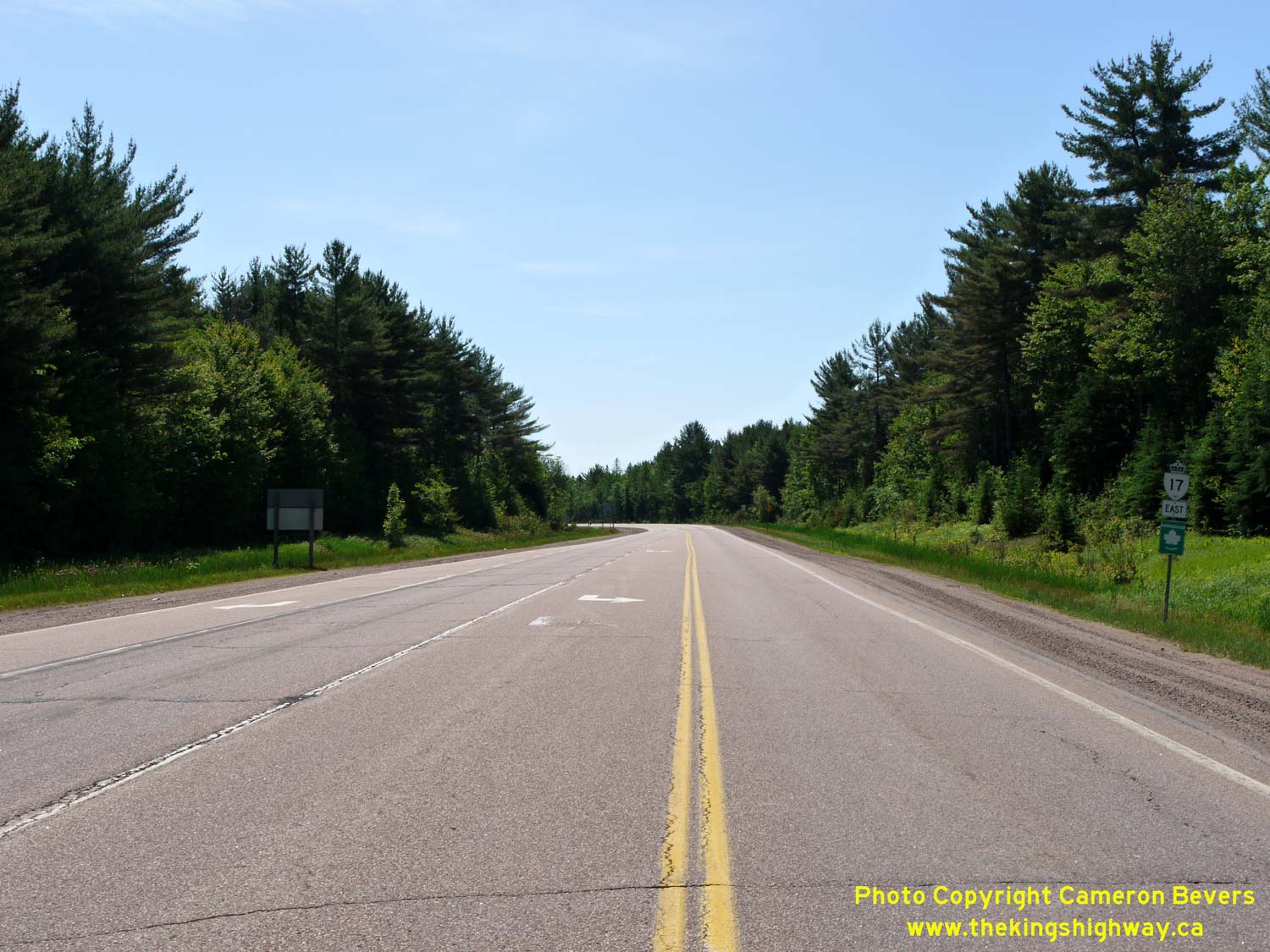
Left - Facing east along Hwy 17 from the Round Lake Road (Hwy 62 & Hwy 148) Junction near Pembroke. See an
Enlarged Photo Here. (Photograph taken on June 4, 2010 - © Cameron Bevers) Right - View of the traffic signals at Hwy 17 and Round Lake Road (Hwy 62 & Hwy 148). See an Enlarged Photo Here. (Photograph taken on June 4, 2010 - © Cameron Bevers) 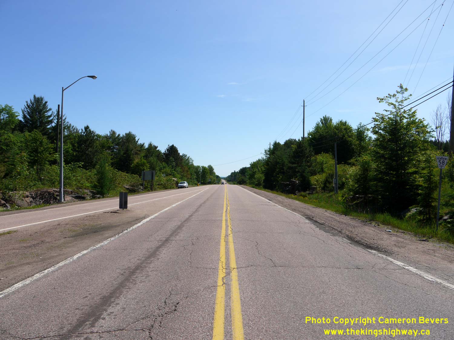
Left - Facing north along Round Lake Road (Hwy 148) from the Hwy 17 & Hwy 62 Junction near Pembroke. Downtown Pembroke lies about 7 km ahead. See an
Enlarged Photo Here. (Photograph taken on June 4, 2010 - © Cameron Bevers) Right - Approaching the Hwy 17 & Hwy 62 Junction on Round Lake Road (Hwy 148) near Pembroke. See an Enlarged Photo Here. (Photograph taken on June 4, 2010 - © Cameron Bevers) 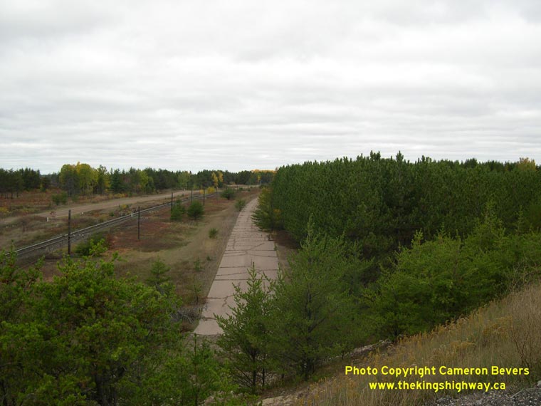
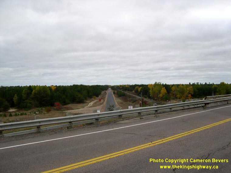
Left - Abandoned Hwy 17 alignment at C.F.B. Petawawa, facing west towards Deep River. The old highway was bypassed by a new Hwy 17 alignment in the late 1970s. (Photograph taken on October 11, 2004 - © Cameron Bevers) Right - Former Hwy 17 alignment at C.F.B. Petawawa, facing east towards Pembroke. The current route of Hwy 17 can be seen in the foreground. (Photograph taken on October 11, 2004 - © Cameron Bevers) 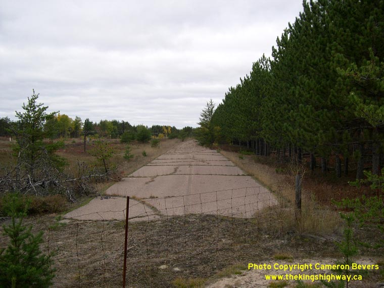
Left - Close-up of the abandoned pavement on the former Hwy 17 alignment at C.F.B. Petawawa. (Photograph taken on October 11, 2004 - © Cameron Bevers) Right - A 1937-dated concrete culvert on Hwy 17 at Chalk River. (Photograph taken on October 11, 2004 - © Cameron Bevers)
Continue on to King's Highway 17 Photos: Deep River to Mattawa
|
|---|
Links to Adjacent King's Highway Photograph Pages:
Back to King's Highway 16 Photos /
King's Highway 17 History /
On to King's Highway 18 Photos
Ontario Highway History - Main Menu / Back to List of Highways Website contents, photos & text © 2002-2026, Cameron
Bevers (Webmaster) - All Rights Reserved / Contact Me
|
|---|