
| 
| |
|
|
This page contains historical photos of Ontario's King's Highway 17 dating from 1954 to 1956. All photographs displayed on
this page were taken by the Ontario Ministry of Transportation, unless specifically noted otherwise. Historical photographs are arranged in approximate chronological
order. Click on any thumbnail to see a larger image!
Please note that all photographs displayed on this
website are protected by copyright. These photographs must not be reproduced, published,
electronically stored or copied, distributed, or posted onto other websites without
my written permission. If you want to use photos from this website, please
email me first for permission. Thank-you!
|
|---|
|
Page 4: Historical King's Highway 17 Photographs (1954 to 1956)

Above - New Hwy 17 alignment and bridge at Green's Creek between Ottawa and Orleans. The new bridge over Green's Creek was constructed under Contract
#1952-115. See an Enlarged Photo Here. Photo taken on July 19, 1954. (Photo courtesy of Ontario Ministry of Transportation - © King's Printer for Ontario, 1954) 
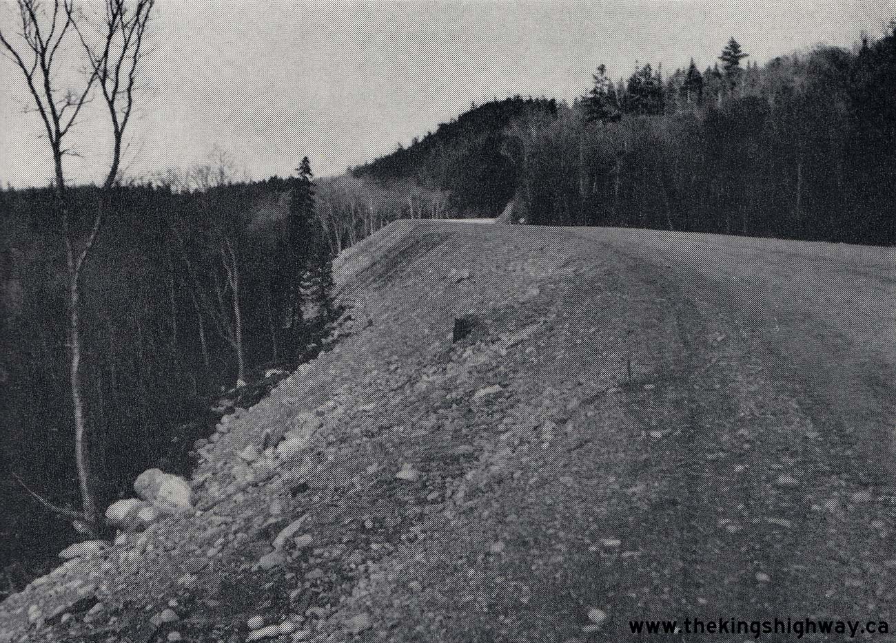
Above - Completed grading for an extension of Hwy 17 at Montreal River Hill, located about 75 miles north of Sault Ste. Marie. See an
Enlarged Photo Here. Photo taken on October 18, 1954. (Photo courtesy of Ontario Ministry of Transportation - © King's Printer for Ontario, 1954) 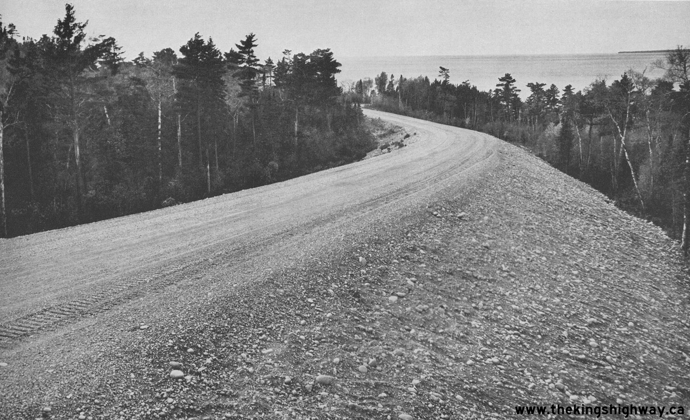
Left - Grading work for the extension of Hwy 17 facing south from Sta. 58+77 between Montreal River Hill and the Agawa River north of Sault Ste. Marie, Contract
#1953-77. See an Enlarged Photo Here. Photo taken on October 18, 1954. (Photo courtesy of Ontario Ministry of Transportation - © King's Printer for Ontario, 1954) Right - Realignment of Hwy 17 between Naughton and Whitefish in 1954. A hot-mix asphalt pavement was completed along Hwy 17 for a distance of about 10 miles between Copper Cliff and the Vermilion River Bridge in 1954, under Contract #1953-59. See an Enlarged Photo Here. Photo taken on October 19, 1954. (Photo courtesy of Ontario Ministry of Transportation - © King's Printer for Ontario, 1954) 
Above - View of a reconstructed section of Hwy 17 about 2 miles west of Naughton, showing completed hot-mix asphalt paving and zone striping,
Contract #1953-59. See an Enlarged Photo Here. Photo taken on October 19, 1954. (Photo courtesy of Ontario Ministry of Transportation - © King's Printer for Ontario, 1954) 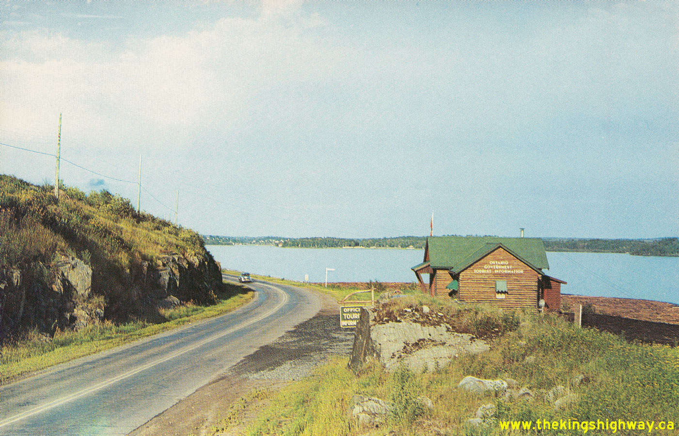
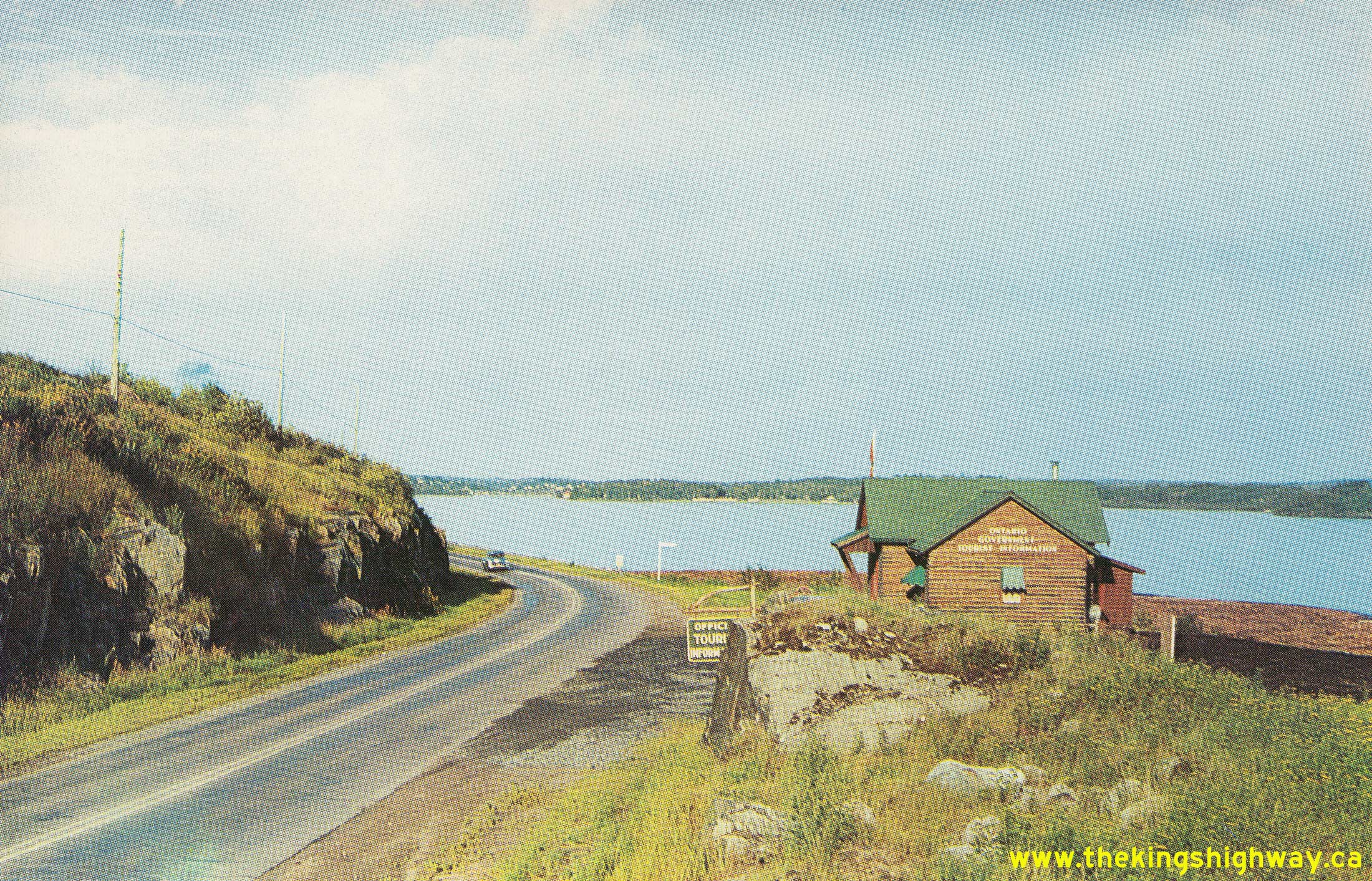
Left - Circa 1954 postcard view of Hwy 17 beside Lake of the Woods, facing east towards Kenora from the Keewatin Channel Bridge. At one time, an
Ontario Government Tourist Information Centre existed at this location, but it has since been relocated. See an
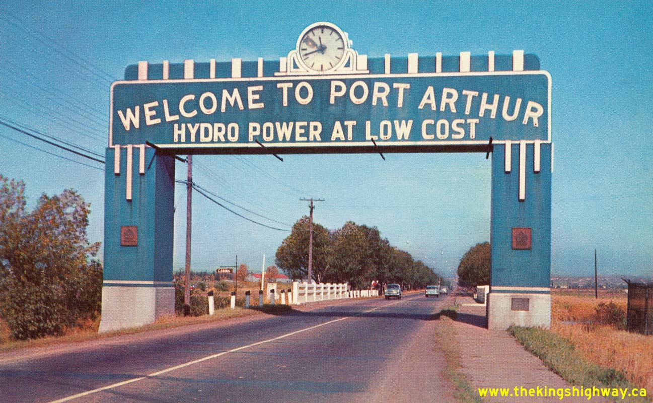
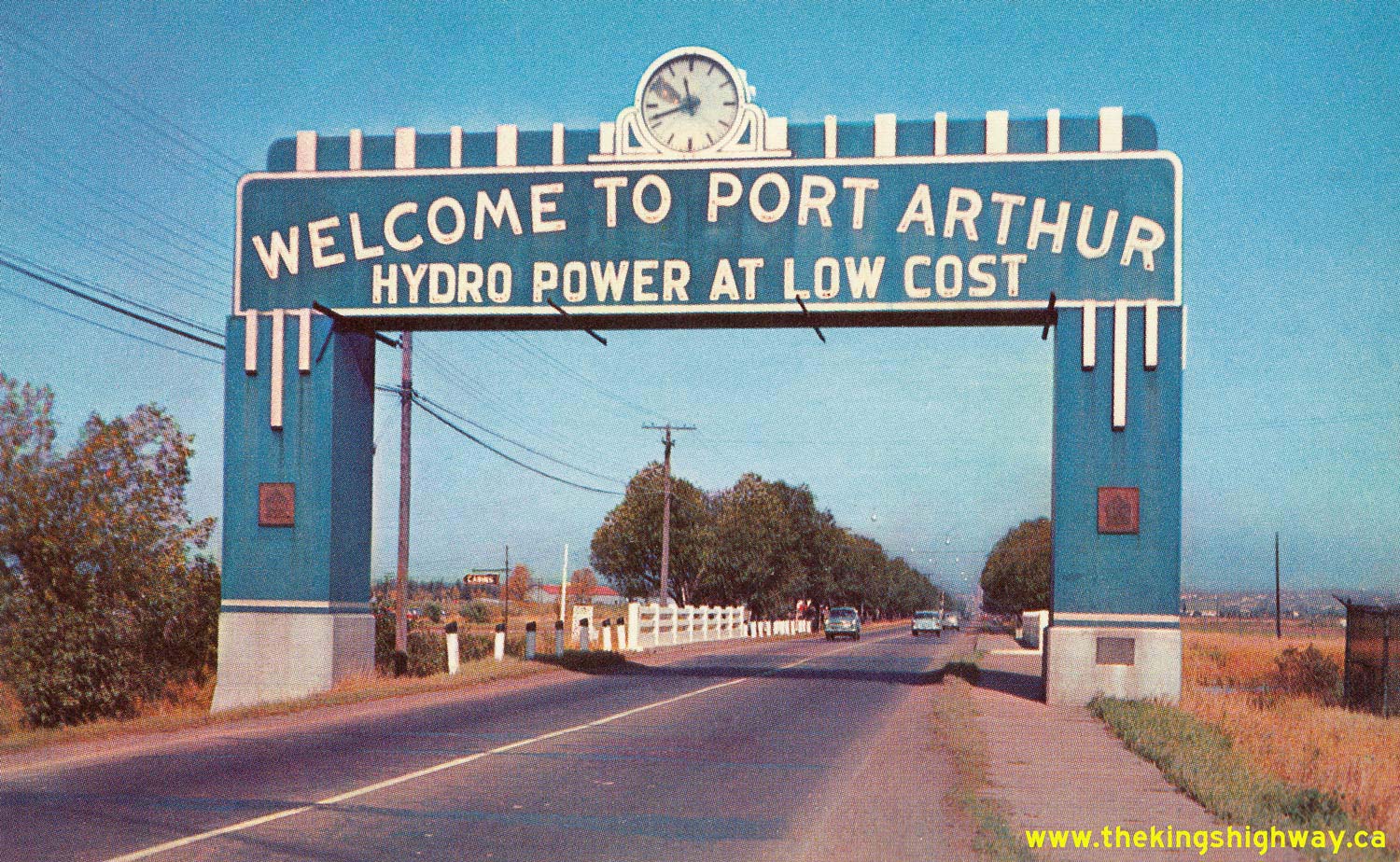
Enlarged Photo Here. Photo taken circa 1954. (Photo courtesy of Northern Photo Services Ltd., Winnipeg) Right - Circa 1955 postcard view of the Port Arthur Welcome Arch on Hwy 17 (Memorial Avenue). This early colour postcard shows the original blue-and-white colour scheme of this 1930s-era municipal welcome arch. During the 1960s, the arch was reconstructed in order to accommodate a widened four-lane Hwy 17 below the structure. During reconstruction, the arch was repainted with a new orange-and-white colour scheme and the electric clock above the highway was removed. Note the series of steel outriggers immediately below the sign, which were presumably installed to enable work crews to do maintenance activities on the clock and the neon tube lighting. The steel outriggers were apparently a retrofit, as they were not present in this earlier 1939 Photo of the arch. See an Enlarged Photo Here. (Photo courtesy of Western Smallwares & Stationery Co. Ltd, Winnipeg) 
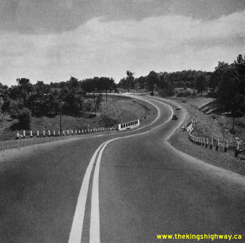
Above - Facing east along Hwy 17 towards Earls Lake from the scenic lookout 4 miles west of Mattawa (ca. 1955) (Photo from Cameron Bevers' historical photograph collection - Original photographer unknown) 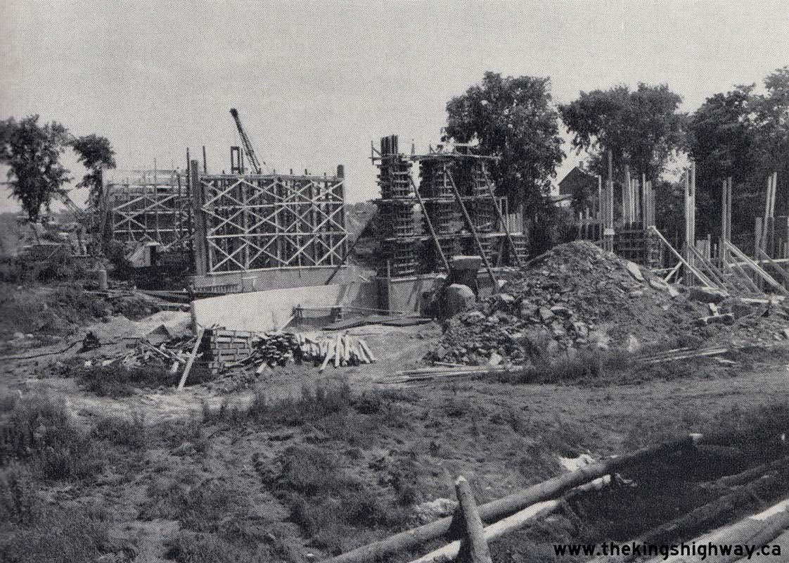
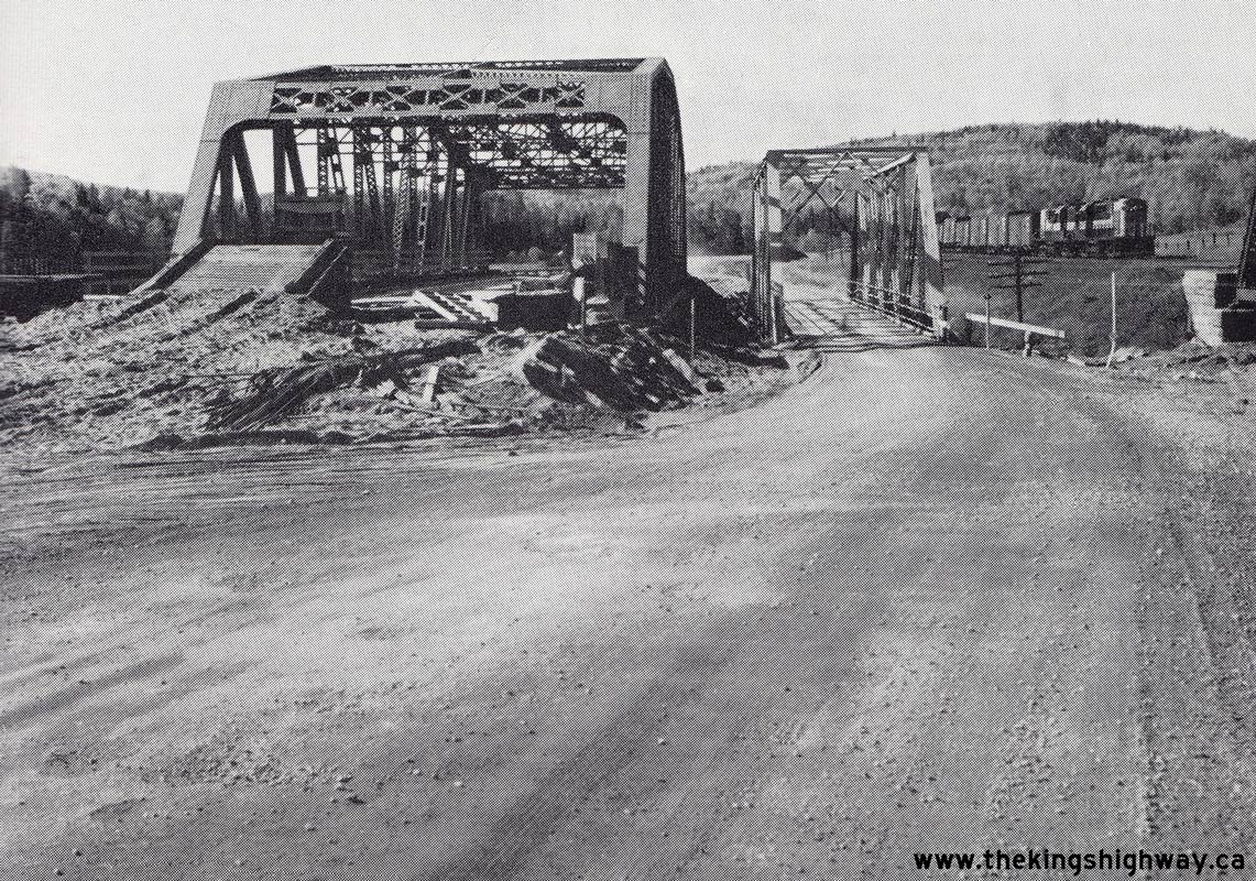
Above - Construction of the new Hawkesbury Creek and Canadian National Railway (CNR) Overhead on the Hawkesbury Bypass (Hwy 17). Photo taken on July 26, 1955. (Photo courtesy of Ontario Ministry of Transportation - © King's Printer for Ontario, 1955) 
Above - Grading operations underway on the Hawkesbury Bypass (Hwy 17). Photo taken on July 26, 1955. (Photo courtesy of Ontario Ministry of Transportation - © King's Printer for Ontario, 1955) 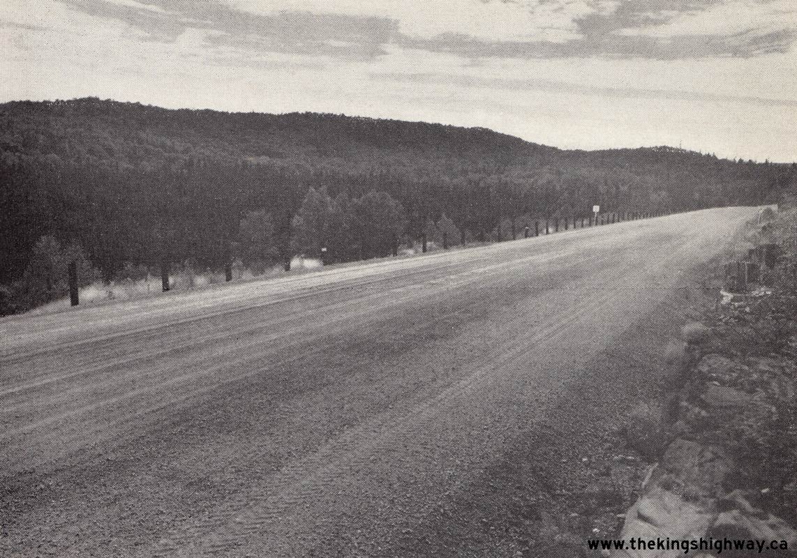

Left - Completed grading on Hwy 17 about 7 miles east of the Steel River Bridge between Terrace Bay and Marathon. Photo taken on September 7, 1955. (Photo courtesy of Ontario Ministry of Transportation - © King's Printer for Ontario, 1955) Right - New section of Hwy 17 about 7 miles west of Marathon. Photo taken on September 7, 1955. (Photo courtesy of Ontario Ministry of Transportation - © King's Printer for Ontario, 1955) 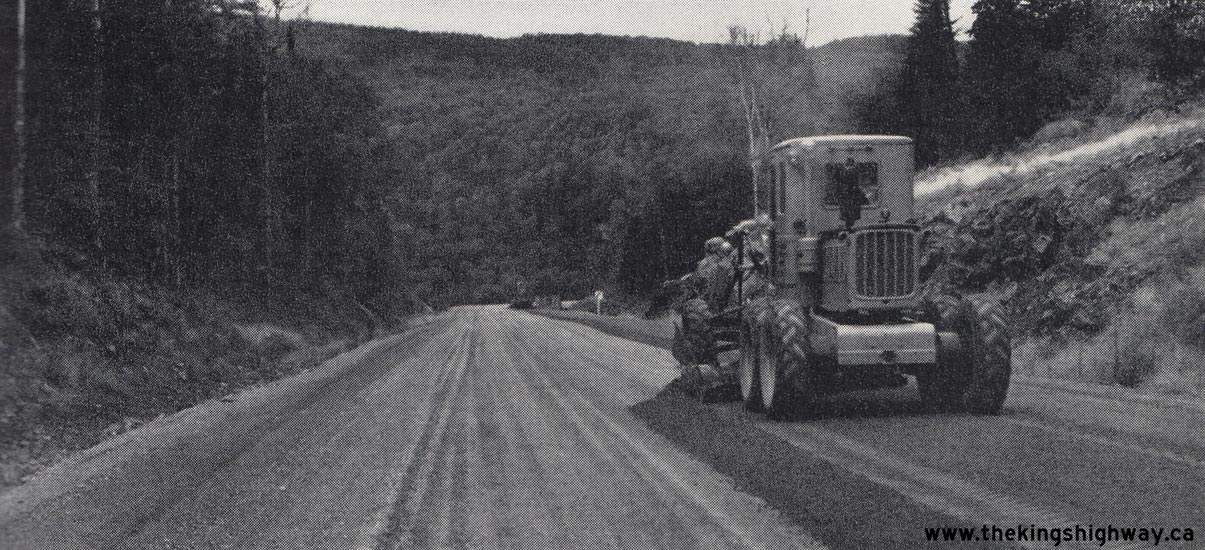
Above - Grader laying a fresh granular surface on an extension of Hwy 17, 8 miles west of Marathon. Photo taken on September 7, 1955. (Photo courtesy of Ontario Ministry of Transportation - © King's Printer for Ontario, 1955) 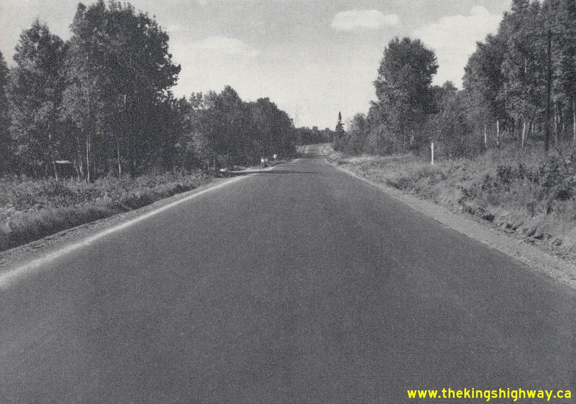

Left - Resurfaced section of Hwy 17 approaching Port Arthur (1955) (Photo courtesy of Ontario Ministry of Transportation - © King's Printer for Ontario, 1955) Right - New Department of Highways of Ontario (DHO) Fort William District Office on Hwy 17 (Arthur Street) at the Hwy 61 Junction in 1955. The Thunder Bay (Northwestern Regional Office) is now located on James Street. The former DHO Fort William District Office seen here was subsequently re-purposed after the DHO moved out, although the building itself still stands today at 1825 Arthur Street East at the corner of Kingsway. Note the Hwy 17 & Hwy 61 junction sign assembly at right. Photo taken in 1955. (Photo courtesy of Ontario Ministry of Transportation - © King's Printer for Ontario, 1955) 
Above - Reconstruction of Hwy 17 near Dryden, showing a roadside diversion for traffic staging (1955) (Photo courtesy of Ontario Ministry of Transportation - © King's Printer for Ontario, 1955) 
Above - Grading operations underway on Hwy 17 near Dryden (1955) (Photo courtesy of Ontario Ministry of Transportation - © King's Printer for Ontario, 1955) 
Above - Completed grading on Hwy 17 at a new earth cut near Oxdrift, west of Dryden (1955) (Photo courtesy of Ontario Ministry of Transportation - © King's Printer for Ontario, 1955) 
Above - Junction of Hwy 17 & Hwy 70 (today's Hwy 71) at Longbow Corners, facing west towards Kenora. Photo taken on September 13, 1955. (Photo courtesy of Ontario Ministry of Transportation - © King's Printer for Ontario, 1955) 

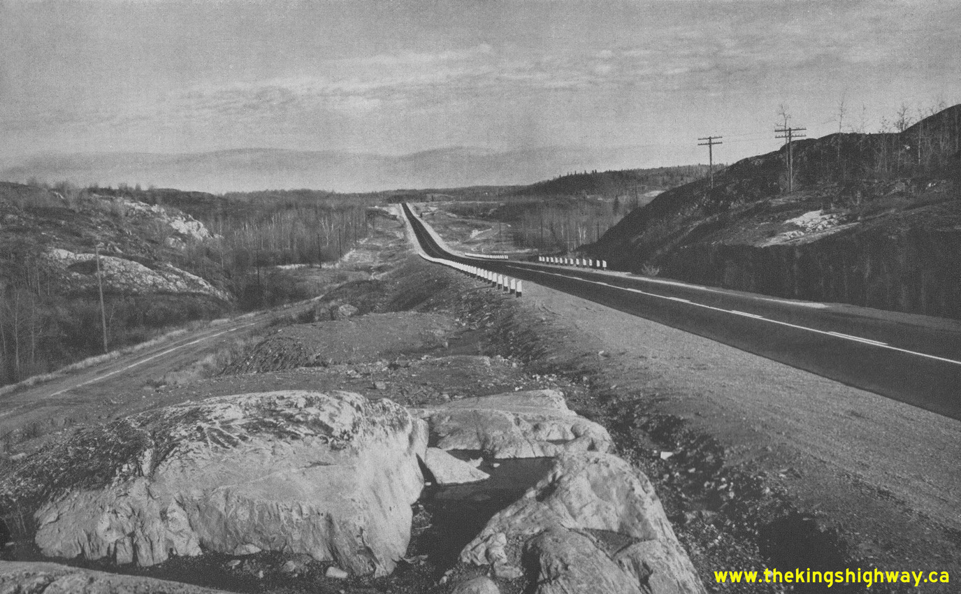
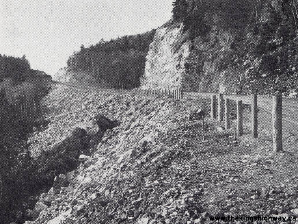
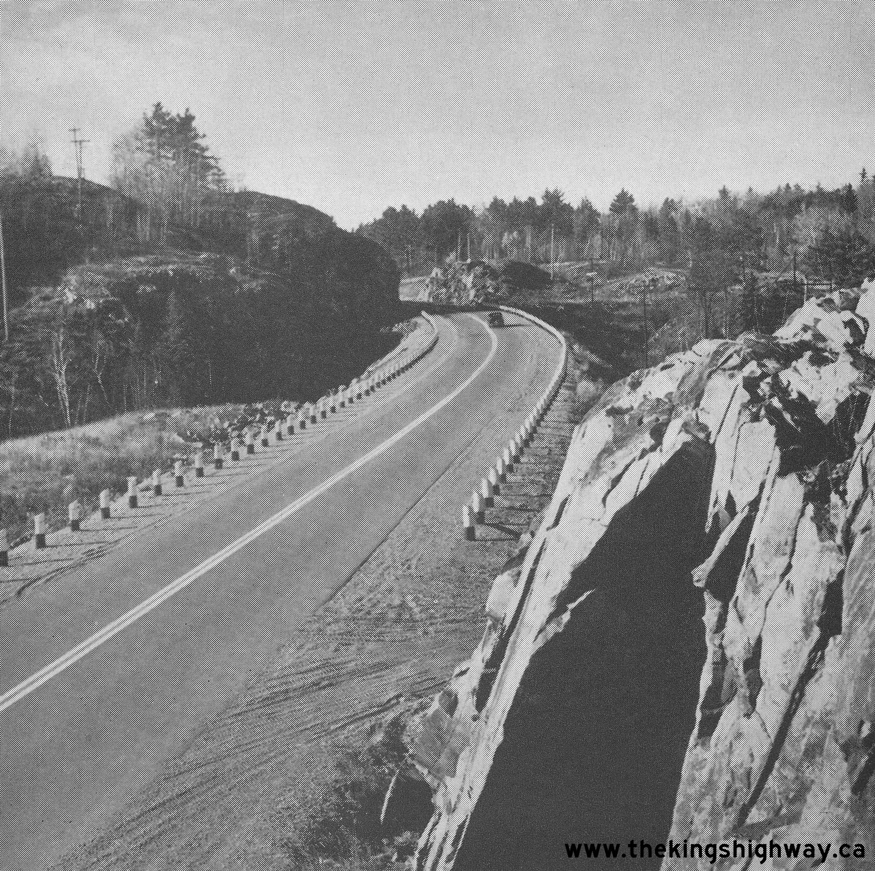
Left - Completed rock cut on Hwy 17 near the Little Pic River west of Marathon (1955) (Photo courtesy of Ontario Ministry of Transportation - © King's Printer for Ontario, 1955) Right - Completed mulch paving on Hwy 17 at Montreal River Hill, overlooking Lake Superior. Photo taken on September 20, 1955. (Photo courtesy of Ontario Ministry of Transportation - © King's Printer for Ontario, 1955) 

Left - Completed mulch pavement at Montreal River Hill on an extension of Hwy 17, about 75 miles north of Sault Ste. Marie. Photo taken on September 20, 1955. (Photo courtesy of Ontario Ministry of Transportation - © King's Printer for Ontario, 1955) Right - Birch Creek Bridge replacement on Hwy 17 near Webbwood, between Espanola and Massey. Photo taken on September 22, 1955. (Photo courtesy of Ontario Ministry of Transportation - © King's Printer for Ontario, 1955) 
Above - Pier construction at the new Spanish River Bridge on Hwy 17 east of Espanola. Photo taken on September 23, 1955. (Photo courtesy of Ontario Ministry of Transportation - © King's Printer for Ontario, 1955) 
Above - Pier construction at the new Spanish River Bridge, located about 5 miles east of Espanola. Photo taken on September 23, 1955. (Photo courtesy of Ontario Ministry of Transportation - © King's Printer for Ontario, 1955) 
Above - Completed Copper Cliff CPR Overhead on Hwy 17 west of Sudbury. Photo taken on September 23, 1955. (Photo courtesy of Ontario Ministry of Transportation - © King's Printer for Ontario, 1955) 
Above - Completed hot mix paving on Hwy 17 west of North Bay near Beaucage, facing west from Sta. 470+00, Contract #1955-83. Photo taken on September 26, 1955. (Photo courtesy of Ontario Ministry of Transportation - © King's Printer for Ontario, 1955) 
Above - New corrugated steel culverts on Hwy 17, 3 miles east of Hawkesbury. Photo taken on August 7, 1956. (Photo courtesy of Ontario Ministry of Transportation - © King's Printer for Ontario, 1956) 
Above - Completed Hawkesbury Creek and CNR Overhead on the Hawkesbury Bypass (Hwy 17). Photo taken on August 7, 1956. (Photo courtesy of Ontario Ministry of Transportation - © King's Printer for Ontario, 1956) 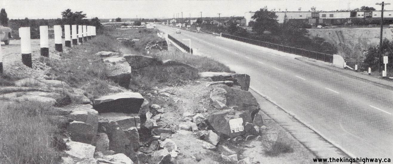
Above - Hot mix paving on Hwy 17 through Sturgeon Falls. Photo taken on September 18, 1956. (Photo courtesy of Ontario Ministry of Transportation - © King's Printer for Ontario, 1956) 
Left - Hot mix paving on Hwy 17, 17 miles east of Terrace Bay. Photo taken on September 28, 1956. (Photo courtesy of Ontario Ministry of Transportation - © King's Printer for Ontario, 1956) Right - New Matawin River Bridge on Hwy 17 at Sunshine, located 12 miles west of Kakabeka Falls. Note the diminutive one lane bridge on Hwy 17 at right. Photo taken on September 30, 1956. (Photo courtesy of Ontario Ministry of Transportation - © King's Printer for Ontario, 1956) 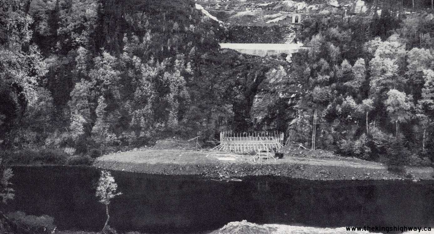
Above - Pier construction for the new Little Pic River Bridge on a diversion of Hwy 17, 17 miles west of Marathon. Photo taken on September 28, 1956. (Photo courtesy of Ontario Ministry of Transportation - © King's Printer for Ontario, 1956) 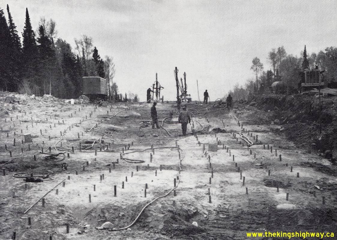
Above - Preparation to blast a new rock cut on Hwy 17, 9 miles west of the Hwy 120 Junction (today's Hwy 11) at Shabaqua Corners. Photo taken on October 1,
1956. (Photo courtesy of Ontario Ministry of Transportation - © King's Printer for Ontario, 1956) 
Above - Reconstruction of Hwy 17 under Contract #1955-95, 8 miles west of Oxdrift. Photo taken on October 2, 1956. (Photo courtesy of Ontario Ministry of Transportation - © King's Printer for Ontario, 1956) 
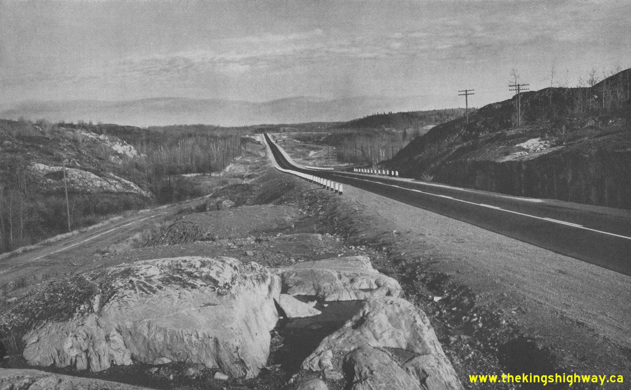
Above - Clearing and rock excavation for a new alignment of Hwy 17, 1 1/2 miles east of the Ontario-Manitoba Boundary. Photo taken on October 3, 1956. (Photo courtesy of Ontario Ministry of Transportation - © King's Printer for Ontario, 1956) 
Above - Construction of a new nine-bay DHO highway maintenance garage on Hwy 17 east of Kenora. Photo taken on October 4, 1956. (Photo courtesy of Ontario Ministry of Transportation - © King's Printer for Ontario, 1956) 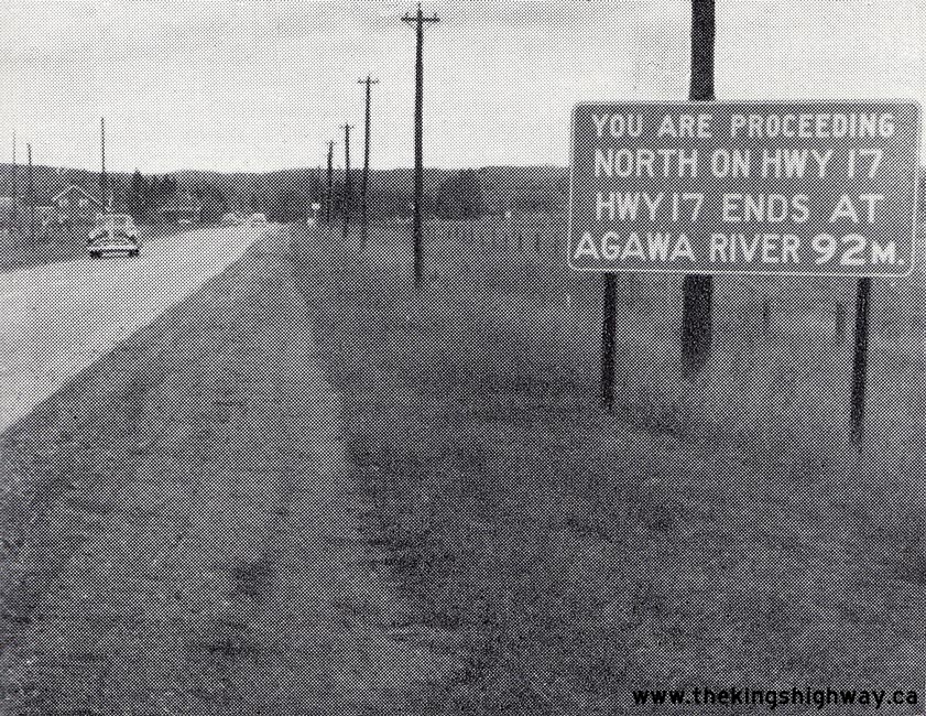
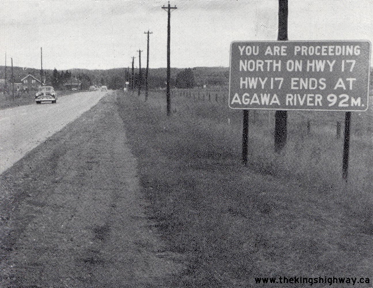
Left - Sign on northbound Hwy 17 departing from Sault Ste. Marie warning motorists that the highway ends 92 miles ahead at the Agawa River. It wasn't until
1960 that Hwy 17 was punched through to Wawa and Marathon. Motorists in Sault Ste. Marie who wished to travel to Northwestern Ontario on an all-Canadian highway route
had to double-back all the way to Sturgeon Falls and use Hwy 64 and Hwy 11 to reach Nipigon and the discontinuous western leg of Hwy 17. Alternatively, motorists
could drive through the United States via Michigan, Wisconsin and Minnesota, or have their vehicle transported to Port Arthur from Sault Ste. Marie by ship. Suffice
to say, travelling around Northern Ontario was far more difficult back then! When Hwy 17 was completed around Lake Superior in 1960, the highway distance through
Ontario between Sault Ste. Marie and Port Arthur (now part of Thunder Bay) was reduced by nearly 800 km (500 miles). See an
Enlarged Photo Here. Photo taken on October 9, 1956. (Photo courtesy of Ontario Ministry of Transportation - © King's Printer for Ontario, 1956) Right - Grading for an extension of Hwy 17 north of Agawa River. Photo taken on October 9, 1956. (Photo courtesy of Ontario Ministry of Transportation - © King's Printer for Ontario, 1956) 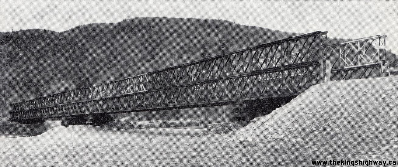
Above - Temporary Agawa River Bailey Bridge on Hwy 17 in Lake Superior Provincial Park north of Sault Ste. Marie. Photo taken on October 9, 1956. (Photo courtesy of Ontario Ministry of Transportation - © King's Printer for Ontario, 1956) 
Above - New rock cut and completed grading approaching the Spanish River Bridge, located about 5 miles east of Espanola. Photo taken on October 11, 1956. (Photo courtesy of Ontario Ministry of Transportation - © King's Printer for Ontario, 1956) 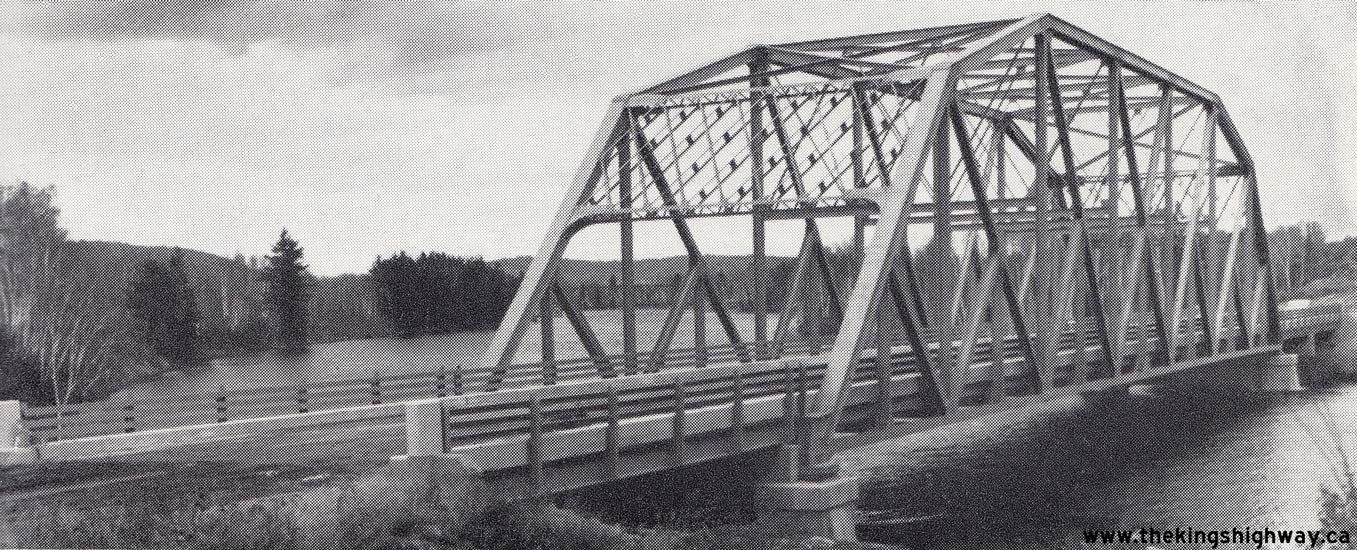
Above - Completed Spanish River Bridge on Hwy 17 between Espanola and Nairn Centre. Photo taken on October 11, 1956. (Photo courtesy of Ontario Ministry of Transportation - © King's Printer for Ontario, 1956) 
Above - Completed approach to the Nairn Railway Overhead on Hwy 17 between Sudbury and Espanola. Photo taken on October 12, 1956. (Photo courtesy of Ontario Ministry of Transportation - © King's Printer for Ontario, 1956)
Continue on to King's Highway 17 Photos: Historical Photos: 1957-1959
|
|---|
Links to Adjacent King's Highway Photograph Pages:
Back to Hwy 17 - Historical Photos (1950-1953)
Hwy 17 Photo Index
On to Hwy 17 - Historical Photos (1957-1959)
Back to King's Highway 16 Photos /
King's Highway 17 History /
On to King's Highway 18 Photos
Ontario Highway History - Main Menu / Back to List of Highways Website contents, photos & text © 2002-2026, Cameron
Bevers (Webmaster) - All Rights Reserved / Contact Me
|
|---|