
| 
| |
|
|
This page contains historical photos of Ontario's King's Highway 17 dating from 1957 to 1959. All photographs displayed on
this page were taken by the Ontario Ministry of Transportation, unless specifically noted otherwise. Historical photographs are arranged in approximate chronological
order. Click on any thumbnail to see a larger image!
Please note that all photographs displayed on this
website are protected by copyright. These photographs must not be reproduced, published,
electronically stored or copied, distributed, or posted onto other websites without
my written permission. If you want to use photos from this website, please
email me first for permission. Thank-you!
|
|---|
|
Page 5: Historical King's Highway 17 Photographs (1957 to 1959)

Above - Facing east along Hwy 17 towards the Hwy 29 Junction near Arnprior (ca. 1957) (Photo from Cameron Bevers' historical photograph collection - Original photographer unknown) 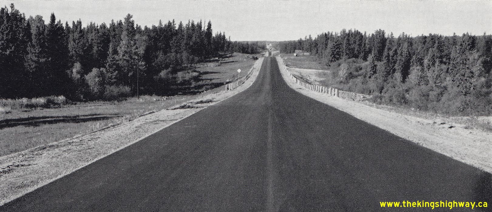
Above - Completed hot mix asphalt pavement on Hwy 17 about 3 miles west of the Hwy 120 Junction (today's Hwy 11) at Shabaqua Corners. See an
Enlarged Photo Here. Photo taken on September 25, 1957. (Photo courtesy of Ontario Ministry of Transportation - © King's Printer for Ontario, 1957) 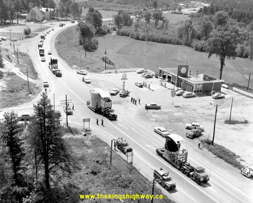

Left - Oversized loads on Hwy 17 at Deep River in 1957. The trucks are hauling components for the Rolphton Power Plant. (Photo from Cameron Bevers' historical photograph collection - Original photographer unknown) Right - Wolf River Bridge on Hwy 17 between Dorion and Hurkett in 1957. The original Wolf River Bridge on Hwy 17 was a timber through truss bridge, similar in design to the famous Sioux Narrows Bridge on Hwy 71. The main through truss span was 90 feet (28 metres) in length. The Wolf River Bridge was completed in 1937. Unfortunately, the eastern approach to this bridge was narrow and winding and a new alignment was eventually built which bypassed the wooden bridge entirely. The current Wolf River Bridge was completed in 1959 and the old wooden bridge seen here was subsequently demolished. The approaches to the former Wolf River Bridge can still be found today in the forest just to the north of the current highway. See an Enlarged Photo Here. Photo taken on September 25, 1957. (Photo © Archives of Ontario - Series RG-14-162-5-166, Photo #914-57, AO6881) 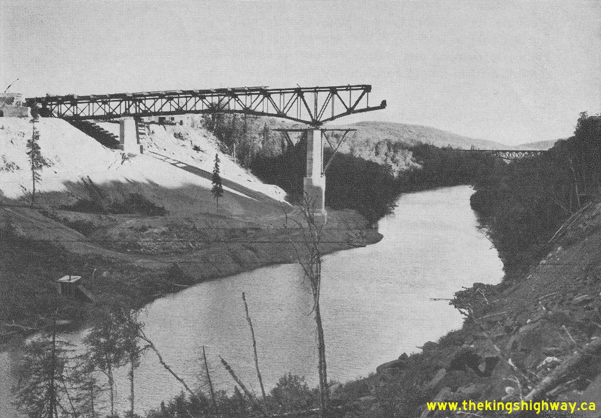
Above - Construction of the Little Pic River Bridge on Hwy 17 near Marathon, Contract #1956-20. The steel deck truss portion of the bridge was about 50%
complete when this photo was taken in the autumn of 1957. Until the permanent bridge was completed in 1958, Hwy 17 traffic used a temporary Bailey Bridge located a
short distance upstream of the permanent bridge site. See an Enlarged Photo Here. Photo taken
in September 27, 1957. (Photo courtesy of Ontario Ministry of Transportation - © King's Printer for Ontario, 1957) 

Left - Guide sign at the western end of the North Bay Bypass (Hwy 17) at the Hwy 17B Junction. Photo taken circa 1957. (Photo courtesy of North Magazine - Donated by Eric Vettoretti) Right - Hwy 11 & Hwy 17 route markers on the North Bay Bypass. Photo taken circa 1957. (Photo courtesy of North Magazine - Donated by Eric Vettoretti) 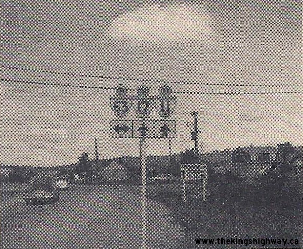

Left - Route marker assembly approaching the Hwy 63 Junction on the North Bay Bypass (Hwy 11 & Hwy 17). Photo taken circa 1957. (Photo courtesy of North Magazine - Donated by Eric Vettoretti) Right - Route marker assembly approaching Fisher Street on the North Bay Bypass (Hwy 11 & Hwy 17). Photo taken circa 1957. (Photo courtesy of North Magazine - Donated by Eric Vettoretti) 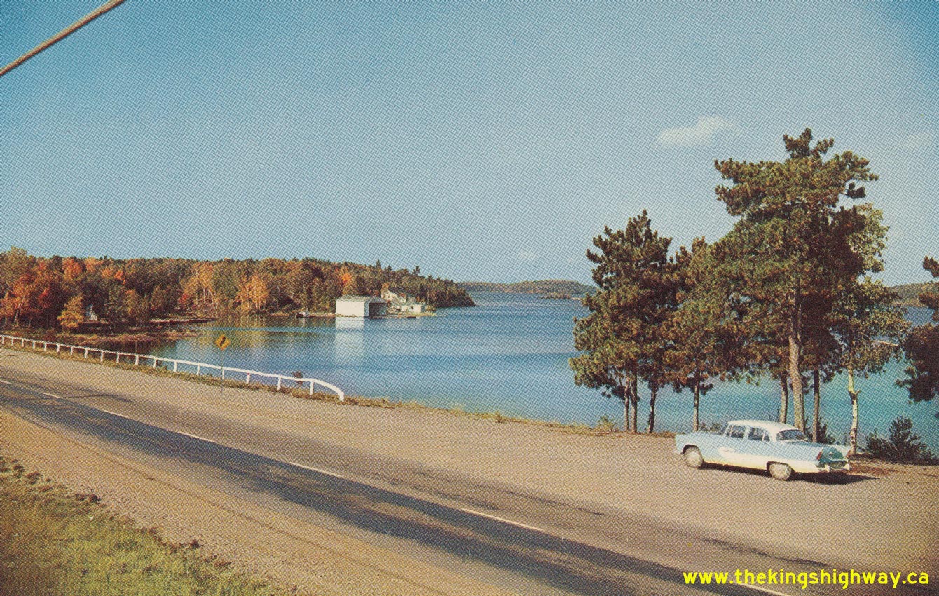
Left - Circa 1957 postcard view of Hwy 17 at Lauzon Lake, east of Blind River. See an
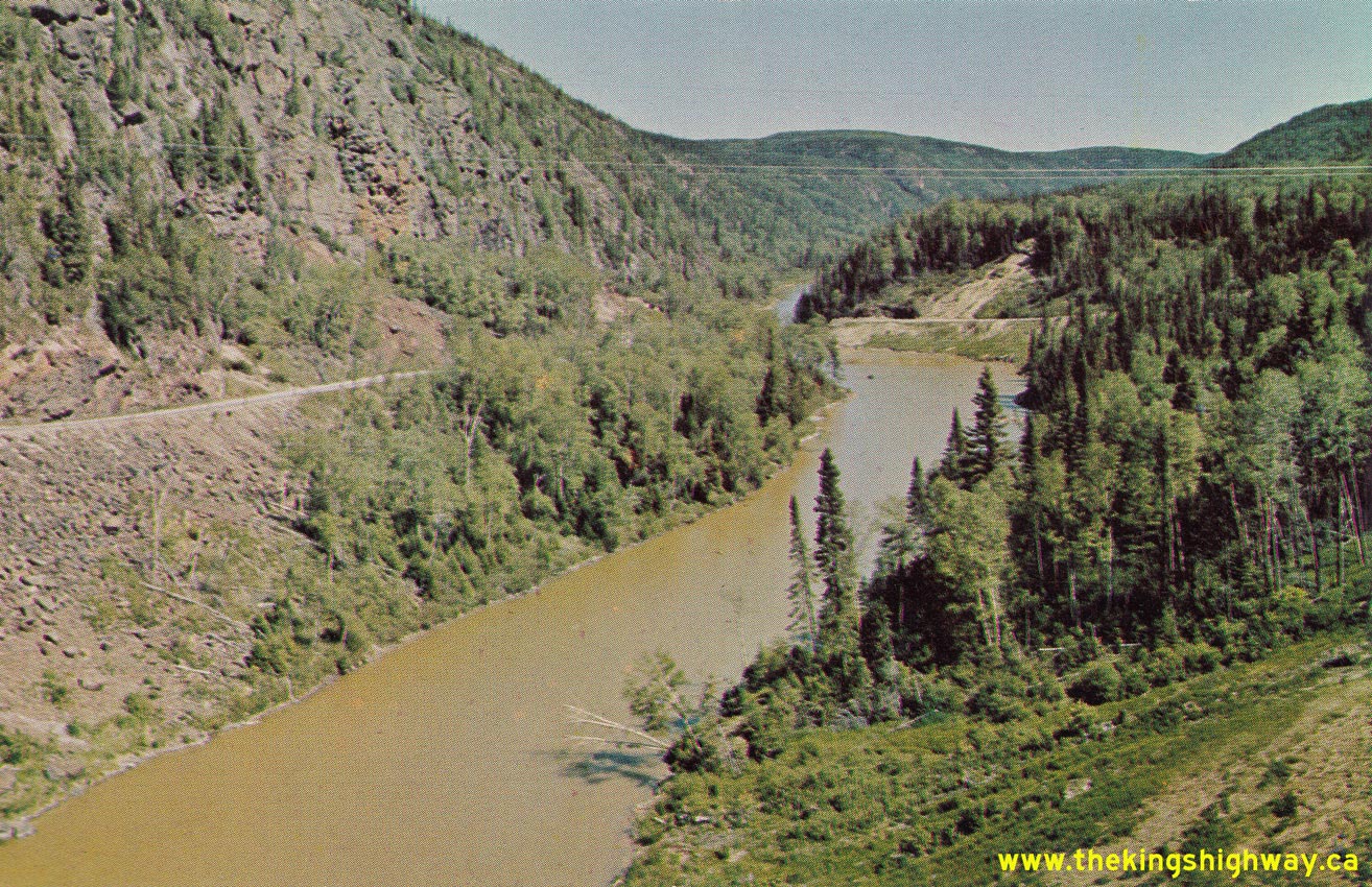
Enlarged Photo Here. Photo taken circa 1957. (Photo courtesy of Sudbury News Service Ltd, Sudbury) Right - Circa 1958 postcard view of the Little Pic River from the Hwy 17 Bridge between Marathon and Terrace Bay. Note the old alignment of Hwy 17 clinging to the cliffs at left, which led down to a temporary bridge across the Little Pic River. This former alignment of Hwy 17 was closed to traffic once the permanent Little Pic River Bridge opened to traffic in 1958. See an Enlarged Photo Here. Photo taken circa 1958. (Photo courtesy of Alex Wilson Publications Ltd, Dryden) 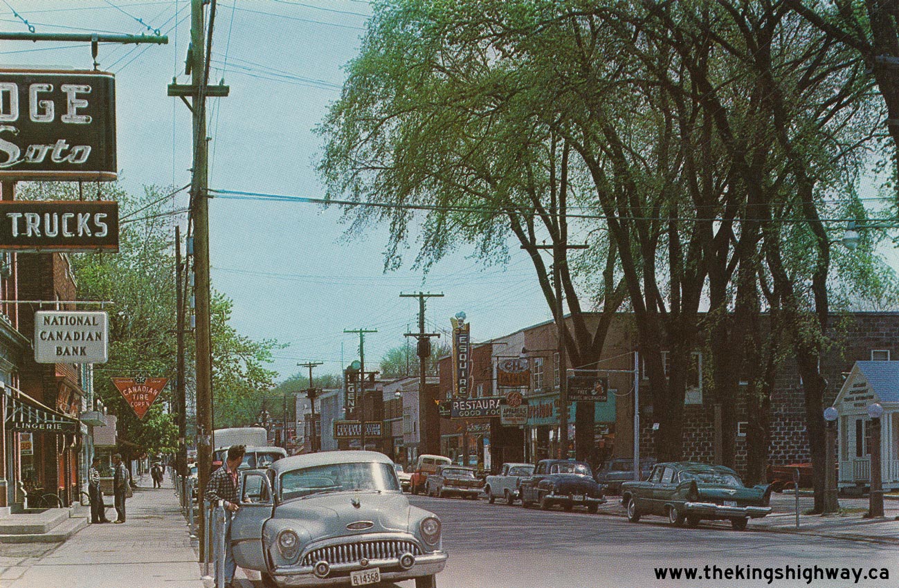
Left - Circa 1958 postcard view of Main Street (Hwy 17) in Hawkesbury. See an
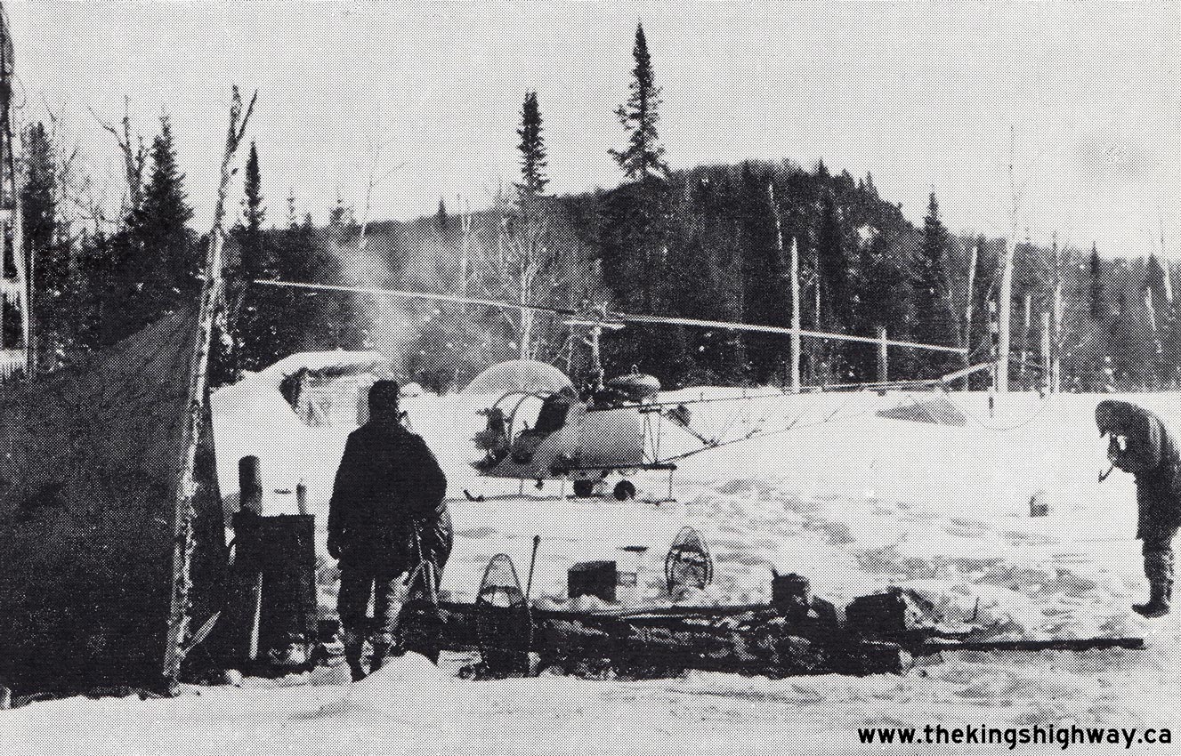
Enlarged Photo Here. Photo taken circa 1958. (Photo courtesy of UNIC Publications, Montreal) Right - Geotechnical and foundations work camp in Lake Superior Provincial Park in 1958. The wild eastern shoreline of Lake Superior was practically inaccessible by ground prior to the construction of Hwy 17. Engineers had to be transported by helicopter to access some of the more remote camps to do field investigations and surveying for the proposed highway. The crew photographed here were taking soil samples for two proposed Hwy 17 structures over the Baldhead River and North Baldhead River. See an Enlarged Photo Here. Photo taken in February 1958. (Photo courtesy of Ontario Ministry of Transportation - © King's Printer for Ontario, 1958) 
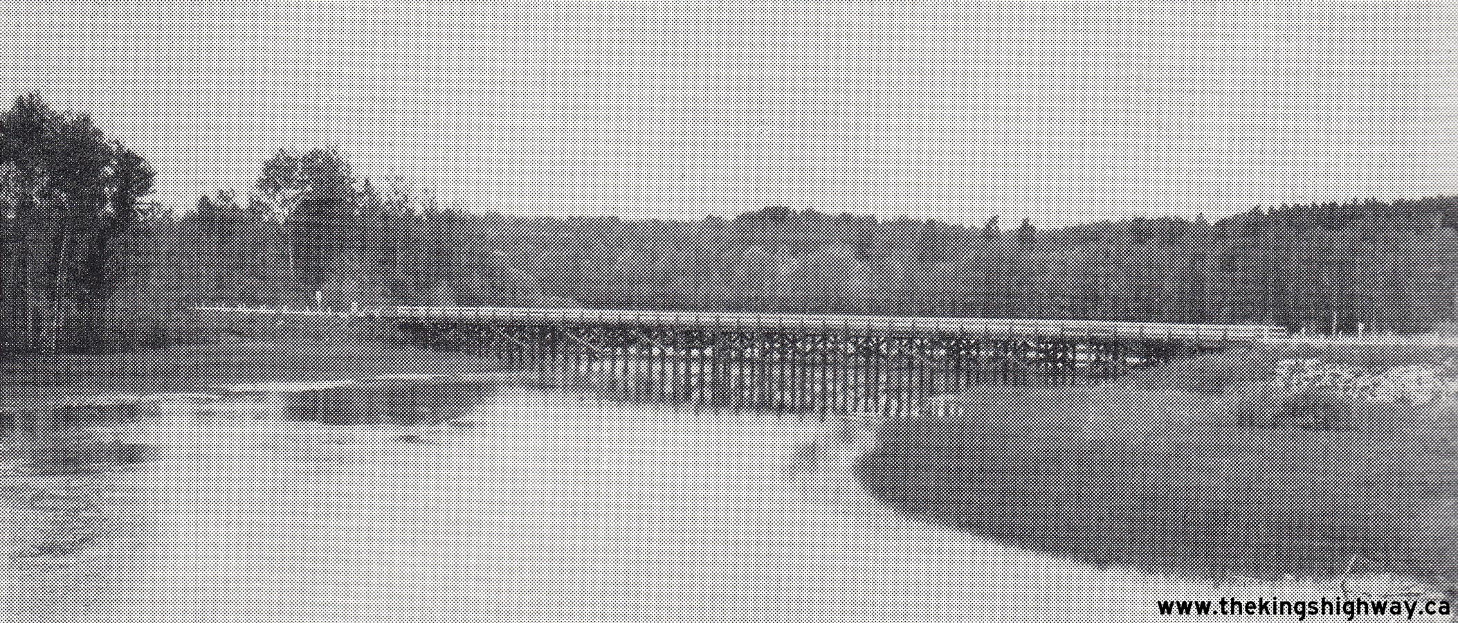
Above - Old timber trestle bridge over the Eagle River on Hwy 17 west of Dryden, prior to being removed. See an
Enlarged Photo Here. Photo taken in 1958. (Photo courtesy of Ontario Ministry of Transportation - © King's Printer for Ontario, 1958) 
Above - Replacement bridge over the Eagle River on Hwy 17 west of Dryden. See an
Enlarged Photo Here. Photo taken in 1958. (Photo courtesy of Ontario Ministry of Transportation - © King's Printer for Ontario, 1958) 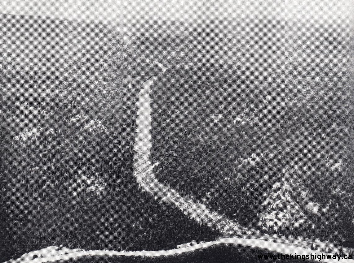

Left - Aerial view of the advance clearing completed for an extension of Hwy 17 north of Old Woman Bay in Lake Superior Provincial Park. See an
Enlarged Photo Here. Photo taken in 1958. (Photo courtesy of Ontario Ministry of Transportation - © King's Printer for Ontario, 1958) Right - Aerial view of the new approaches to the proposed Big Pic River Bridge near Marathon. The intersection in the foreground is the Hwy 17 & Hwy 627 Junction. Note the temporary Hwy 17 bridge across the Big Pic River downstream of the proposed structure. See an Enlarged Photo Here. Photo taken in 1958. (Photo courtesy of Ontario Ministry of Transportation - © King's Printer for Ontario, 1958) 
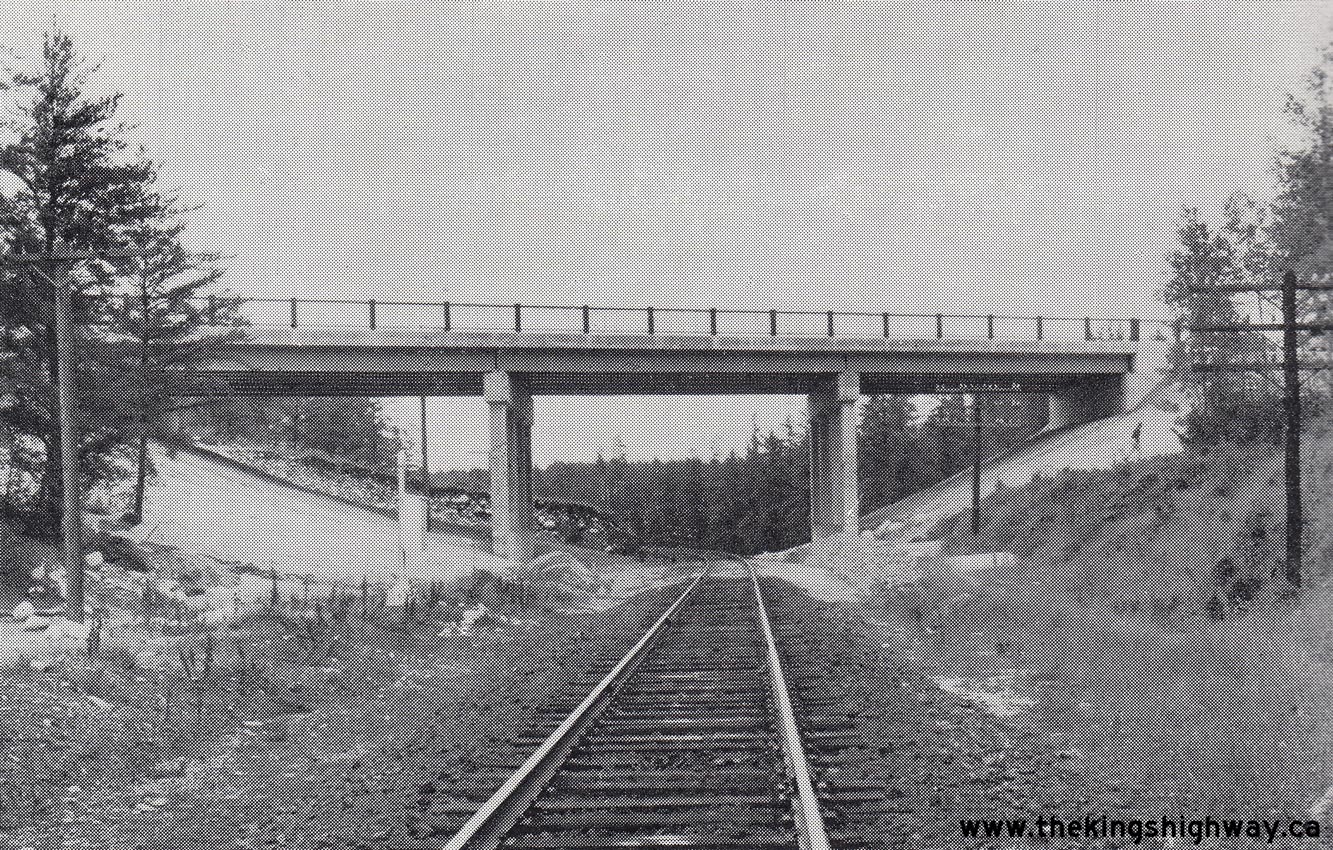
Above - New DHO Truck Scales on Hwy 17 east of Petawawa. See an
Enlarged Photo Here. Photo taken in 1958. (Photo courtesy of Ontario Ministry of Transportation - © King's Printer for Ontario, 1958) 
Above - DHO roadside park and lookout over the Ottawa River on Hwy 17 near Deux Rivieres. See an
Enlarged Photo Here. Photo taken in 1958. (Photo courtesy of Ontario Ministry of Transportation - © King's Printer for Ontario, 1958) 
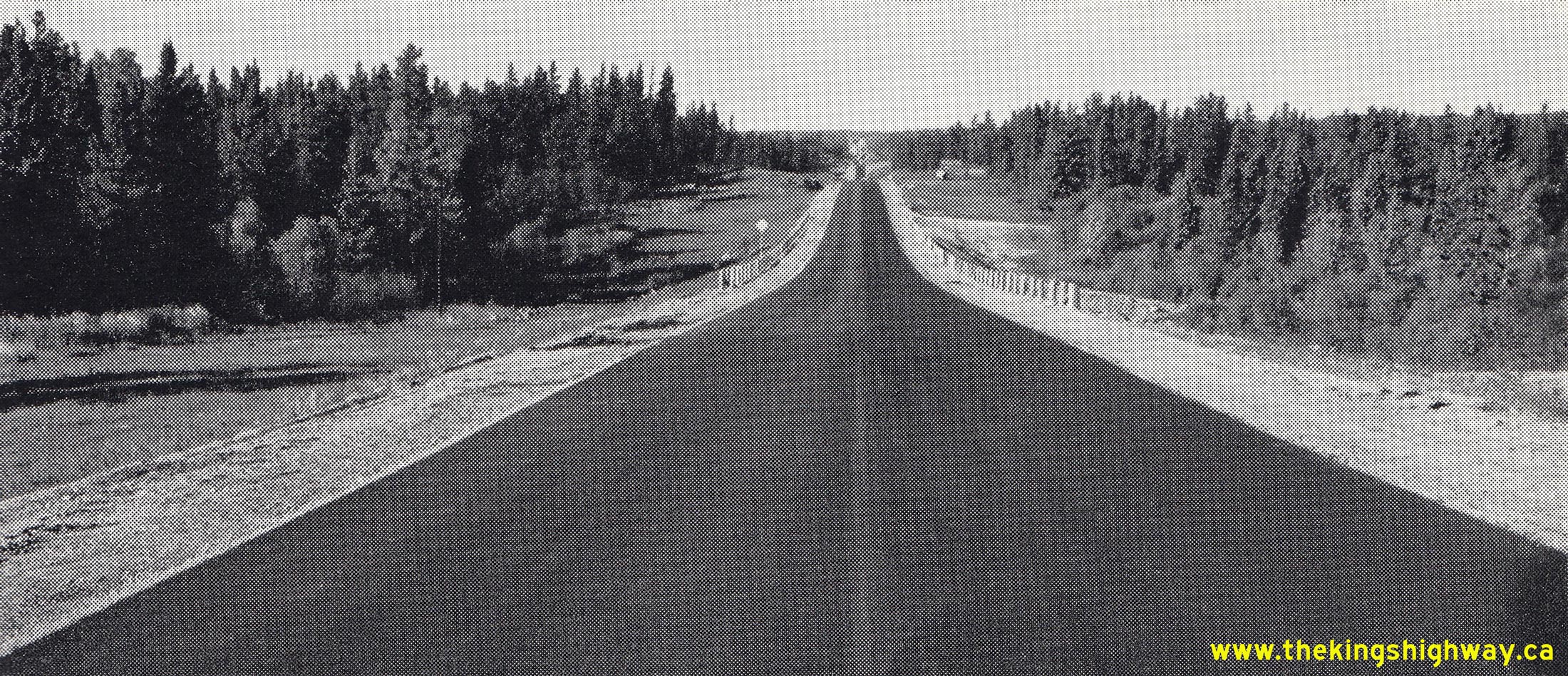
Above - Completed hot mix asphalt pavement on Hwy 17, 5 miles west of Iron Bridge. See an
Enlarged Photo Here. Photo taken in 1958. (Photo courtesy of Ontario Ministry of Transportation - © King's Printer for Ontario, 1958) 
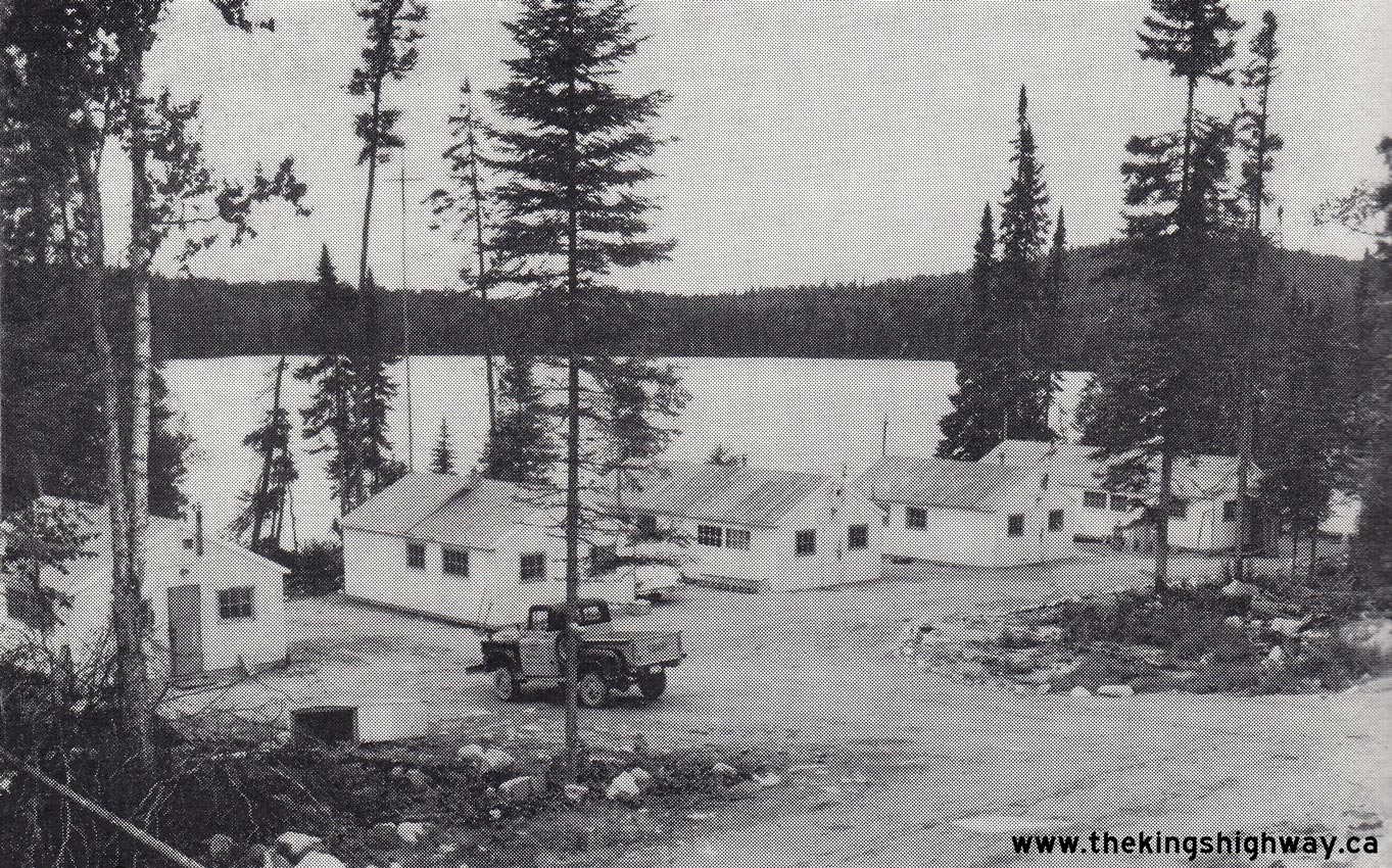
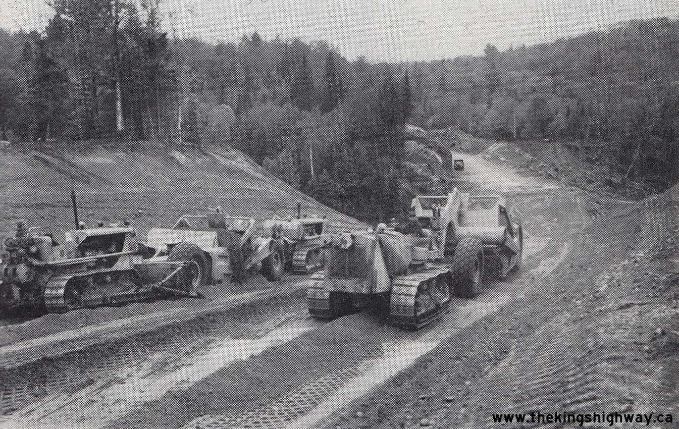
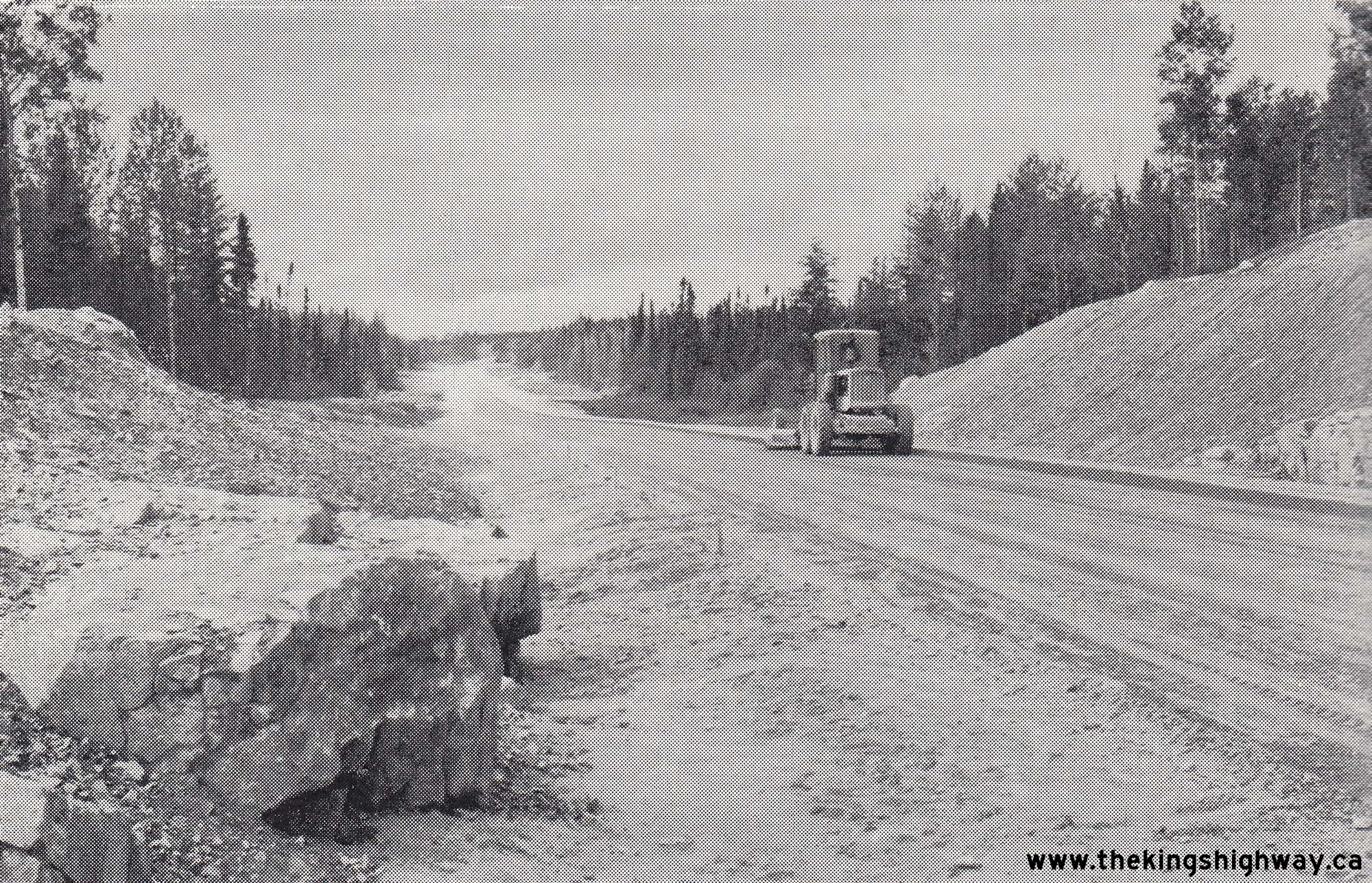
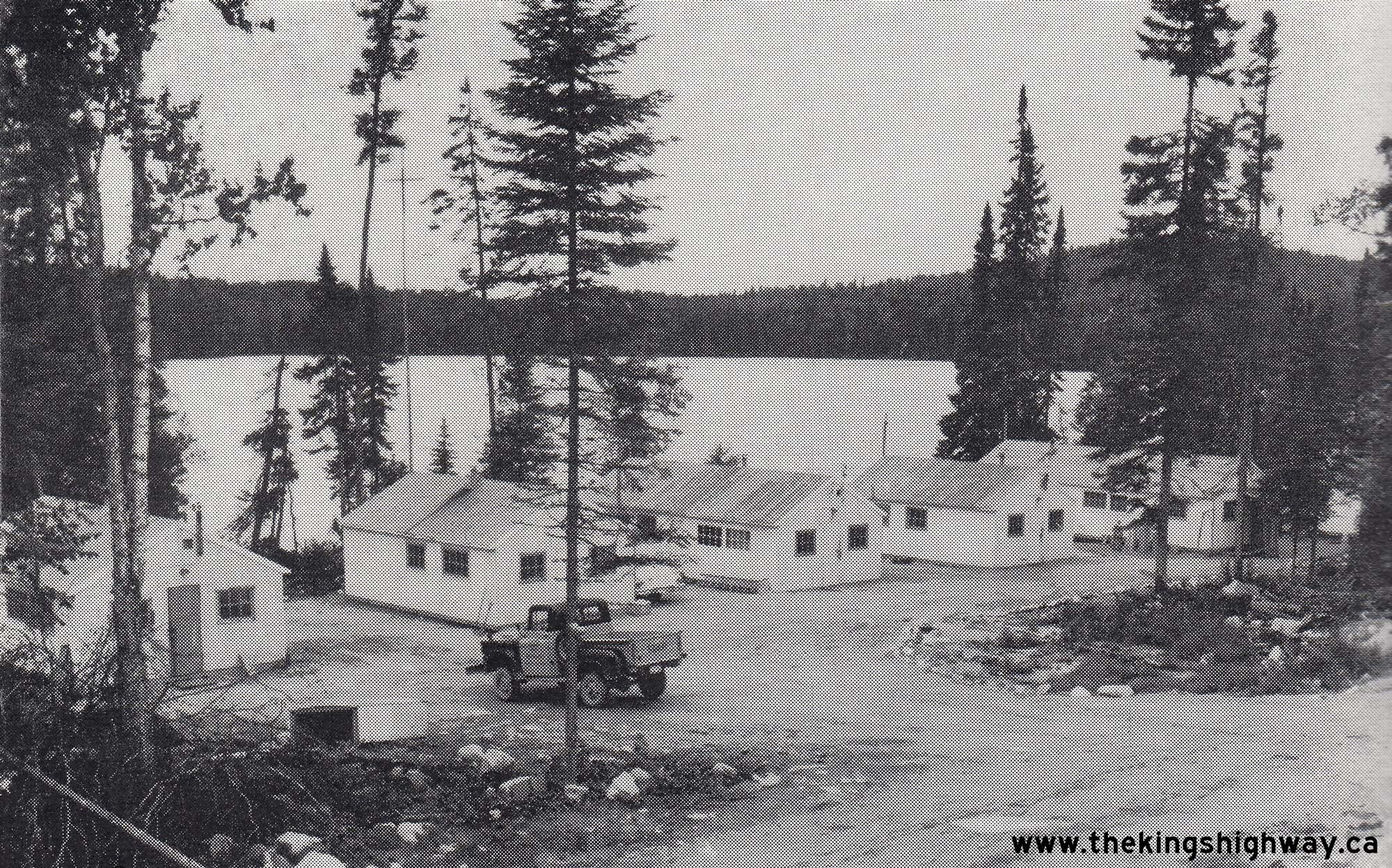
Left - Grading nearing completion on an extension of Hwy 17, 6 miles south of White River. See an
Enlarged Photo Here. Photo taken in 1958. (Photo courtesy of Ontario Ministry of Transportation - © King's Printer for Ontario, 1958) Right - Remote highway construction camp on Hwy 17 at Marion Lake, 15 miles south of White River. This temporary building complex was provided to house construction and engineering staff during construction of the Trans-Canada Highway between White River and Wawa. See an Enlarged Photo Here. Photo taken in 1958. (Photo courtesy of Ontario Ministry of Transportation - © King's Printer for Ontario, 1958) 
Above - Old Hwy 17 bridge over the Kaministiquia River at Kakabeka Falls in 1958. Although Hwy 17 was reconstructed on a new alignment which bypassed the
old bridge, this former highway structure was retained as part of an access road within Kakabeka Falls Provincial Park for many years before being replaced in the
early 2000s. See an Enlarged Photo Here. Photo taken in 1958. (Photo courtesy of Ontario Ministry of Transportation - © King's Printer for Ontario, 1958) 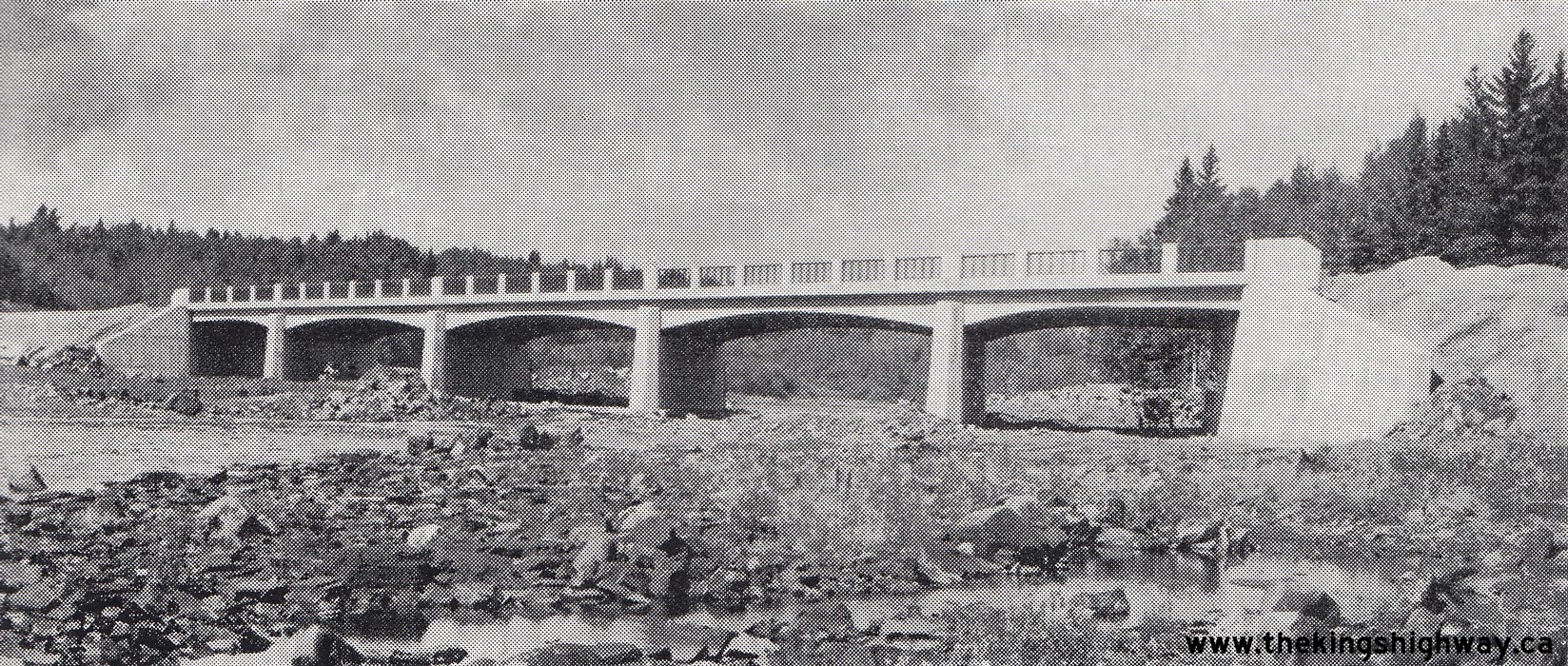
Above - New Kaministiquia River Bridge on Hwy 17 at Kakabeka Falls. See an
Enlarged Photo Here. Photo taken in 1958. (Photo courtesy of Ontario Ministry of Transportation - © King's Printer for Ontario, 1958) 
Left - View of Lake Superior and completed grading on an extension of Hwy 17, 13 miles north of the Agawa River. See an
Enlarged Photo Here. Photo taken in September 1958. (Photo courtesy of Ontario Ministry of Transportation - © King's Printer for Ontario, 1958) Right - Heavy grading on an extension of Hwy 17 about 15 miles north of Agawa River in Lake Superior Provincial Park. See an Enlarged Photo Here. Photo taken in September 1958. (Photo courtesy of Ontario Ministry of Transportation - © King's Printer for Ontario, 1958) 
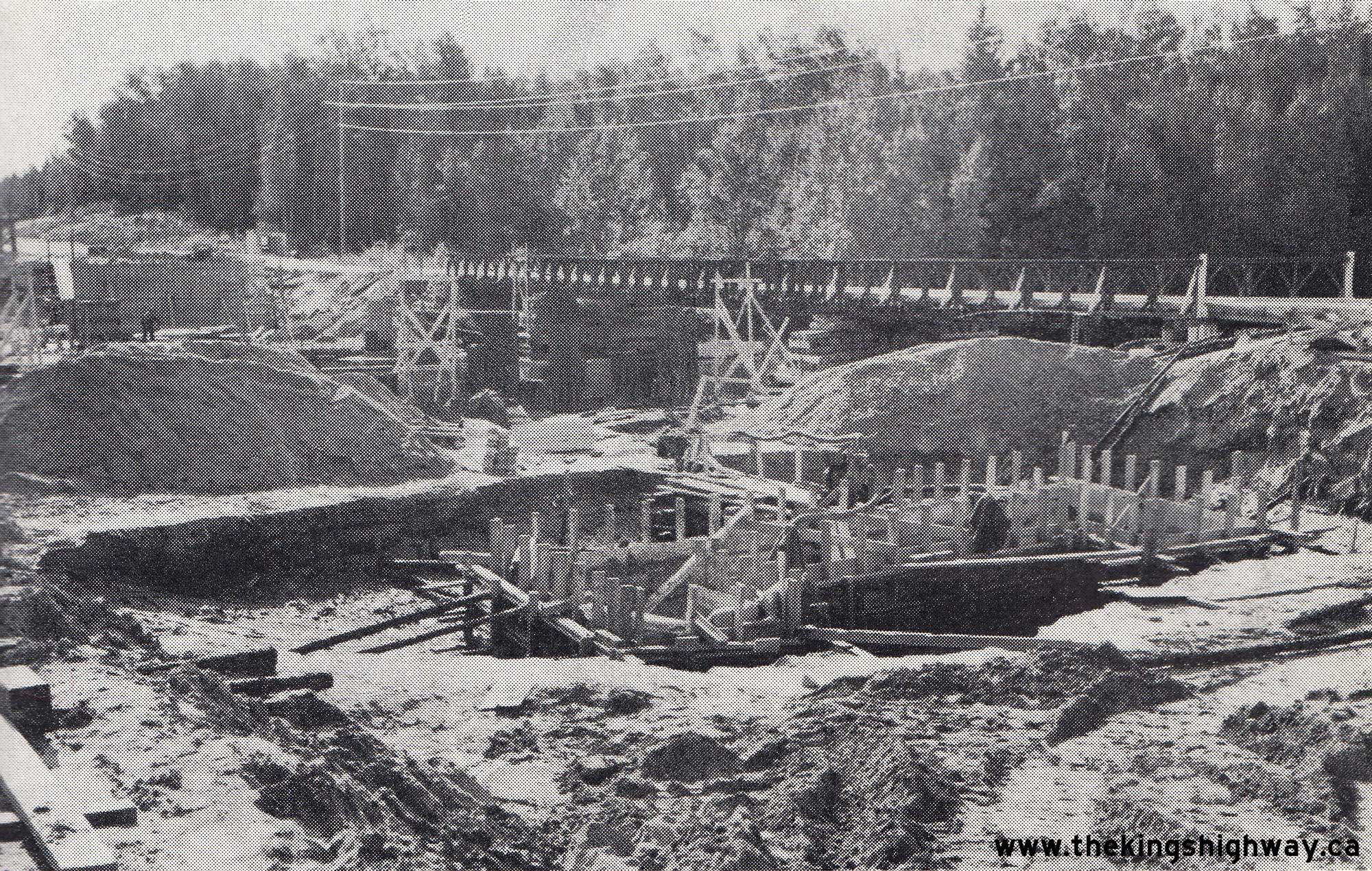
Left - Construction of the permanent White River Bridge on Hwy 17 in 1958, 14 miles north of White River. Note the temporary Hwy 17 bridge in the background.
See an Enlarged Photo Here. Photo taken in 1958. (Photo courtesy of Ontario Ministry of Transportation - © King's Printer for Ontario, 1958) Right - White River Canadian Pacific Railway (CPR) Overhead on Hwy 17 south of White River. See an Enlarged Photo Here. Photo taken in 1958. (Photo courtesy of Ontario Ministry of Transportation - © King's Printer for Ontario, 1958) 
Above - Start of the new Thessalon Bypass (Hwy 17), facing east from the Hwy 17B Junction at Thessalon's western entrance. See an
Enlarged Photo Here. Photo taken in 1958. (Photo courtesy of Ontario Ministry of Transportation - © King's Printer for Ontario, 1958) 

Left - Completed Little Pic River Bridge on Hwy 17 north of Marathon. See an
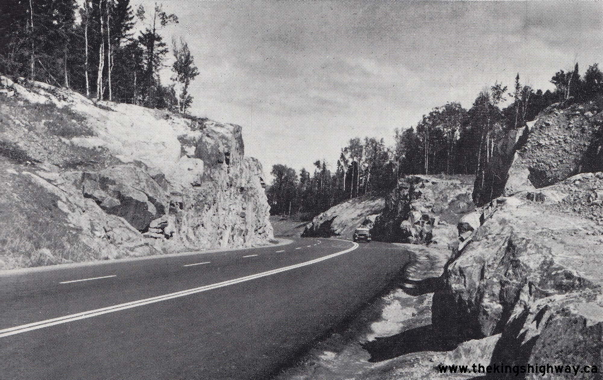
Enlarged Photo Here. Photo taken in 1958. (Photo courtesy of Ontario Ministry of Transportation - © King's Printer for Ontario, 1958) Right - Revised alignment of Hwy 17 and new rock cut about 2 miles west of Nipigon. See an Enlarged Photo Here. Photo taken in 1958. (Photo courtesy of Ontario Ministry of Transportation - © King's Printer for Ontario, 1958) 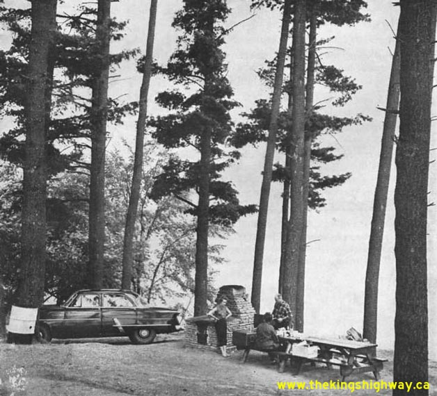
Above - Roadside park and picnic area on Hwy 17 at Muskrat Lake near Cobden (1958) (Photo courtesy of Ontario Ministry of Transportation - © King's Printer for Ontario, 1958) 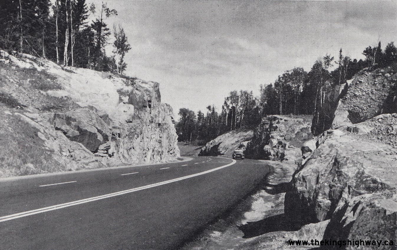

Left - Completed hot mix asphalt pavement and new rock cut on Hwy 17 south of the Hwy 17A Junction (today's Hwy 102) at Sistonens Corners. Note the passing
lane provided for eastbound traffic. While passing lanes appear fairly frequently along Hwy 17 today, they were not very common back in the 1950s. See an
Enlarged Photo Here. Photo taken in 1958. (Photo courtesy of Ontario Ministry of Transportation - © King's Printer for Ontario, 1958) Right - Alignment revision of Hwy 17 near Revell River, 15 miles west of Ignace. See an Enlarged Photo Here. Photo taken in 1958. (Photo courtesy of Ontario Ministry of Transportation - © King's Printer for Ontario, 1958) 
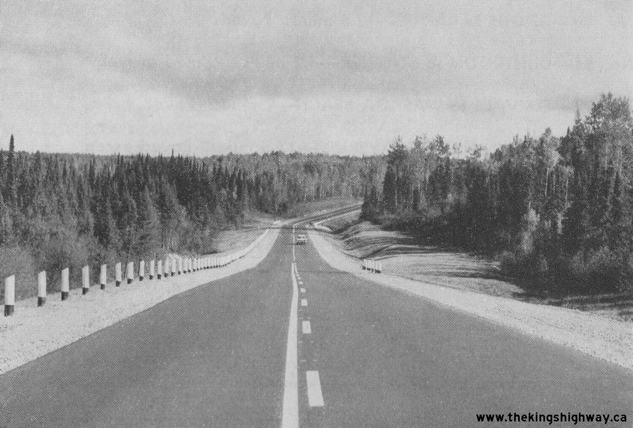
Left - Compacting granular base on Hwy 17 near the Agawa River north of Sault Ste. Marie. See an
Enlarged Photo Here. Photo taken in 1958. (Photo courtesy of Ontario Ministry of Transportation - © King's Printer for Ontario, 1958) Right - Asphalt pavement and zone striping on Hwy 17 west of Red Rock Corners near Nipigon. See an Enlarged Photo Here. Photo taken in 1959. (Photo courtesy of Ontario Ministry of Transportation - © King's Printer for Ontario, 1959) 
Above - Heavy grading and rock cut on the Cavers Hill Diversion near Rossport (1959) (Photo courtesy of Ontario Ministry of Transportation - © King's Printer for Ontario, 1959) 

Left - Construction crew laying hot-mix asphalt on Hwy 17 near White River (1959) (Photo courtesy of Ontario Ministry of Transportation - © King's Printer for Ontario, 1959) Right - Grading operations on a new section of Hwy 17 north of the Agawa River (1959) (Photo courtesy of Ontario Ministry of Transportation - © King's Printer for Ontario, 1959) 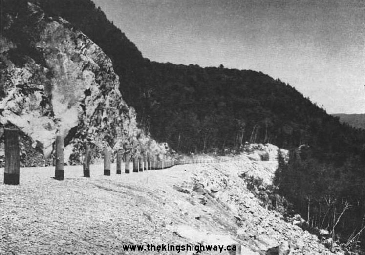
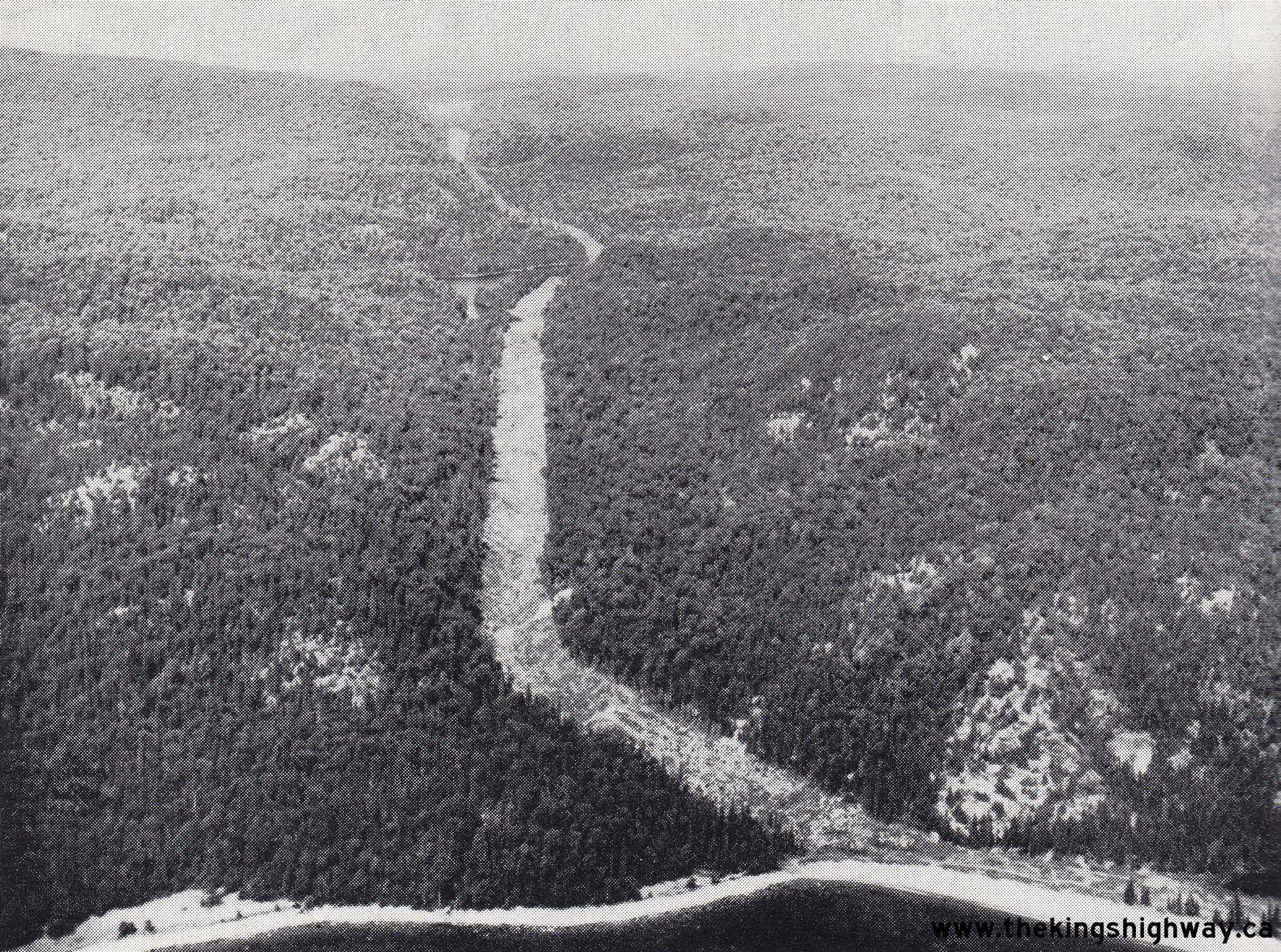
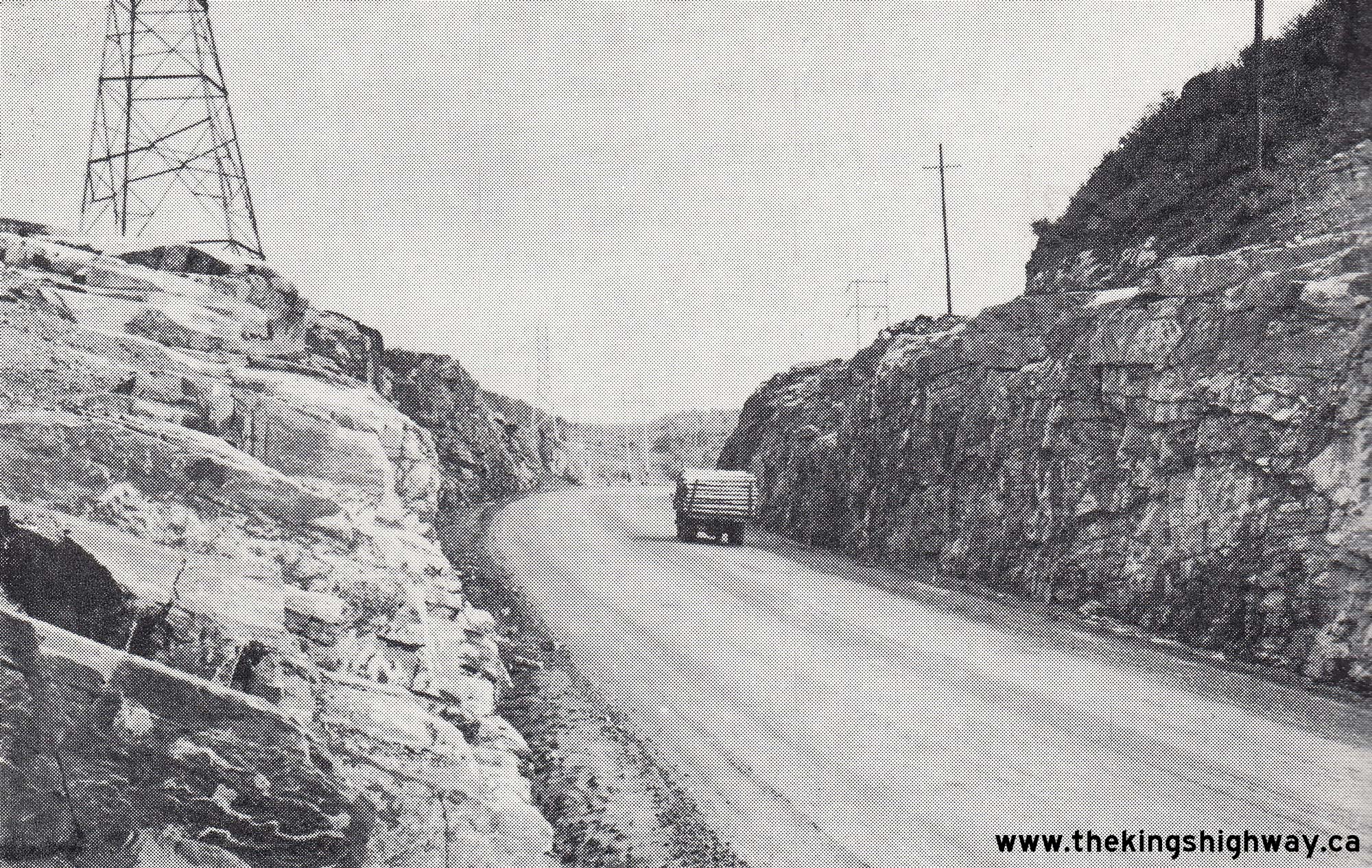
Above - Large rock cut and fill on Hwy 17 at Agawa Hill in 1959. The photo above illustrates some of the difficult terrain that was encountered when building
the Trans-Canada Highway around the northern and eastern shores of Lake Superior. Grading the Agawa Hill section of Hwy 17 took several years to complete. The path
for the new highway was notched out of a nearly vertical rock face. The difference in elevation between the bottom of this rock fill and the top of the rock cut is
about 180 feet (55 metres). (Photo courtesy of Ontario Ministry of Transportation - © King's Printer for Ontario, 1959) 
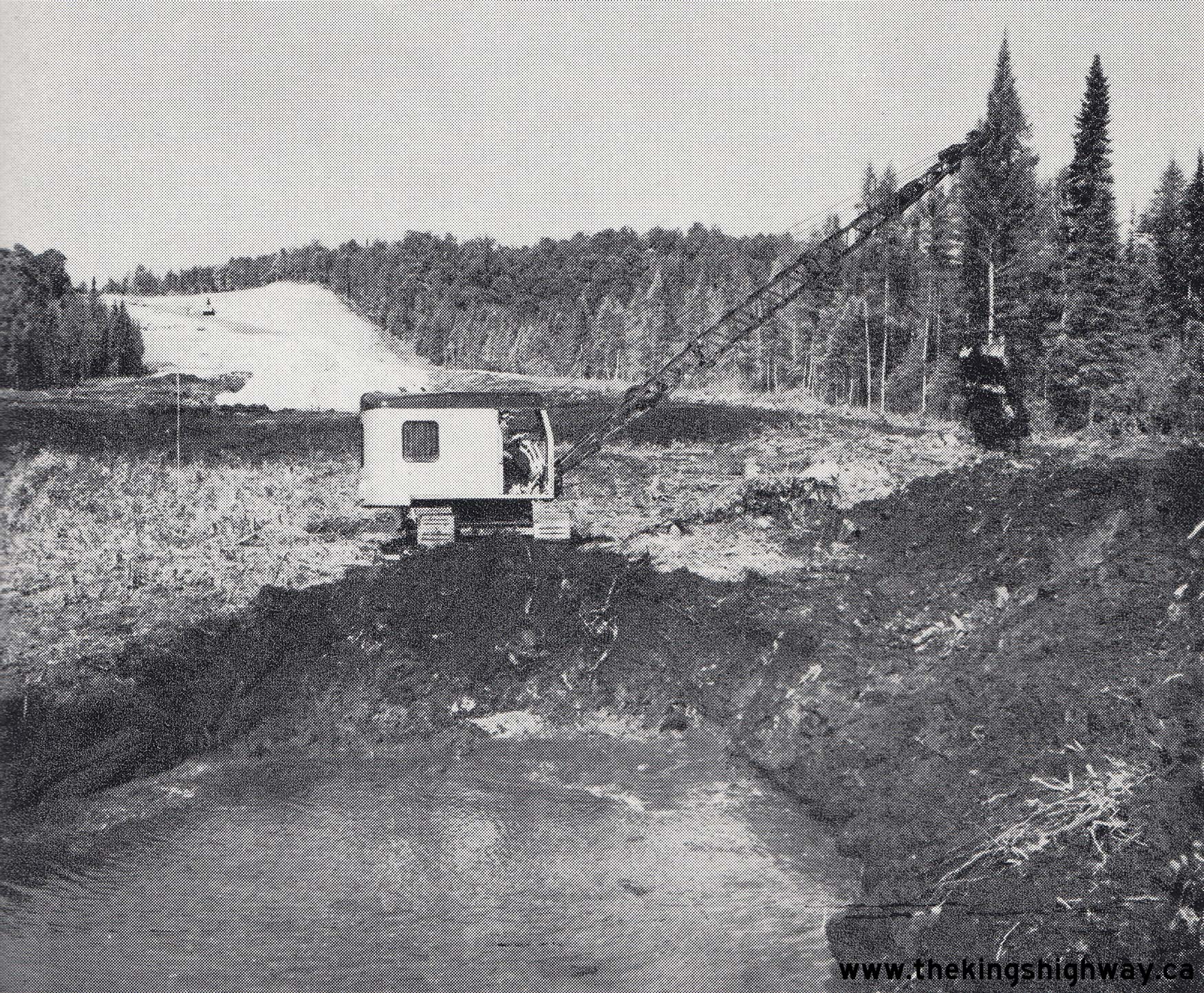
Above - Muskeg excavation on a proposed diversion of Hwy 17 east of North Bay near the Hwy 94 Junction, Contract #1959-65. See an
Enlarged Photo Here. Photo taken on August 6, 1959. (Photo courtesy of Ontario Ministry of Transportation - © King's Printer for Ontario, 1959) 
Above - Construction of the Hwy 17 & Hwy 17A (Alt) Interchange at the eastern end of the Ottawa Queensway at Montreal Road, Contract #1958-48. For many
years, this was the final interchange on the Ottawa Queensway before the dual highway narrowed back to a two-lane undivided highway east of Ottawa. See an
Enlarged Photo Here. Photo taken on September 29, 1959. (Photo courtesy of Ontario Ministry of Transportation - © King's Printer for Ontario, 1959) 

Left - View of Chippewa Falls and the Chippewa River Bridge on Hwy 17, north of Sault Ste. Marie (1959) (Photo courtesy of Ontario Ministry of Transportation - © King's Printer for Ontario, 1959) Right - Aerial view of the completed Michipicoten River Bridge on Hwy 17 south of Wawa in 1959, taken about one year prior to the highway's opening. Compare this 1959 photo to this 1960 photo, which shows the highway after paving operations were completed and the highway was opened to traffic. (Photo courtesy of Ontario Ministry of Transportation - © King's Printer for Ontario, 1959) 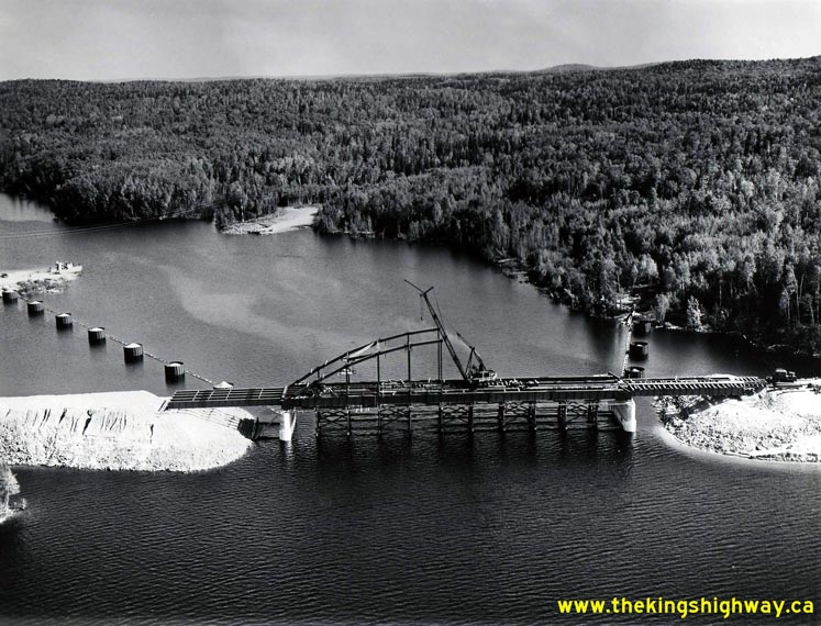
Above - Construction of the White Lake Narrows Bridge on Hwy 17 between Marathon and White River in 1959. Note the ferry operating in the background. For a
few years in the late 1950s, the Department of Highways operated a ferry service for Hwy 17 traffic across White Lake. Once the new White Lake Narrows Bridge was
completed and opened to traffic in 1960, the ferry service was suspended. The two former ferry docks are still visible today along the shores of White Lake. See an
Enlarged Photo Here. Photo taken in 1959. (Photo courtesy of Ontario Ministry of Transportation - © King's Printer for Ontario, 1959) 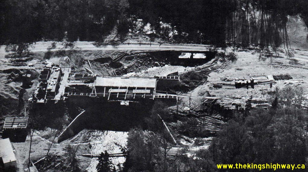
Above - Aerial view of the Barrett River Bridge construction site on Hwy 17 in Lake Superior Provincial Park (1959) (Photo courtesy of Ontario Ministry of Transportation - © King's Printer for Ontario, 1959) 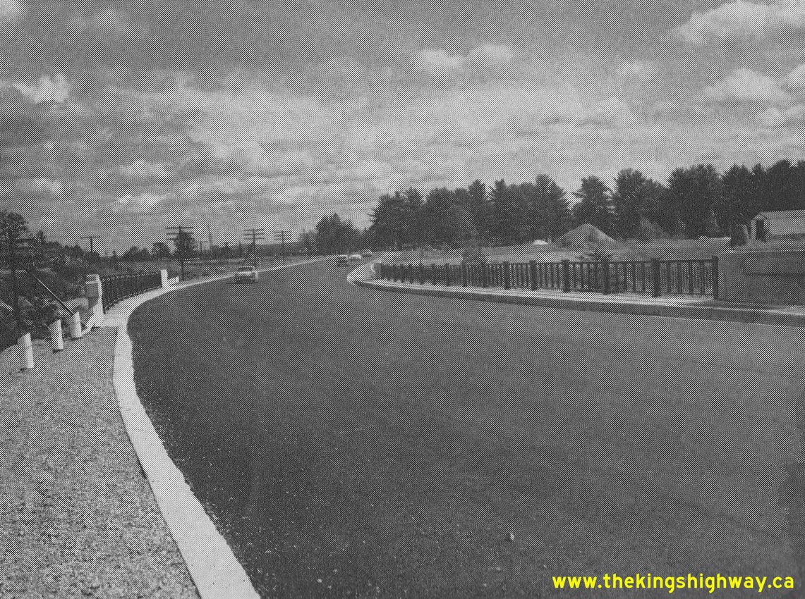

Left - New Hwy 17 Bridge over the River Aux Sables in Massey. See an
Enlarged Photo Here. Photo taken in 1959. (Photo courtesy of Ontario Ministry of Transportation - © King's Printer for Ontario, 1959) Right - Junction of Hwy 17, Hwy 17B and Hwy 129 at the eastern entrance to Thessalon, facing west towards Sault Ste. Marie. See an Enlarged Photo Here. Photo taken in 1959. (Photo courtesy of Ontario Ministry of Transportation - © King's Printer for Ontario, 1959) 
Above - New Winnipeg River Bridge under construction on Hwy 17 west of Kenora (1959) (Photo courtesy of Ontario Ministry of Transportation - © King's Printer for Ontario, 1959) 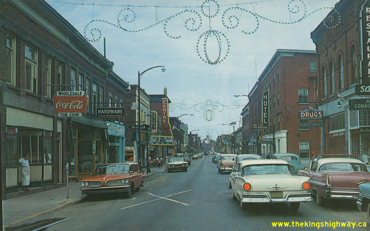
Above - Postcard view of Pembroke Street (Hwy 17, later known as Hwy 148) in 1959, facing east from Moffat Street in Downtown Pembroke. See an
Enlarged Photo Here. Photo taken in 1959. (Photo courtesy of C.R Sterling Photos) 
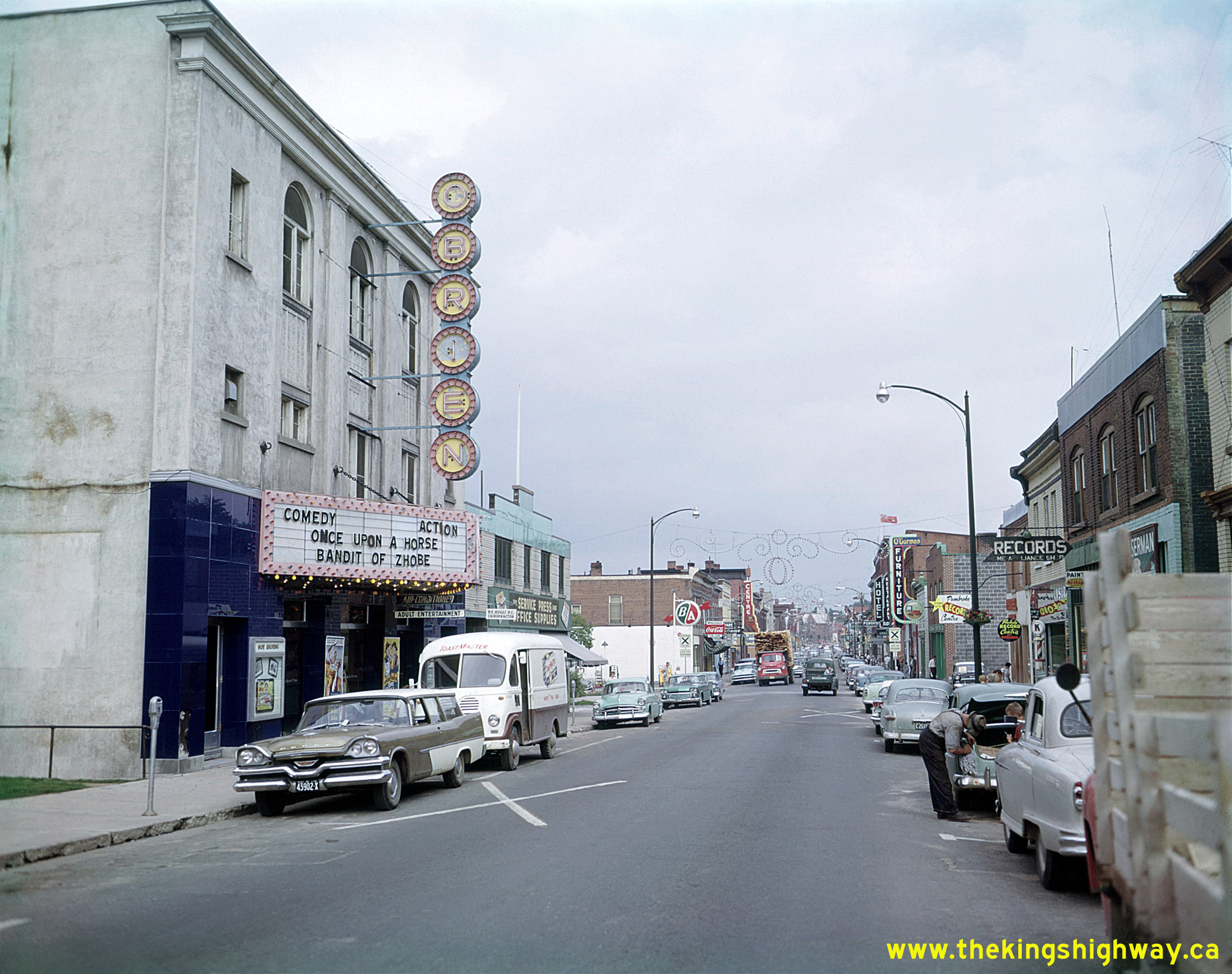
Above - View of Pembroke Street (Hwy 17, later known as Hwy 148) in 1959, facing east towards Agnes Street in Downtown Pembroke. While Hwy 17 served as
Pembroke's main street, it also served as a link in the Trans-Canada Highway and also served as the Ottawa Valley's main through highway. This great photo perfectly
captures daily life in small-town Ontario during the 1950s - busy downtown shops, movie theatres, a downtown gas station and lots of traffic. Over the years, many of
Pembroke's downtown businesses have closed or relocated to suburban shopping centres - a fate not at all uncommon in towns and smaller cities throughout Ontario. It
is interesting to note that the stationery store located beside the movie theatre at left in this photo is still in operation today, although the movie theatre
building beside it has since been demolished. See an Enlarged Photo Here. Photo taken in
1959. (Photo © Archives of Ontario - Series RG-65-35, Photo #I-0005681)
Continue on to King's Highway 17 Photos: Historical Photos: 1960-1964
|
|---|
Links to Adjacent King's Highway Photograph Pages:
Back to Hwy 17 - Historical Photos (1954-1956)
Hwy 17 Photo Index
On to Hwy 17 - Historical Photos (1960-1964)
Back to King's Highway 16 Photos /
King's Highway 17 History /
On to King's Highway 18 Photos
Ontario Highway History - Main Menu / Back to List of Highways Website contents, photos & text © 2002-2026, Cameron
Bevers (Webmaster) - All Rights Reserved / Contact Me
|
|---|