
| 
|  |
|
|
This page contains present day photos (Year 2000 to date) of Ontario's King's Highway 2, arranged by location from
Tilbury easterly to Chatham. All photographs displayed on this page were taken by the Webmaster (Cameron Bevers), unless specifically noted otherwise. Click on
any thumbnail to see a larger image!
Please note that all photographs displayed on this
website are protected by copyright. These photographs must not be reproduced, published,
electronically stored or copied, distributed, or posted onto other websites without
my written permission. If you want to use photos from this website, please
email me first for permission. Thank-you!
|
|---|
|
Page 7: Present Day King's Highway 2 Photographs (Tilbury to Chatham)


Left - Culvert on Old Hwy 2 alignment in Tilbury - "ONTARIO PROVINCIAL HIGHWAY 1922" (Photograph taken on December 5, 2004 - © Cameron Bevers) Right - The original alignment of Hwy 2 followed Pollard Line east from Tilbury (Photograph taken on December 5, 2004 - © Cameron Bevers) 

Left - Inscription on old culvert on Pollard Line (Old Hwy 2) east of Tilbury at Davidson Road - "ONTARIO PROVINCIAL HIGHWAY 1922" (Photograph taken on December 5, 2004 - © Cameron Bevers) Right - Superelevated curve on Pollard Line (Old Hwy 2) east of Tilbury, facing east towards Chatham. This original alignment of Hwy 2 was bypassed by the Tilbury Diversion in 1935. (Photograph taken on December 5, 2004 - © Cameron Bevers) 

Left - Culvert inscription on Hwy 2 Diversion east of Tilbury - "THE KING'S HIGHWAY 1935" (Photograph taken on September 12, 2004 - © Cameron Bevers) Right - Side view of 1935-dated culvert on Hwy 2 Diversion between Tilbury and Hwy 401 (Photograph taken on September 12, 2004 - © Cameron Bevers) 

Left - Culvert inscription on Hwy 2 Diversion east of Tilbury - "THE KING'S HIGHWAY 1935" (Photograph taken on September 12, 2004 - © Cameron Bevers) Right - Facing east along Hwy 401 from the Hwy 2 Overpass east of Tilbury. The ramps at this interchange are in a "Parclo B-2" configuration. A Parclo B-2 is a four-ramp freeway interchange, with ramps in two diagonally-opposing quadrants. This interchange type is characterized by traffic exiting from the freeway on a loop ramp on the far side of the grade separation. (Photograph taken on September 14, 2010 - © Cameron Bevers) 

Left - Hwy 2 Overpass on Hwy 401 east of Tilbury. Structure completed in 1963. (Photograph taken on September 14, 2010 - © Cameron Bevers) Right - The Hwy 2 Overpass east of Tilbury is a simply-supported steel beam structure. Due to the skew of the interchange, this structure is considerably longer than most other freeway overpasses in the area. The bridge is 88 metres (288 feet) in length. (Photograph taken on September 14, 2010 - © Cameron Bevers) 

Left - Facing west along Hwy 401 towards Windsor from the Hwy 2 Overpass east of Tilbury. (Photograph taken on September 14, 2010 - © Cameron Bevers) Right - Facing east across the Hwy 2 Overpass on Hwy 401 east of Tilbury. (Photograph taken on September 14, 2010 - © Cameron Bevers) 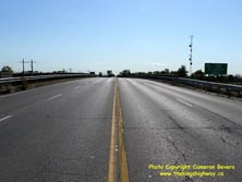
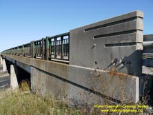
Left - Facing west across the Hwy 2 Overpass on Hwy 401 east of Tilbury. (Photograph taken on September 14, 2010 - © Cameron Bevers) Right - Close-up view of the steel handrail design of the Hwy 2 Overpass on Hwy 401 east of Tilbury. (Photograph taken on September 14, 2010 - © Cameron Bevers) 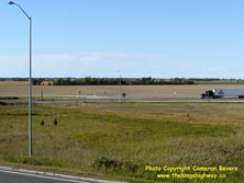

Left - Northwest quadrant ramps at the Hwy 2 & Hwy 401 Interchange east of Tilbury. The two ramps at the Hwy 2 Interchange also provide access
to adjacent Jeannettes Creek Road. This is one of the only freeway ramps in Ontario that has an intersection on it between the freeway and the arterial highway
crossing through the interchange. The ramps in the opposing southeast quadrant of this interchange are also in this unusual configuration. (Photograph taken on September 14, 2010 - © Cameron Bevers) Right - Facing east along Hwy 2 towards Chatham from the Hwy 401 Interchange east of Tilbury. (Photograph taken on September 14, 2010 - © Cameron Bevers) 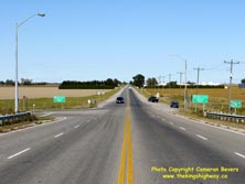
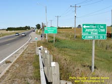
Left - Northwest ramp terminal at the Hwy 2 & Hwy 401 Interchange east of Tilbury. This ramp terminal also provides access to adjacent Jeannettes
Creek Road. (Photograph taken on September 14, 2010 - © Cameron Bevers) Right - Fingerboard signs marking the way from Hwy 2 to Jeannettes Creek Road, via the on-ramp to Hwy 401. (Photograph taken on September 14, 2010 - © Cameron Bevers) 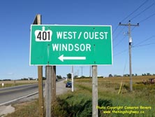

Left - Bilingual guide sign for Hwy 401 West at the Hwy 2 Interchange east of Tilbury. (Photograph taken on September 14, 2010 - © Cameron Bevers) Right - Southeast quadrant ramps at the Hwy 2 & Hwy 401 Interchange east of Tilbury. These two ramps at the Hwy 2 Interchange also provide access to adjacent McKinlay Road, which intersects the ramps just before the freeway entrance. The ramps to Hwy 401 on the other side of this interchange are in a similar configuration, providing access to Jeannettes Creek Road. (Photograph taken on September 14, 2010 - © Cameron Bevers) 

Left - Ramp to eastbound Hwy 401 from Hwy 2 east of Tilbury, showing the at-grade intersection with McKinlay Road. (Photograph taken on September 14, 2010 - © Cameron Bevers) Right - Hwy 2 culvert inscription east of Hwy 401 - "ONTARIO PROVINCIAL HIGHWAY 1922" (Photograph taken on September 12, 2004 - © Cameron Bevers) 

Left - The 1922 culvert in the previous photo was extended during a highway widening project in the 1930s. Interestingly, the north end of this
culvert bears a different date inscription (1933) than the south end. (Photograph taken on September 12, 2004 - © Cameron Bevers) Right - Facing west along a very old alignment of Hwy 2 from Merlin Road (Chatham-Kent Road 7) (Photograph taken on September 12, 2004 - © Cameron Bevers) 

Left - There is an old concrete bridge built by the Department of Highways on the old Hwy 2 alignment (McDougall Line). (Photograph taken on September 12, 2004 - © Cameron Bevers) Right - Northern side of old concrete bridge across Government Drain beside the Merlin Road (Photograph taken on September 12, 2004 - © Cameron Bevers) 

Left - Government Drain Bridge on old Hwy 2 alignment. Structure completed in 1925. (Photograph taken on September 12, 2004 - © Cameron Bevers) Right - It is hard to believe that this quiet rural intersection used to be a portion of Hwy 2, which was Ontario's main thoroughfare in the days before Hwy 401. The old Department of Highways bridge on McDougall Line and the intersection shown here at Merlin Road were bypassed by a new Hwy 2 alignment in 1937. (Photograph taken on September 12, 2004 - © Cameron Bevers) 

Left - View of Hwy 2 at Dillon Road, facing east towards Chatham. Note the wide cleared right-of-way at left, which was graded in the 1930s to
permit construction of a divided highway. (Photograph taken on September 12, 2004 - © Cameron Bevers) Right - View of Hwy 2 at Dillon Road, facing west towards Tilbury. Note the wide right-of-way. (Photograph taken on September 12, 2004 - © Cameron Bevers) 

Left - This photo of Hwy 2 near Chatham shows the graded right-of-way for a dual roadway that was proposed in the 1930s, but was never actually
completed. Note the distance of the utility poles at left from the edge of the highway at right, and the extended concrete culvert in the foreground. (Photograph taken on September 12, 2004 - © Cameron Bevers) Right - View of massive culvert extension built in the 1930s to allow for a divided highway to pass over top. The divided highway was never actually completed, largely due to a reallocation of highway construction priorities during World War II. (Photograph taken on September 12, 2004 - © Cameron Bevers) 
Above - Culvert inscription on proposed Hwy 2 near Chatham - "THE KING'S HIGHWAY 1937" (Photograph taken on September 12, 2004 - © Cameron Bevers)
Continue on to King's Highway 2 Present Day Photos: Chatham to London
|
|---|
Links to Adjacent King's Highway Photograph Pages:
Back to Tertiary Highway 812 Photos /
King's Highway 2 History /
On to King's Highway 3 Photos
Ontario Highway History - Main Menu / Back to List of Highways Website contents, photos & text © 2002-2025, Cameron
Bevers (Webmaster) - All Rights Reserved / Contact Me |
|---|