
| 
| |
|
|
This page contains historical and present day photos of Ontario's King's Highway 43. All photographs displayed on this page
were taken by the Webmaster (Cameron Bevers), unless specifically noted otherwise. Historical photographs are arranged in approximate chronological order, while
present day photographs (Year 2000 to date) are arranged by location from west to east. Click on any thumbnail to see a larger image!
Please note that all photographs displayed on this
website are protected by copyright. These photographs must not be reproduced, published,
electronically stored or copied, distributed, or posted onto other websites without
my written permission. If you want to use photos from this website, please
email me first for permission. Thank-you!
|
|---|
|
Historical King's Highway 43 Photographs


Left - New South Nation River Bridge on Hwy 43 in Downtown Chesterville. Photo taken on March 26, 1951. (Photo courtesy of Ontario Ministry of Transportation - © King's Printer for Ontario, 1951) Right - New bridge over the Payne River on Hwy 43 at Finch. Photo taken on July 20, 1954. (Photo courtesy of Ontario Ministry of Transportation - © King's Printer for Ontario, 1954) 
Above - Craig Street Bridge over the Tay River on Hwy 43 (Formerly Hwy 15) in Perth (1954) (Photo courtesy of Ontario Ministry of Transportation - © King's Printer for Ontario, 1954) 
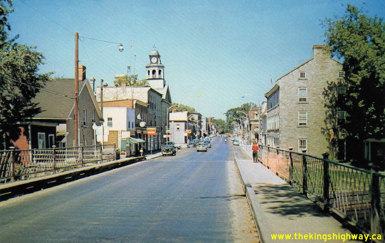
Above - Circa 1955 postcard view of Gore Street (Hwy 43, Formerly Hwy 15) in Downtown Perth, facing north from the Tay River Bridge. See an
Enlarged Photo here. (Photo courtesy of L. F. Charter) |
|---|
|
Present Day King's Highway 43 Photographs


Left - Former route of Hwy 43 (Loucks Road) west of Chesterville. See an
Enlarged Photo here. Photograph taken on July 30, 2005 - © Cameron Bevers Right - Facing west along Old Hwy 43 across the Chesterville Bridge. See an Enlarged Photo here. Photograph taken on July 30, 2005 - © Cameron Bevers 

Left - An old stone wall indicates the location of the old Chesterville Bridge, before it was superceded by the new bridge in 1950. See an
Enlarged Photo here. Photograph taken on July 30, 2005 - © Cameron Bevers Right - South Nation River Bridge on Old Hwy 43 at Chesterville. Structure completed in 1950. See an Enlarged Photo here. Photograph taken on July 30, 2005 - © Cameron Bevers 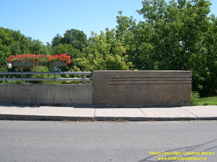

Left - Close-up of an original, unmodified concrete handrail on the Chesterville Bridge. See an
Enlarged Photo here. Photograph taken on July 30, 2005 - © Cameron Bevers Right - An unusual "1950" date stone is located on the Chesterville Bridge's northeast parapet wall. See an Enlarged Photo here. Photograph taken on July 30, 2005 - © Cameron Bevers 

Left - Facing east along Old Hwy 43 across the Chesterville Bridge. See an
Enlarged Photo here. Photograph taken on July 30, 2005 - © Cameron Bevers Right - Eastern side of the South Nation River Bridge in Chesterville. See an Enlarged Photo here. Photograph taken on July 30, 2005 - © Cameron Bevers 

Left - A mural in Downtown Chesterville commemorates the completion of the new Hwy 43 bridge. See an
Enlarged Photo here. Photograph taken on July 30, 2005 - © Cameron Bevers Right - Former Hwy 43 alignment between Finch and Avonmore facing west. See an Enlarged Photo here. Photograph taken on July 30, 2005 - © Cameron Bevers 

Left - Former Hwy 43 alignment between Finch and Avonmore facing east. See an
Enlarged Photo here. Photograph taken on July 30, 2005 - © Cameron Bevers Right - Hwy 43 used to pass directly through Avonmore along Centennial Drive. See an Enlarged Photo here. Photograph taken on July 30, 2005 - © Cameron Bevers 

Left - Another view of the former Hwy 43 alignment along Centennial Drive in Avonmore. See an
Enlarged Photo here. Photograph taken on August 2, 2003 - © Cameron Bevers Right - Inscription on Hwy 43 culvert at Avonmore - "THE KING'S HIGHWAY 1941". See an Enlarged Photo here. Photograph taken on August 2, 2003 - © Cameron Bevers
More King's Highway 43 Photographs Coming Soon!
|
|---|
Links to Adjacent King's Highway Photograph Pages:
Back to King's Highway 42 Photos /
King's Highway 43 History /
On to King's Highway 44 Photos
Ontario Highway History - Main Menu / Back to List of Highways Website contents, photos & text © 2002-2026, Cameron
Bevers (Webmaster) - All Rights Reserved / Contact Me
|
|---|