
| 
| |
|
|
This page contains historical and present day photos of Ontario's King's Highway 49 (#2), which ran from Picton northerly to
Highway 401 in the Belleville area. All photographs displayed on this page were taken by the Webmaster (Cameron Bevers), unless specifically noted otherwise.
Historical photographs are arranged in approximate chronological order, while present day photographs (Year 2000 to date) are arranged by location from south to
north. Click on any thumbnail to see a larger image!
Please note that all photographs displayed on this
website are protected by copyright. These photographs must not be reproduced, published,
electronically stored or copied, distributed, or posted onto other websites without
my written permission. If you want to use photos from this website, please
email me first for permission. Thank-you!
|
|---|
|
Historical King's Highway 49 (#2) Photographs

Above - View of the Selby Creek Bridge in 1962, prior to replacement. This small steel structure was completed in 1920 and was located on Hwy 2 (later Hwy 2
& Hwy 49) about 2 miles south of Marysville. This bridge was replaced with a new concrete rigid frame structure in 1963. See an
Enlarged Photo Here. Photo taken in 1962. (Photo courtesy of Ontario Ministry of Transportation - © King's Printer for Ontario, 1962) 
Above - Artistic rendering of the proposed Quinte Skyway on Hwy 49 (Formerly Hwy 41) near Deseronto from 1963. See an
Enlarged Photo Here. (Photo courtesy of Ontario Ministry of Transportation - © King's Printer for Ontario, 1963) 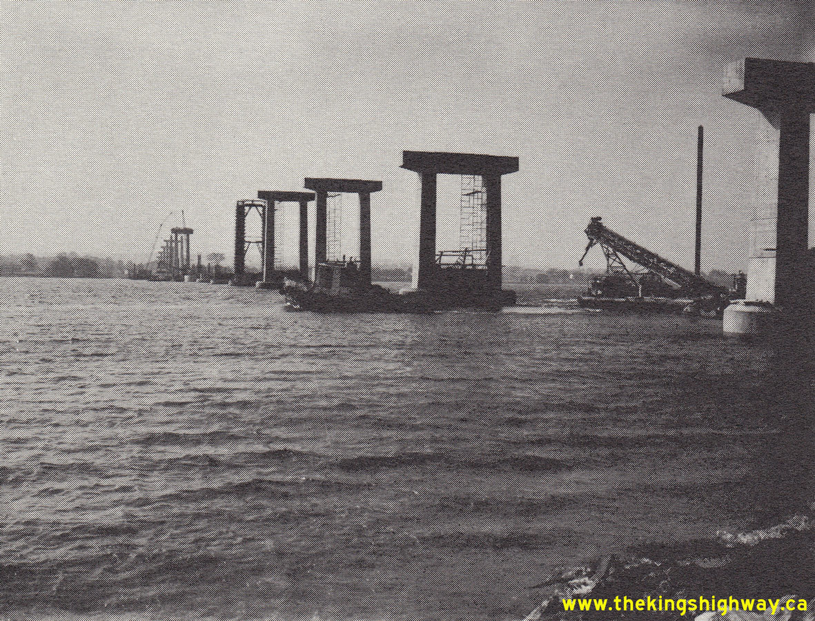
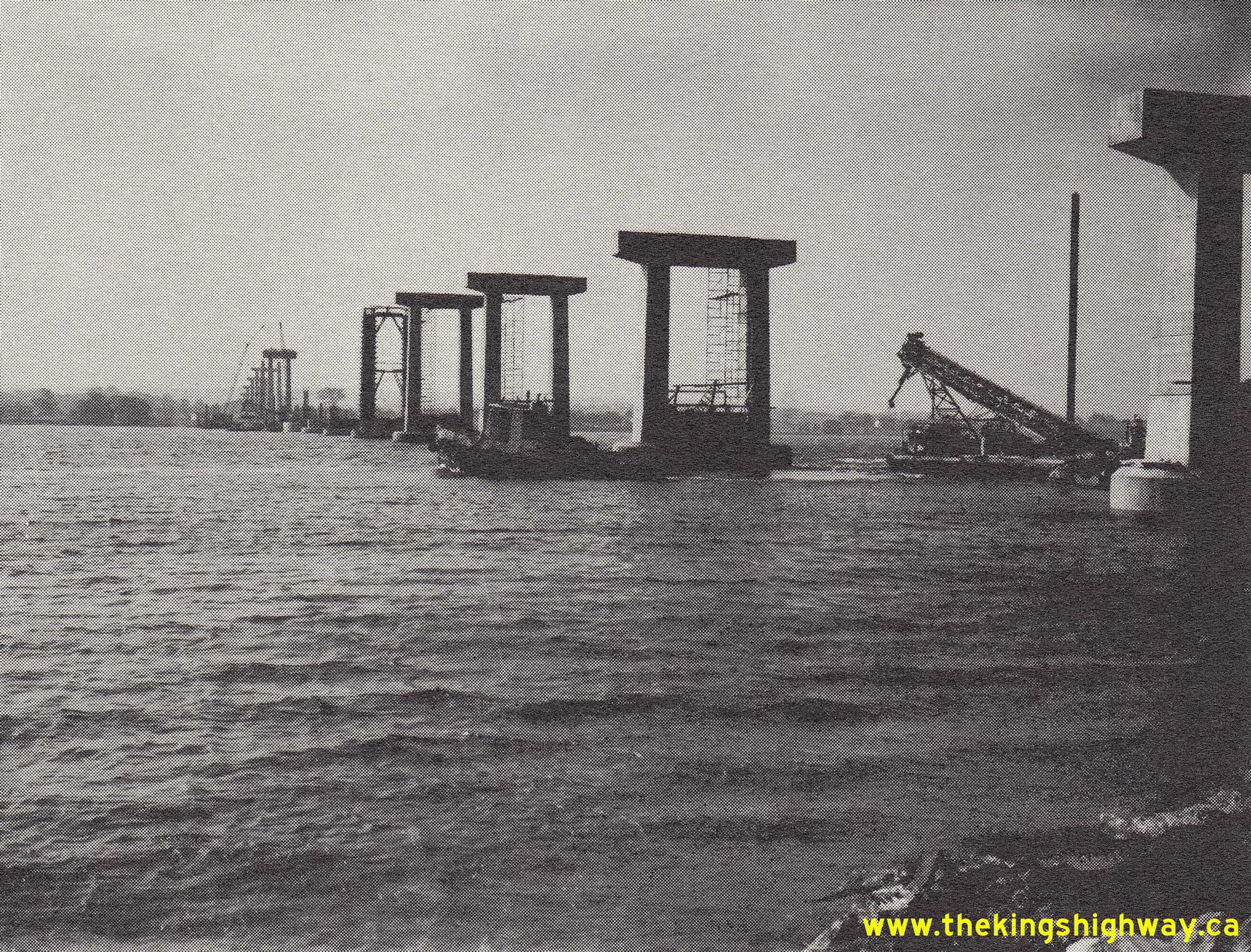
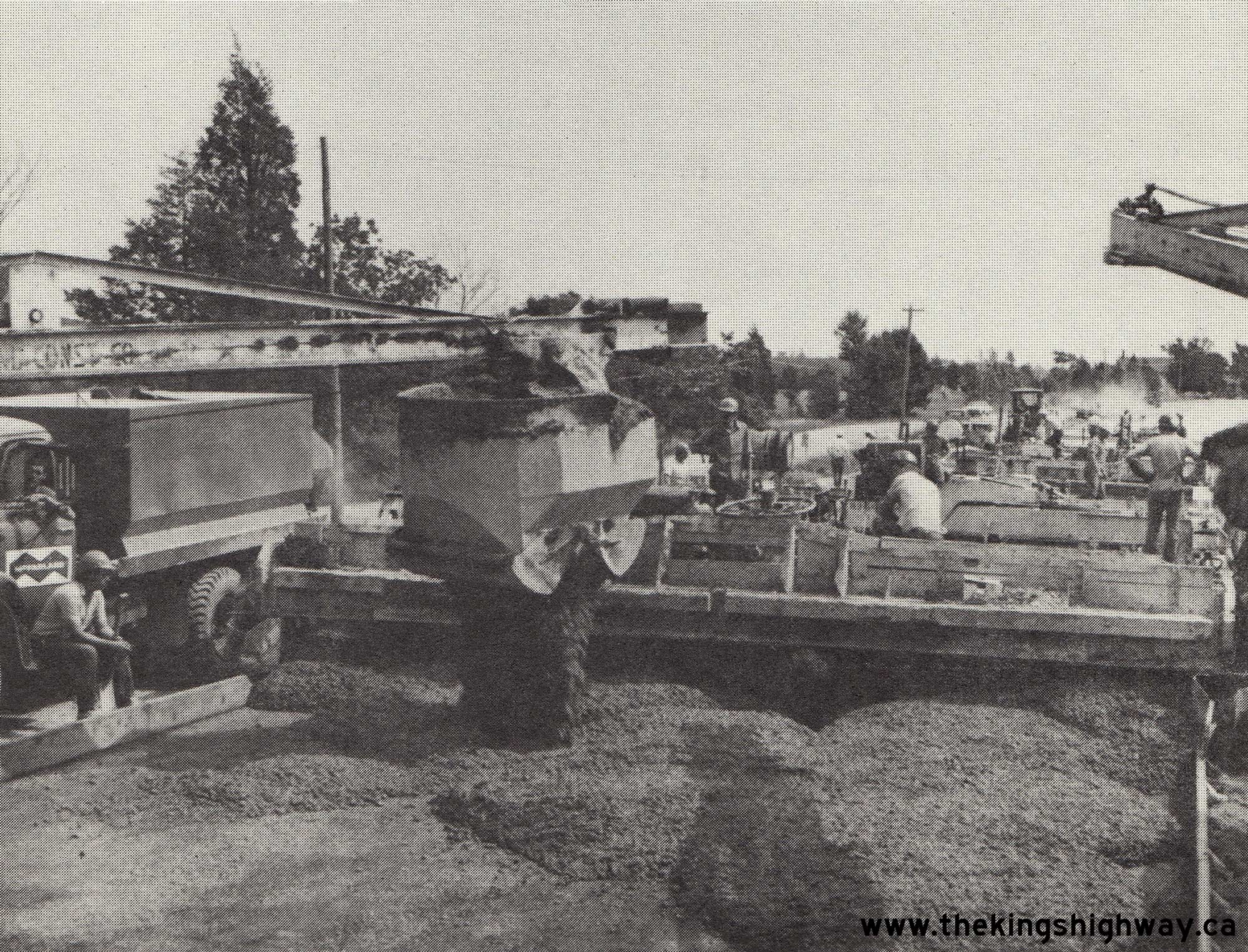
  Left - Pier construction for the new Quinte Skyway on Hwy 49 near Deseronto, Contract #1964-117 (structural steel) and Contract #1964-279 (concrete
substructure and approaches). Both contracts were awarded in November 1964, with construction commencing during the Winter of 1964-1965. See an
Enlarged Photo Here. Photo taken in 1965. Left - Pier construction for the new Quinte Skyway on Hwy 49 near Deseronto, Contract #1964-117 (structural steel) and Contract #1964-279 (concrete
substructure and approaches). Both contracts were awarded in November 1964, with construction commencing during the Winter of 1964-1965. See an
Enlarged Photo Here. Photo taken in 1965.(Photo courtesy of Ontario Ministry of Transportation - © King's Printer for Ontario, 1965) Right - Construction progress on the concrete piers for the Quinte Skyway on Hwy 49 near Deseronto in 1965. See an
Enlarged Photo Here. Photo taken in 1965.(Photo courtesy of Ontario Ministry of Transportation - © King's Printer for Ontario, 1965) 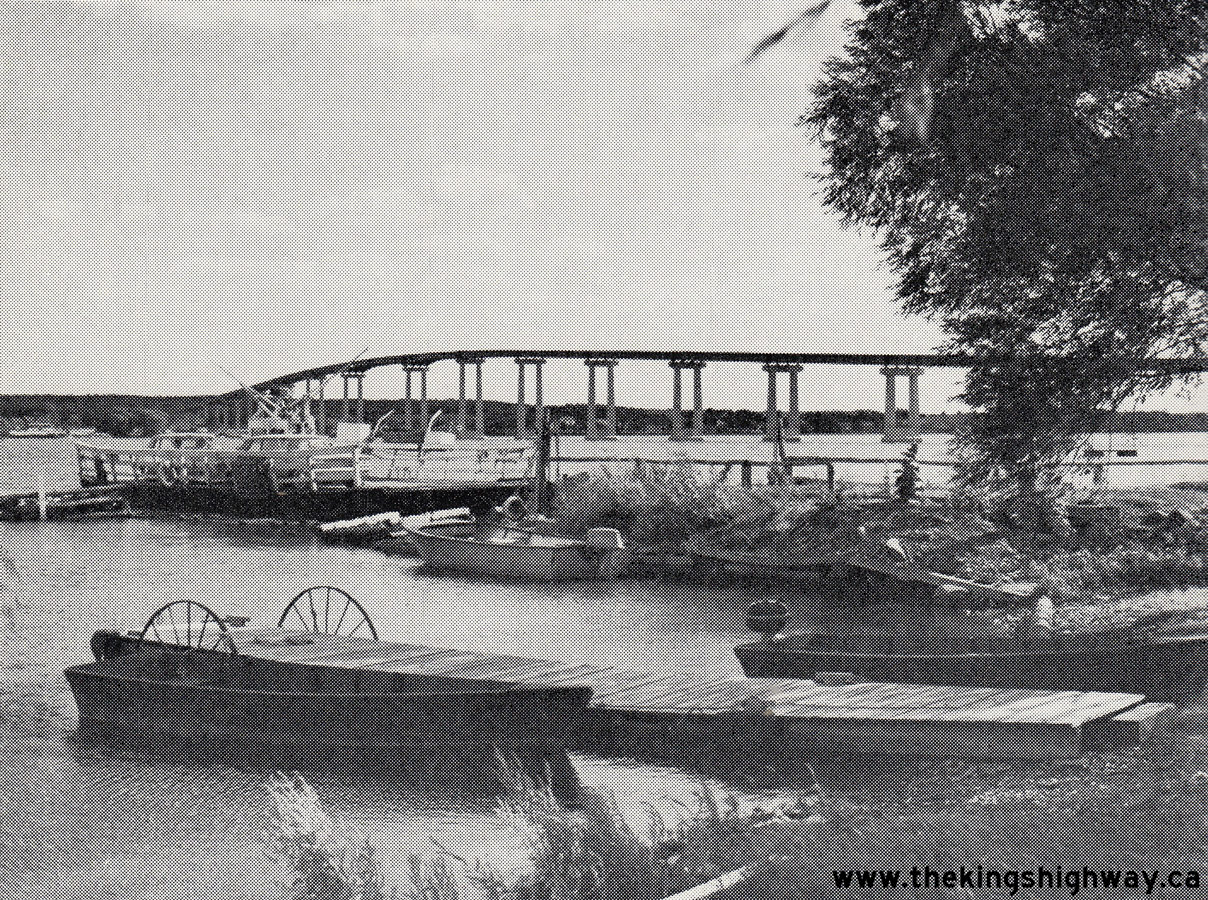
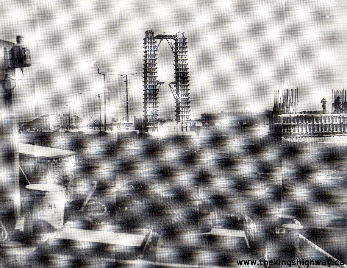
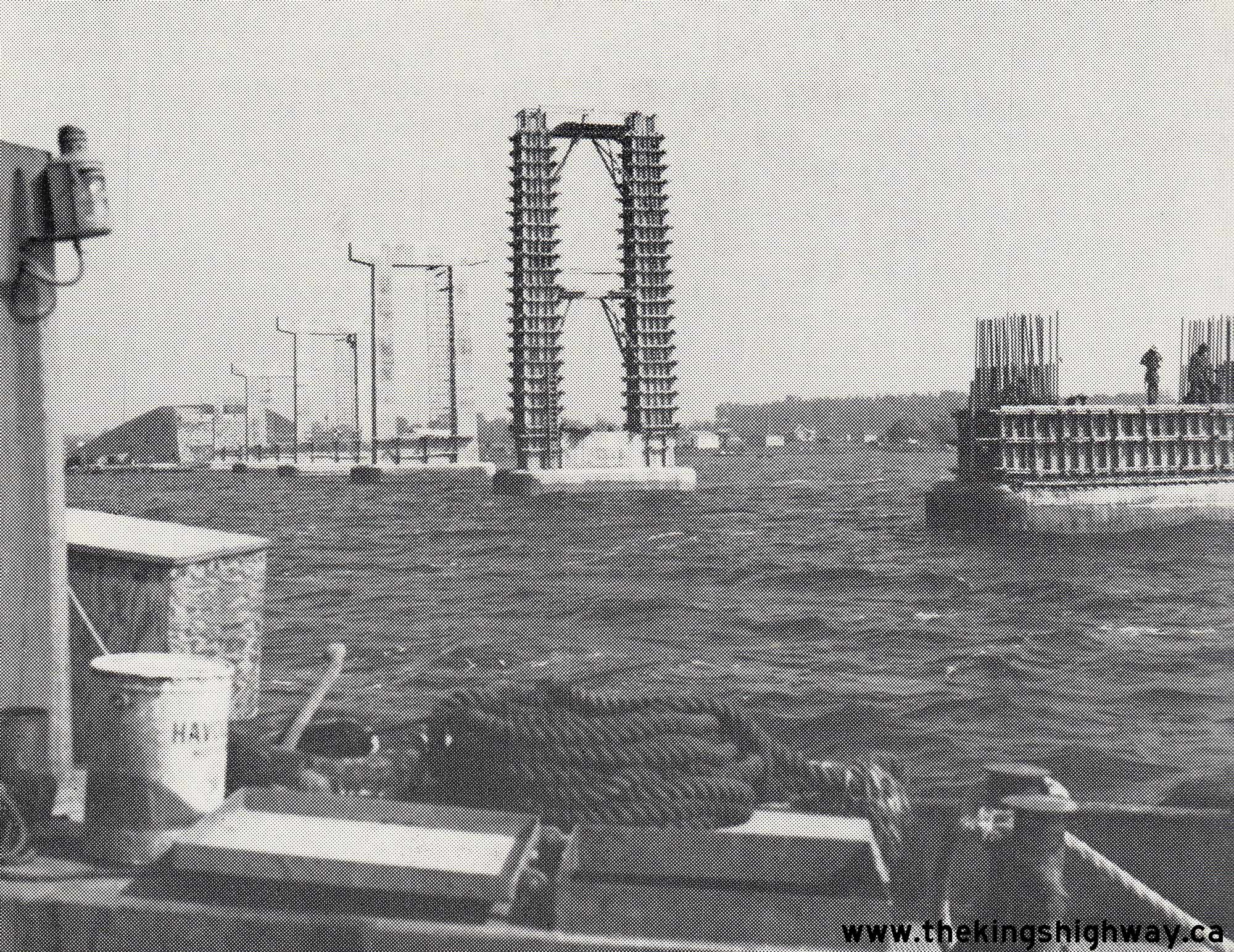
 Left - View of the Quinte Skyway under construction in 1966, with its steel girders fully placed. In the foreground, Cronk's Ferry carries traffic from Prince Edward
County to Hwy 2 on the mainland near Deseronto. This privately-operated ferry service discontinued operations after the Quinte Skyway was opened to traffic in 1967.
See an Enlarged Photo Here. Photo taken in 1966. Left - View of the Quinte Skyway under construction in 1966, with its steel girders fully placed. In the foreground, Cronk's Ferry carries traffic from Prince Edward
County to Hwy 2 on the mainland near Deseronto. This privately-operated ferry service discontinued operations after the Quinte Skyway was opened to traffic in 1967.
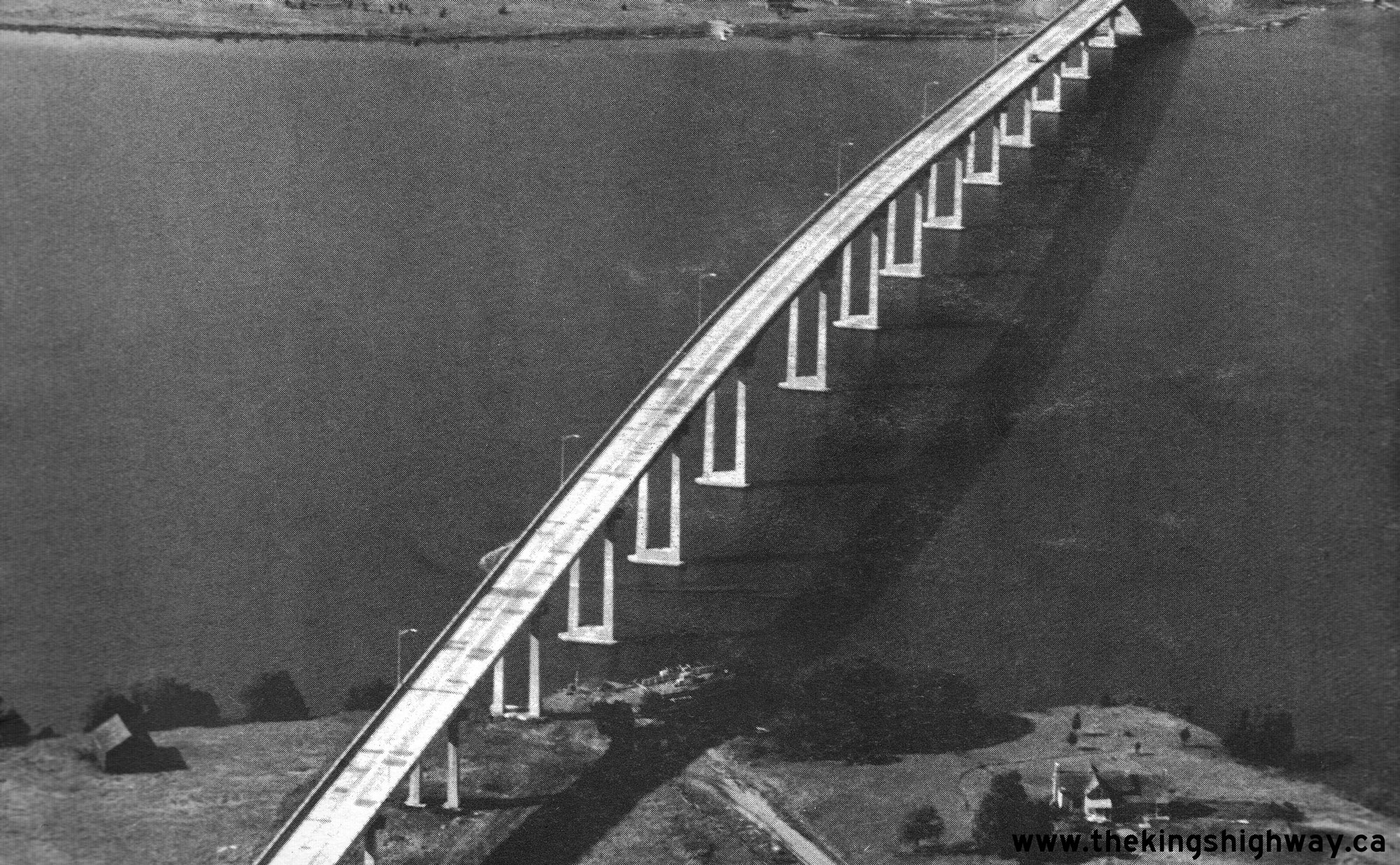
See an Enlarged Photo Here. Photo taken in 1966.(Photo courtesy of Ontario Ministry of Transportation - © King's Printer for Ontario, 1966) Right - Aerial view of the completed Quinte Skyway on Hwy 49 in 1967, facing northeast towards Deseronto. See an
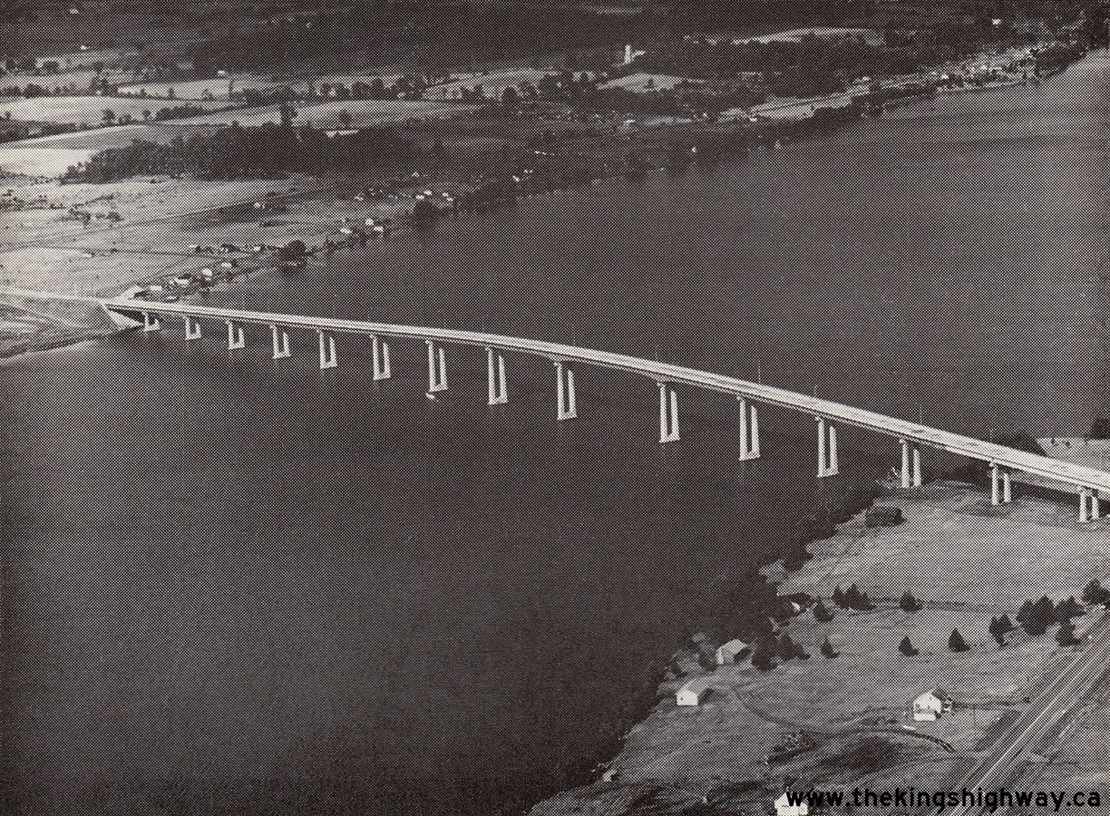
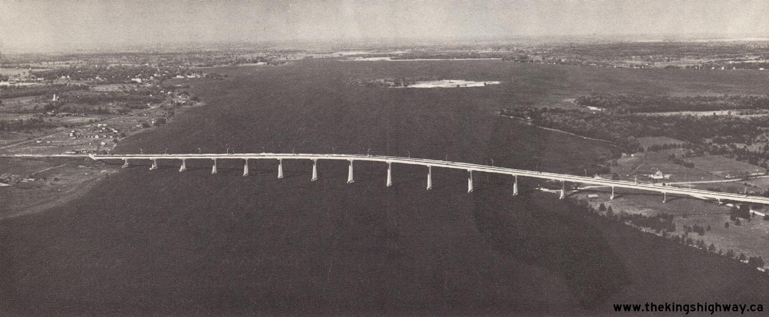
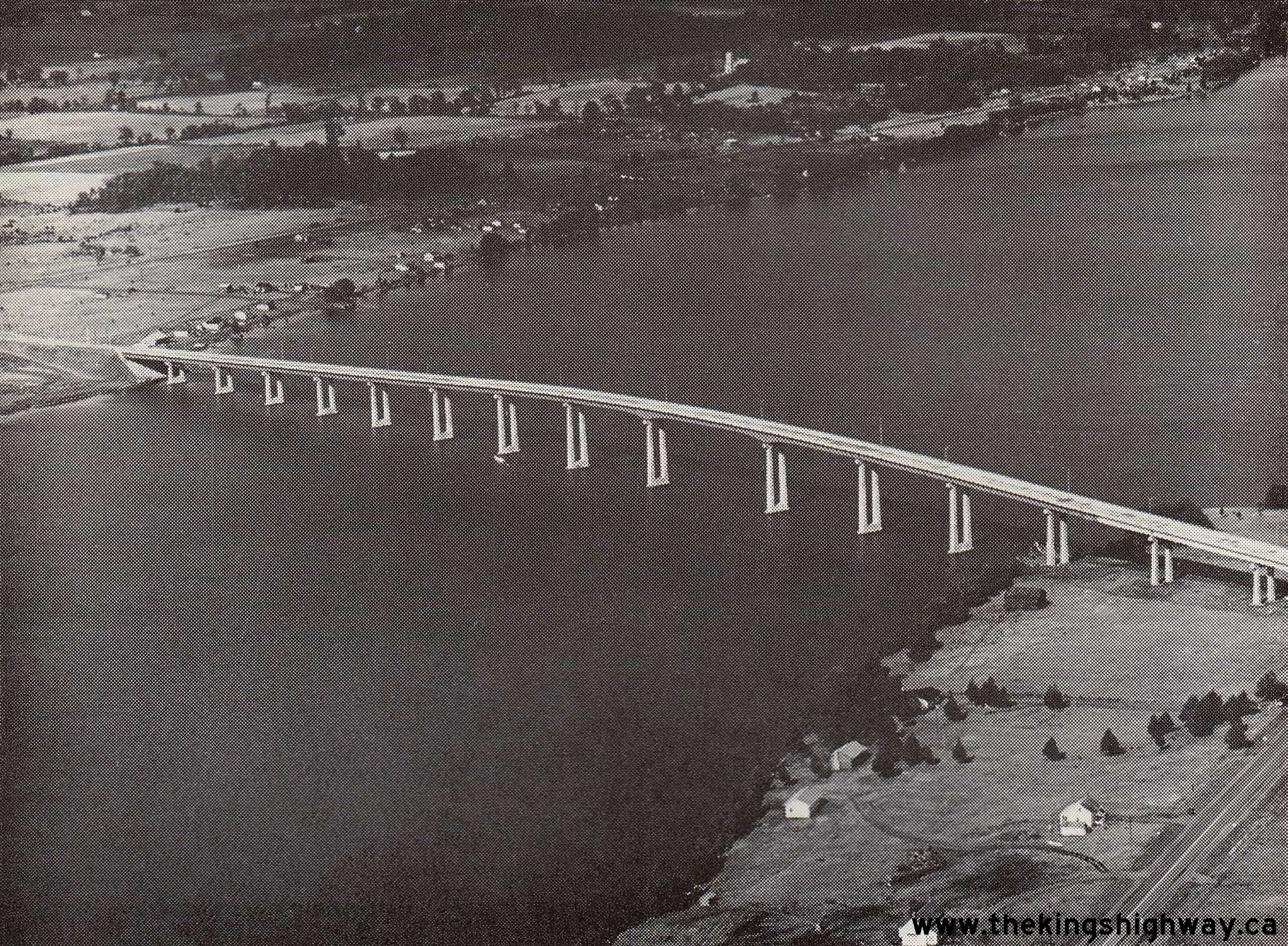
Enlarged Photo Here. Photo taken in 1967.(Photo courtesy of Ontario Ministry of Transportation - © King's Printer for Ontario, 1967)  Above - Aerial view of the completed Quinte Skyway on Hwy 49 in 1967, facing north towards Tyendinaga and the Hwy 401 Interchange near Marysville. The new
skyway had a total length of 2,780 feet (847.3 metres) and had a vertical clearance of 90 feet (27.4 metres) through the main navigation channel below the structure.
See an Enlarged Photo Here. Photo taken in 1967. Above - Aerial view of the completed Quinte Skyway on Hwy 49 in 1967, facing north towards Tyendinaga and the Hwy 401 Interchange near Marysville. The new
skyway had a total length of 2,780 feet (847.3 metres) and had a vertical clearance of 90 feet (27.4 metres) through the main navigation channel below the structure.
See an Enlarged Photo Here. Photo taken in 1967.(Photo courtesy of Ontario Ministry of Transportation - © King's Printer for Ontario, 1967) 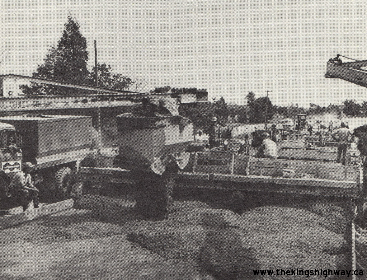
 Left - Concrete paving operations along Hwy 49 north of Picton, Contract #1968-16. See an
Enlarged Photo Here. Photo taken in 1969. Left - Concrete paving operations along Hwy 49 north of Picton, Contract #1968-16. See an
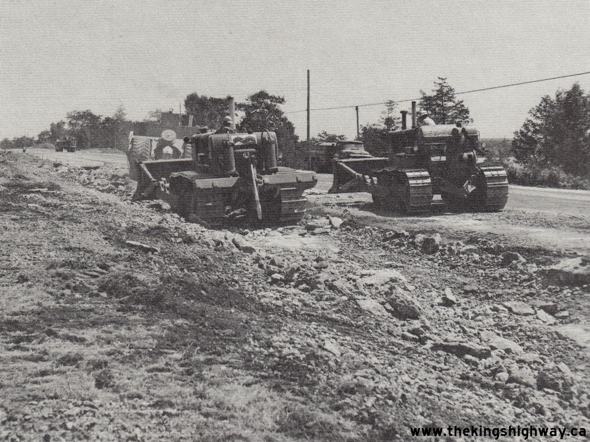
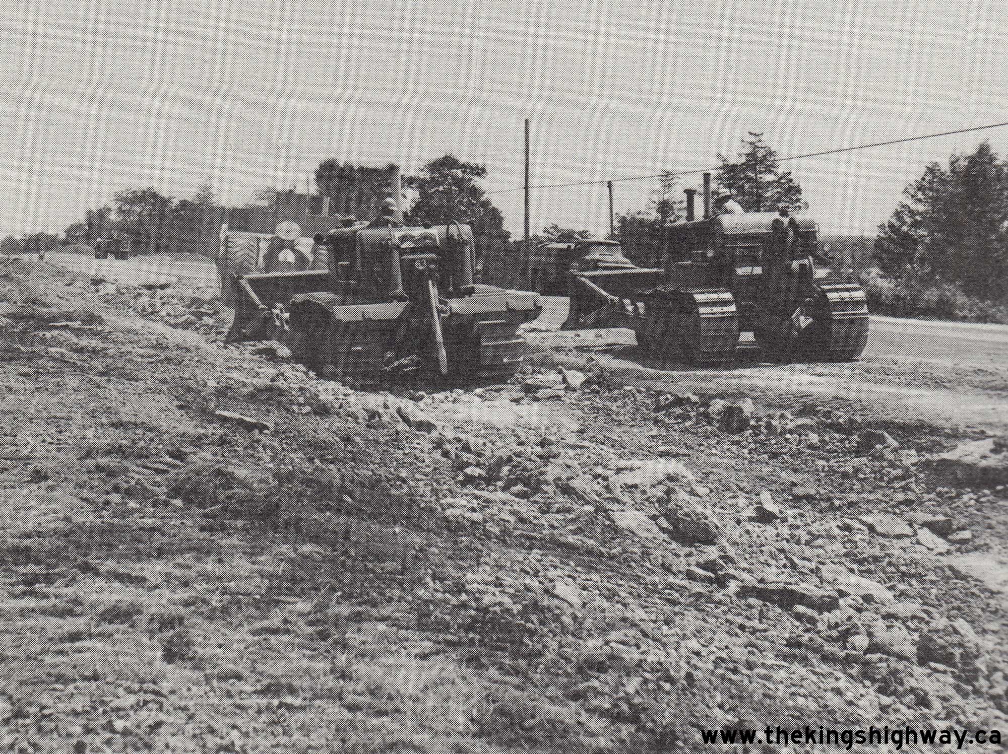
Enlarged Photo Here. Photo taken in 1969.(Photo courtesy of Ontario Ministry of Transportation - © King's Printer for Ontario, 1969) Right - Heavy grading on a new alignment of Hwy 49 south of Roblin Mills, Contract #1970-169. See an Enlarged Photo Here. Photo taken in 1971. (Photo courtesy of Ontario Ministry of Transportation - © King's Printer for Ontario, 1971) |
|---|
|
Present Day King's Highway 49 (#2) Photographs


Left - An older "angled" exit sign for Hwy 49 on eastbound Hwy 401. See an
Enlarged Photo Here. (Photograph taken on August 11, 2007 - © Cameron Bevers) Right - Western side of the Hwy 49 Overpass on Hwy 401 near Deseronto. See an Enlarged Photo Here. (Photograph taken on August 11, 2007 - © Cameron Bevers) 

Left - Eastern side of the Hwy 49 Overpass on Hwy 401. This four-span continuous T-beam structure was completed in 1961. See an
Enlarged Photo Here. (Photograph taken on August 11, 2007 - © Cameron Bevers) Right - Green guide sign on southbound Hwy 2 & Hwy 49 near Deseronto, marking the turn-off for Hwy 2 East. See an Enlarged Photo Here. (Photograph taken on August 11, 2007 - © Cameron Bevers) 

Left - Junction route marker assembly at the Hwy 2 East and Hwy 49 Junction near Deseronto. Hwy 2 & Hwy 49 share a concurrent route for approximately
4.2 km in the Deseronto area. The two highways part ways again in nearby Marysville, where Hwy 49 continues north to Hwy 401, while Hwy 2 West turns off towards
Belleville. See an Enlarged Photo Here. (Photograph taken on August 11, 2007 - © Cameron Bevers) Right - Junction route marker assembly for Hwy 49 near Deseronto. See an Enlarged Photo Here. (Photograph taken on August 11, 2007 - © Cameron Bevers) 

Left - Green guide sign for Hwy 2 East on northbound Hwy 49 near Deseronto. See an
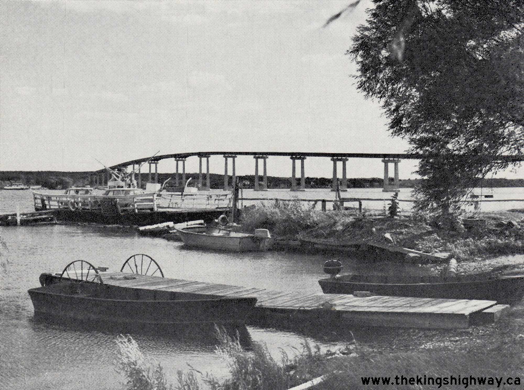
Enlarged Photo Here. (Photograph taken on August 11, 2007 - © Cameron Bevers) Right - Facing south towards the Quinte Skyway on Hwy 49 near Deseronto. The Quinte Skyway is one of two high-level bridges connecting the mainland to the island municipality of Prince Edward County. The other structure is the Norris Whitney (Belleville Bay) Bridge on Hwy 62. The tangential alignment of Hwy 49 across the Quinte Skyway and the lack of reference points on the horizon gives the false illusion that the skyway merely "ends" in mid-air. See an Enlarged Photo Here. (Photograph taken on August 11, 2007 - © Cameron Bevers) 
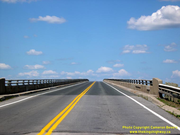
Left - Facing north along Hwy 49 towards Deseronto on the Quinte Skyway. The Quinte Skyway was completed and officially opened to traffic on September 6, 1967,
by Ontario Premier John Robarts after almost three years of construction. The Quinte Skyway provided a more direct highway link between Hwy 401 and Picton. See an
Enlarged Photo Here. (Photograph taken on August 11, 2007 - © Cameron Bevers) Right - Facing north from the south end of the Quinte Skyway on Hwy 49 between Picton and Deseronto. See an Enlarged Photo Here. (Photograph taken on August 11, 2007 - © Cameron Bevers) 

Left - The Quinte Skyway on Hwy 49 rises high above the north shore of Prince Edward County. This 17-span steel plate girder structure has a total length of
approximately 850 metres (2,780 feet). See an Enlarged Photo Here. (Photograph taken on August 11, 2007 - © Cameron Bevers) Right - Facing north along Hwy 49 towards the Quinte Skyway from Prince Edward Road 15. See an Enlarged Photo Here. (Photograph taken on August 11, 2007 - © Cameron Bevers)
More King's Highway 49 (#2) Photographs Coming Soon!
|
|---|
Links to Adjacent King's Highway Photograph Pages:
Back to King's Highway 49 (#1) Photos /
King's Highway 49 (#2) History /
Back to King's Highway 50 Photos
Ontario Highway History - Main Menu / Back to List of Highways Website contents, photos & text © 2002-2026, Cameron
Bevers (Webmaster) - All Rights Reserved / Contact Me
|
|---|