
| 
| |
|
|
This page contains present day photos (Year 2000 to date) of Ontario's King's Highway 60, arranged by location from Algonquin
Provincial Park's West Gate easterly to Whitney. All photographs displayed on this page were taken by the Webmaster (Cameron Bevers), unless specifically noted
otherwise. Click on any thumbnail to see a larger image!
Please note that all photographs displayed on this
website are protected by copyright. These photographs must not be reproduced, published,
electronically stored or copied, distributed, or posted onto other websites without
my written permission. If you want to use photos from this website, please
email me first for permission. Thank-you!
|
|---|
|
Page 4: Present Day King's Highway 60 Photographs (Algonquin Park's West Gate to Whitney)


Left - Facing west along the Smoke Creek Diversion near the Tea Lake Campground. The old highway alignment, seen at right, was left open to provide access to
the Tea Lake Campground. See an Enlarged Photo here. (Photograph taken on August 6, 2006 - © Cameron Bevers) Right - Facing east along Hwy 60 towards the Smoke Creek Bridge. See an Enlarged Photo here. (Photograph taken on August 6, 2006 - © Cameron Bevers) 

Left - Site of the original Smoke Creek Bridge. The new structure was built directly beside the old bridge, but both bridge approaches were extensively rebuilt
on improved alignments so that substandard curves adjacent to the bridge could be corrected. See an
Enlarged Photo here. (Photograph taken on August 6, 2006 - © Cameron Bevers) Right - Facing east across the new Smoke Creek Bridge on Hwy 60 near the Tea Lake Campground. See an Enlarged Photo here. (Photograph taken on August 6, 2006 - © Cameron Bevers) 

Left - Smoke Creek Bridge on Hwy 60 in Algonquin Park. This concrete replacement structure was built in 2000, after the original timber bridge burnt down in
August 1999. The fire started when a transport truck lost control and overturned on the Smoke Creek Bridge, spilling fuel onto the bridge deck. The fuel subsequently
ignited and set fire to the creosoted timber substructure of the bridge, quickly engulfing the entire structure in flames. The old bridge was so badly damaged by the
fire, that it had to be replaced. See an Enlarged Photo here. (Photograph taken on August 6, 2006 - © Cameron Bevers) Right - Close-up of the date stamp (2000) and structure identification number on the new Smoke Creek Bridge. Following the fire, the Ministry of Transportation installed a Bailey Bridge at this location in order to restore access to Algonquin Provincial Park while a replacement bridge could be designed and constructed. Until the Bailey Bridge was installed, traffic faced a lengthy detour via Bancroft and Whitney in order to reach the main campground areas of Algonquin Park. See an Enlarged Photo here. (Photograph taken on August 6, 2006 - © Cameron Bevers) 

Left - The abandoned highway passes through a large rock cut east of the Smoke Creek Bridge. See an
Enlarged Photo here. (Photograph taken on August 6, 2006 - © Cameron Bevers) Right - As part of the Smoke Creek Bridge replacement project, the Ministry of Transportation took the opportunity to bypass this very sharp curve in the original highway just east of Smoke Creek. Although the asphalt has been removed, the roadbed of the old highway curve is still clearly visible today. See an Enlarged Photo here. (Photograph taken on August 6, 2006 - © Cameron Bevers) 

Left - Facing west towards the Smoke Creek Bridge on Hwy 60 in Algonquin Park. The bridge was accidentally destroyed by fire in 1999, forcing a
complete reconstruction of the Smoke Creek Bridge and its approaches. See an
Enlarged Photo here. (Photograph taken on August 6, 2006 - © Cameron Bevers) Right - Facing east along the Smoke Creek Diversion. About 1 km of Hwy 60 was relocated as a result of the bridge replacement project. See an Enlarged Photo here. (Photograph taken on August 6, 2006 - © Cameron Bevers) 

Left - Beginning of the Smoke Creek Diversion on Hwy 60. Note the abandoned roadway off to the right of the current highway. See an
Enlarged Photo here. (Photograph taken on August 6, 2006 - © Cameron Bevers) Right - Facing west along Hwy 60 near Canisbay Lake in Algonquin Park. See an Enlarged Photo here. (Photograph taken on August 6, 2006 - © Cameron Bevers) 
Above - King's Highway 60 sign with Frank MacDougall Parkway commemorative sign. See an
Enlarged Photo here. (Photograph taken on August 6, 2006 - © Cameron Bevers) 

Left - Northern side of the Madawaska River Bridge on Hwy 60 at Lake of Two Rivers. See an
Enlarged Photo here. (Photograph taken on August 6, 2006 - © Cameron Bevers) Right - Southern side of the Madawaska River Bridge. This single span concrete rigid frame structure was completed in 1951. See an Enlarged Photo here. (Photograph taken on August 6, 2006 - © Cameron Bevers) 

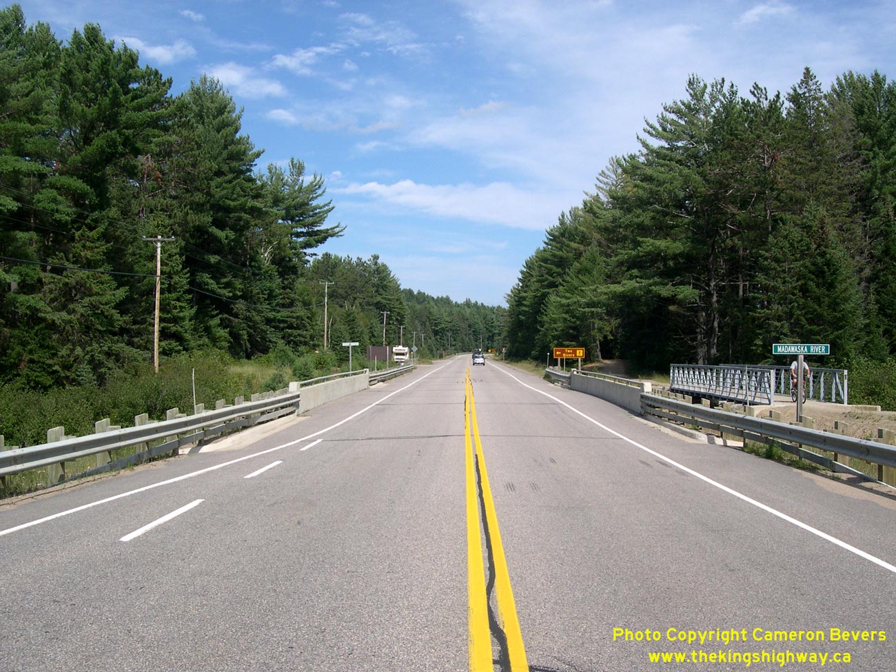
Left - Facing east along Hwy 60 at the Madawaska River Bridge at Lake of Two Rivers. See an
Enlarged Photo here. (Photograph taken on August 6, 2006 - © Cameron Bevers) Right - Facing west along Hwy 60 beside Lake of Two Rivers. See an Enlarged Photo here. (Photograph taken on August 6, 2006 - © Cameron Bevers) 

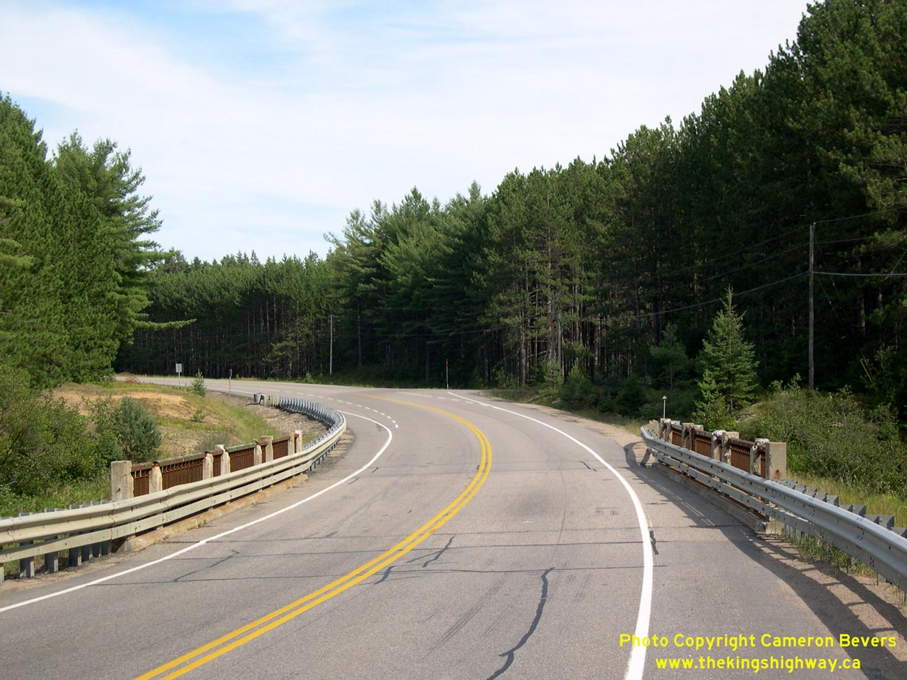
Left - Facing west along Hwy 60 towards Lake of Two Rivers in Algonquin Park. See an
Enlarged Photo here. (Photograph taken on August 6, 2006 - © Cameron Bevers) Right - Facing east along Hwy 60 at Lake of Two Rivers. The highway through Algonquin Park has many scenic lake views such as this one. See an Enlarged Photo here. (Photograph taken on August 6, 2006 - © Cameron Bevers) 

Left - Close-up of the concrete and steel handrail design of the Kearney Creek Bridge on Hwy 60. See an
Enlarged Photo here. (Photograph taken on August 6, 2006 - © Cameron Bevers) Right - Facing west along Hwy 60 at the Kearney Creek Bridge. This section of Hwy 60 will be bypassed during the upcoming bridge replacement project, in order to eliminate this sharp curve in the highway. See an Enlarged Photo here. (Photograph taken on August 6, 2006 - © Cameron Bevers) 

Left - Northern side of the Kearney Creek Bridge on Hwy 60 in Algonquin Park. This aging bridge will be replaced in 2008. See an
Enlarged Photo here. (Photograph taken on August 6, 2006 - © Cameron Bevers) Right - Close-up of the steel beam design and timber trestle substructure of the Kearney Creek Bridge. See an Enlarged Photo here. (Photograph taken on August 6, 2006 - © Cameron Bevers) 

Left - Facing east along Hwy 60 towards the Kearney Campground at Kearney Creek. See an
Enlarged Photo here. (Photograph taken on August 6, 2006 - © Cameron Bevers) Right - Southern side of the Kearney Creek Bridge on Hwy 60. Structure completed in 1939. See an Enlarged Photo here. (Photograph taken on August 6, 2006 - © Cameron Bevers) 

Left - Southern side of the Headstone Creek Bridge on Hwy 60. See an
Enlarged Photo here. (Photograph taken on August 6, 2006 - © Cameron Bevers) Right - Close-up of the parapet design of the Headstone Creek Bridge on Hwy 60. See an Enlarged Photo here. (Photograph taken on August 6, 2006 - © Cameron Bevers) 

Left - Deck view of the Headstone Creek Bridge on Hwy 60. This bridge is scheduled for replacement in 2008. See an
Enlarged Photo here. (Photograph taken on August 6, 2006 - © Cameron Bevers) Right - Facing west along Hwy 60 at the Headstone Creek Bridge near the Algonquin Park East Gate. See an Enlarged Photo here. (Photograph taken on August 6, 2006 - © Cameron Bevers) 

Left - Northern side of the Headstone Creek Bridge on Hwy 60. Structure completed in 1939. See an
Enlarged Photo here. (Photograph taken on August 6, 2006 - © Cameron Bevers) Right - Close-up of the steel beam and timber trestle superstructure of the Headstone Creek Bridge. See an Enlarged Photo here. (Photograph taken on August 6, 2006 - © Cameron Bevers) 

Left - Facing east along Hwy 60 towards the Algonquin Park East Gate at the Headstone Creek Bridge. See an
Enlarged Photo here. (Photograph taken on August 6, 2006 - © Cameron Bevers) Right - Approaching the Algonquin Park East Gate on Hwy 60 near Whitney. Motorists who want to drive through Algonquin Park along Hwy 60 can do so at no charge. However, park permits are required if motorists wish to make use of any of the park's camping, hiking or picnic facilities. See an Enlarged Photo here. (Photograph taken on August 6, 2006 - © Cameron Bevers)
Continue on to King's Highway 60 Photos: Whitney to Barry's Bay
|
|---|
Links to Adjacent King's Highway Photograph Pages:
Back to Hwy 60 - Dwight to Algonquin Park's West Gate
Hwy 60 Photo Index
On to Hwy 60 - Whitney to Barry's Bay
Back to King's Highway 59 Photos /
King's Highway 60 History /
Back to King's Highway 61 Photos
Ontario Highway History - Main Menu / Back to List of Highways Website contents, photos & text © 2002-2026, Cameron
Bevers (Webmaster) - All Rights Reserved / Contact Me
|
|---|