
| 
| |
|
|
This page contains present day photos (Year 2000 to date) of Ontario's King's Highway 65, arranged by location from New
Liskeard westerly to Elk Lake. All photographs displayed on this page were taken by the Webmaster (Cameron Bevers), unless specifically noted otherwise. Click on any
thumbnail to see a larger image!
Please note that all photographs displayed on this
website are protected by copyright. These photographs must not be reproduced, published,
electronically stored or copied, distributed, or posted onto other websites without
my written permission. If you want to use photos from this website, please
email me first for permission. Thank-you!
|
|---|
|
Page 2: Present Day King's Highway 65 Photographs (New Liskeard to Elk Lake)


Left - Western side of the Wabi River Bridge on Hwy 11 & Hwy 65. The trapezoidal-shaped continuous steel plate girder superstructure is supported on two
concrete piers situated on the river banks. The structure therefore has no footprint in the water. See an
Enlarged Photo Here. Right - Eastern side of the Wabi River Bridge on Hwy 11 & Hwy 65 near New Liskeard. See an Enlarged Photo Here. (Photograph taken on September 1, 2007 - © Cameron Bevers) 

Left - Deck view of the Wabi River Bridge on the Tri-Town Bypass (Hwy 11 & Hwy 65). The Wabi River Bridge is the longest structure on Hwy 11 between
North Bay and New Liskeard, with a total length of 123.5 metres (405 feet). See an
Enlarged Photo Here. (Photograph taken on September 1, 2007 - © Cameron Bevers) Right - Facing north along Hwy 11 & Hwy 65 towards Englehart at the Wabi River Bridge near New Liskeard. See an Enlarged Photo Here. (Photograph taken on September 1, 2007 - © Cameron Bevers) 

Left - Facing south along Hwy 11 & Hwy 65 towards Latchford at the Wabi River Bridge near New Liskeard. See an
Enlarged Photo Here. (Photograph taken on September 1, 2007 - © Cameron Bevers) Right - Wabi River Bridge on the Tri-Town Bypass (Hwy 11 & Hwy 65) near New Liskeard. Structure completed in 1963. See an Enlarged Photo Here. (Photograph taken on September 1, 2007 - © Cameron Bevers) 

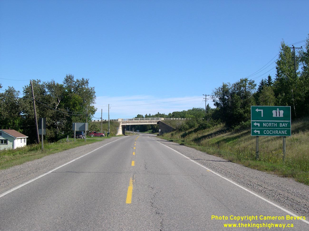
Left - General view of the Hwy 11 and Hwy 65 West Junction near New Liskeard. This highway junction is grade-separated, but the two highways are joined
together by a single connector ramp. The Hwy 11 Connector Ramp is not fully channelized, so the junction is not really a proper interchange. See an
Enlarged Photo Here. (Photograph taken on September 1, 2007 - © Cameron Bevers) Right - Facing north along Hwy 11 towards Englehart at the Hwy 65 Underpass in New Liskeard. See an Enlarged Photo Here. (Photograph taken on September 1, 2007 - © Cameron Bevers) 

Left - Facing east along Hwy 65 towards New Liskeard from the Hwy 65 Underpass. The Hwy 11 Connector Ramp joins Hwy 65 at a regular T-intersection. See an
Enlarged Photo Here. (Photograph taken on September 1, 2007 - © Cameron Bevers) Right - Facing west along Hwy 65 towards Elk Lake from the Hwy 65 Underpass. The junction of Hwy 11 and Hwy 65 was obviously not grade separated because of excessive traffic volumes. The surrounding topography made it virtually impossible for the two highways to meet at-grade, so a grade separation was constructed. See an Enlarged Photo Here. (Photograph taken on September 1, 2007 - © Cameron Bevers) 

Left - Facing south along Hwy 11 towards Latchford at the Hwy 65 Underpass in New Liskeard. See an
Enlarged Photo Here. (Photograph taken on September 1, 2007 - © Cameron Bevers) Right - Deck view of the Hwy 65 Underpass on the Tri-Town Bypass (Hwy 11), facing north. See an Enlarged Photo Here. (Photograph taken on September 1, 2007 - © Cameron Bevers) 

Left - Western side of the Hwy 65 Underpass on Hwy 11. This single-span prestressed concrete girder structure was completed in 1963. See an
Enlarged Photo Here. (Photograph taken on September 1, 2007 - © Cameron Bevers) Right - Eastern side of the Hwy 65 Underpass on Hwy 11 in New Liskeard. See an Enlarged Photo Here. (Photograph taken on September 1, 2007 - © Cameron Bevers) 
Left - Junction of the Hwy 11 Connector Ramp and Hwy 65 in New Liskeard. Until recently, Hwy 65 continued straight ahead via Whitewood Avenue through Downtown
New Liskeard, but the highway's route was changed in 2003 so that Hwy 65 turned left at this intersection and followed the Tri-Town Bypass (Hwy 11) instead. However,
as seen in this photo, there is no indication at the Hwy 11 Connector Ramp that Hwy 65 actually continues any further east. See an
Enlarged Photo Here. (Photograph taken on September 1, 2007 - © Cameron Bevers) Right - Facing east along Hwy 65 towards the underpass below Hwy 11 at New Liskeard. See an Enlarged Photo Here. (Photograph taken on September 1, 2007 - © Cameron Bevers) 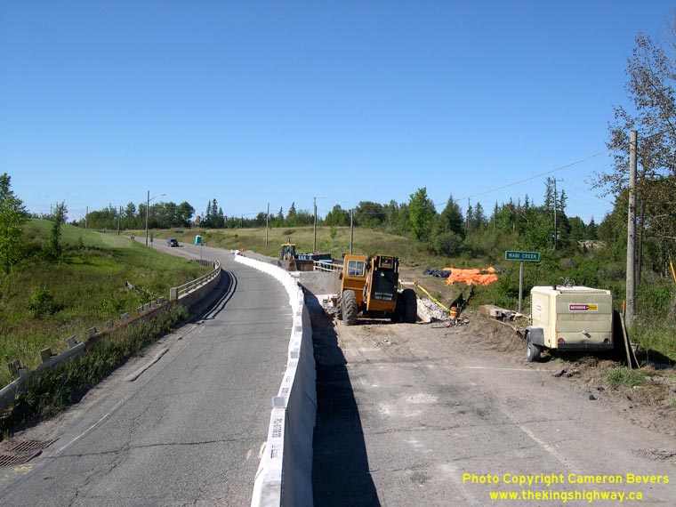

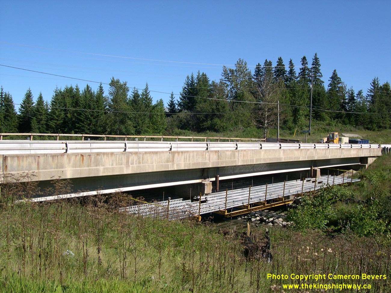
Left - Approaching the Wabi Creek Bridge on Hwy 65 west of New Liskeard. The structure was undergoing a deck rehabilitation when this photo was
taken in 2007. One lane of traffic was maintained across the bridge during the rehabilitation project. See an
Enlarged Photo Here. (Photograph taken on September 1, 2007 - © Cameron Bevers) Right - South side of the Wabi Creek Bridge on Hwy 65. Structure completed in 1973. See an Enlarged Photo Here. (Photograph taken on September 1, 2007 - © Cameron Bevers) 
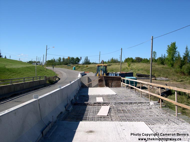
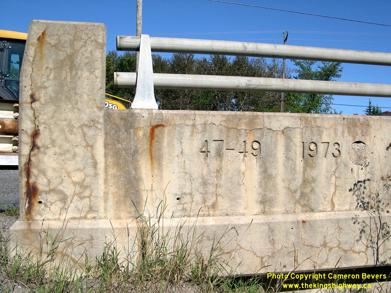
Left - Structure identification number and date stamp (1973) on the Wabi Creek Bridge. See an
Enlarged Photo Here. (Photograph taken on September 1, 2007 - © Cameron Bevers) Right - The entire deck of the Wabi Creek Bridge was replaced in 2007-2008. See an Enlarged Photo Here. (Photograph taken on September 1, 2007 - © Cameron Bevers) 

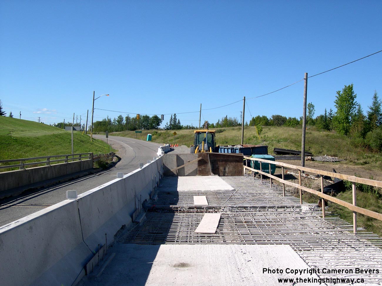
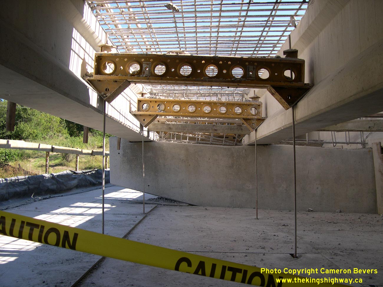
Left - Looking below the Wabi Creek Bridge on Hwy 65 west of New Liskeard, showing the removed bridge deck. See an
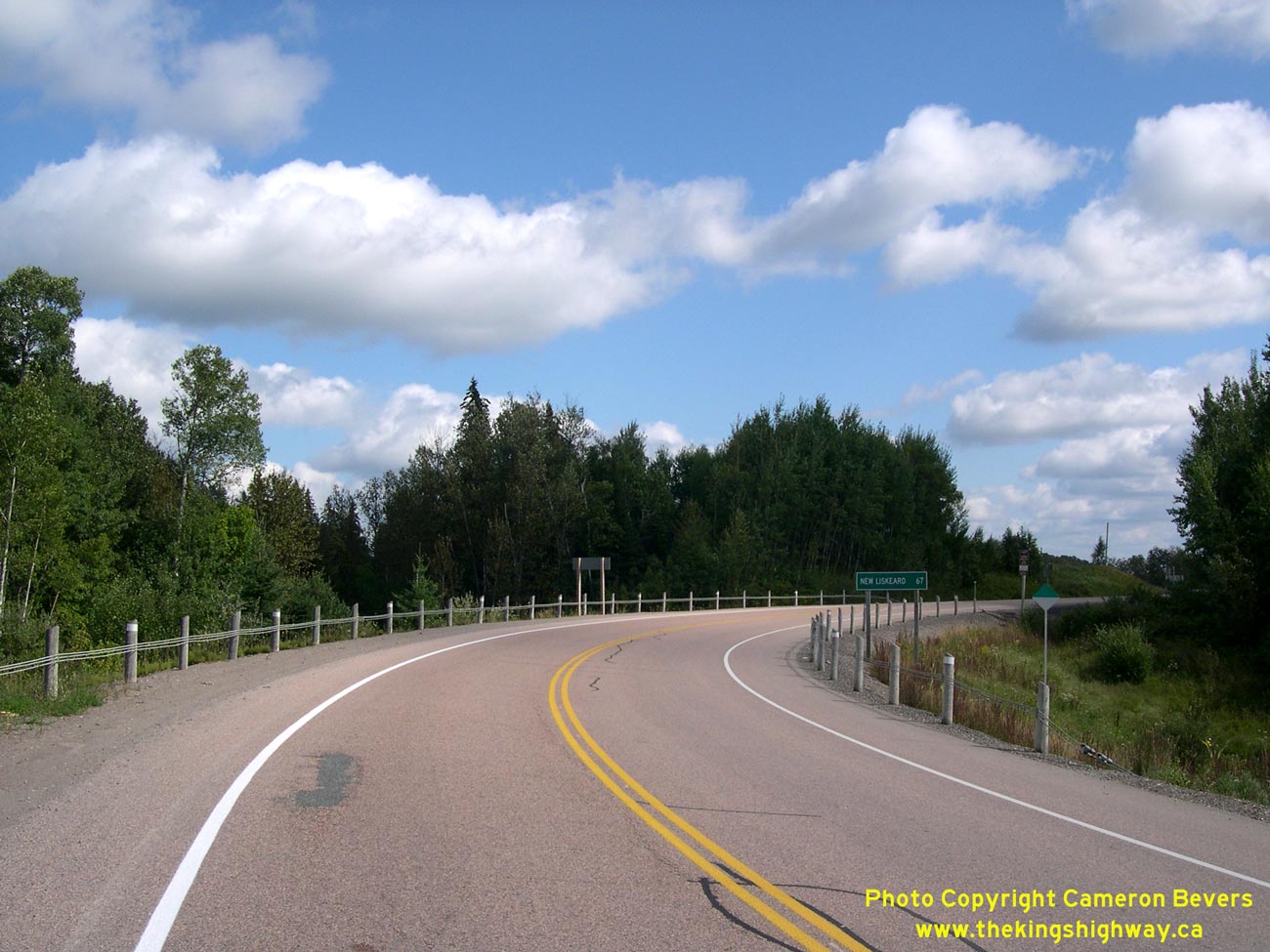
Enlarged Photo Here. (Photograph taken on September 1, 2007 - © Cameron Bevers) Right - Facing west along Hwy 65 approaching the Hwy 562 Junction south of Earlton. See an Enlarged Photo Here. (Photograph taken on September 23, 2017 - © Cameron Bevers) 

Left - Hwy 562 Junction on Hwy 65, facing west towards Elk Lake. See an
Enlarged Photo Here. (Photograph taken on September 23, 2017 - © Cameron Bevers) Right - Facing east along Hwy 65 towards New Liskeard from the Hwy 562 Junction. See an Enlarged Photo Here. (Photograph taken on September 23, 2017 - © Cameron Bevers) 

Left - Facing east along Hwy 562 towards Thornloe and Earlton from the Hwy 65 Junction. See an
Enlarged Photo Here. (Photograph taken on September 23, 2017 - © Cameron Bevers) Right - Hwy 65 "JCT" sign on westbound Hwy 562, approaching the Hwy 65 & Hwy 562 Junction. See an Enlarged Photo Here. (Photograph taken on September 23, 2017 - © Cameron Bevers) 

Left - Hwy 65 & Hwy 562 junction assembly south of Earlton. See an
Enlarged Photo Here. (Photograph taken on September 23, 2017 - © Cameron Bevers) Right - Western terminus of Hwy 562 at the Hwy 65 Junction south of Earlton. See an Enlarged Photo Here. (Photograph taken on September 23, 2017 - © Cameron Bevers) 

Left - Hwy 562 Junction on Hwy 65, facing east towards New Liskeard. See an
Enlarged Photo Here. (Photograph taken on September 23, 2017 - © Cameron Bevers) Right - Facing west along Hwy 65 towards Elk Lake from the Hwy 562 Junction. See an Enlarged Photo Here. (Photograph taken on September 23, 2017 - © Cameron Bevers) 

Left - Approaching the Hwy 562 Junction on Hwy 65, facing east towards New Liskeard. See an
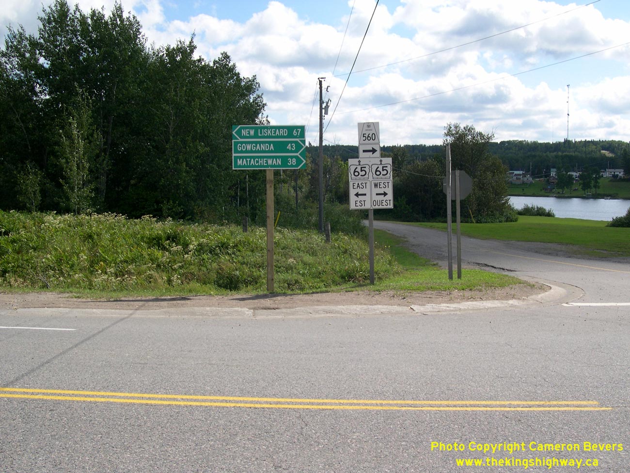
Enlarged Photo Here. (Photograph taken on September 23, 2017 - © Cameron Bevers) Right - Facing east along Hwy 65 from the Hwy 560 Junction in Elk Lake. See an Enlarged Photo Here. (Photograph taken on August 27, 2006 - © Cameron Bevers) 

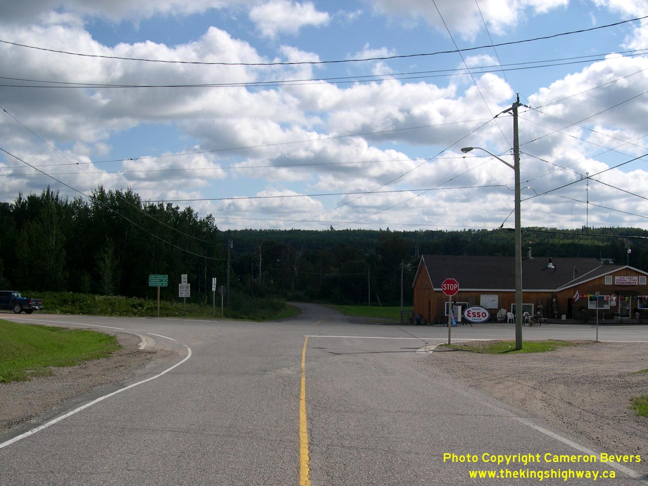
Left - Junction of Hwy 65 and Hwy 560 in Elk Lake. At the stop sign, Hwy 560 turns right and runs concurrently with Hwy 65 through Elk Lake. After
1 km, Hwy 560 turns away from Hwy 65 and heads west towards Gowganda and Hwy 144. See an
Enlarged Photo Here. (Photograph taken on August 27, 2006 - © Cameron Bevers) Right - Junction assembly at the Hwy 65 and Hwy 560 Junction in Elk Lake. See an Enlarged Photo Here. (Photograph taken on August 27, 2006 - © Cameron Bevers) 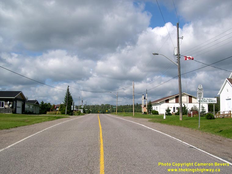
Left - Facing east towards Englehart along Hwy 560 from the Hwy 65 Junction in Elk Lake. See an
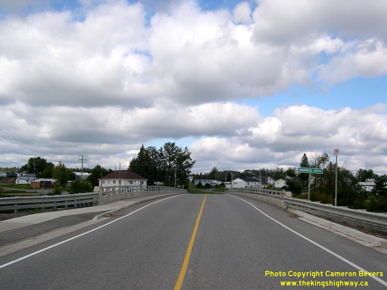
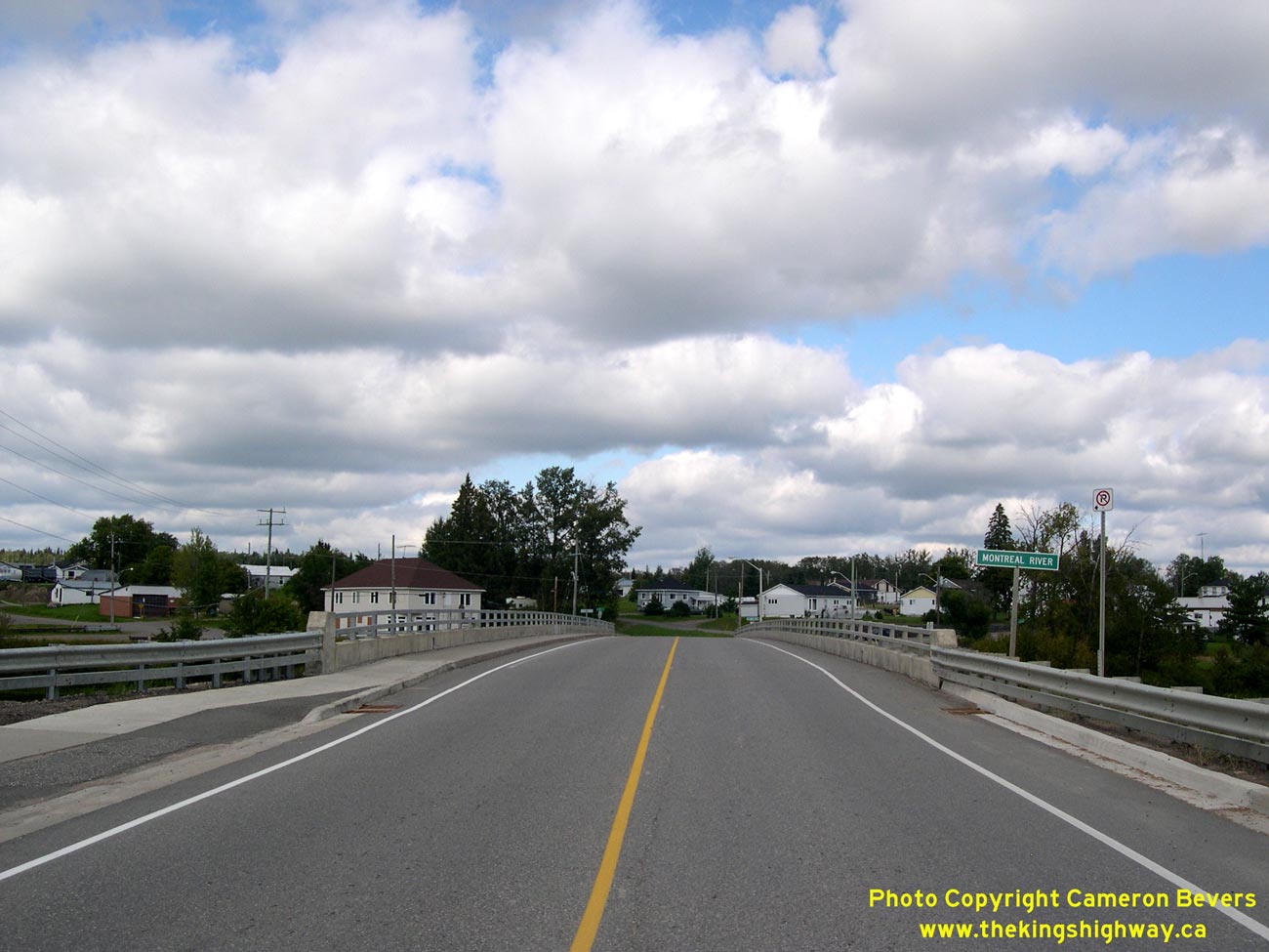
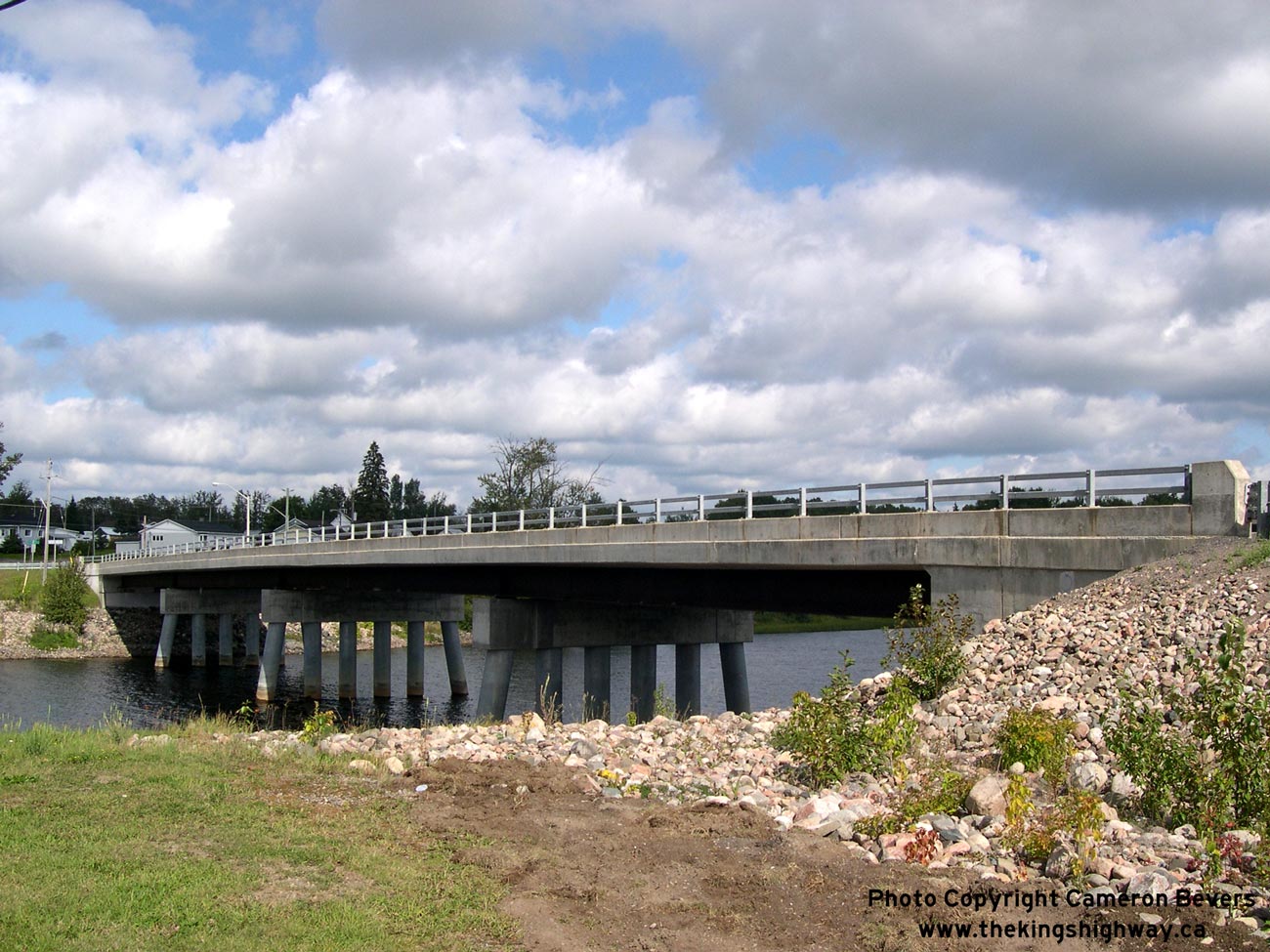
Enlarged Photo Here. (Photograph taken on August 27, 2006 - © Cameron Bevers) Right - Montreal River Bridge on Hwy 65 and Hwy 560 in Elk Lake. Structure completed in 1997. See an Enlarged Photo Here. (Photograph taken on August 27, 2006 - © Cameron Bevers) 
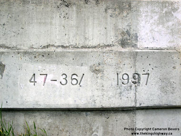
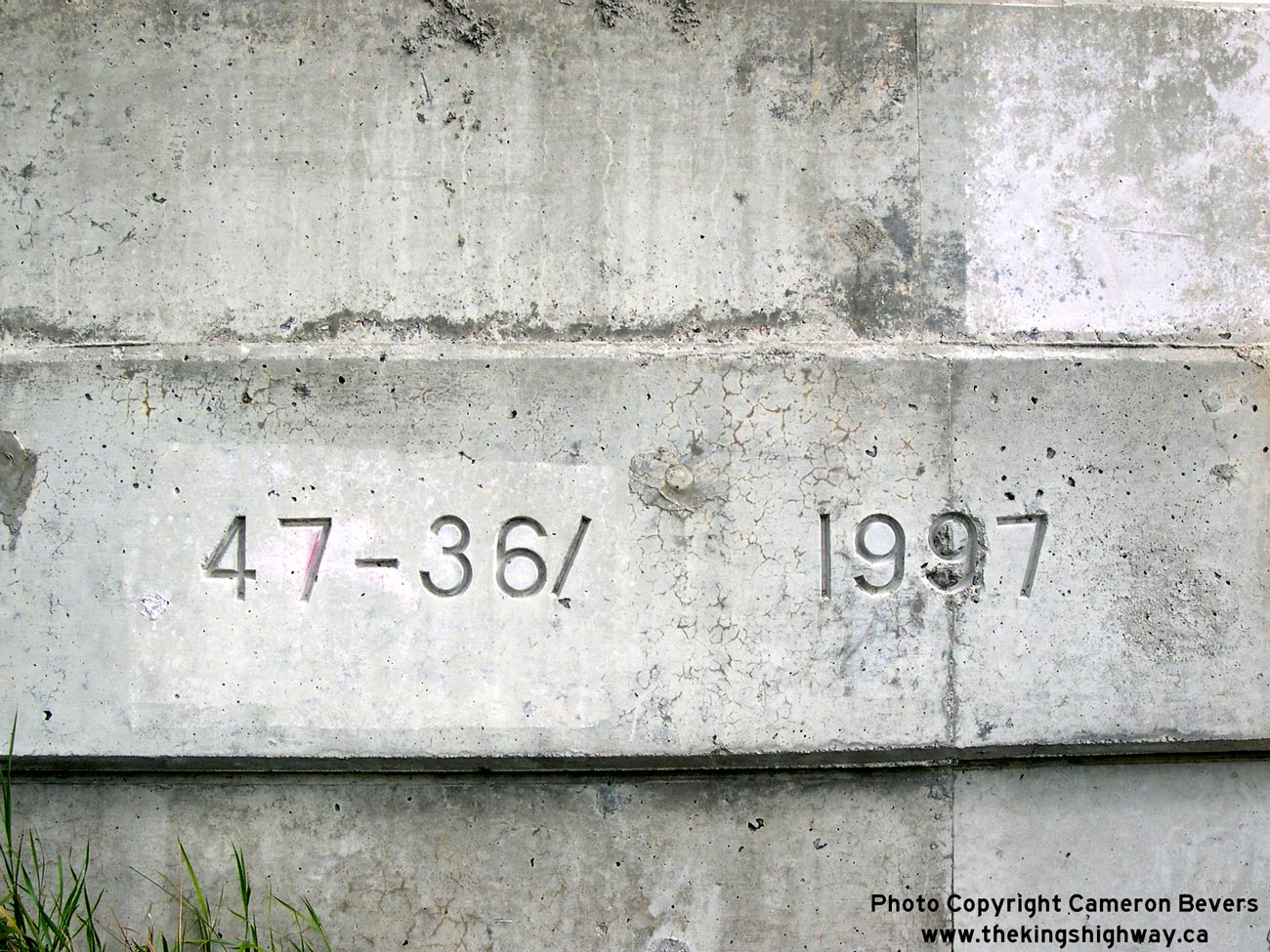
Left - The new Montreal River Bridge replaced an earlier steel beam and timber trestle structure that was built in 1950. See an
Enlarged Photo Here. (Photograph taken on August 27, 2006 - © Cameron Bevers) Right - Structure identification number and date stamp (1997) on the Montreal River Bridge in Elk Lake. See an Enlarged Photo Here. (Photograph taken on August 27, 2006 - © Cameron Bevers)
Continue on to King's Highway 65 Photos: Elk Lake to Hwy 66
|
|---|
Links to Adjacent King's Highway Photograph Pages:
Back to Hwy 65 - Quebec Boundary to New Liskeard
Hwy 65 Photo Index
On to Hwy 65 - Elk Lake to Hwy 66
Back to King's Highway 64 Photos /
King's Highway 65 History /
On to King's Highway 66 Photos
Ontario Highway History - Main Menu / Back to List of Highways Website contents, photos & text © 2002-2026, Cameron
Bevers (Webmaster) - All Rights Reserved / Contact Me
|
|---|