
| 
| |
|
|
All photographs displayed on this page were taken by the
Webmaster (Cameron Bevers), unless specifically noted otherwise. Historical photographs are
arranged in approximate chronological order, while present day photographs (Year 2010 to date)
are arranged by location from west to east. Click on any thumbnail to see a larger image!
Please note that all photographs displayed on this
website are protected by copyright. These photographs must not be reproduced, published,
electronically stored or copied, distributed, or posted onto other websites without
my written permission. If you want to use photos from this website, please
email me first for permission. Thank-you!
|
|---|
|
Historical Secondary Highway 660 Photographs

Left - Completed Bala Diversion on Hwy 69 (later known as Hwy 169) in 1965, facing north from the Hwy 660 Junction (today's Muskoka Road 38). The new Hwy 69
Diversion in Bala included a new railway subway and bridge over the Moon River. The diversion bypassed the original route of Hwy 69 through Bala, which had a very
poor alignment and a narrow single-lane railway subway with limited vertical clearance. The old railway subway at Bala restricted transport truck movements in this
part of Ontario for many years. By the 1960s, the subway also began to cause significant traffic delays as motorists often had to wait their turn to squeeze through
it. The new diversion seen here greatly improved traffic flow through Bala. See an
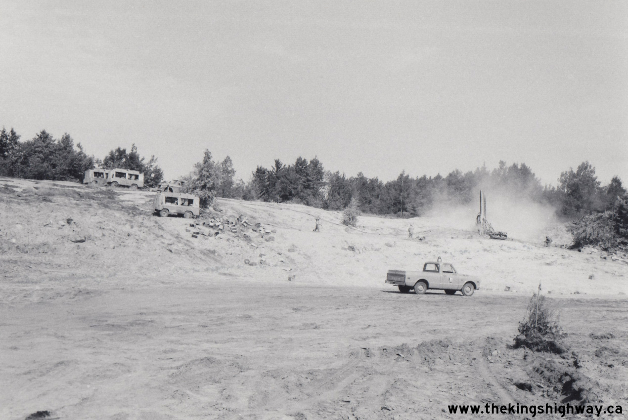
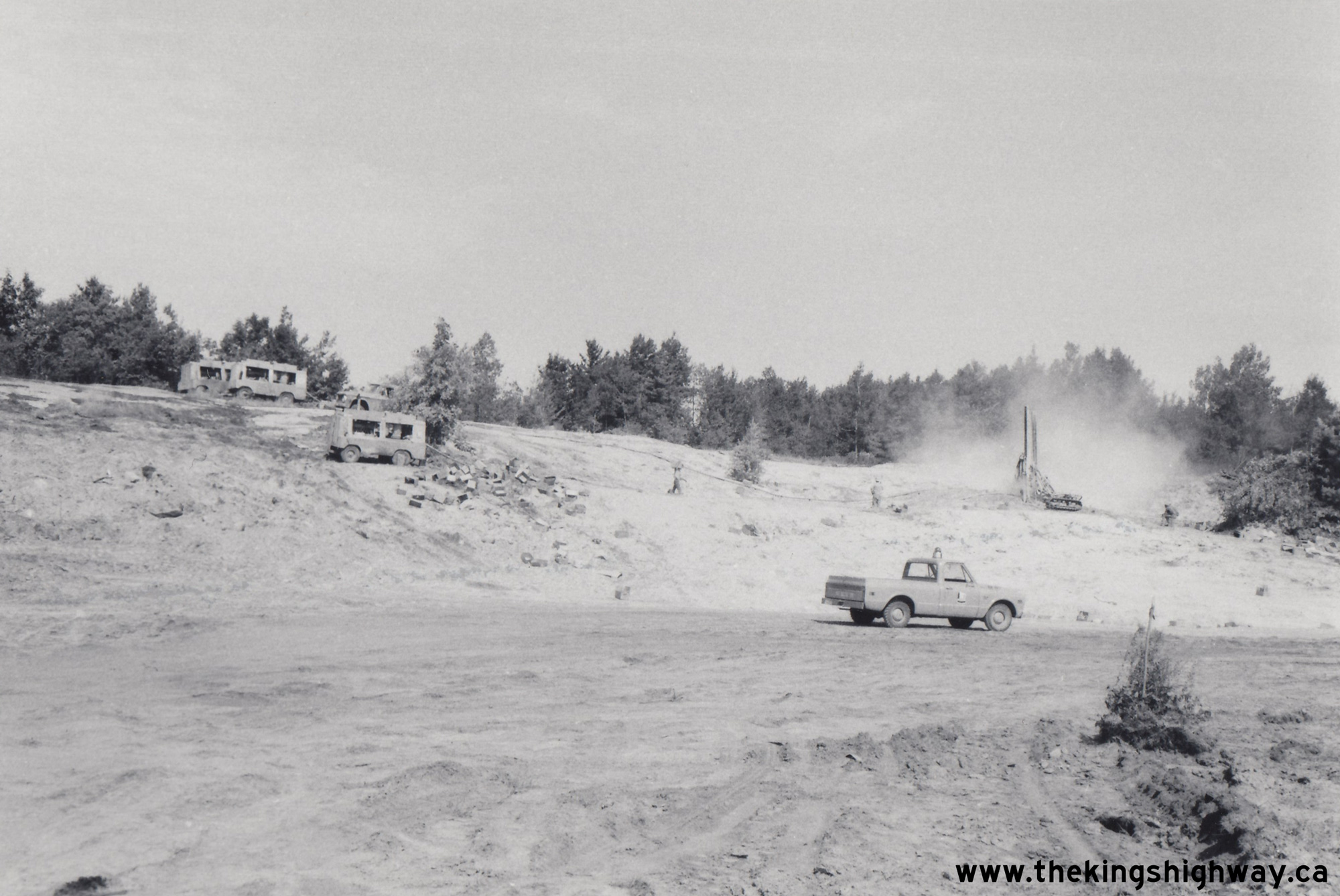
Enlarged Photo Here. Photo taken in 1965. (Photo courtesy of Henry Fry) Right - Rock drilling in preparation for a new rock cut on a diversion of Hwy 660 west of Bala, Contract #1969-46. See an Enlarged Photo Here. Photo taken in 1969. (Photo courtesy of Ontario Ministry of Transportation - © King's Printer for Ontario, 2023) 

Left - Facing south along the southbound lanes of Hwy 400 at the Go Home Lake Road (Muskoka Road 32 & Muskoka Road 38) Interchange in 2007, shortly after
completion. This new grade-separated interchange was constructed in 2005 to replace an old at-grade intersection on the divided highway. Traces of the former
left-turn lane can be seen in this photo, where the left-hand shoulder widens out part-way up the hill. The former at-grade intersection was situated at the crest of
this hill. See an Enlarged Photo Here. (Photograph taken on June 10, 2007 - © Cameron Bevers) Right - Facing north along the southbound lanes of Hwy 400 towards MacTier at the newly-completed Go Home Lake Road Interchange in 2007. See an Enlarged Photo Here. (Photograph taken on June 10, 2007 - © Cameron Bevers) 

Left - Facing north along the northbound lanes of Hwy 400 from the newly-completed Go Home Lake Road (Muskoka Road 32 & Muskoka Road 38) Overpass in 2007.
See an Enlarged Photo Here. (Photograph taken on June 10, 2007 - © Cameron Bevers) Right - Good use was made of the rocky terrain surrounding the new Go Home Lake Road Overpass structure. The exposed bedrock allowed the construction of a much shallower bridge abutment at this location. See an Enlarged Photo Here. (Photograph taken on June 10, 2007 - © Cameron Bevers) |
|---|
|
Present Day Secondary Highway 660 Photographs


Left - Facing east across the Go Home Lake Road Overpass on Hwy 400 west of Bala. As the route marker assembly at right indicates, Muskoka Road 32 (Go Home
Lake Road) ends at this interchange and becomes Muskoka Road 38 (Former Hwy 660) east of Hwy 400. Up until the 1990s, Muskoka Road 32 intersected with Hwy 69 (now
known as Hwy 400) about 700 metres to the north of Muskoka Road 38. As a result of the Hwy 69 expansion to four lanes, both Muskoka Road 32 and Muskoka Road 38 were
realigned to consolidate these two intersections into a single crossing. See an
Enlarged Photo Here. (Photograph taken on October 2, 2022 - © Cameron Bevers) Right - Structure identification number (Site #42-314/2) and date stamp (2005) on the Go Home Lake Road Overpass across the southbound lanes of Hwy 400. See an Enlarged Photo Here. (Photograph taken on October 2, 2022 - © Cameron Bevers) 

Left - Go Home Lake Road Overpass over the southbound lanes of Hwy 400. Due to the median width here, there are two independent structures which carry
Go Home Lake Road across Hwy 400. This single-span concrete girder structure was completed in 2005. See an
Enlarged Photo Here. (Photograph taken on October 2, 2022 - © Cameron Bevers) Right - Facing north along the northbound lanes of Hwy 400 towards MacTier from the Go Home Lake Road Overpass. See an Enlarged Photo Here. (Photograph taken on October 2, 2022 - © Cameron Bevers) 

Left - View of Hwy 400 from the Go Home Lake Road Overpass, facing north towards MacTier. Traces of the old at-grade intersection with Muskoka Road 32 can be
seen just before the large rock cut in the distance. Until the 1990s, Muskoka Road 32 intersected with the two-lane Hwy 69 which now forms the northbound carriageway.
Once Hwy 69 was twinned with a new southbound carriageway, the old at-grade intersection was closed off and Muskoka Road 32 realigned so that it crossed Hwy 69 at a
common at-grade intersection with Muskoka Road 38. The at-grade intersection was removed several years later, when a grade-separated interchange was constructed at
this location. See an Enlarged Photo Here. (Photograph taken on October 2, 2022 - © Cameron Bevers) Right - Facing south towards Port Severn along the southbound lanes of Hwy 400 at the Go Home Lake Road Overpass. The Go Home Lake Road Interchange ramps are in a "Parclo A-B" configuration, with all four interchange ramps situated on the southern side of the grade separation. Southbound Hwy 400 traffic coming from MacTier must exit from the freeway via an inner loop ramp at right in order to reach Go Home Lake Road. See an Enlarged Photo Here. (Photograph taken on October 2, 2022 - © Cameron Bevers) 

Left - Go Home Lake Road Overpass over the northbound lanes of Hwy 400. This single-span concrete girder structure was completed in 2005. See an
Enlarged Photo Here. (Photograph taken on October 2, 2022 - © Cameron Bevers) Right - Structure identification number (Site #42-314/1) and date stamp (2005) on the Go Home Lake Road Overpass across the northbound lanes of Hwy 400. See an Enlarged Photo Here. (Photograph taken on October 2, 2022 - © Cameron Bevers) 

Left - Facing south towards Port Severn along the southbound lanes of Hwy 400 at the Go Home Lake Road Overpass. See an
Enlarged Photo Here. (Photograph taken on October 2, 2022 - © Cameron Bevers) Right - View of Hwy 400 facing north along the northbound lanes towards MacTier from the Go Home Lake Road Overpass. This roadway formed the original two-lane Hwy 69 before the highway was twinned in the 1990s. A second carriageway was built along the western side of the existing highway to carry all southbound highway traffic. Once completed, the existing two-lane highway was converted to carry northbound traffic only. See an Enlarged Photo Here. (Photograph taken on October 2, 2022 - © Cameron Bevers) 

Left - View of the Go Home Lake Road (Muskoka Road 32 & Muskoka Road 38) Interchange on Hwy 400 west of Bala. The Hwy 400 & Hwy 69 corridor is one of
two major trucking routes which link Southern Ontario to Northern Ontario - the other route being Hwy 11. Prior to the completion of the Georgian Bay Route of the
Trans-Canada Highway to Sudbury during the 1950s, all traffic bound for Northern Ontario had to use Hwy 11 via North Bay. The completion of Hwy 400 & Hwy 69 along
the eastern shores of Georgian Bay shortened the highway distance between Toronto and Sudbury by about 50 miles (80 km). See an
Enlarged Photo Here. (Photograph taken on October 2, 2022 - © Cameron Bevers) Right - Facing west across the Go Home Lake Road Overpass (Muskoka Road 32 & Muskoka Road 38) on Hwy 400 west of Bala. See an Enlarged Photo Here. (Photograph taken on October 2, 2022 - © Cameron Bevers) 
Left - Facing east towards Bala on Muskoka Road 38 (Former Hwy 660) from the Hwy 400 Interchange. Secondary Highway 660 was established as a provincial highway
link between the Trans-Canada Highway's Georgian Bay Route and Hwy 69 (later known as Hwy 169) in Bala in 1965. Like all of Ontario's Secondary Highways located in
the District of Muskoka, jurisdiction over Hwy 660 was eventually transferred from the province to the District Municipality. Provincial jurisdiction over Hwy 660
ceased effective May 1, 1982. Bala lies about 18 km ahead. See an
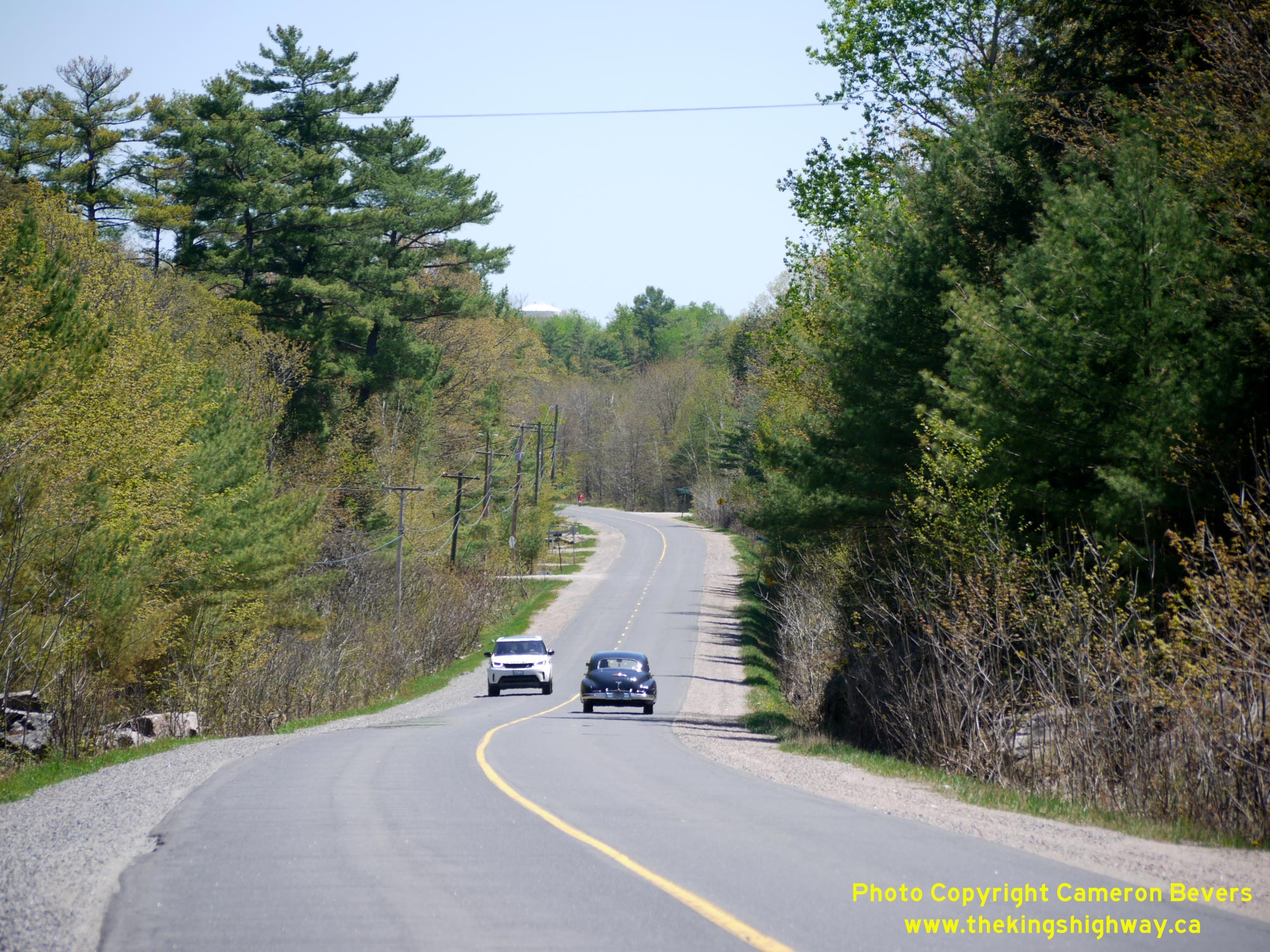
Enlarged Photo Here. (Photograph taken on October 2, 2022 - © Cameron Bevers) Right - View of Muskoka Road 38 (Former Hwy 660) about 2 km west of Bala, facing east. The top of Bala's municipal water tower can be seen in the distance. Note the 1947 Buick Roadmaster out for a day cruise, heading eastbound towards Bala. The scenic lakeside Muskoka town of Bala is a popular destination for motorcycle and vintage automobile tours. See an Enlarged Photo Here. (Photograph taken on May 22, 2020 - © Cameron Bevers) 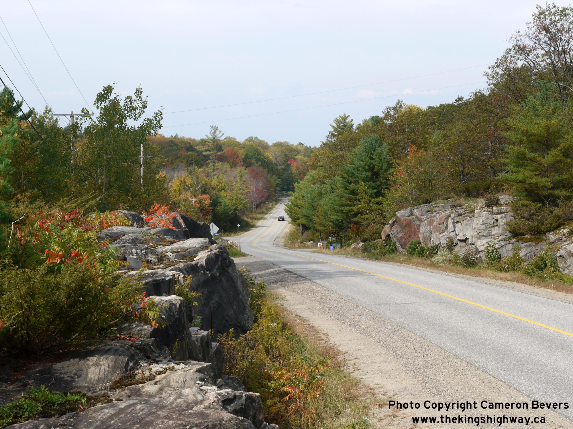
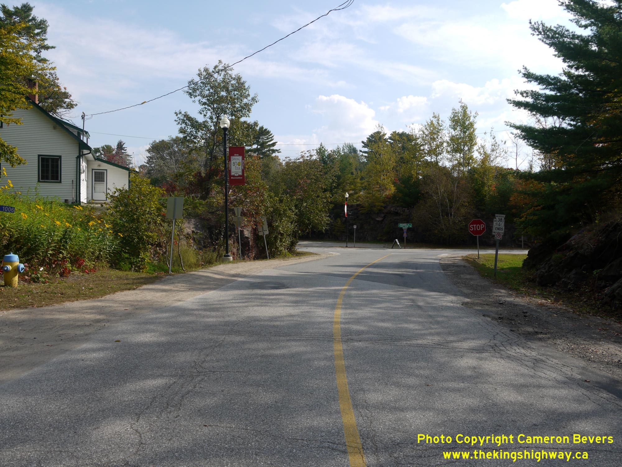
Left - Facing west along Muskoka Road 38 (Former Hwy 660) from the western entrance to Bala. See an
Enlarged Photo Here. (Photograph taken on September 29, 2013 - © Cameron Bevers) Right - Approaching the eastern terminus of Muskoka Road 38 (Former Hwy 660) at the Hwy 169 Junction in Bala. See an Enlarged Photo Here. (Photograph taken on September 29, 2013 - © Cameron Bevers) 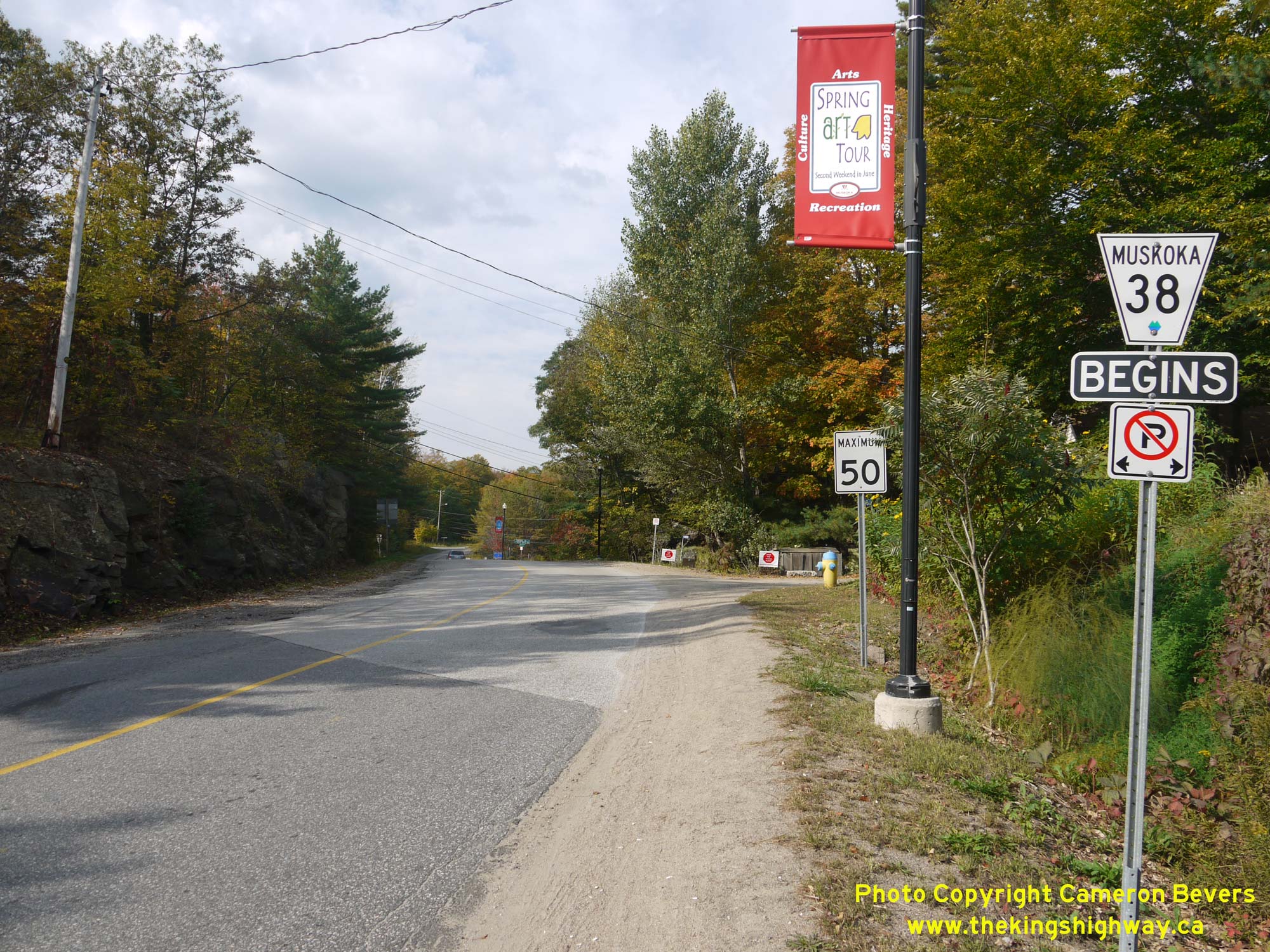
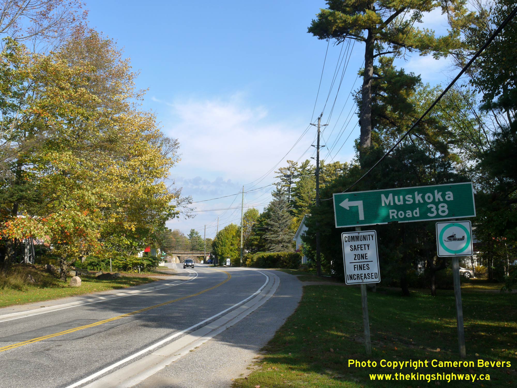
Left - Facing west along Muskoka Road 38 (Former Hwy 660) from the Hwy 169 Junction in Bala. See an
Enlarged Photo Here. (Photograph taken on September 29, 2013 - © Cameron Bevers) Right - An older MTO green guide sign on northbound Hwy 169 marking the upcoming junction of Muskoka Road 38 in Bala. See an Enlarged Photo Here. (Photograph taken on September 29, 2013 - © Cameron Bevers) 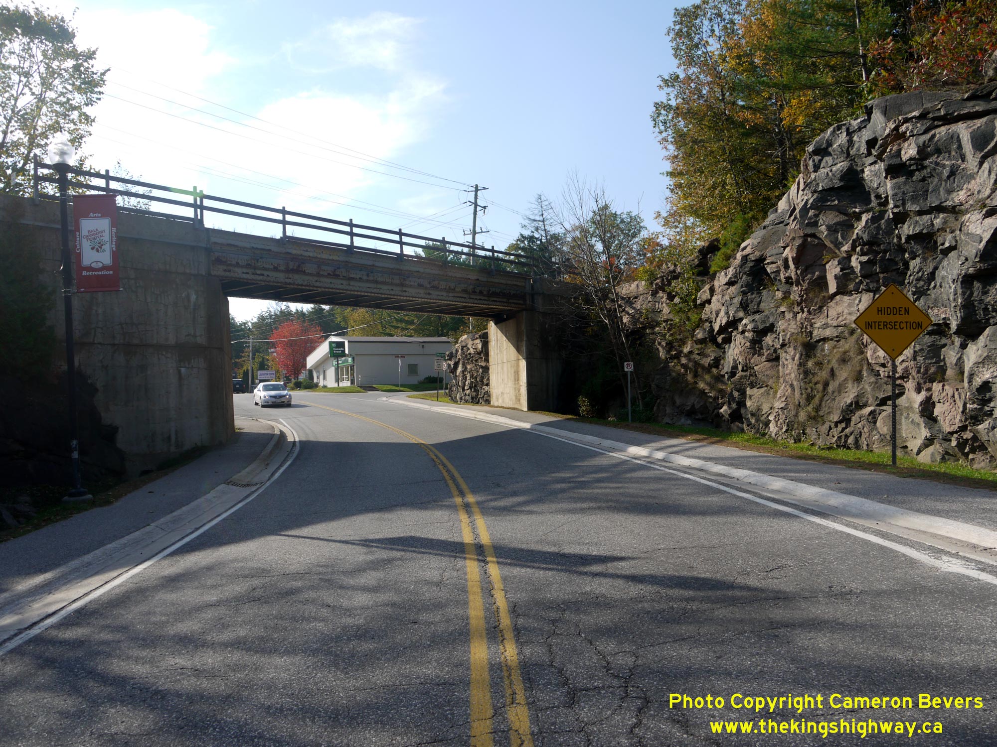
Left - Facing south along Hwy 169 from the Muskoka Road 38 Junction towards the Canadian Pacific Railway (CPR) Subway. This two-lane subway was completed in
1965 along the new highway diversion through Bala. The Bala CPR Subway lies immediately to the south of the Hwy 169 and Muskoka Road 38 (Former Hwy 660) Junction. See
an Enlarged Photo Here. (Photograph taken on September 29, 2013 - © Cameron Bevers) Right - Junction of Muskoka Road 38 (Former Hwy 660) and Hwy 169 in Bala, facing north. Compare this 2013 photo above to this Historical 1965 Photo, which was taken shortly after the Bala Diversion and Moon River Bridge was completed through Bala. See an Enlarged Photo Here. (Photograph taken on September 29, 2013 - © Cameron Bevers) 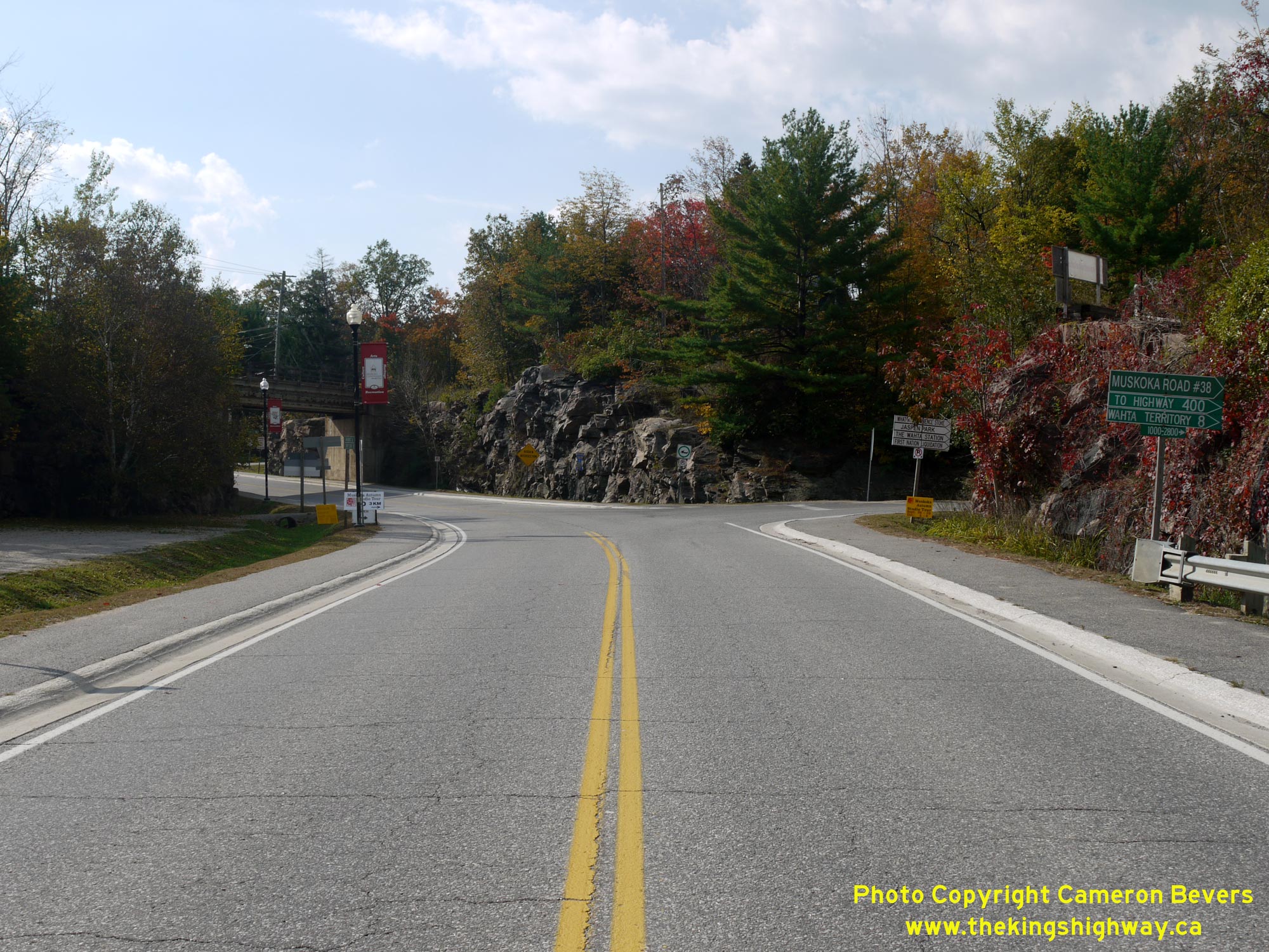
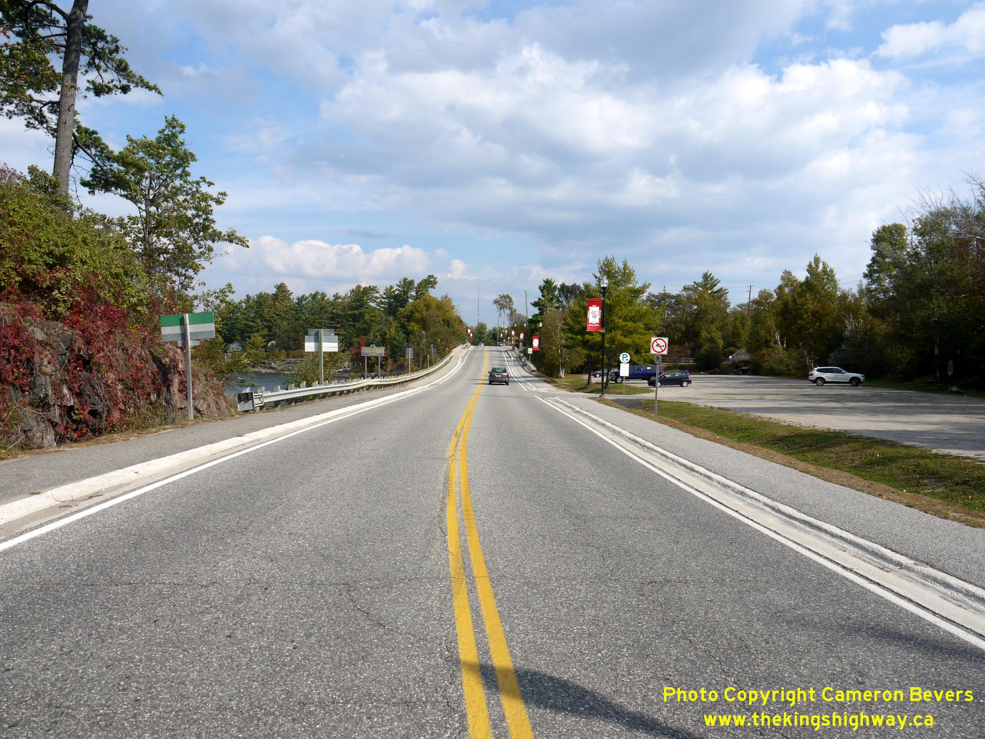
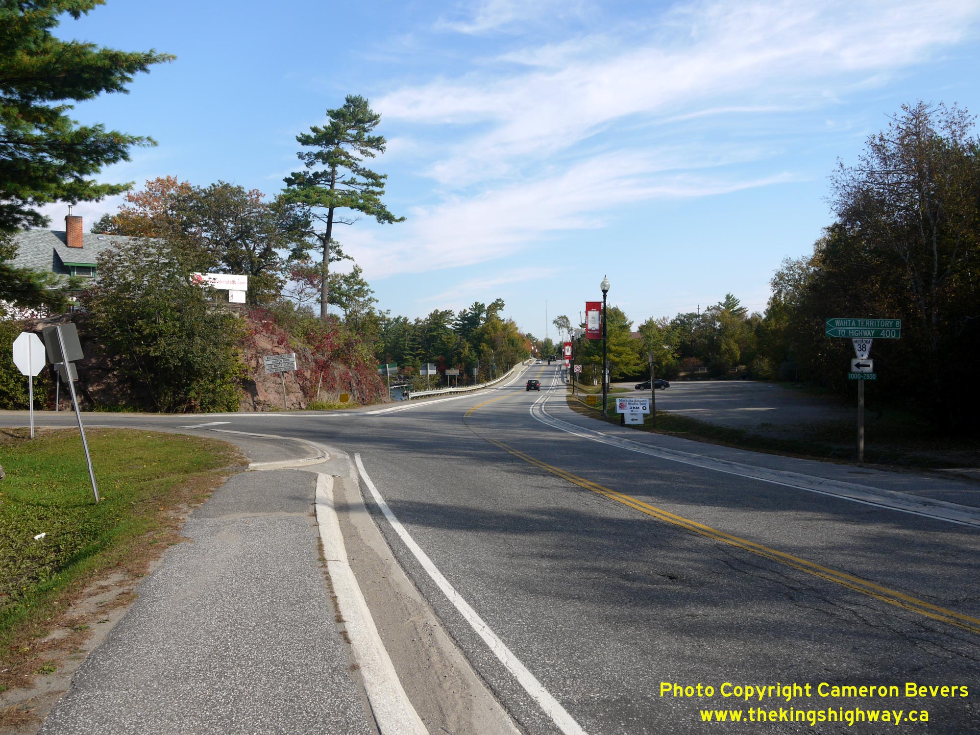
Left - Facing south along Hwy 169 towards Gravenhurst approaching the Muskoka Road 38 Junction. See an
Enlarged Photo Here. (Photograph taken on September 29, 2013 - © Cameron Bevers) Right - Facing north along Hwy 169 from the Muskoka Road 38 Junction towards the Moon River Bridge in Bala. This section of Hwy 169 was actually a diversion which was built in the mid-1960s. Previously, through traffic followed Bala Falls Road through Bala. See an Enlarged Photo Here. (Photograph taken on September 29, 2013 - © Cameron Bevers) 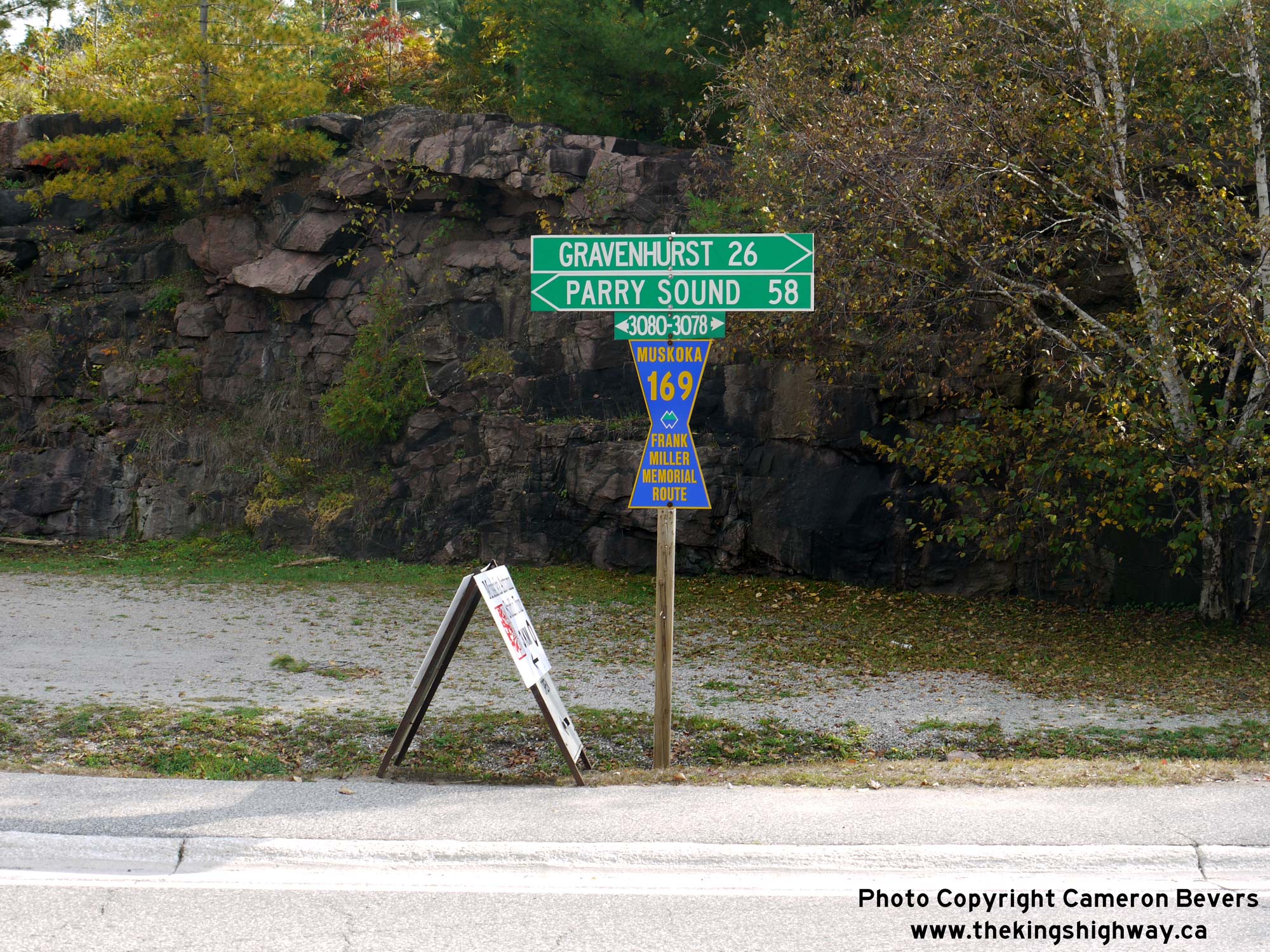
Above - Fingerboard guide signs at the eastern terminus of Muskoka Road 38 (Former Hwy 660) in Bala. The control cities of Gravenhurst and Parry Sound are
vestiges from the past, when Hwy 169 was still a King's Highway under MTO jurisdiction. Today, the local community of Port Carling is shown as the northbound control
city at this highway junction. See an Enlarged Photo Here. (Photograph taken on September 29, 2013 - © Cameron Bevers)
More Secondary Highway 660 Photographs Coming Soon!
|
|---|
Links to Adjacent Highway Photograph Pages:
Back to Secondary Highway 656 Photos /
Secondary Highway 660 History /
On to Secondary Highway 662 Photos
Ontario Highway History - Main Menu / Back to List of Highways / Main Photograph Index Page Website contents, photos & text © 2002-2026, Cameron
Bevers (Webmaster) - All Rights Reserved / Contact Me
|
|---|