
| 
| |
|
|
All photographs displayed on this page were taken by the
Webmaster (Cameron Bevers), unless specifically noted otherwise. Historical photographs are
arranged in approximate chronological order, while present day photographs (Year 2000 to date)
are arranged by location from west to east. Click on any thumbnail to see a larger image!
Please note that all photographs displayed on this
website are protected by copyright. These photographs must not be reproduced, published,
electronically stored or copied, distributed, or posted onto other websites without
my written permission. If you want to use photos from this website, please
email me first for permission. Thank-you!
|
|---|
|
Present Day Secondary Highway 662 & Highway 7082 Photographs


Left - Facing west along Hwy 17 at Smith Street (Former Hwy 662) in Nairn Centre. See an
Enlarged Photo Here. (Photograph taken on August 28, 2011 - © Cameron Bevers) Right - Approaching Smith Street (Former Hwy 662) on Hwy 17 in Nairn Centre, facing east towards Sudbury. (Photograph taken on August 28, 2011 - © Cameron Bevers) 
Left - Facing north along Former Hwy 662 (Smith Street) in Nairn Centre. The Ministry of Transportation (MTO) maintains this road,
although it hasn't been signed as Hwy 662 in many years (if ever). In all likelihood, the Hwy 662 designation was not actually a posted route number, since the
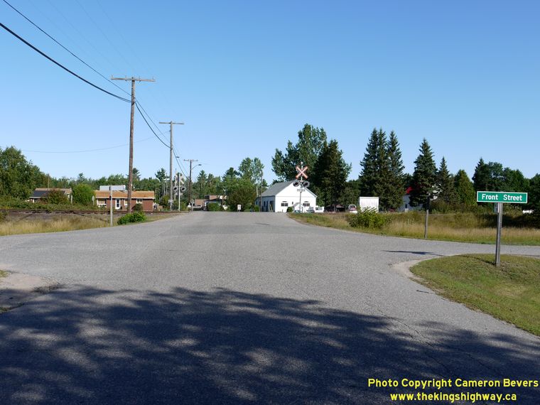
highway is not marked on any Ontario Official Road Maps. (Photograph taken on August 28, 2011 - © Cameron Bevers) Right - Smith Street in Nairn Centre, facing north at Front Street. Note the MTO roadway identification sign at right. (Photograph taken on August 28, 2011 - © Cameron Bevers)< 

Left - Former Hwy 662 turned right from Smith Street onto McIntyre Street just after the railway crossing. (Photograph taken on August 28, 2011 - © Cameron Bevers) Right - Facing south along Former Hwy 662 (Smith Street) towards Hwy 17 from the railway crossing near McIntyre Street. (Photograph taken on August 28, 2011 - © Cameron Bevers) 

Left - Facing north at the end of Former Hwy 662 (McIntyre Street) in Nairn Centre. At this point, the Spanish River Road begins (Hwy 7082). (Photograph taken on August 28, 2011 - © Cameron Bevers) Right - The Spanish River Road (Hwy 7082) is actually a former alignment of Hwy 17. In the 1950s, a substantial portion of Hwy 17 was bypassed between Whitefish and Nairn Centre. The new route of Hwy 17 between Whitefish and Nairn Centre eliminated several at-grade railway crossings, including this one at Turbine. (Photograph taken on August 28, 2011 - © Cameron Bevers) 

Left - MTO fingerboard guide sign marking the Spanish River Road (Hwy 7082) at Turbine, east of Nairn Centre. (Photograph taken on August 28, 2011 - © Cameron Bevers) Right - Facing east along the Spanish River Road (Hwy 7082) towards Worthington from Turbine. This section of Hwy 17 was bypassed by the new Hwy 17 in 1953. Even today, the Spanish River Road still looks like an old King's Highway. See an Enlarged Photo Here. (Photograph taken on August 28, 2011 - © Cameron Bevers) 
Above - Facing west along the Spanish River Road from Worthington. This point marks the western terminus of Former Hwy 7082. Note the green MTO fingerboard
guide sign at right. From this point easterly to Victoria Mine, the former route of Hwy 17 is a Sudbury municipal road known as Fairbank Lake Road. See an
Enlarged Photo Here. (Photograph taken on August 28, 2011 - © Cameron Bevers)
More Secondary Highway 662 & Highway 7082 Photographs Coming Soon!
|
|---|
Links to Adjacent Highway Photograph Pages:
Back to Secondary Highway 660 Photos /
Secondary Highway 662 History /
On to Secondary Highway 663 Photos
Ontario Highway History - Main Menu / Back to List of Highways / Main Photograph Index Page Website contents, photos & text © 2002-2026, Cameron
Bevers (Webmaster) - All Rights Reserved / Contact Me
|
|---|