
| 
| |
|
|
This page contains present day photos (Year 2000 to date) of Ontario's King's Highway 8, arranged by location from Goderich
easterly to Mitchell. All photographs displayed on this page were taken by the Webmaster (Cameron Bevers), unless specifically noted otherwise. Click on any
thumbnail to see a larger image!
Please note that all photographs displayed on this
website are protected by copyright. These photographs must not be reproduced, published,
electronically stored or copied, distributed, or posted onto other websites without
my written permission. If you want to use photos from this website, please
email me first for permission. Thank-you!
|
|---|
|
Page 4: Present Day King's Highway 8 Photographs (Goderich to Mitchell)
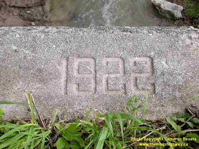
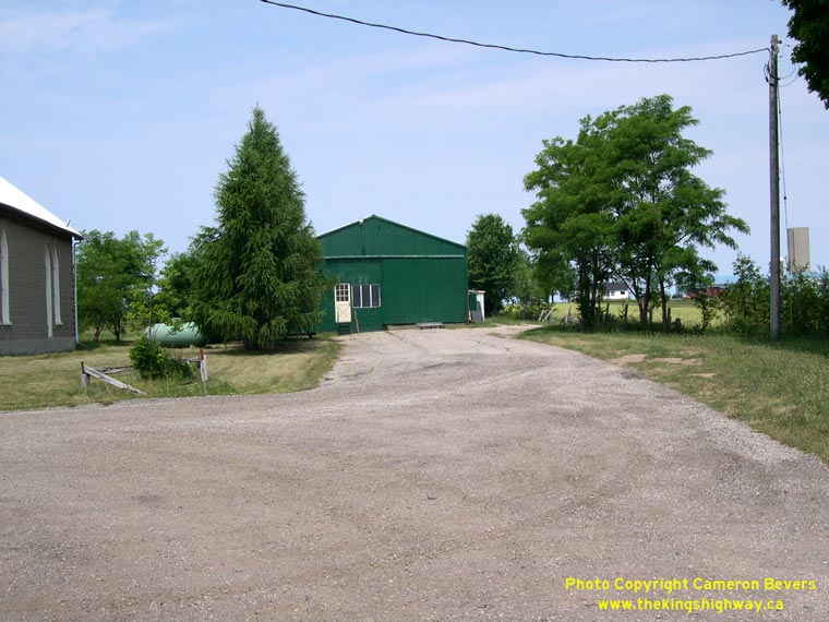
Left - Date stamp on old culvert near Goderich - "1922". (Photograph taken on May 24, 2003 - © Cameron Bevers) Right - This abandoned Hwy 8 alignment east of Goderich now serves as a private driveway. See an Enlarged Photo here. (Photograph taken on June 26, 2005 - © Cameron Bevers) 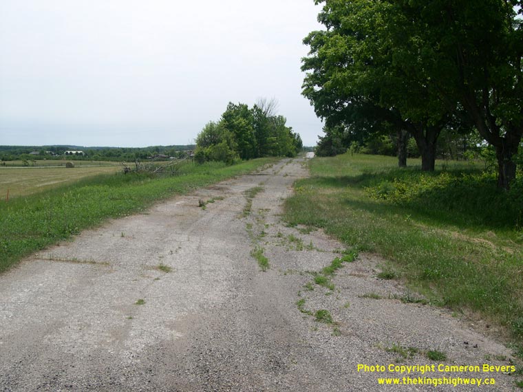
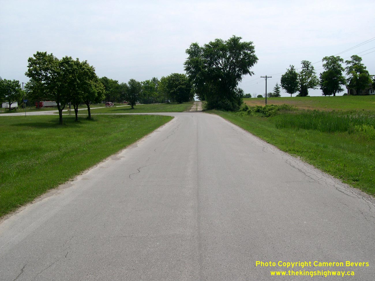
Left - An abandoned superelevated curve on an old Hwy 8 alignment east of Goderich. See an
Enlarged Photo here. (Photograph taken on June 26, 2005 - © Cameron Bevers) Right - Abandoned Hwy 8 alignment west of Holmesville. See an Enlarged Photo here. (Photograph taken on June 26, 2005 - © Cameron Bevers) 

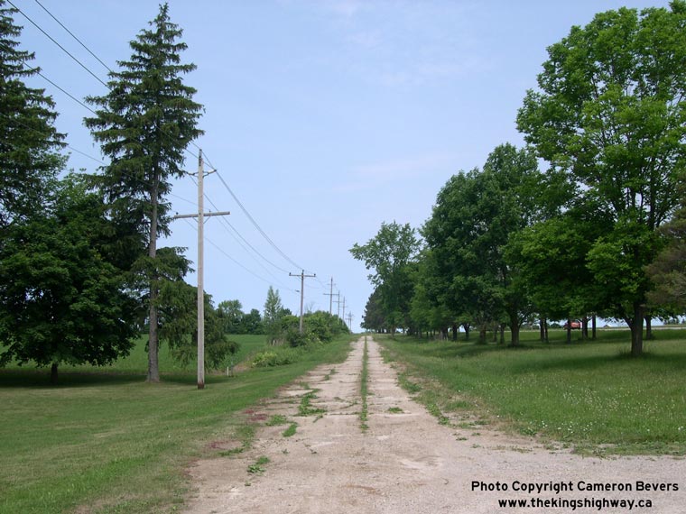
Left - Former Hwy 8 alignment in Holmesville, west of Clinton. See an
Enlarged Photo here. (Photograph taken on June 26, 2005 - © Cameron Bevers) Right - Former Hwy 8 alignment east of Holmesville. Note the current highway at left, and the abandoned alignment in the background. See an Enlarged Photo here. (Photograph taken on June 26, 2005 - © Cameron Bevers) 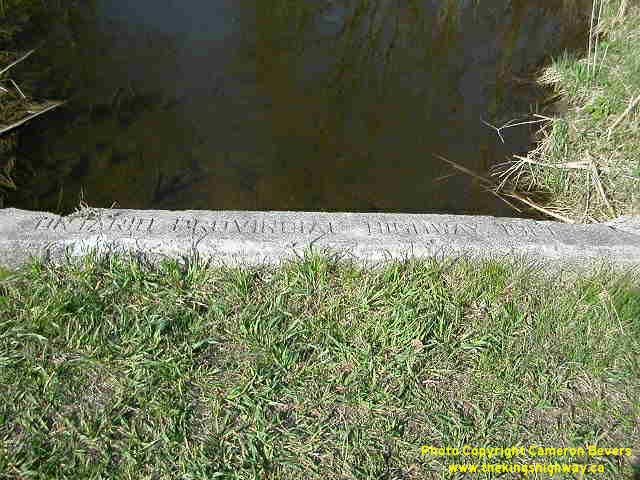
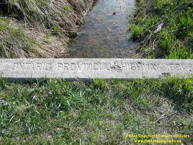
Left - Inscription on culvert in Holmesville - "ONTARIO PROVINCIAL HIGHWAY 1921" (Photograph taken on May 4, 2003 - © Cameron Bevers) Right - Inscription on culvert near Clinton - "ONTARIO PROVINCIAL HIGHWAY 1921" (Photograph taken on May 4, 2003 - © Cameron Bevers) 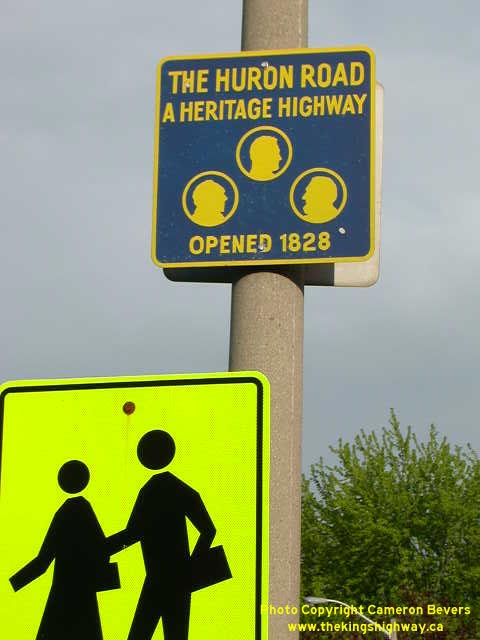
Above - Old Huron Road historical route marker on Hwy 8 at Clinton (Photograph taken on May 24, 2003 - © Cameron Bevers) 

Left - Facing south along Victoria Street (Hwy 4) from the Hwy 8 Junction in Clinton. See an
Enlarged Photo Here. (Photograph taken on May 24, 2010 - © Cameron Bevers) Right - Approaching Hwy 8 (Huron Street & Ontario Street) on Victoria Street (Hwy 4) in Clinton facing north. See an Enlarged Photo Here. (Photograph taken on May 24, 2010 - © Cameron Bevers) 

Left - A narrow raised median island was built along Victoria Street (Hwy 4) in Downtown Clinton, to prevent left turns off of Isaac Street. Note the strange
"Keep Right" sign on the median island. See an Enlarged Photo Here. (Photograph taken on May 24, 2010 - © Cameron Bevers) Right - Junction of Hwy 4 & Hwy 8 in Downtown Clinton. From here, Hwy 8 follows Huron Street west to Goderich or Ontario Street east to Stratford. The route of Hwy 4 continues straight ahead via Albert Street towards Wingham. As a result of the mass highway downloading of 1997-1998, the portion of Hwy 4 lying north of Clinton is no longer maintained by the province. The highway is now maintained by Huron County between Clinton and the Wingham area. See an Enlarged Photo Here. (Photograph taken on May 24, 2010 - © Cameron Bevers) 

Left - Facing west along Ontario Street (Hwy 8) at Hwy 4 (Victoria Street & Albert Street) in Downtown Clinton. The route of Hwy 8 continues straight ahead
towards Goderich via Huron Street. See an Enlarged Photo Here. (Photograph taken on May 24, 2010 - © Cameron Bevers) Right - Approaching the junction of Hwy 4 & Hwy 8 in Downtown Clinton, facing south. The route of Hwy 4 bends to the left just beyond the intersection and continues south towards London via Victoria Street. See an Enlarged Photo Here. (Photograph taken on May 24, 2010 - © Cameron Bevers) 

Left - Facing north along Albert Street (Hwy 4) from the Hwy 8 Junction in Downtown Clinton. See an
Enlarged Photo Here. (Photograph taken on May 24, 2010 - © Cameron Bevers) Right - Facing east along Huron Street (Hwy 8) approaching the Hwy 4 Junction in Downtown Clinton. The routes of Hwy 4 & Hwy 8 have met at this intersection since 1927, the year in which Hwy 4 was extended from Elginfield northerly to Clinton. See an Enlarged Photo Here. (Photograph taken on May 24, 2010 - © Cameron Bevers) 

Left - Facing west towards Goderich along Huron Street (Hwy 8) from the Hwy 4 Junction in Downtown Clinton. See an
Enlarged Photo Here. (Photograph taken on May 24, 2010 - © Cameron Bevers) Right - Facing east along Ontario Street (Hwy 8) towards Stratford from the Hwy 4 Junction in Downtown Clinton. See an Enlarged Photo Here. (Photograph taken on May 24, 2010 - © Cameron Bevers) 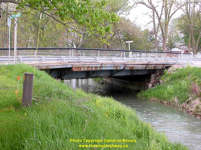
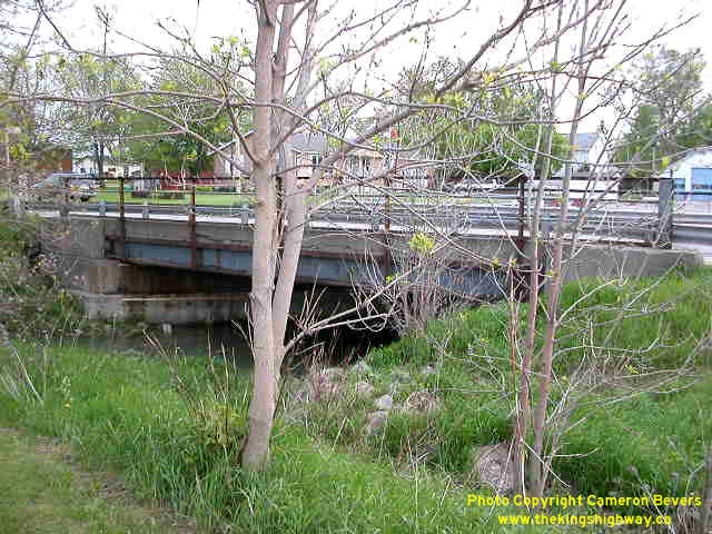
Left - Liffey Drain Bridge in Dublin. Structure completed in 1923. (Photograph taken on May 24, 2003 - © Cameron Bevers) Right - Northern side of Liffey Drain Bridge on Hwy 8 in Dublin (Photograph taken on May 24, 2003 - © Cameron Bevers) 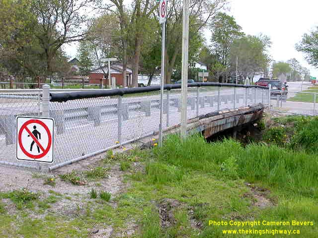
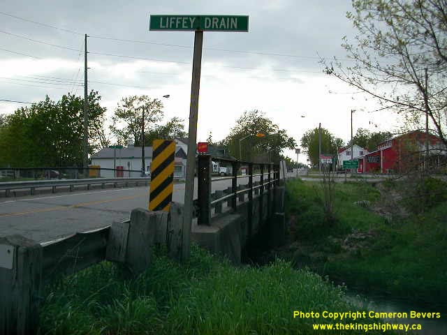
Left - Looking east along Hwy 8 across Liffey Drain. The sidewalk of this structure was closed due to a partial deck failure. (Photograph taken on May 24, 2003 - © Cameron Bevers) Right - Looking west along Hwy 8 across Liffey Drain in Dublin. This structure was replaced in late 2003. (Photograph taken on May 24, 2003 - © Cameron Bevers)
Continue on to King's Highway 8 Photos: Mitchell to Stratford
|
|---|
Links to Adjacent King's Highway Photograph Pages:
Back to King's Highway 7 Photos /
King's Highway 8 History /
On to King's Highway 9 Photos
Ontario Highway History - Main Menu / Back to List of Highways Website contents, photos & text © 2002-2026, Cameron
Bevers (Webmaster) - All Rights Reserved / Contact Me
|
|---|