
| 
|  |
|
|
This page contains historical and present day photos of Ontario's King's Highway 91. All photographs displayed on
this page were taken by the Webmaster (Cameron Bevers), unless specifically noted otherwise. Historical photographs are arranged in approximate chronological order,
while present day photographs (Year 2000 to date) are arranged by location from east to west. Click on any thumbnail to see a larger image!
Please note that all photographs displayed on this
website are protected by copyright. These photographs must not be reproduced, published,
electronically stored or copied, distributed, or posted onto other websites without
my written permission. If you want to use photos from this website, please
email me first for permission. Thank-you!
|
|---|
|
Present Day King's Highway 91 Photographs

Left - Facing east along Hwy 91 towards Stayner at the Lamont Creek Bridge. See an
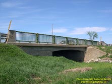
Enlarged Photo here. (Photograph taken on May 13, 2007 - © Cameron Bevers) Right - Southern side of the Lamont Creek Bridge on Hwy 91 west of Stayner. Structure completed in 1965. See an Enlarged Photo here. (Photograph taken on May 13, 2007 - © Cameron Bevers) 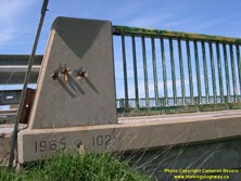

Left - Close-up of the steel handrail design and date stamp (1965) on the Lamont Creek Bridge on Hwy 91. See an
Enlarged Photo here. (Photograph taken on May 13, 2007 - © Cameron Bevers) Right - The southeastern wingwall was angled outwards from the highway to reduce the risk of erosion to the Hwy 91 roadbed. See an Enlarged Photo here. (Photograph taken on May 13, 2007 - © Cameron Bevers) 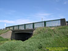
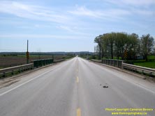
Left - Northern side of the Lamont Creek Bridge on Hwy 91 west of Stayner. See an
Enlarged Photo here. (Photograph taken on May 13, 2007 - © Cameron Bevers) Right - Facing west along Hwy 91 towards Duntroon at the Lamont Creek Bridge. See an Enlarged Photo here. (Photograph taken on May 13, 2007 - © Cameron Bevers) 
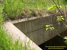
Left - Batteaux River Culvert on Hwy 91 east of Duntroon. See an
Enlarged Photo here. (Photograph taken on May 13, 2007 - © Cameron Bevers) Right - Close-up of the date stamp (1965) on the Batteaux River Culvert on Hwy 91. See an Enlarged Photo here. (Photograph taken on May 13, 2007 - © Cameron Bevers) 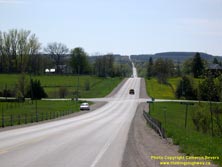

Left - Facing west along Hwy 91 towards Duntroon at the Batteaux River. See an
Enlarged Photo here. (Photograph taken on May 13, 2007 - © Cameron Bevers) Right - Facing east along Hwy 91 towards Stayner at the Batteaux River. See an Enlarged Photo here. (Photograph taken on May 13, 2007 - © Cameron Bevers) 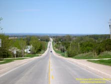

Left - Facing west along Hwy 91 towards Stayner from Duntroon. See an
Enlarged Photo here. (Photograph taken on May 13, 2007 - © Cameron Bevers) Right - Distance guide sign facing southbound Hwy 24 traffic at the Hwy 91 Junction in Duntroon. See an Enlarged Photo Here. (Photograph taken on May 22, 2023 - © Cameron Bevers) 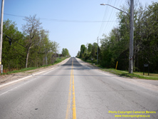
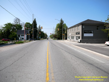
Left - Facing south along Hwy 24 from the Hwy 91 Junction in Duntroon. Note that the concrete curb and gutter alongside Hwy 24 was extended well beyond the
built-up area in order to manage stormwater runoff. Southbound motorists on Hwy 24 should always be on the lookout for slow-moving trucks on this long grade. Although
the revised 1944 route of Hwy 24 has a less severe grade than the original route of Hwy 24 assumed previously in 1937, it is still a long and arduous ascent for a
transport truck - even today! See an Enlarged Photo Here. (Photograph taken on May 22, 2023 - © Cameron Bevers) Right - Approaching the Hwy 91 Junction on Hwy 24 in Duntroon, facing north. At this intersection, the revised 1944 route of Hwy 24 connects back to the original 1937 route of Hwy 24, which approaches from the west at this traffic signal. It is rather noteworthy that all four legs of this intersection were at one time King's Highways. The diminutive route of Hwy 91 approaches from Stayner at right. See an Enlarged Photo Here. (Photograph taken on May 22, 2023 - © Cameron Bevers) 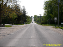
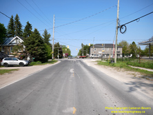
Left - View of Old Hwy 24 approaching Duntroon from the west. This bypassed section of Hwy 24 was the main highway south to Shelburne from 1937 up until 1944,
when it was bypassed by a new Hwy 24 route which had gentler grades. Old Hwy 24 is now part of today's Simcoe County Road 91. After serving in the highway system for
about 7 years, jurisdiction over Old Hwy 24 was transferred from the DHO to the County of Simcoe in July 1944. See an
Enlarged Photo Here. (Photograph taken on May 22, 2023 - © Cameron Bevers) Right - Approaching the Hwy 24 & Hwy 91 Junction on Old Hwy 24 in Duntroon, facing east. When Hwy 24 was first assumed through Simcoe County in 1937, northbound Hwy 24 motorists heading to Collingwood would have to turn left at this intersection. Motorists could also proceed straight ahead to Stayner via Hwy 91, which began at this intersection. Both the Singhampton-Collingwood Highway (Hwy 24) and the Duntroon-Stayner Highway (Hwy 91) were both assumed as King's Highways by the DHO on the same day - August 11, 1937. See an Enlarged Photo Here. (Photograph taken on May 22, 2023 - © Cameron Bevers) 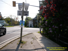
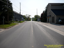
Left - Older Simcoe County Road 124 junction sign assembly in Duntroon. Simcoe County has been replacing its older county road route markers with a newer
graphical version in recent years. Prior to the highway's transfer or "downloading" in 1998, there would have been two Hwy 24 crown signs in this assembly. See an
Enlarged Photo Here. (Photograph taken on May 22, 2023 - © Cameron Bevers) Right - Approaching the historical western terminus of King's Highway 91 in Duntroon. The highway ended at the King's Highway 24 Junction in Duntroon between 1937 and 1998. After jurisdiction over Hwy 91 was transferred from the province to the County of Simcoe in the 1990s, the county decided to renumber one of its existing county roads west of Duntroon (Simcoe County Road 63) as an extension of Simcoe County Road 91. Accordingly, the present day route of Simcoe County Road 91 is actually much longer than King's Highway 91 was prior to downloading. See an Enlarged Photo Here. (Photograph taken on May 22, 2023 - © Cameron Bevers) 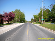

Left - Facing east along Hwy 91 towards Stayner from the Hwy 24 Junction in Duntroon. With a total length of only 7.9 km (4.9 miles), Hwy 91 was among
Ontario's shortest King's Highways. This highway formed a short cut-off route between Hwy 24 and Hwy 26, which intersects with Hwy 91 in nearby Stayner. See an
Enlarged Photo Here. (Photograph taken on May 22, 2023 - © Cameron Bevers) Right - A newer Simcoe County Road 91 route marker in Duntroon. The newer route markers feature the graphical county logo. See an Enlarged Photo Here. (Photograph taken on May 22, 2023 - © Cameron Bevers) 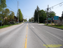

Left - Facing south along Hwy 24 approaching the Hwy 91 Junction in Duntroon. Early motorists arriving at this junction would have had to turn right in order
to stay on Hwy 24 to Shelburne. The DHO assumed a revised route for Hwy 24 in 1944, which resulted in the highway continuing straight ahead at the main intersection
in Duntroon. See an Enlarged Photo Here. (Photograph taken on May 22, 2023 - © Cameron Bevers) Right - View of Hwy 24 in Duntroon, facing north from the Hwy 91 Junction. See an Enlarged Photo Here. (Photograph taken on May 22, 2023 - © Cameron Bevers)
More King's Highway 91 Photographs Coming Soon!
|
|---|
Links to Adjacent King's Highway Photograph Pages:
Back to King's Highway 90 Photos /
King's Highway 91 History /
On to King's Highway 92 Photos
Ontario Highway History - Main Menu / Back to List of Highways Website contents, photos & text © 2002-2026, Cameron
Bevers (Webmaster) - All Rights Reserved / Contact Me
|
|---|