
| 
| |
|
|
This page contains present day photos (Year 2000 to date) of Ontario's King's Highway 28, arranged by location from
Peterborough northerly to Bancroft. All photographs displayed on this page were taken by the Webmaster (Cameron Bevers), unless specifically noted otherwise. Click on
any thumbnail to see a larger image!
Please note that all photographs displayed on this
website are protected by copyright. These photographs must not be reproduced, published,
electronically stored or copied, distributed, or posted onto other websites without
my written permission. If you want to use photos from this website, please
email me first for permission. Thank-you!
|
|---|
|
Page 3: Present Day King's Highway 28 Photographs (Peterborough to Bancroft)
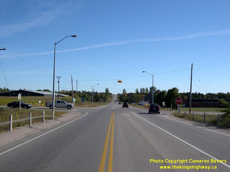

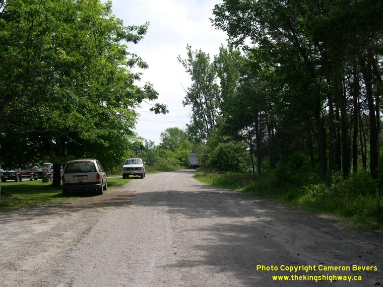
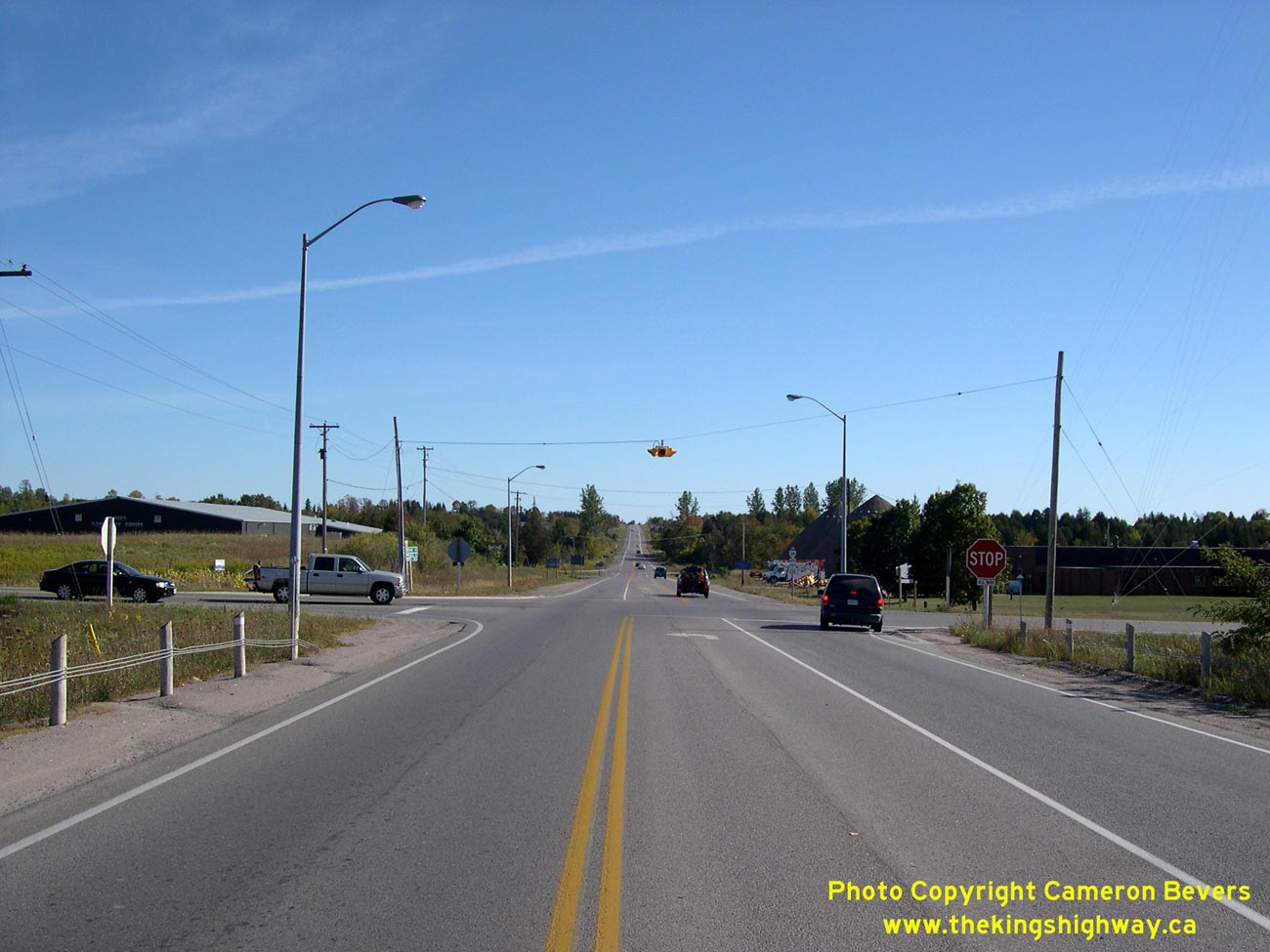
Left - Peterborough County Road 4 Junction on Hwy 28 (Former Hwy 134) near Peterborough, facing south. This intersection is rather unusual, because it is under
an All-Way Stop control. There are only a handful of All-Way Stop controlled intersections on Ontario's King's Highways. Interestingly, another example of an All-Way
Stop controlled intersection on a provincial highway is located on Hwy 7A in nearby Cavan, at the junction with Peterborough County Road 10. See an
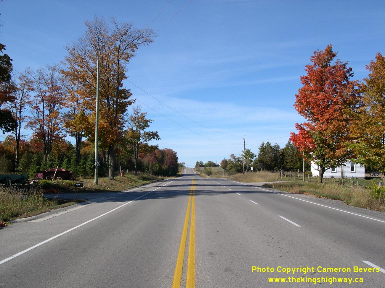
Enlarged Photo Here. (Photograph taken on September 23, 2007 - © Cameron Bevers) Right - Fall colours on Hwy 28 (Former Hwy 134) between the Peterborough County Road 4 Junction and Lakefield. Former Hwy 134 was logically re-designated as Hwy 28 in 2003, as part of a widespread highway renumbering plan in the Peterborough area. Note the northbound passing lane which was built to provide motorists with an opportunity to pass slower heavy vehicles on this long uphill grade. See an Enlarged Photo Here. (Photograph taken on September 23, 2007 - © Cameron Bevers) 
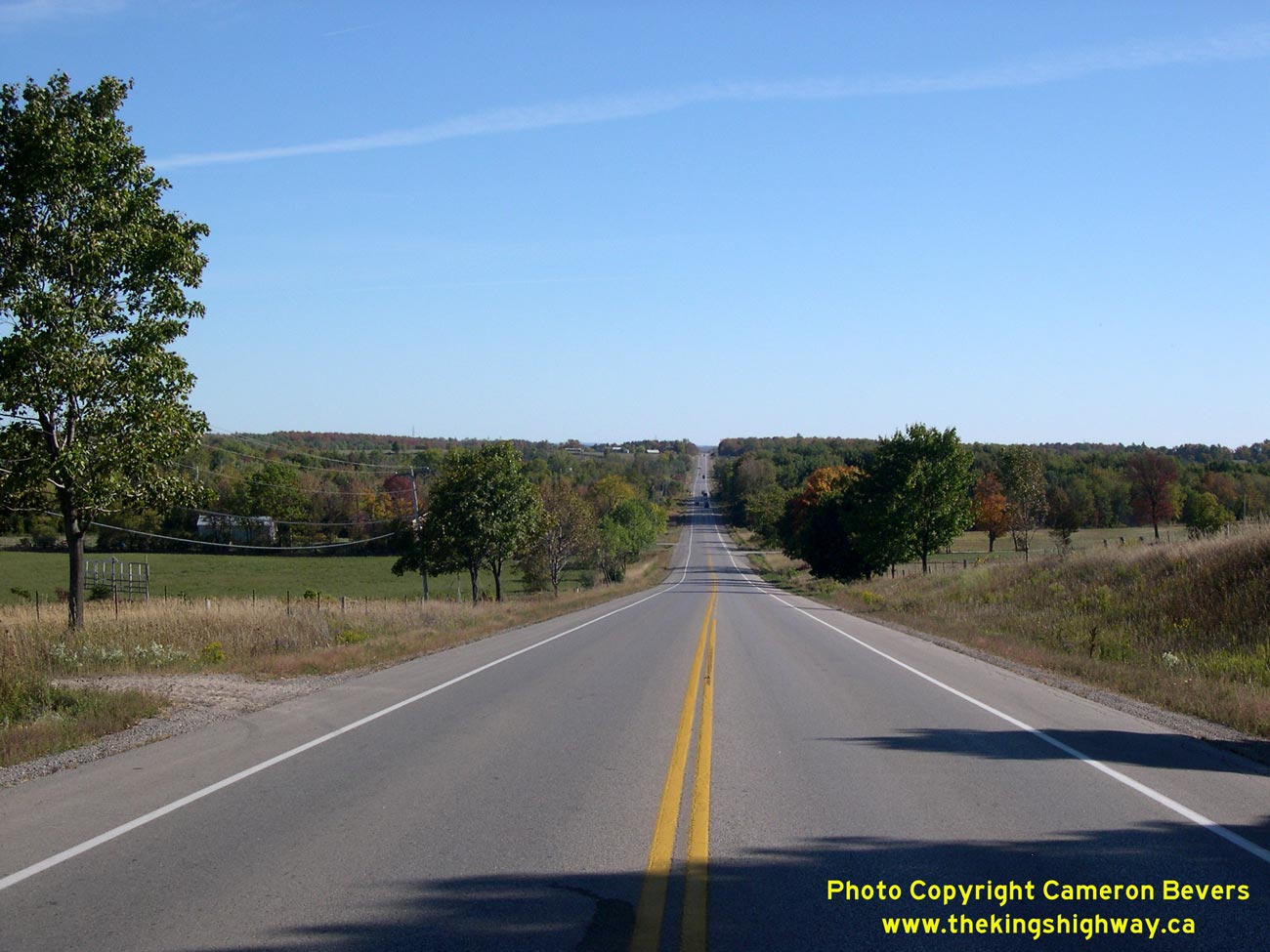
Left - Facing south along Hwy 28 (Former Hwy 134), just south of Lakefield. The section of Hwy 28 between Lakefield and the Hwy 7 Junction east of Peterborough
passes through an area with rather hilly topography. As a result, this highway offers motorists some very pleasant vistas of the road ahead. See an
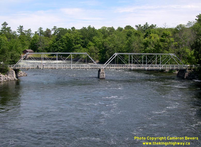
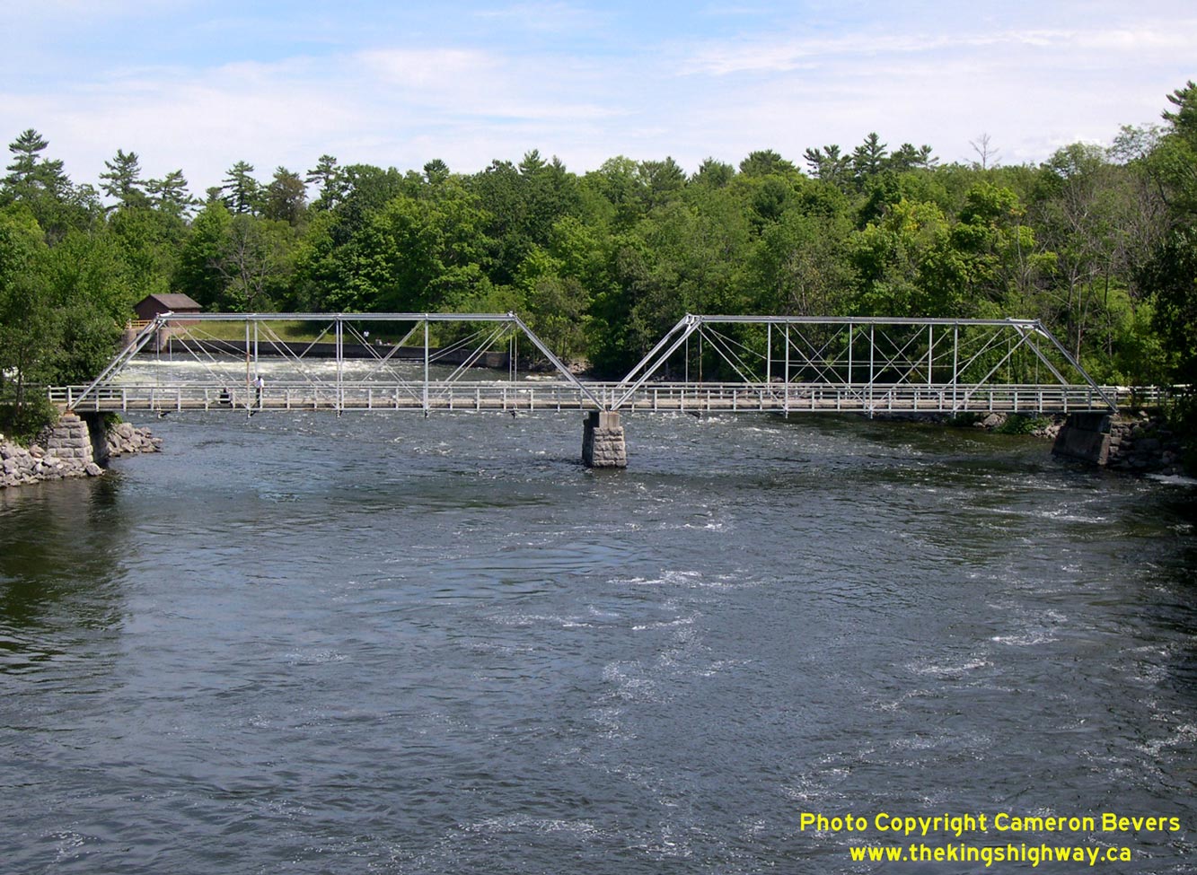
Enlarged Photo Here. (Photograph taken on September 23, 2007 - © Cameron Bevers) Right - An old 19th Century truss bridge can be seen from the current Hwy 28 bridge at Youngs Point, north of Peterborough. This truss bridge was built in 1884-1885. It carried Hwy 28 traffic across the Otonabee River until the current high-level bridge at Youngs Point was built in the mid-1950s. See an Enlarged Photo Here. (Photograph taken on July 25, 2004 - © Cameron Bevers) 

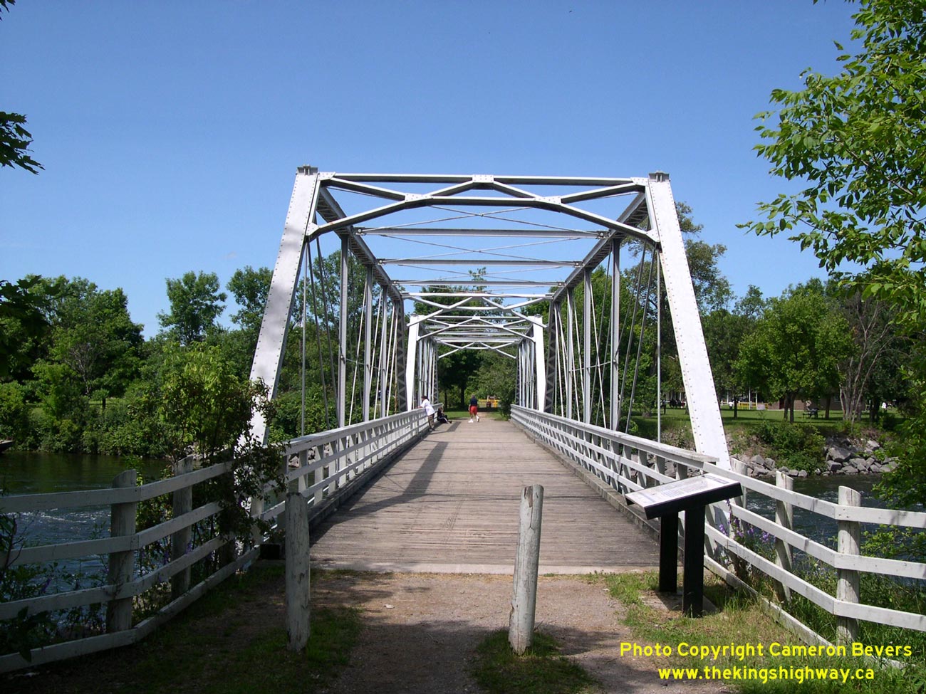
Left - Facing north towards the Old Youngs Point Bridge along the former Hwy 28 alignment. The Old Youngs Point Bridge was constructed by the Dominion Bridge
Company in 1884-1885. It is one of the oldest surviving truss bridges in the province. This one-lane bridge carried Hwy 28 traffic across the Otonabee River for two
decades, from the time Hwy 28 was first designated through this area in 1934 up until the completion of the high-level bridge in 1954. See an
Enlarged Photo Here. (Photograph taken on July 25, 2004 - © Cameron Bevers) Right - The historic pin-connected wrought iron and steel truss bridge at Youngs Point is believed to be the only surviving example of its kind in Ontario. This structure represents an interesting transition in bridge construction techniques, since it was built using both wrought iron (commonly used in bridges built in the 1870s and 1880s) and steel, which has been used as a construction material in nearly all bridges built since the 1880s. In addition, the method of connecting the truss members together using pins fell out of favour by the 1890s, when rivets became the predominant method of assembling truss members. Thankfully, this attractive Pratt truss structure was thoughtfully preserved after the completion of the current Hwy 28 bridge at Youngs Point. The old bridge now serves as a pedestrian trail between Old Hwy 28 at the south end of the community of Youngs Point and the Trent-Severn Waterway Lock. (Photograph taken on July 25, 2004 - © Cameron Bevers) 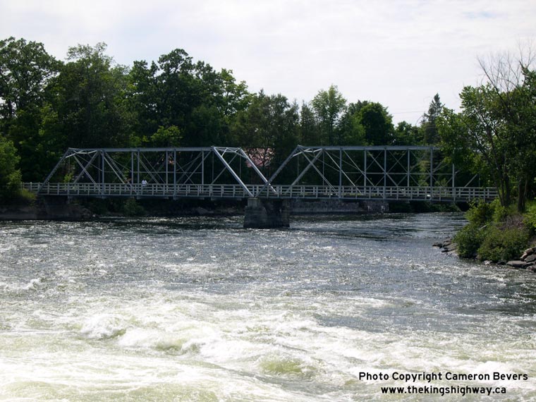
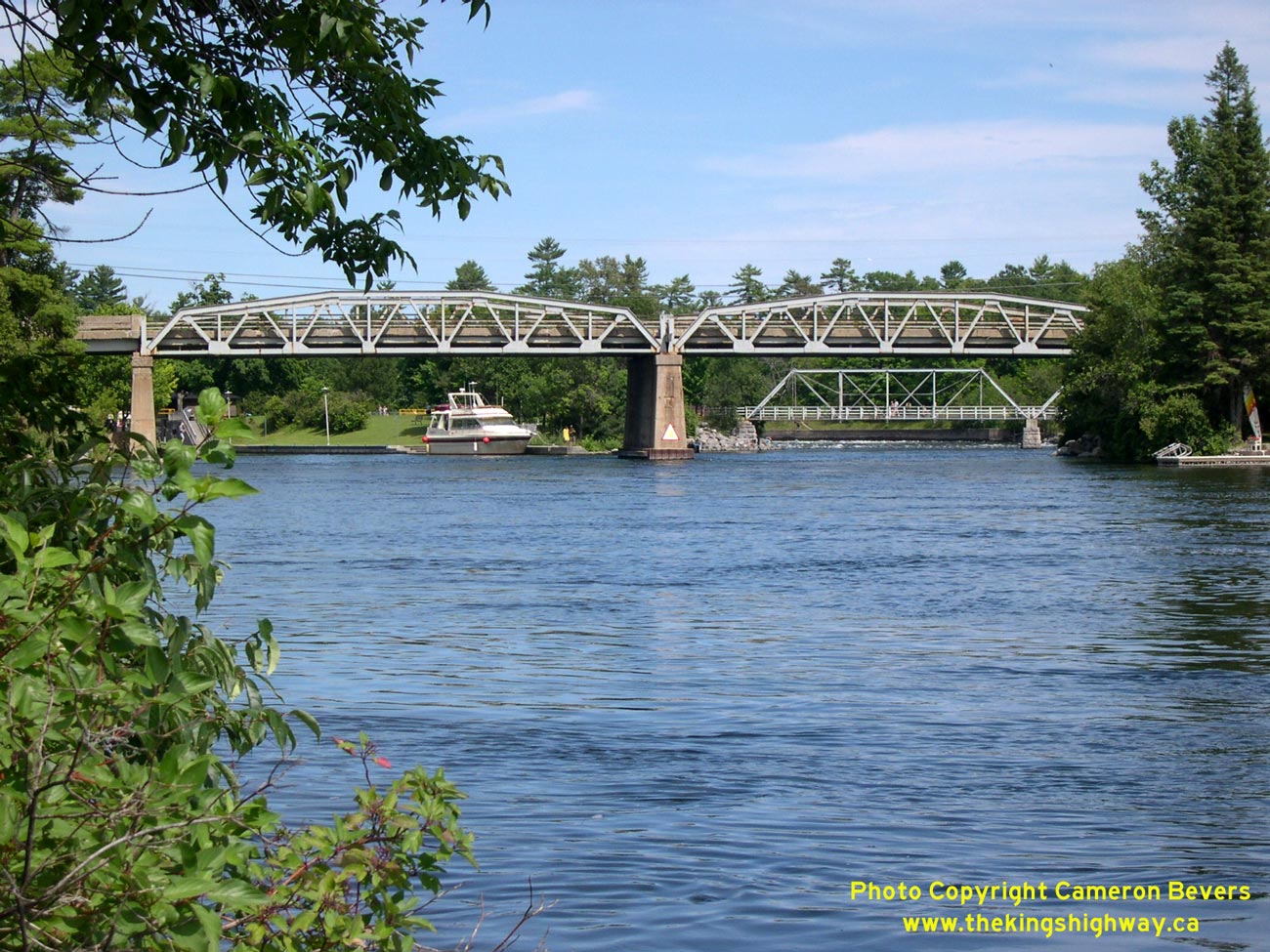
Left - Eastern side of the Old Hwy 28 Bridge at Youngs Point, as seen from the Trent-Severn Waterway Lock. The Youngs Point Lock (Lock #27) allows marine
traffic on the Trent-Severn Waterway to travel between Clear Lake and Katchewanooka Lake, bypassing these dramatic rapids on the Otonabee River. It is one of 44
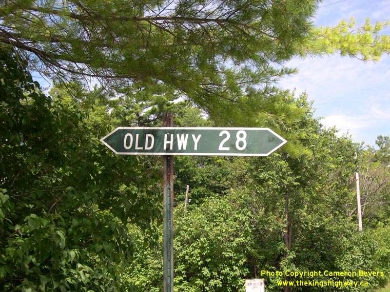
locks on the Trent-Severn Waterway system. (Photograph taken on July 25, 2004 - © Cameron Bevers) Right - The old alignment of Hwy 28 at Youngs Point is still signed as such today. Sadly, this ancient fingerboard sign was replaced during a construction project a few years ago. (Photograph taken on July 25, 2004 - © Cameron Bevers) 
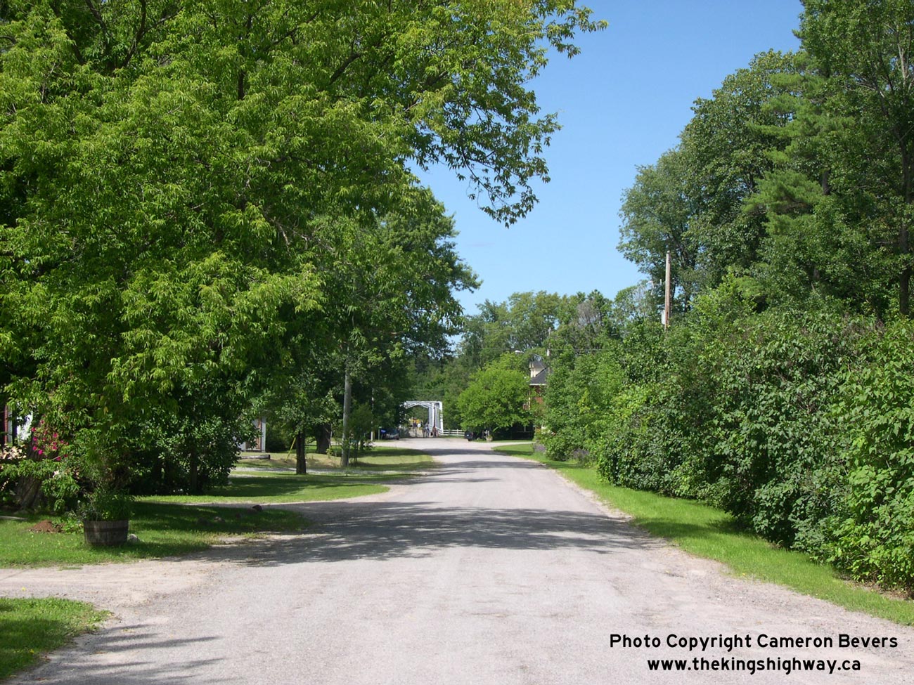
Left - Former Hwy 28 alignment at Youngs Point, facing north towards the old bridge. The original highway alignment is now a quiet side street. See an
Enlarged Photo Here. (Photograph taken on July 25, 2004 - © Cameron Bevers) Right - Former Hwy 28 alignment at Youngs Point, facing south towards Lakefield. A substantial diversion was built on Hwy 28 during the 1950s in order to construct a new high-level fixed-span bridge over the Trent-Severn Waterway at Youngs Point. As a result, bypassed portions of the original highway can be found both to the north and south of the Old Youngs Point Bridge. (Photograph taken on July 25, 2004 - © Cameron Bevers) 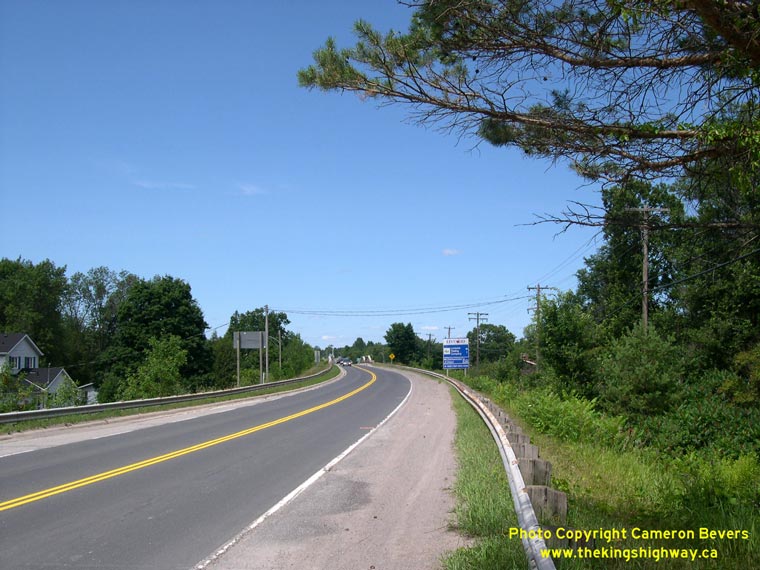
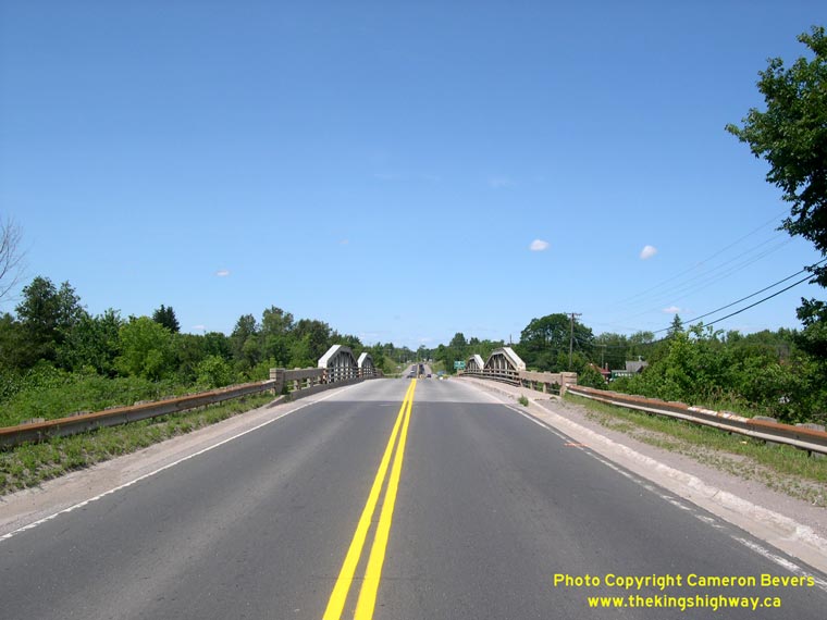
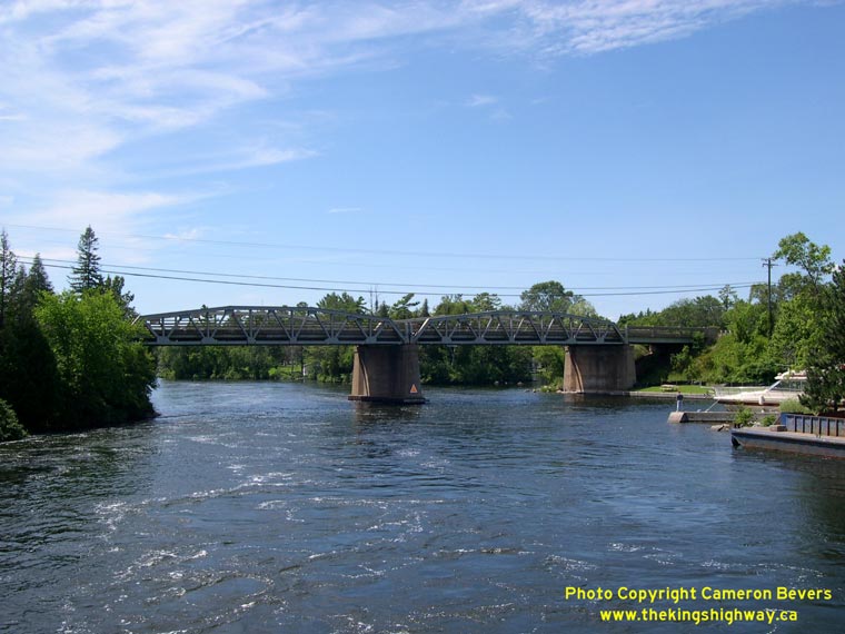
Left - Current Hwy 28 alignment facing north towards the Youngs Point Bridge. Approximately one mile of Hwy 28 was relocated onto a new alignment during
1953-1954 as part of the construction of the new high-level bridge over the Trent-Severn Waterway at Youngs Point. See an
Enlarged Photo Here. (Photograph taken on July 25, 2004 - © Cameron Bevers) Right - Youngs Point Bridge on Hwy 28, facing north towards Bancroft. Structure completed in 1954. See an Enlarged Photo Here. (Photograph taken on July 25, 2004 - © Cameron Bevers) 
Left - Youngs Point Bridge on Hwy 28, facing south towards Lakefield. (Photograph taken on July 25, 2004 - © Cameron Bevers) Right - The current high-level Youngs Point Bridge was completed in 1954. It consists of two Warren-type steel pony truss spans and two steel beam approach spans. The Youngs Point Bridge is the only steel truss structure on Hwy 28, and is one of only a handful of steel pony truss structures left on the provincial highway system. (Photograph taken on July 25, 2004 - © Cameron Bevers) 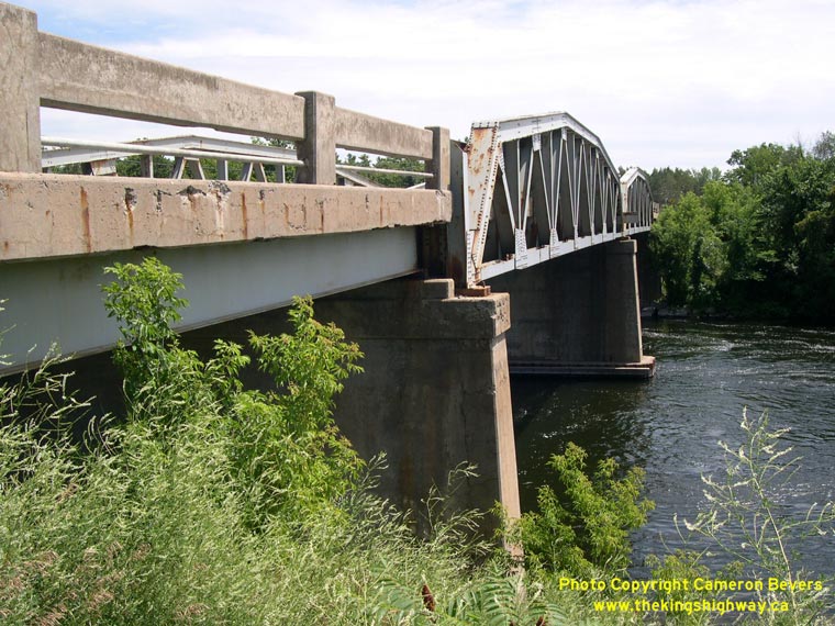
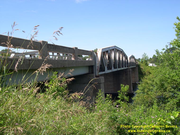
Left - Close-up of the concrete bar-and-post handrail of the current Youngs Point Bridge on Hwy 28. The Youngs Point Bridge was rehabilitated in 2005-2006, so
the original concrete bar-and-post handrail seen here was replaced by a standard solid concrete parapet wall. (Photograph taken on July 25, 2004 - © Cameron Bevers) Right - Eastern side of the Youngs Point Bridge on Hwy 28, as seen from the Trent-Severn Waterway Lock. See an Enlarged Photo Here. (Photograph taken on July 25, 2004 - © Cameron Bevers) 
Left - Current Hwy 28 alignment facing south towards the Youngs Point Bridge. Originally, Hwy 28 passed by a short distance to the east, crossing the
Trent-Severn Waterway on a bridge which had an opening span. The completion of the high-level bridge at Youngs Point in 1954 removed a serious traffic bottleneck on
Hwy 28, since highway traffic no longer had to wait for marine traffic to pass by on the canal below. See an
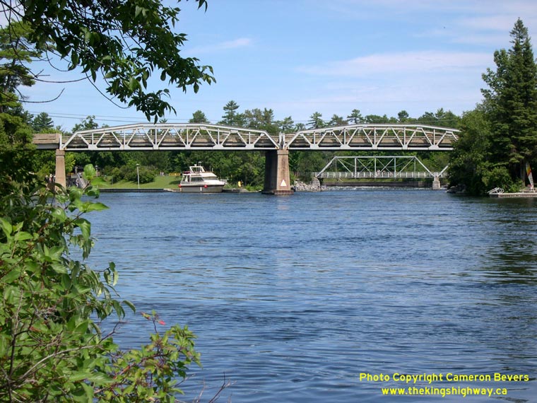
Enlarged Photo Here. (Photograph taken on July 25, 2004 - © Cameron Bevers) Right - Both the old and new bridges at Youngs Point can be seen from this photogenic vantage point just west of Hwy 28. See an Enlarged Photo Here. (Photograph taken on July 25, 2004 - © Cameron Bevers) 
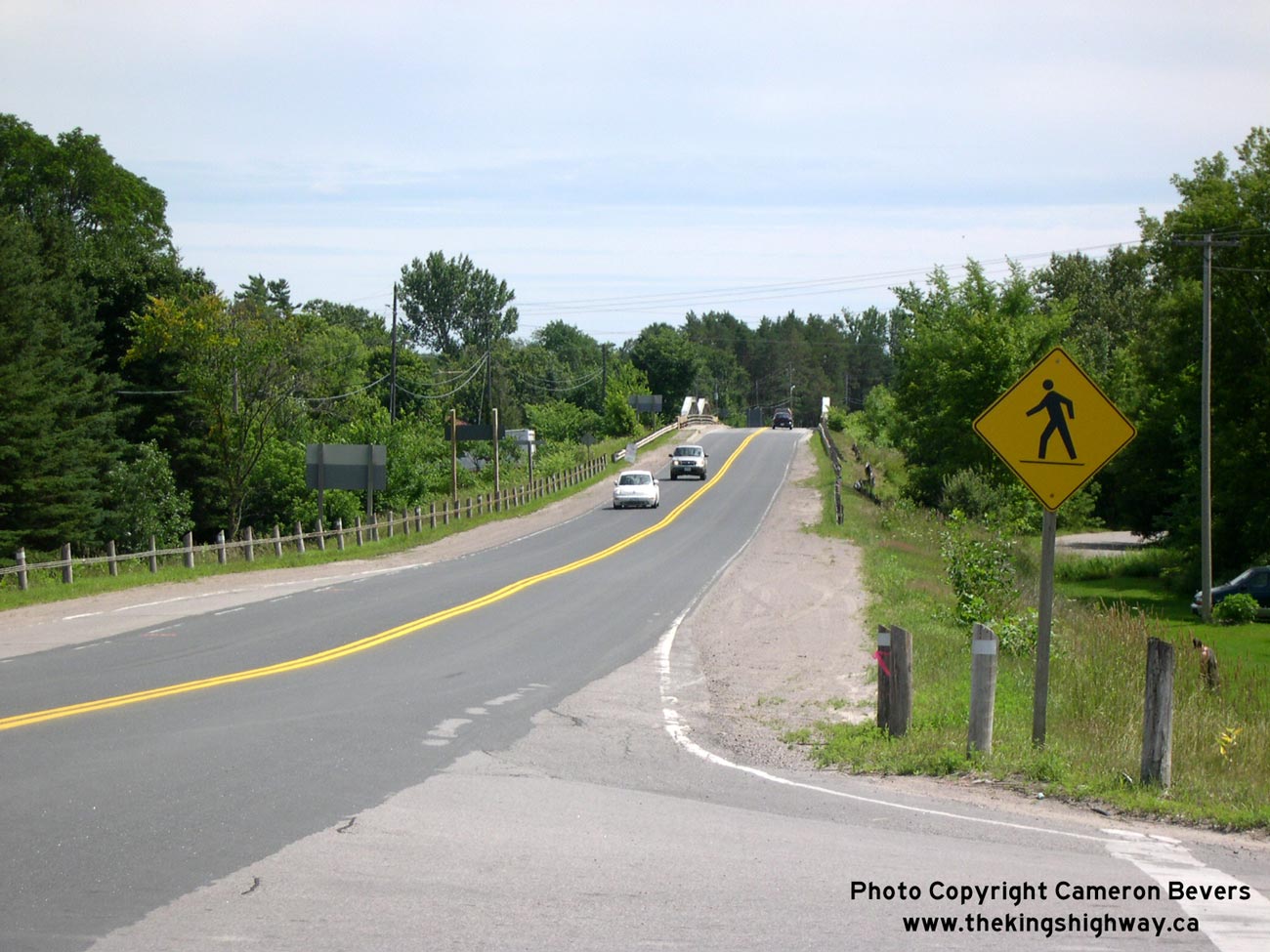
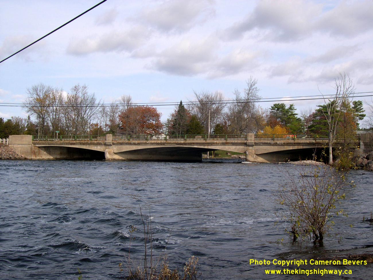
Left - South Burleigh Falls Bridge on Hwy 28. This three-span concrete "T" beam structure was completed in 1953. See an
Enlarged Photo Here. (Photograph taken on October 31, 2003 - © Cameron Bevers) Right - Facing south along Hwy 28 towards Peterborough from the Perry Creek Bridge at Burleigh Falls. (Photograph taken on September 23, 2007 - © Cameron Bevers) 
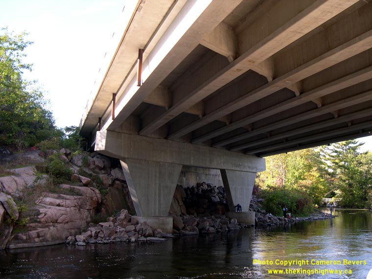
Left - Western side of the Perry Creek Bridge on Hwy 28 at Burleigh Falls. In 1966-1967, a major reconstruction project took place on Hwy 28 at Burleigh Falls,
which saw two new high-level structures built along a new highway alignment through the community. In addition, a new intersection was built at Hwy 28 and Hwy 36,
bypassing an awkward directional "Y" junction that had existed on the original highway since the 1930s. (Photograph taken on September 23, 2007 - © Cameron Bevers) Right - Superstructure of the Perry Creek Bridge on Hwy 28 at Burleigh Falls. Structure completed in 1967. The unusual tapered piers make this otherwise plain prestressed concrete beam structure more aesthetically pleasing - something of a rarity in newer bridges. (Photograph taken on September 23, 2007 - © Cameron Bevers) 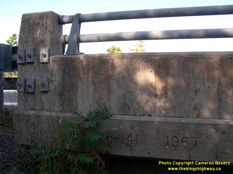
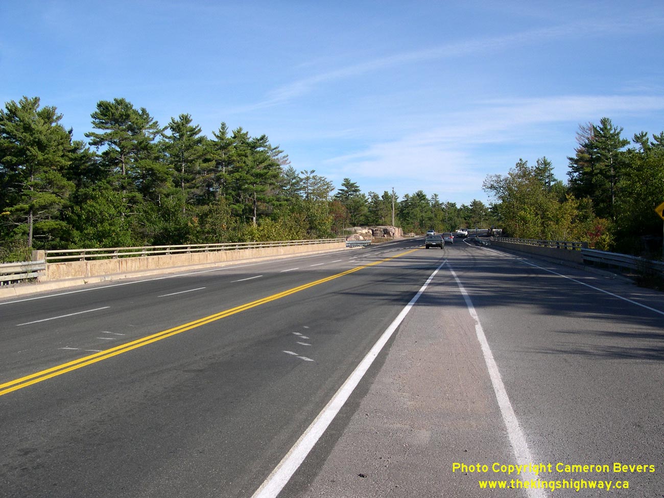
Left - Structure identification number and date stamp (1967) on the Perry Creek Bridge on Hwy 28 at Burleigh Falls. (Photograph taken on September 23, 2007 - © Cameron Bevers) Right - Perry Creek Bridge on Hwy 28 at Burleigh Falls. The Hwy 36 Junction lies immediately north of the Perry Creek Bridge. As a result, the bridge is somewhat wider than what is typically seen on two lane King's Highways, because of the right-turn channelization and acceleration taper from Hwy 36 to southbound Hwy 28 and the left-turn lane from northbound Hwy 28 to Hwy 36. Thus, the bridge deck width becomes progressively wider as one views the structure from the south. See an Enlarged Photo Here. (Photograph taken on September 23, 2007 - © Cameron Bevers) 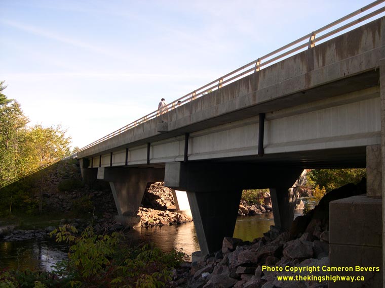

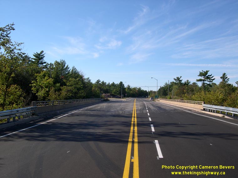
Left - Eastern side of the Perry Creek Bridge on Hwy 28 at Burleigh Falls. (Photograph taken on September 23, 2007 - © Cameron Bevers) Right - Facing south across the Perry Creek Bridge on Hwy 28 at Burleigh Falls. See an Enlarged Photo Here. (Photograph taken on September 23, 2007 - © Cameron Bevers) 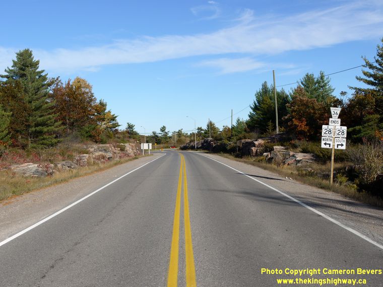
Left - Junction assembly marking the end of Hwy 36 at the Hwy 28 Junction at Burleigh Falls. (Photograph taken on October 9, 2010 - © Cameron Bevers) Right - Northern terminus of Hwy 36 at the Hwy 28 Junction at Burleigh Falls. This intersection is actually the relocated northern terminus of Hwy 36. From 1937 until the late 1960s, Hwy 36 ended at an old directional "Y" Junction with Hwy 28 just southwest of this point in Burleigh Falls. When Hwy 28 was reconstructed and relocated onto a new alignment through Burleigh Falls in 1967, Hwy 36 was also relocated so that it met Hwy 28 at this much-improved highway junction. (Photograph taken on October 9, 2010 - © Cameron Bevers) 
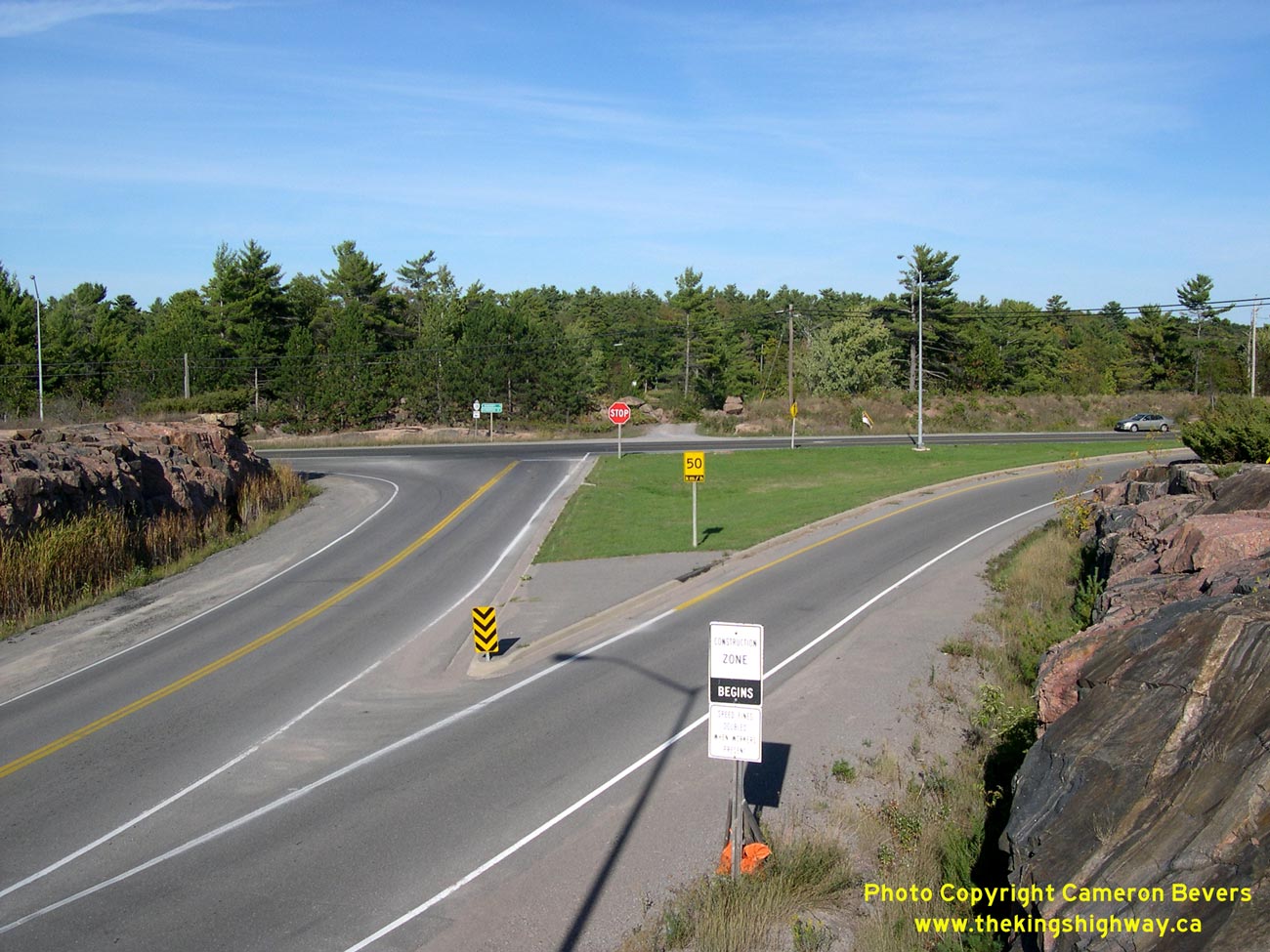
Left - After traveling almost 75 km through the Kawartha Lakes region, Hwy 36 reaches its northern terminus at the Hwy 28 Junction at Burleigh Falls. Motorists
turning right at this junction can return back to Hwy 7 near Peterborough by following Hwy 28 South through Burleigh Falls. Motorists turning left at the junction
can follow Hwy 28 North to Bancroft. Hwy 28 is the principal through route through the northern portion of Peterborough County. See an
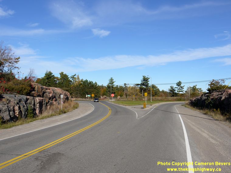
Enlarged Photo Here. (Photograph taken on September 23, 2007 - © Cameron Bevers) Right - Old directional "Y" junction on Old Hwy 28 (Ojibway Drive) at Old Hwy 36 (Spur Road) at Burleigh Falls, facing south towards Peterborough. From 1937 until 1967, Hwy 28 and Hwy 36 met at this unusual intersection. Southbound traffic arriving at Burleigh Falls from Bancroft had the option of taking Hwy 28 South (left fork) to Lakefield and Peterborough or taking Hwy 36 South (right fork) to Bobcaygeon and Lindsay. Today, Ojibway Drive dead-ends about 650 metres ahead, so the old highway alignment no longer carries any through traffic. (Photograph taken on September 23, 2007 - © Cameron Bevers) 
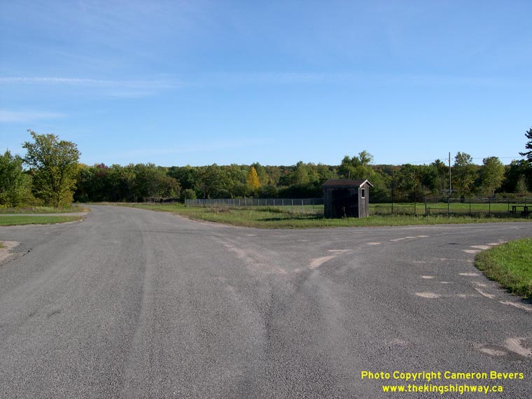
Left - Former northern terminus of Hwy 36 at Old Hwy 28 in Burleigh Falls. Traces of the south leg of the directional "Y" junction are still visible today, to
the right of the hut. The south leg of the "Y" is seldom used anymore, since Ojibway Drive (Old Hwy 28) has been closed to through traffic at the Trent-Severn
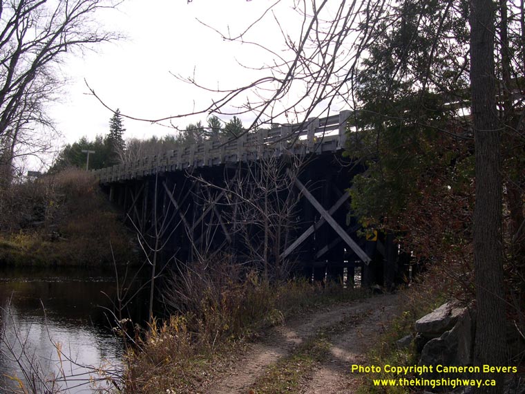
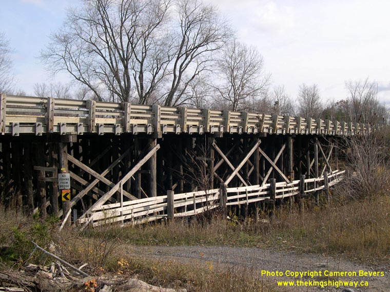
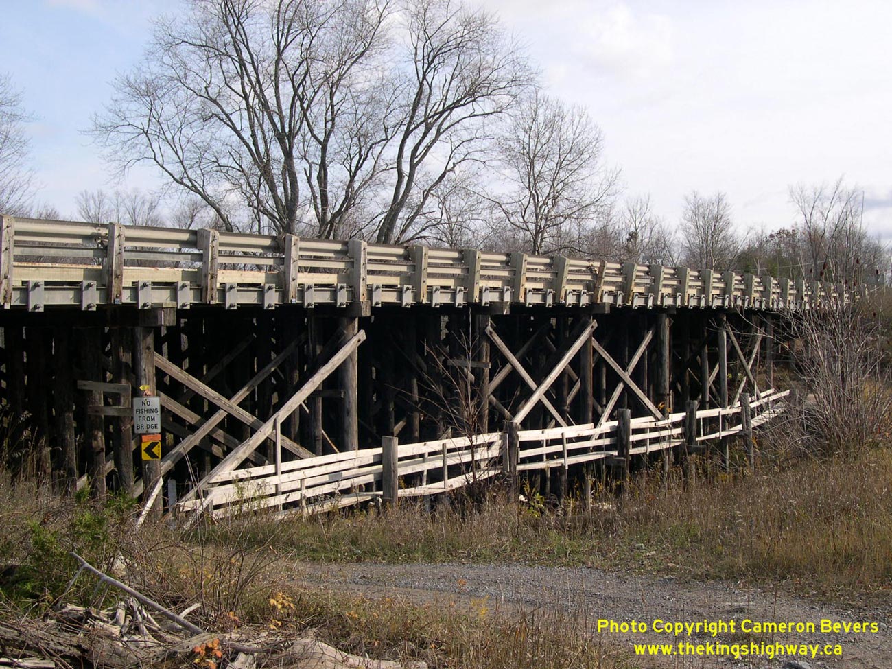
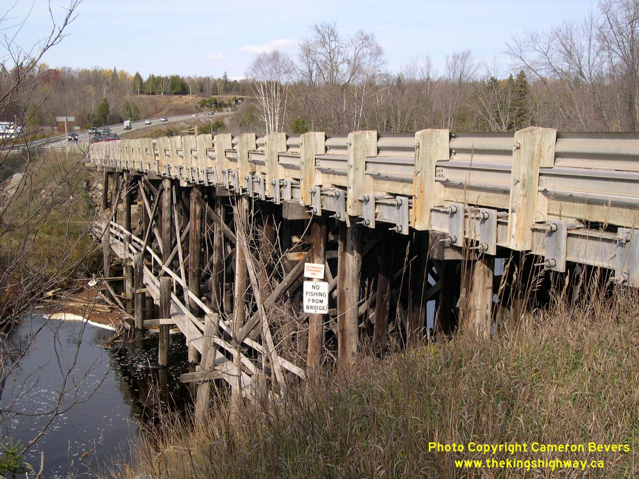
Waterway since the 1960s. See an Enlarged Photo Here. (Photograph taken on September 23, 2007 - © Cameron Bevers) Right - Timber trestle bridge over Eels Creek on Hwy 28 north of Burleigh Falls at Haultain. This 10-span timber trestle bridge is the last surviving timber bridge on Hwy 28. (Photograph taken on October 31, 2003 - © Cameron Bevers) 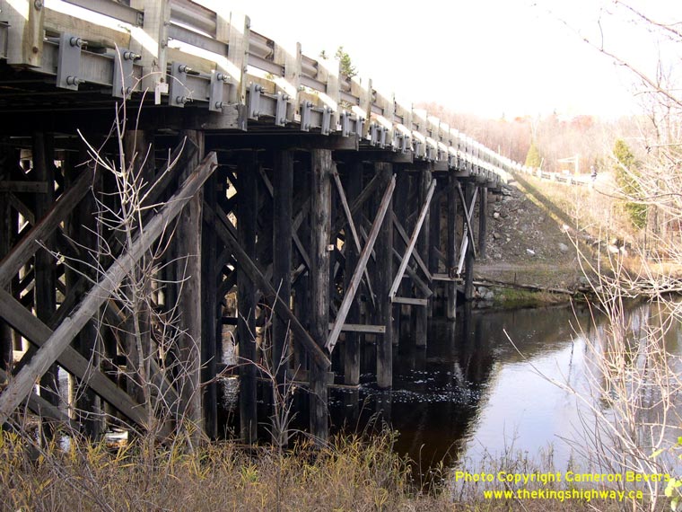
Left - Eastern side of the Eels Creek Bridge on Hwy 28 at Haultain. Structure completed in 1952. (Photograph taken on October 31, 2003 - © Cameron Bevers) Right - Western side of the Eels Creek Bridge on Hwy 28 at Haultain. See an Enlarged Photo Here. (Photograph taken on October 31, 2003 - © Cameron Bevers) 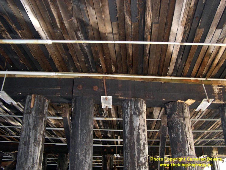
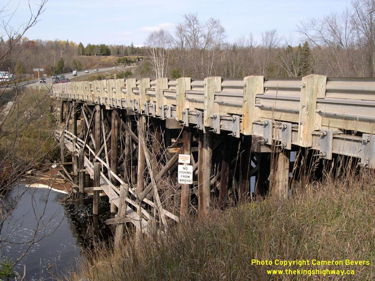
Left - The Eels Creek Bridge at Haultain has a laminated timber deck. This bridge design was only used in a few locations across the southern half of Ontario.
Laminated timber deck bridges are usually found in Northern Ontario, where local supplies of concrete may be difficult to find. In these instances, the MTO will
often construct a laminated timber bridge instead of a concrete bridge. (Photograph taken on October 31, 2003 - © Cameron Bevers) Right - Eels Creek Bridge on Hwy 28 at Haultain, as seen from the southwestern side. In 1952, the narrow steel pony truss bridge on Hwy 28 at Haultain was replaced by the current timber trestle bridge. The concrete abutments of the original steel truss bridge are still visible today on the western side of the highway. See an Enlarged Photo Here. (Photograph taken on October 31, 2003 - © Cameron Bevers) 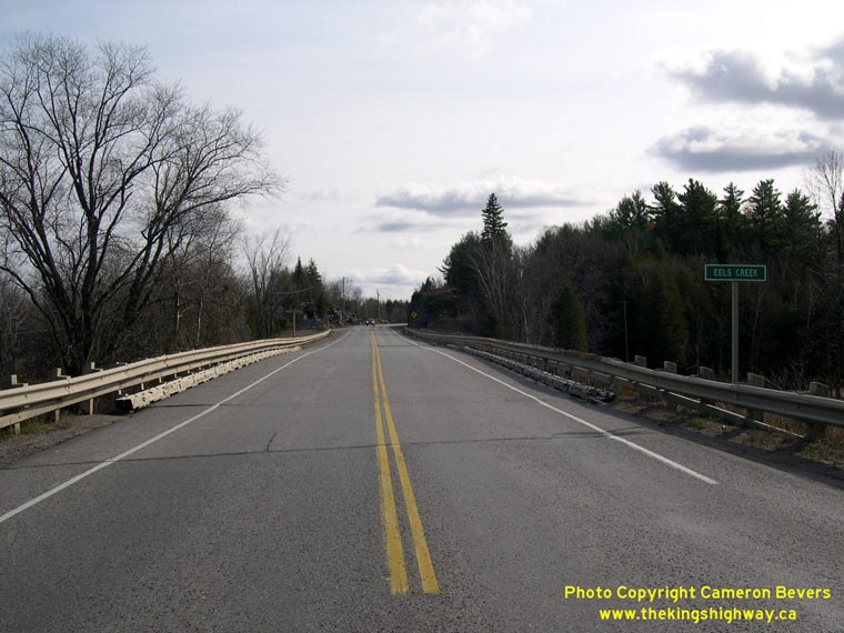
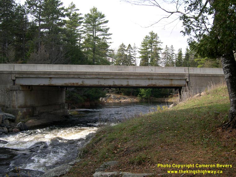
Left - Facing south along Hwy 28 across the Eels Creek timber trestle bridge at Haultain. (Photograph taken on October 31, 2003 - © Cameron Bevers) Right - Eastern side of the Eels Creek Bridge between Haultain and Apsley. This is one of several bridges over Eels Creek along the Hwy 28 corridor. The highway closely follows Eels Creek in the Apsley area. This single-span steel beam bridge replaced a timber structure, which dated from the original construction of this section of Hwy 28 in the 1930s. (Photograph taken on October 31, 2003 - © Cameron Bevers) 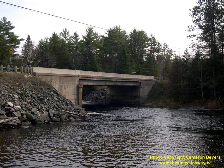
Above - Western side of the Eels Creek Bridge south of Apsley. Structure completed in 1953.
(Photograph taken on October 31, 2003 - © Cameron Bevers) 

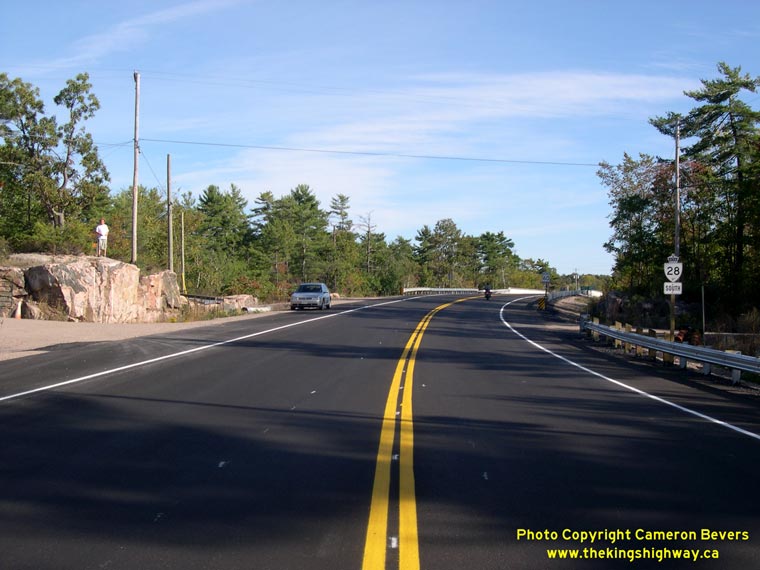
Left - Distance guide sign facing southbound traffic on Hwy 28 at the Hwy 504 Junction in Apsley. See an
Enlarged Photo Here. (Photograph taken on September 30, 2022 - © Cameron Bevers) Right - Facing north along Hwy 28 approaching the Hwy 504 Junction in Apsley. Up until the 1940s, Hwy 28 curved to the right into Apsley's village centre. A diversion was built around the western side of the village during the early 1940s, when Hwy 28 was extended north from Apsley to Bancroft. Ever since this highway diversion was built in 1941-1942, motorists along Hwy 28 bound for Apsley have been required to exit from the highway in order to reach the village centre. The bypassed Hwy 28 spur which led into Apsley later became a part of Hwy 504. See an Enlarged Photo Here. (Photograph taken on September 30, 2022 - © Cameron Bevers) 

Left - Facing south along Hwy 28 towards Burleigh Falls from the Hwy 504 Junction in Apsley. The diversion around Apsley comes to an end at this highway curve,
where the Hwy 28 Extension to Bancroft ties back into the 1937 route of Hwy 28 from Apsley to Burleigh Falls. A 16-mile section of the Apsley-Bancroft Road was
reconstructed on an improved alignment in the early 1940s, just prior to the road being assumed as a King's Highway. The completion of Hwy 28 between Apsley and
Bancroft in 1943 was one of only a handful of new highway links constructed in Ontario during World War II. See an
Enlarged Photo Here. (Photograph taken on September 30, 2022 - © Cameron Bevers) Right - An older fingerboard guide sign for Burleigh Falls still stands at the Hwy 28 & Hwy 504 Junction in Apsley. This is one of the older narrow fingerboard guide signs whose use was discontinued in the 1990s. Today, the fingerboard guide signs used at highway junctions are about double this height to assist with sign message legibility. See an Enlarged Photo Here. (Photograph taken on September 30, 2022 - © Cameron Bevers) 

Left - Approaching the Hwy 504 Junction on Hwy 28 in Apsley, facing south towards Burleigh Falls. Like all other Secondary Highways located within Peterborough
County, Hwy 504 was transferred or "downloaded" to the municipal tier in the late 1990s. This road is no longer a provincial highway - today, Hwy 504 is officially
known as Peterborough County Road 504 . Within Apsley, parts of Hwy 504 are also known as Burleigh Street. See an
Enlarged Photo Here. (Photograph taken on September 30, 2022 - © Cameron Bevers) Right - Facing north along Hwy 28 towards Bancroft from the Hwy 504 Junction in Apsley. This part of Hwy 28 was built in the early 1940s, as part of an extension of Hwy 28 from Apsley up to Bancroft. Prior to the construction of the Apsley Diversion, Hwy 28 curved into Apsley where the highway came to an end near the village centre. See an Enlarged Photo Here. (Photograph taken on September 30, 2022 - © Cameron Bevers) 

Left - Facing east along Hwy 504 from the Hwy 28 Junction at the southern entrance to Apsley. For several years in the late 1930s and early 1940s, this
entrance road into Apsley was part of Hwy 28. Once the new highway extension to Bancroft was completed in 1943, this old section of Hwy 28 was bypassed by an improved
highway alignment west of the village. Old Hwy 28 through Apsley was re-designated as a part of Secondary Highway 504 in May 1956. The northbound-to-eastbound turn
from Hwy 28 onto Hwy 504 at the southern entrance to Apsley is channelized in order to expedite traffic flow. See an
Enlarged Photo Here. (Photograph taken on September 30, 2022 - © Cameron Bevers) Right - Junction of Hwy 28 & Hwy 504, facing west. Hwy 504 reaches its western terminus at this highway junction. See an Enlarged Photo Here. (Photograph taken on September 30, 2022 - © Cameron Bevers) 

Left - Junction sign assembly at the western terminus of Hwy 504 at the Hwy 28 Junction. Provincial jurisdiction over Hwy 504 ended in 1998, when this section
of the highway was transferred of "downloaded" to the County of Peterborough. Although the route number remains the same today, Hwy 504 is now signed with County Road
504 "flowerpot" route markers rather than provincial Secondary Highway 504 route markers. See an
Enlarged Photo Here. (Photograph taken on September 30, 2022 - © Cameron Bevers) Right - Southern side of the Eels Creek Bridge (Site #26-05) on Hwy 504 at the southern entrance into Apsley from Hwy 28. This single-span concrete rigid frame structure was built under Contract #1964-249 and was completed in 1965. See an Enlarged Photo Here. (Photograph taken on September 30, 2022 - © Cameron Bevers) 

Left - Facing east along Hwy 504 towards Apsley at the Eels Creek Bridge, located just east of the Hwy 28 Junction. See an
Enlarged Photo Here. (Photograph taken on September 30, 2022 - © Cameron Bevers) Right - Northern side of the Eels Creek Bridge on Hwy 504 in Apsley. See an Enlarged Photo Here. (Photograph taken on September 30, 2022 - © Cameron Bevers) 

Left - Facing west along Hwy 504 towards the Hwy 28 Junction at the Eels Creek Bridge at the southern entrance to Apsley. See an
Enlarged Photo Here. (Photograph taken on September 30, 2022 - © Cameron Bevers) Right - Approaching Apsley's village centre on Hwy 504 (Old Hwy 28). When the Department of Highways of Ontario (DHO) acquired jurisdiction and control over the Burleigh Falls-Apsley Road as an extension of Hwy 28 in August 1937, the King's Highway came to an end at River Street, located about 500 metres beyond this intersection. This bypassed spur of Hwy 28 which led into Apsley became part of Hwy 504 in 1956. See an Enlarged Photo Here. (Photograph taken on September 30, 2022 - © Cameron Bevers) 
Above - Junction sign assembly approaching the Hwy 504 and Hwy 620A Junction in Apsley. Just ahead, Hwy 504 turns right off of Burleigh Street onto Wellington
Street and heads east out of Apsley and then around the southern side of Chandos Lake. By continuing straight through on Burleigh Street, motorists will find
themselves following the unsigned route of Hwy 620A north. Rather than actually sign this diminutive route as Hwy 620A, MTO simply installed green-and-white "TO 504"
and "TO 620" trailblazer signs along Burleigh Street through Apsley. The short route of Hwy 620A connects Hwy 504 up to Hwy 620, which is located at the northern
entrance to Apsley. See an Enlarged Photo Here. (Photograph taken on September 30, 2022 - © Cameron Bevers) 

Left - Sometimes when I'm out taking highway photos, I just happen to be at the right place at the right time. In this photo, a beautiful 1933 or 1934
3-Windowed Ford Coupe just happened to be making the turn from Burleigh Street onto eastbound Hwy 504 in Apsley. Burleigh Street was the initial route of Hwy 28 when
the King's Highway was extended from Burleigh Falls up to Apsley in 1937. This highway extension came about at a time when streamlined and sporty motorcars like this
one could be found cruising out on the province's King's Highways. The extension and improvement of the provincial highway network into Ontario's lake districts
during the 1930s triggered a major boom for motor tourism and ushered in a new era of weekend cottage vacationing. See an
Enlarged Photo Here. (Photograph taken on September 30, 2022 - © Cameron Bevers) Right - Facing west along Wellington Street (Hwy 504) in Apsley. At the intersection of Burleigh Street, Hwy 504 turns left and heads out to the Hwy 28 Junction. At right, the unsigned route of Hwy 620A follows Burleigh Street north to the Hwy 620 Junction at the northern entrance to Apsley. See an Enlarged Photo Here. (Photograph taken on September 30, 2022 - © Cameron Bevers) 

Left - Facing east along Wellington Street (Hwy 504) in Apsley from the intersection of Burleigh Street. Hwy 504 forms a partial loop highway around the
southern side of Chandos Lake. Hwy 504 connects with Hwy 620 near Glen Alda, which is a small community located about 25 km to the east. See an
Enlarged Photo Here. (Photograph taken on September 30, 2022 - © Cameron Bevers) Right - Southern terminus of Hwy 620A at the Hwy 504 Junction in Apsley. At this intersection, traffic can either turn left and head east along Hwy 504 via Wellington Street to Glen Alda, or continue straight through on Burleigh Street out to the Hwy 28 Junction. See an Enlarged Photo Here. (Photograph taken on September 30, 2022 - © Cameron Bevers) 

Left - Facing north along Burleigh Street (Hwy 620A) from the Hwy 504 Junction at Wellington Street in Apsley. Prior to the 1990s, Hwy 620A was among Ontario's
shortest provincial highways, with a total length of about 800 metres (1/2 mile). However, provincial jurisdiction over Hwy 620A ended in 1998, when the highway was
downloaded to the County of Peterborough. Burleigh Street had been under provincial jurisdiction since 1937, when the DHO acquired jurisdiction over Apsley's main
street as part of Hwy 28. See an Enlarged Photo Here. (Photograph taken on September 30, 2022 - © Cameron Bevers) Right - Green-and-white trailblazer route markers for Hwy 620 and Hwy 28 on Hwy 504 in Apsley. For such a small community, Apsley has an astonishing number of trailblazed highway routes, with "TO 28", "TO 504" and "TO 620" markers all prominently placed throughout the village. See an Enlarged Photo Here. (Photograph taken on September 30, 2022 - © Cameron Bevers) 
Above - An old green-and-white "TO 504" trailblazer sign on Burleigh Street (Hwy 620A) in Apsley. See an
Enlarged Photo Here. (Photograph taken on September 30, 2022 - © Cameron Bevers)
Continue on to King's Highway 28 Photos: Bancroft to Denbigh
|
|---|
Links to Adjacent King's Highway Photograph Pages:
Back to King's Highway 27 Photos /
King's Highway 28 History /
Back to King's Highway 29 Photos
Ontario Highway History - Main Menu / Back to List of Highways Website contents, photos & text © 2002-2026, Cameron
Bevers (Webmaster) - All Rights Reserved / Contact Me
|
|---|